Photo Post

Fire Mountain (火炎山)

I’ve lived in Taiwan for well over a decade now and for almost as long as I can remember, every time I’ve travelled south along the national highway, I’ve always enjoyed the view when crossing the Da’an River (大安溪), the area that geographically separates Miaoli from Taichung. 

The reason for this is quite simple, the Miaoli side has a beautiful mountain that glistens in the sun whenever you pass by. When you consider most of Taiwan’s mountains are lush with greenery, this one stands out thanks to almost red-like soil on the mountain side.

Its fair to say that I’ve probably passed by the mountain on the highway a few hundred times throughout my years living here and even though in the back of my mind I always wondered about the mountain, by the time I arrived at my destination, I had already forgotten about it.

Over the past year though, the mountain, which I’ve since learned is aptly named “Fire Mountain” (火炎山), has become a bit of a hit with young people, especially those on Instagram who hike (most of the way) to the top to get a photo of themselves at a spot that has become known as “Taiwan’s Grand Canyon” (台灣大峽谷). 

In retrospect my curiosity about the mountain should have led me to finding out about it much sooner, but sometimes my curiosity about mysterious places often leads me down really deep rabbit holes, so I’ve been trying to make an effort as of late to not let my curiosity take up so much of the little free time I have. 

That being said, the proverbial cat is out of the bag when it comes to this mountain and its recent popularity meant that a visit was definitely in order as I rarely miss the chance to get those super popular instagram photos (Pardon the sarcasm) 

Fire Mountain (火炎山)  

Situated on the geographic barrier between Taiwan’s Miaoli County and Taichung County, “Fire Mountain” or “Flame Mountain” (火炎山) has become one of the new hot spots on the country’s day-hike scene and is highly regarded for its stunning landscapes.  

Once a protected nature reserve and home to several endangered local bird species, the mountain was for quite some time restricted only to researchers and bird watchers with a permit. Now it has reopened to the public and thanks to the skill of some Instagrammers, its popularity has skyrocketed making it one of the busiest trails in central Taiwan, second of course only to Yuanzui Mountain

Stunning landscapes and Instagram photos aside, as one of Taiwan’s Top 100 Mountains (小百岳), Fire Mountain has always been a popular one among crowds attempting to complete one of Taiwan’s hiking challenges. It is also a popular stop for local birdwatchers who visit the mountain every year between April and May to observe flocks of migratory birds arriving back in Taiwan from the Philippines. 

Note: To avoid a bit of confusion I think I should explain: There are two lists of ‘100 Peaks’ in Taiwan. One is a list of 100 peaks that are over 3,000 meters above sea level, known as the “Bai Yue” (台灣百岳) while the other is a list of 100 Peaks that can be climbed relatively easily known as the “Mini Bai Yue” (小百岳), this mountain is on the list of smaller peaks. 

Link: 台灣小百岳列表 (Wiki)

Link: 100 Peaks of Taiwan (台灣百岳) 

Video: Taiwan’s 100 Best Mountains (Goldthread / Youtube)

At its highest, Fire Mountain reaches an elevation of 614 meters on its Northern Peak (北峰) while its Main Peak (主峰) is 596 meters above sea level. Formed hundreds of thousand of years ago, the geological structure of the mountain is similar to that of many of Taiwan’s mountains in that it was created by the movement of tectonic plates.

From the outset, this mountain set itself apart (from the others) in its composition from the ground up thanks to the weak cohesion of sandstone and sedimentary rock that make it less stable. Speaking plainly, this instability simply means that the physical attributes of the mountain are in a constant state of change, so whenever there is a heavy rain, typhoon or earthquake, the mountain changes a bit. 

This natural effect is also the reason why the mountain has become so attractive as its jagged peaks, cliffs, valleys and slopes have all been formed by natural degradation over time. 

Unfortunately (as mentioned above) due to the fragility of the mountain, it had to be closed off to the public for several decades. In 1986 (民國75年) the government designated the mountain as the “Fire Mountain Nature Reserve” (火炎山自然保護區) in order to allow for the mountain to naturally repair itself to prevent the effects of erosion, and to also allow the native Masson’s Pine Tree (馬尾松) to replenish itself. 

Now that the trail has reopened, it has become a popular weekend destination for hikers and day-trippers, so the local government has made an effort to improve the safety of the trail allowing for a much better hiker experience for all. If you do plan on hiking this one (and you should), its important to remember that it is still a protected nature reserve, so try to have as little impact as you can on the natural environment and as always remember to take your trash with you. 

Hiking Fire Mountain

This hike is relatively easy and will only require a few hours of your time. Unlike many of the other mountains that have become popular in recent years, this one is essentially just a brisk nature walk, so you don’t need to be an experienced climber to complete the hike. With this in mind, if you’d like to bring your family or friends for an afternoon outing, this is a trail that should allow everyone to get a bit of exercise and enjoy a bit of Taiwan’s beautiful mountainous landscapes.  

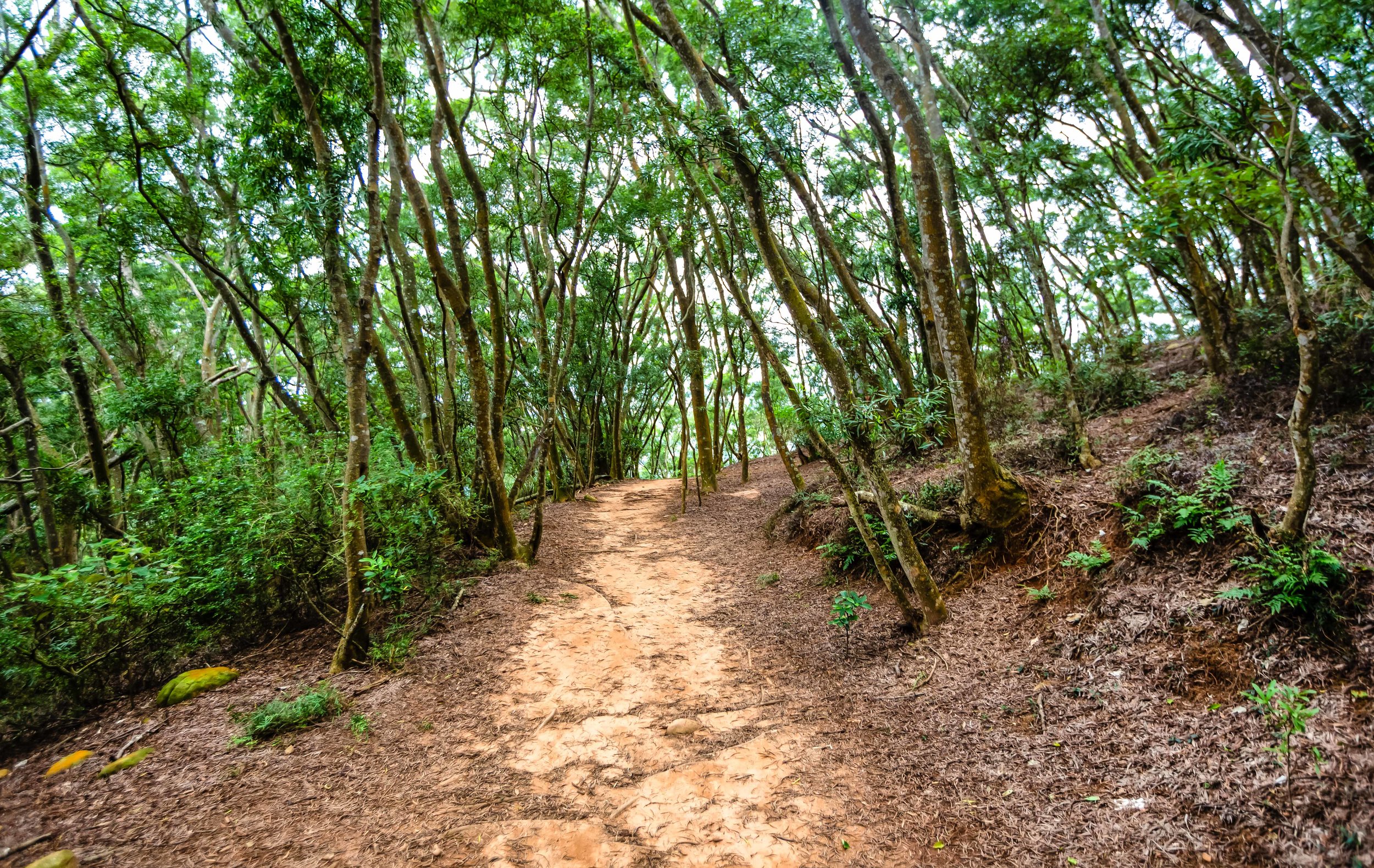
From the outset, the incline of the trail rises at a gradual pace which means that you won’t be starting out with a steep set of stairs like so many other trails. After about five-to-ten minutes of walking, you’ll start to be able to see the elevated highway through the trees and the path will start turning red.

As you hike you’re going to start noticing a few warning signs on the trail where there will be a beaten down path nearby - Unlike most of Taiwans trails, where hikers tie markers to trees which indicate the direction you should be heading in, this one is quite well developed and there is signage everywhere. The lack of these markers isn’t entirely a terrible thing in this case though as the warning signs you’ll see along the way (more often than not indicate) that there is a picturesque vista nearby.

So whenever you come across a warning sign, you’re likely to find an unmarked path branching off from the main trail that leads to an area where you’re able to take photos, and the higher you climb the more beautiful these vistas become. 

The warning signs however are obviously there for a very important reason - The cliffs where you’re able to take these beautiful photos are often quite dangerous and while it may seem like a good idea to get a photo of yourself sitting on the edge of the cliff, you should be aware that erosion on this mountain is a real thing and that if you’re not careful, you might be involved in a landslide of your own making.

You definitely don’t want to have your dead body featured on the news and force the closure of the trail, which would ruin the experience for everyone else, so use your brain and stay safe.

Each time you approach one of the vistas, you may start thinking to yourself that you’ve arrived at the ‘famous photo spot’ but I assure you, when you reach the ‘spot’, you’re going to know. This is because there is a rather generous amount of signage that indicates that you’re approaching the ‘Grand Canyon’ and once you’ve arrived, you’ve pretty much reached your destination. 

When you’re standing at the trailhead and you’re looking at the map of the trail, it provides an ‘estimate’ of how long it should take you to complete the hike. Something that you’re going to have to learn about these signs here in Taiwan is that the estimate is way off and it is never going to take nearly nearly as long to complete. Still though, these estimates are good at scaring people away.

The local authorities estimate that this mountain is going to take about 3.5-4 hours to complete, but its important to note that the vast majority of hikers aren’t coming here to "complete” the mountain, they’re only really hiking to the Grand Canyon and then heading back to the trailhead. With this in mind, you can easily shave off an extra hour or so of the estimate.

Unfortunately, if you are hiking this trail on the weekend, the time you save by not hiking to the peak may end up not being time saved at all - Hiking on the weekends mean that you’re going to have to deal with a bit more traffic on the trails. It also means that if you want to take photos at the Grand Canyon that you’re going to have to get in line with a bunch of ravenous (yet beautiful) Instagram celebrities. If you’re like me though, you may feel quite entertained by watching them take photos with all all their weird poses. 

Given that the trail is so well-developed and that hiking it is rather difficult, you shouldn’t have much trouble hiking this one. If you take a look on instagram at some of the outfits many of the instagram celebrities have worn while hiking, it should offer a much better indication of just how easy this one is. Nevertheless, this is a mountain, so you’ll want to make sure you bring enough water and wear proper footwear. You’ll probably also want to bring a raincoat with you just in case it starts to rain. 

Tour / Permit 

Trailhead warning sign and map

It seems like there is a bit of misinformation out there about whether or not you need a permit to hike the mountain or whether you need to have a tour guide take you up the mountain. 

Let me dispel both of these rumours right now. 

You might have read somewhere on the internet or heard from a friend that you need a permit to hike the mountain. That’s false. You don’t need to have a permit. There are quite a few mountains in Taiwan where you’ll need a permit, but this isn’t one of them. You’re not going to encounter anyone at the trailhead checking for permits or identification. What you will find at the trailhead is simply a map of the route and several warnings about the danger of walking too close to unstable cliffs. 

The reason why people claim that a permit is necessary is because years ago the mountain was a protected nature reserve for replenishing trees and protecting a few endangered local species of birds, most notably the “Grey-faced Buzzard” (灰面鵟鷹) which migrates to the Philippines during the Winter and returns in Taiwan in April each year. 

Those issues seem to have been rectified with time, so they’ve reopened the trail to the public. 

Hello friend!

You might have also read online, especially on some Taiwanese tour sites that you need to take a tour to hike the mountain. That is also false.

If you see a website claiming that you need to join a tour to hike this one, they’re just spreading misinformation in order to make some money off of their paid tours. I don’t want to ruin anyone’s business, but I also don’t like people spreading false information to tourists in order to cheat them and make money. 

Of course having a tour guide and travelling with a tour group could solve some of the travel issues involved with getting to the mountain, but most of these tours are more expensive than what you would pay if you followed the travel advice I’m going to provide below. 

Ultimately it is up to you how you get to the trail, but you definitely don’t need a permit and its not necessary to join a tour - All you have to do is simply walk up to the trailhead and enjoy your hike. 

Getting There


One of the main obstacles to climbing Fire Mountain is actually getting to Fire Mountain. 

When I say that, I mean for those who don’t have their own means of transportation, be it car or scooter, getting to the trailhead can be a bit of a hassle that will probably include a train ride and a taxi ride. 

If you have a car, getting to Fire Mountain is rather straight forward - Take the National Highway Number One (國道一號) and get off at the Sanyi Exit (三義交流道). From the interchange make a right turn and then at the first set of traffic lights turn left on Road 13 (台13線). Follow that road until you reach the bottom of the hill where you’ll find yourself under the highway. The trailhead is located directly next to that road. 

When you want to park your car, there isn’t much choice in terms of legal parking spots, so you’ll likely have to park in the “正松泉停車場” paid parking space by the trailhead. The parking fee is only 50NT though, so it shouldn’t be much of a problem - unless of course its full. 

If you are relying on public transportation, the easiest way to get there is to take a train and then take a taxi from the station to the trailhead. If you are travelling from the north, I recommend getting off at Miaoli’s Sanyi Station (三義車站) and if you’re coming from the south, you could get off at Taichung’s Tai’An Station (泰安車站). The distance from both stations is more or less the same, but the trip from Sanyi is probably the most straightforward and should cost around $200NT 

It is important to remember though that if you are taking a train to Sanyi or Tai’An, that at some point you’ll have to switch to a Local Train (區間車) as the Express Trains don’t stop at either of those stations. If you’re coming from the north, get off at Miaoli Station (苗栗車站) and if you’re coming from the south get off at Houli Station (后里車站) to transfer. 

Once you’ve arrived and you get in the taxi, if you can’t speak Chinese you can show him this or try your best to read the pinyin: “我要去火炎山登山口” (wǒ yào qù huǒ yán shān dēng shān kǒu). Considering the popularity of the hike as of late, the driver is likely to know exactly where you want to go. You might also want to remember the drivers phone number or get a copy of his card so that you can call him to pick you up. 

For most travellers this hiking trail isn’t going to be a particularly easy one to get to, but it is a fun one and if you do decide to hike it, you’re going to be rewarded with excellent views of Taiwan’s so-called “Grand Canyon” as well as the Da’an River that stretches all the way out to the ocean. The hike is relatively easy and is well-maintained, so with a bit of effort you’ll be rewarded with several picturesque vistas and you’ll be able to get one of those important instagram photos that everybody’s looking for.

Remember though, some of the cliffs are dangerous, so if you notice a warning sign, it’s best to take some precaution while at the same time enjoying the experience of hiking this beautiful trail.


Edinburgh Castle

A trip to Europe couldn’t possibly be considered complete if you didn’t visit at least one castle.

Am I right?

It doesn’t really matter what country you’re visiting in Europe, there’s always going to be a castle to visit and when you do you’re always going to be accompanied by a billion other tourists. Castle tourism is great for attracting tourist dollars and in countries like England, France and Germany, you’ll find that castles are often at the top of the list of tourist attractions for most visitors.

Castles are also part of what makes European history so interesting - They were once the homes of Kings, Queens, Knights and medieval battles. For a lot of tourists though, especially those from Asia or North America, the only “castle” we’ve ever really known is the Cinderella Castle at Disney’s Magic Kingdom.

But c’mon, that’s not really a castle - A real castle needs to be hundreds of years old, dark, damp and have a dungeon in the basement - and preferably perched high atop a mountain.

If that’s what you’re looking for though, you’re most often going to have to travel a short distance out of most modern European cities to find one. There are a few rare cases however where you’ll find a castle that has played such a pivotal role in a city’s history that even after hundreds of years of development and outward growth, that it still remains the beating heart of the city as well as a symbol of the greatness of the people who live there.

Edinburgh Castle is pretty much the definition of such a castle.

And for that reason, it not only acts as the beating heart of the Scottish capital but also attracts more than two million tourists through its gates every year.

Edinburgh Castle (Caisteal Dhùn Èideann)

The history of Edinburgh Castle is thought to have started around 340 million BC when a volcanic eruption formed the basis for what we know today as “Castle Rock” (Creag a' Chaisteil). The small mountain rises 130 metres (430 ft) above sea level and at its highest, 80 metres (260 ft) from the surrounding landscape.

With rigid cliff walls rising up on the north, south and west, Castle Rock has proven throughout its long history of human settlement to be an ideal space, especially for defensive purposes as the only way to approach was on the long eastern slope - something which was of both benefit and detriment to those who lived on top of the mountain.

Human settlement on (or around) Castle Rock sometime around 900 BC, but it is unclear as to what extent the rock was inhabited or even the nature of habitation. What we do know however is that it wouldn’t be until the reign of Scottish King David I in the 12th Century that a royal castle would be constructed on the mountain.

For the next several hundred years the castle would find itself in a perpetual state of siege with ownership often changing hands and having to be repaired and reconstructed on a number of occasions.

Considered to be the “most besieged place in Great Britain”, Edinburgh Castle has found itself under attack more than twenty-six times in its 1100 year history and even though its role as a royal palace and military stronghold declined as the years went by, the castle has presided over many of the most important eras of modern Scottish history.

Timeline

  • 1093 - First historical mention of a castle constructed on Castle Rock, named “Castle of Maidens” where Scottish Queen (Saint) Margaret died.

  • 1130 - David I constructs the edifice of the castle that is still standing today.

  • 1286 - Alexander III dies without a successor and King Edward of England decades himself overlord of Scotland.

  • 1296 - Edward lays siege to Edinburgh and captures the castle.

  • 1313 - Edinburgh Castle is re-captured by the Scots.

  • 1335 - Edinburgh Castle is re-captured by the English.

  • 1341 - Edinburgh Castle is re-captured by the Scots.

  • 1356 - David II repairs and rebuilds much of the castle.

  • 1460 - James III rebuilds and refurbishes the Royal Residences.

  • 1500 - The castle becomes the home of the Scottish Regalia (The Crown, Sceptre and the Stone of Destiny)

  • 1511 - James IV constructs the Great Hall.

  • 1571 - 1573 - The two year long “Lang Siege” to remove Mary, Queen of Scots and her followers from the castle leaves much of the castle in ruins. 

  • 1578 - The castle is rebuilt once again.

  • 1650 - Oliver Cromwell executes King Charles I and captures the castle.

  • 1689 - Members of the First Jacobite Rising attempt to recapture the castle.

  • 1745 - Members of the Fifth Jacobite Rising once again attempt to recapture the castle.

  • 1757 - The castle is converted into a prison and becomes home to thousands of military prisoners.

  • 1927 - Part of the upper castle grounds is converted into the Scottish National War Memorial.

  • 1999 - Management of the castle is transferred to the devolved Scottish Parliament under the auspices of Historic Environment Scotland.

Today, management of the castle is overseen by Historic Environment Scotland and has become Scotland’s most widely-visited tourist destination attracting over two million visitors a year. In addition to being a popular tourist destination, the castle is also home to the Scottish National War Memorial, the National War Museum of Scotland and the “Honours of Scotland” - The Crown Jewels of the Scottish Monarchy.

The site is also the backdrop of the annual Edinburgh Military Tattoo, the Edinburgh Fringe Festival and continues to function as a military installation, but for mostly ceremonial purposes.

For a much more detailed history lesson, check out the Wiki article for Edinburgh Castle.

Points of Interest

There is quite a bit to see and do while you’re touring the castle - I’m not going to be providing a complete description of everything that you can do while visiting, I’m going to touch upon some of the highlights of the tour, which I think are important.

The Royal Apartments

The Royal Apartments are considered to be the ‘royal palace’ within Edinburgh Castle and were not only the official home of many of Scotland’s monarchs but also the Regalia of Scotland and the Stone of Destiny.

The apartments were originally an extension of Holyrood Palace at the lower end of the Royal Mile and served primarily as a place of refuge for Scottish royalty up until the 15th Century when the Stuarts had the residence refurbished and moved in on a permanent basis.

It was within the residence that Mary Queen of Scot’s famously gave birth to Scotland’s King James VI who would eventually unify the crowns and become King James I of England, Scotland and Ireland.

The palace was damaged considerably during the Lang Siege but was repaired and remodelled later in 1617 and has stayed relatively the same in the four centuries since.

As the apartments are home to the former royal palace and the Crown Jewels of Scotland, it tends to be one the most popular spot to visit within the castle. You should probably expect a bit of a line of people formed up in the Royal Square outside the main entrance waiting to get in. This is one of the must visit spots within the castle though, so make sure to take your time to enjoy the architecture of the interior of the building and the displays of historic royal family treasures.

Crown Jewels and the Stone of Destiny

The first floor of the Royal Apartments is home to Honours of Scotland, which include the Royal Crown, the Sceptre and the Sword of State. The Stone of Scone (or the Stone of Destiny), the rock upon which the monarchs of Scotland were traditionally crowned, was returned to Scotland in 1996 and also currently sits within the highly secure room.

The Crown Room, which was constructed in 1615 to house the regalia is constructed with beautifully stained wood but don’t let that fool you - it has been updated in the years since to become a highly-secured vault in order to protect the priceless regalia within.

Once you’re in the room you’re likely to notice that there are security guards stationed in the four corners of the room who are watching your every move making sure that you don’t try something stupid. Once you’re in the highly-secure room you are only allowed to enjoy the beauty of the Scottish regalia with your eyes and photography is prohibited.

While the crown, sword and sceptre are really cool to check out, I recommend a bit of extra reading about the Stone of Destiny which legends insist to have originated during biblical times where it is known as the “Stone of Jacob” (Genesis 28:10-22).

Link: Stone of Destiny (Wiki)

What’s most interesting about the stone aren’t the legends surrounding its origins, but the history it shares with Scottish royalty, the several hundred years it spent as a prisoner of war at London’s Westminster Abbey and its theft by Scottish nationalists leading to its ultimate return to Scotland in 1996.

The Great Hall

Are you a fan of Game of Thrones? Were you impressed by the Great Hall of Winterfell? If so, the Great Hall in Edinburgh Castle should excite you. The large 29m x 12.5m hall is beautifully decorated with stained glass windows and walls that are decorated with weapons and amour that tell Scotland’s military history. The impressive “hammerbeam roof” is also an eye-catcher, especially since scientists have discovered it was constructed with wood that was shipped all the way to Edinburgh from Norway.   

Constructed in 1512 by King James IV, the Great Hall was meant to hold state banquets and meetings to conduct affairs of state as well a pomp royal ceremonies. Unfortunately the King wasn’t able to enjoy the hall for very long as he was killed in war a few years after it was completed.

In 1650 the Great Hall was converted into a barracks for the troops of Oliver Cromwell. Then in the 1790s, it became a military hospital and stayed that way until 1897 when it was emptied and returned to its original role as a Great Hall.

When you’re in the Great Hall you’ll want to pay attention the the stained glass windows which feature many of Scottish history’s most historic figures, including King Robert and William Wallace. There is also a small memorial to “Braveheart” with a replica of the broadsword that Wallace famously used to massacre the English.

The Scottish National War Memorial

Standing directly opposite the Great Hall in the Royal Square, the Scottish National War Memorial, constructed in 1927, is one of the newest additions to Edinburgh Castle. The memorial beautifully and respectfully commemorates the brave Scots who gave their lives in the two World Wars (and more recent conflicts) as well as the various Scottish regiments that have served the nation during times of war.

While the memorial is grand in design, it is stressed throughout the building in many different ways that the memorial is not a monument to war, but a way to express the hope for peace and that the sacrifice made by those enshrined within wasn’t in vain.

Constructed on the medieval site of St. Mary’s Chapel (and later the barracks for the Infantry Garrison of Edinburgh), the choice of Edinburgh Castle for the site of the National War Memorial was inspirational due to the castle’s location in the city and its connection with the folklore and traditions of the Scottish people.

The building is stunning in design, inspired by the architecture of the Renaissance of Scotland with the interior decorated with the colours and logos of the Scottish regiments. The building also contains beautiful stained-glass windows, sculptures and artwork that are meant to symbolize ‘courage, peace, justice and the survival of the spirit’.

From the main entrance of the building you will see the shrine room directly in front of you with an east and west wing on either side. Both the Eastern and Western transepts consist of imagery of many of Scotland’s regimental groups but the western side has a special shrine dedicated to the sacrifice made by Scottish women during the war, many of whom went to work to provide for the nation and lost husbands, fathers, brothers and sons in the process.

The Main Shrine of the chapel-like building is an altar with a sealed casket placed on top. The steel casket is decorated with angels and also has images of St. Andrew and St. Margaret. Below the casket you’ll find four small bronze sculptures of kneeling angels paying homage to the “Rolls of Honour”, which is a list of the names of the over 147,000 men and women who died serving their country.

The visit to the National War Memorial was a special experience for me as members of my own family are listed on the Rolls of Honour and the Highland Regiment that my grandfather belonged to is depicted on the walls of the Eastern wing. Likewise, there is a memorial dedicated to members of Nova Scotia’s Highlander regiment on the walls - something I learned about in history class while growing up and was eager to see in person.

Even though the War Memorial is one of the newest additions to the castle’s grounds, you’ll definitely want to pay a visit to this hallowed ground where you’ll be able to enjoy beautiful architecture, colourful logos and pay homage to a history that we all hope never repeats itself.

St. Margaret’s Chapel

St. Margaret’s Chapel is the oldest surviving building within the castle, and is coincidentally also the oldest building in the whole of Edinburgh. The chapel dates back to the 12th Century to the reign of King David I (1124-1153) and was originally constructed as a private chapel for the use of the royal family.

Constructed in honour of Queen Margaret (1045 - 1093), an 11th Century Scottish Queen who was so renowned for her faith and charitable works that she would be canonized by Pope Innocent IV after her death.

The small stone chapel is similar in design to that of early Celtic chapels but also includes Romanesque design elements. The simple interior, which is only about three meters wide and five meters long contains many of original mouldings and columns but has some stained-glass windows which were added around a century ago.

The stained-glass windows are probably the most colourful and decorative part of the interior of the chapel with five windows dedicated to St. Margaret, St. Andrew, St. Columba, St. Ninian and William Wallace. The rest of the sanctuary is rather plain with the most distinguishing feature being the apsed ceiling, an altar and fresh flowers which are placed inside daily.

In the 16th Century, after several centuries of use, the chapel fell into disuse during the Protestant Reformation. For the next few centuries it was used primarily as a storeroom for gunpowder and then later a storeroom for the garrison chapel and memory of its original purpose largely faded.

In the 18th Century, antiquarian Sir Daniel Wilson discovered the historical significance of the building and published articles about its history creating a movement to have it properly restored and opened to the public. Restoration of the chapel started in the 1850s and then again later in 1922 and 1929 and was finally reopened in 1934.

Today the chapel is a popular tourist attraction within the castle and is also a popular location for wedding photography and is available for small weddings and christenings.

Views of the City from the Castle Walls

Edinburgh Castle is home to around two dozen historic buildings and museums to explore which should take up the better part of your day. The castle is also home to some of the best views you’re going to find anywhere in the city and as you make your way around the castle walls you’ll be able to enjoy an almost 360 degree view of the city.

The walk around the elevated platforms along the castle walls were historically used for the defence of the castle but are now the walking paths of tourists from all over the world.

While touring the castle make sure to take a bit of time to walk around the walls to enjoy the view, you won’t regret it.

Touring the Castle


Getting to Edinburgh Castle is rather simple.

So simple in fact that you might say that all roads in Edinburgh lead to the castle and there are few places within the city where you won’t be able to spot it dominating the skyline.

Edinburgh Castle is conveniently located at the highest point of the Royal Mile and is easily accessible through various methods of public transportation.

Address: Edinburgh Castle, Castlehill, Edinburgh, EH1 2NG.

From Edinburgh Airport you can take the Airlink 100 Express Bus into the city or the tram that departs every seven minutes. The castle is a short walk away from their stops at Waverley Bridge and Princes Street.

If you are arriving in Edinburgh by rail, the castle is a short walk away from Edinburgh’s Waverley Station.

The walk from the train station is a special one if you’re a Marvel fan as it was the setting for an important scene in the movie Avengers: Infinity War.

Link: Directions to Edinburgh Castle (Car-Free Tourism)

No matter what method of transportation you take, you’ll have to do a bit of walking to reach the castle. Authorities have implemented traffic restrictions on the steep walkway up the Royal Mile to the castle to cater to the amount of pedestrians in the area. So, if you are arriving by bus, train, tram, taxi or even bicycle, you’ll have to disembark before reaching the entrance.

When it comes to tickets, your best bet is to purchase them online in advance of your trip. Not only will this save you time waiting in line when you arrive at the castle but also provides you with the cheapest price of entry.

Essentially, tickets must be booked at least a day in advance, especially during the busy tourism season in the summer months. The rules can be a bit confusing though - If you are purchasing for the earliest, mot popular time slot, which is at 9:30 am, you must book at least a day in advance. If you are booking tickets for any of the other time slots, you are only required to book at least an hour and a half in advance.

I booked my tickets several months prior to the day I’d be visiting the castle and the early time slow was almost completely sold out. So if you want that coveted morning time slot, make sure to plan in advance and book your tickets.

Currently the price of admission for Adults (16-59 years) is £19.50 at the gate or £17.50 online. The price of admission for children (5-15 years) is discounted at £11.50 / £10.50.

Note: The price of admission takes into consideration that people of all ages want to enjoy touring the castle. If you have a disability or are a caregiver for someone who has one, you may qualify for a special concession ticket. Likewise the castle also offers discounted tickets or free entry to others. Check the website before you purchase your tickets to find out if you qualify.

When you visit Edinburgh Castle, the price of your ticket also includes an optional Guided Tour - If you prefer to walk around and experience the castle on your own, that’s more than fine. You are more than welcome though to join one of the various tours that are held throughout the day. In the summer months the tours set out once every half an hour and in the winter once every hour. The tour lasts for about thirty minutes and the experienced guides share important historical information, their favourite stories and are able to answer any questions you might have.

Between April and September the tours run every half an hour from 9:45am - 4:25pm.

In the winter months rom October to March the tours run from 10am - 3:10pm.

If you’d like to join a tour, simply go to the meeting point just beyond the main gate. You’ll find signs on the right by the large clock that indicate that the tours depart from there.

Link: Purchase Admission Tickets

It goes without saying that if you’re planning a trip to Scotland, you’re likely going to find yourself taking a tour of Edinburgh Castle - In fact it is estimated than more than seventy percent of the total tourists who visit Scotland each year will pass through the turnstiles at the castle. No visit to the country could be considered complete without some time spent at this awe inspiring testament to Scottish history.

Edinburgh Castle has helped shape Scotland’s capital into the great city it is today and its role as the beating heart of Scotland’s cultural heritage cannot be understated. Having played such a significant role in Scottish history, we can only assume that it will continue to do so as Scotland bravely forges ahead as an independent and prosperous nation that warmly extends a welcome invitation to everyone around the world.


Fuzhou Mountain (福州山)

Taiwan’s capital city of Taipei is an amazing city that is extremely fortunate to be almost completely surrounded by mountains. It seems like no matter where you are, you’re never far away from a hiking trail and some of those trails have an added bonus of providing hikers with spectacular views of the cityscape.

The sad thing is though, most tourists who come to Taiwan are only really aware of the Elephant Mountain trail, which provides one of the most iconic views of the city, but is also the reason why the mountain is jam-packed every day of the week.

Admittedly, Elephant Mountain does offer the best view and is the most ‘iconic’ spot to take photos of Taipei’s constantly changing skyline - There are however several other locations where you can go to get impressive shots of the city without having to wait all day. So, if you’re like me, and don’t like wasting time in long lines, but still want one of these iconic travel photos, you may want to consider an alternatives.

Most people don’t realize that the Elephant Mountain trail is part of a larger network of trails known as the ‘Four Beasts ’ (四獸山) which also includes Tiger Mountain, Leopard Mountain and Lion Mountain. Likewise you’ll also find Thumb Mountain (拇指山), 9-5 Peak (九五峰), Nangang Mountain (南港山) and Fuzhou Mountain (福州山) close by which are all equally attractive spots, but are frequented considerably less by tourists visiting the city.

Fuzhou Mountain in particular is one that can be easily accessed through Taipei’s excellent public transportation network and takes very little effort to climb but offers maximum enjoyment when it comes to the amazing view of the city.

The mountain which sits directly west of Elephant Mountain offers comparable views of the cityscape, but I would argue the view from this mountain gives visitors a much wider perspective of the city and the lack of any tall buildings obscuring the view of Taipei 101 makes the skyscraper look even more gigantic.

If you’re looking for one of those epic photos and don’t want to have to deal with a bunch of tourists getting in your shot, you’ll definitely want to consider this mountain.

Fuzhou Mountain Hike

Considerably one of the easiest hikes in Taipei, the Fuzhou Mountain trail takes less than twenty minutes from the trailhead to the peak and isn’t even remotely as steep as some of its more popular neighbors. This makes the mountain much more suitable for travelers who are traveling with children or seniors. Like most hikes in the city, the trails are well-maintained with well-developed walkways and even lights that guide your path at night.

If Instagram is any indication, the majority of people who hike this one take almost all of their photos from a specific area, which offers one of the best views of the Taipei cityscape -  but may fail to realize that the park has two additional viewing areas where you’ll also get great views of the city.

Depending on how much time you have and whether or not you plan on visiting one of the platforms or all of the platforms, there are a few things you should keep in mind when planning a trip to the mountain as there are a few different trailheads and a few different ways to get there.

To make things simple, I’m going to separate my recommendations for the trails into two different sections, so if you want to simply get to the most popular platform, take some photos and then leave as fast as possible check out the section immediately below. If however you plan to take your time, check out all three spots, you should check out the second description. It will provide you with faster access to the other two viewing platforms before arriving at the most popular one.

Starting from Fuyang Eco-Park

Once you’re in the park (directions below) you’ll come up to a roof-top pavilion with nearby bathroom facilities. You’ll likely find quite a few locals hanging out there drinking tea and chatting. The nature park, which is completely covered by trees offers a cool respite from the summer heat, so it tends to be a popular place to hang out.

Next to the pavilion is a set of stairs where you’ll start your ‘hike’ up the mountain - I wouldn’t actually even consider this one a ‘hike’ as its more or less just a brisk ten minute walk up a hill. The incline isn’t that steep and after a few short minutes you’ll start seeing the cityscape appearing through the brush.

After the short walk up the hill you’ll reach a park with playground-like facilities with another set of stairs leading up to the platform. This platform, the most popular of the three is where you’ll find the best view of the city.

Even though the view is generally unobstructed, I’d recommend that you bring a tripod with you, especially if you are going to be taking night shots. The taller the tripod the better as it is possible that you may end up having a bit of brush growing in front of the platform.

From this platform you have the option of continuing along the trail to the other two platforms or leaving the way you came to go back to the MRT station. If you’ve got the time, I recommend continuing on.

Starting from Wolong Street Trailhead

Mothra?

The Wolong Street Trailhead is probably the most popular starting point for this hike, but for the life of me I have absolutely no idea why. When you start your hike from the Fuyang Eco Park, you’re constantly surrounded by nature and the path, even though it is well maintained, blends in with the natural environment. The Wolong entrance however is a steep cement trail. There are of course trees all around you, but when you’re walking up a cement path wide enough for cars, I wouldn’t really call that a nature hike. Its more like a walk up a steep street. 
One of the other negatives is that the hike from Wolong Street takes much longer (and that doesn’t even include the amount of time it takes to arrive at the trailhead). If you start at the park and walk at my pace (which is relatively fast) you can be at the viewing platform in around five to ten minutes. The Wolong entrance on the other hand is going to take a bit more time and you’ll have to contend with a couple of really steep sets of stairs that are going to tire you out. 

I suppose the popularity of the Wolong Street trailhead as a starting point is mostly just so that people can make a complete circuit of the main part of the trail. If you start at Wolong, you can easily end your hike at the Eco Park, which is conveniently located near the MRT station. 

How you hike is up to you, but if you’re looking for a much faster and easier experience, I’d recommend not bothering with this trail at all. Personally, I’ve hiked this mountain well over a dozen times and the only time I started from this entrance was to get photos for this blog. Its not likely that I’ll ever start from there on a future visit.

Why are there so few people?

Despite offering what are arguably some of the best views of the city, there is a very practical reason why this mountain isn’t as popular as you’d expect it would be. Suffice to say, most locals consider it to be one of the most haunted areas in the city.

Why? Well, there are actually several reasons, all of which involve ghosts.

  1. The area where the hiking trails currently exist were once home to a graveyard that has since been relocated elsewhere.

  2. The southern side of the mountain, where you won’t find hiking trails, is still occupied by a large public graveyard and there are funeral homes near the base.

  3. The eastern side of the mountain is home to the Taipei Necropolis, an infamous site full of unmarked graves of those murdered by the government during Taiwan’s “White Terror” period (白色恐怖).

  4. The infamous Xinhai Tunnel (辛亥隧道) was constructed inside the mountain and connects two city districts geographically separated by the mountain.

I’m not really a person that pays much attention to this superstition stuff, so let me give you a few details so you’re not that freaked out.

The Taipei Necropolis and 228 Graveyard are actually on a distant part of the mountain range than the hiking trails (Closer to Liuzhangli MRT 六張犁捷運站). Unfortunately, the reminders of Taiwan’s history are enough to keep some away.

Link: The Graveyard at the Center of Taiwan’s White Terror Period (English / 中文)

In the early 2000’s when the graveyard was relocated and the city government started to lay the foundation for the hiking trails, the Taiwanese media (which thrives off of sensationalism) posted articles which complained about the poor job the city government did with relocating the graves and also enforced the idea that this place was definitely one where you wouldn’t want to visit. Here’s a translated excerpt from a 2005 TVBS article:

On Wolong Street in Taipei there was once a cemetery. Five or six years ago the cemetery was relocated and the city converted the area into a park. While the trails were being laid you wouldn’t believe that the city government did such a terrible job of cleaning up the remains of the tombs. It’s outrageous that a tombstone is still clearly visible next to the trail. If you want to enjoy the beauty of the world’s tallest building, Taipei 101, Fuzhou Park will satisfy you. However if you want to climb this mountain you’ll need a bit of courage because you have to walk along a path full of graves.

「台北市在臥龍街附近有一塊公墓,在五六年前墓地遷移之後,市府在原地改建成公園,還舖上木製登山步道,不過市府卻沒有將墳墓的遺跡清理乾淨,離譜的是,有墓碑就被崁進階梯裡,上面刻的姓氏還可以清楚看到。想要眺望世界最高樓台北101週圍的美景,有一個地方可以滿足您,那就是位在臥龍街附近的福州山公園,不過想登高望遠,可能要有點勇氣,因為您得踏著墳墓棧道,一步一步往上走。」

Confounding the urban myths about the mountain being haunted is the fact that the Xinhai Tunnel (辛亥隧道) was constructed within the mountain while the graveyard was still on top. There have have been countless stories about ghosts appearing in the back seats of people’s cars as well as on the road, causing several fatal accidents over the years. In 2013 the tunnel was listed as one of the ‘Top Ten Haunted Sites in Taiwan” by an online poll. (English / 中文版)

Fuzhou Mountain is a vibrant natural area in the middle of the city and is full of life and not those who have already departed this world. I’m sure most foreign visitors won’t have any reservations about visiting. I can attest to the fact that I’ve been in this park more than a handful of times, most of them hiking on my own, and haven’t experienced anything remotely strange - although on one occasion a grandma asked to take a selfie with me.

Getting There


There are a several different trailheads on this mountain, so how you get to the mountain really depends on which trailhead you prefer to start on. The entrance that most people use is a short walk from the Linguang Station (臨廣捷運站) on the MRT’s Brown Line (文湖線). The other two trailheads are either a longer walk away from the MRT station or are accessible by bus.

If you prefer to take the bus, you can take bus GR11 from the Taipower Building MRT Station (台電大樓捷運站) or Gongguan MRT Station (公館捷運站) and get off at the ‘Mortuary Service Office Second Funeral Parlor’ (第二殯儀館) bus stop and walk across the street to the trailhead.

From Linguang MRT Station you have two options for trailheads:

Fastest Route: From Exit 2 cross the street onto Lane 416 Heping East Road (和平東路416巷) and walk straight until you reach Fuyang Road (富陽路). Make a left turn there and walk straight until you reach the park.

Copy this address into Google Maps and it will give you the location of the trailhead: 台北市富陽路165號

Second Route: From Exit 1 turn left and walk down Wolong Street (臥龍街) continuing along for about ten minutes. You’ll find the trailhead, a set of stairs with a trailhead marker next to the road.

Copy this address into Google Maps and it will give you the location of the trailhead: 台北市大安區臥龍街195巷

If you don’t have internet access and can’t use Google Maps to find your way, never fear. When you arrive at the MRT station, you’ll also find maps of the area posted on the walls by the exit. They will offer directions to the Fuzhou Mountain Park (福州山公園).

As an alternative to Elephant Mountain and the other peaks on the ‘Four Beasts’ trail, the Fuzhou Mountain hike is a leisurely trail to hike, especially if you’re traveling with seniors or young children. The park is quite interesting and has some cool stuff to see with a trail that extends much further than just the cityscape viewing platform so if you’re looking for an easy hike with considerably less tourists blocking your view, you’ll definitely want to consider this one. Don’t believe any of the urban myths you hear about the place being haunted. This small mountain in the heart of Taipei offers beautiful views of the city and is a great place to visit any time of the year.