Photo Post

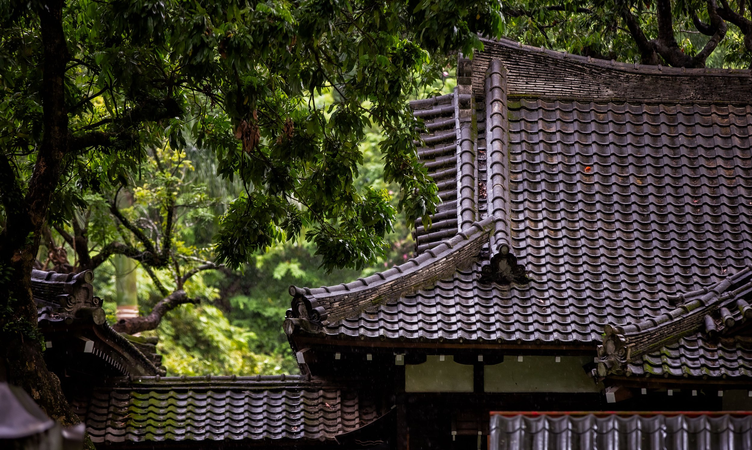
Luye Shinto Shrine (鹿野神社)

One of the most popular Taiwanese films to come out in recent years was the movie “Kano”, which told the story of an historic Taiwanese high school baseball team that participated in the Koshien Baseball Tournament in Japan and was one of those underdog sports stories that captivated audiences.

It also helped to rekindle a nations love for its national sport, which just years before had been embroiled in so many corruption scandals that people started losing interest.

The Kano Baseball Team (嘉農野球部) from central Taiwan’s Chiayi (嘉義) was a ragtag group of Hoklo, Hakka, Indigenous and Japanese players, who received little to no respect but ended up becoming the biggest surprise of Japan’s national baseball championships in 1931. 

Link: Japanese High School Baseball Championship (Wiki) 

While audiences loved the movie, there was a bit of confusion regarding its title.

Quite a few wondered aloud how a local movie could come out without a Chinese language title. 

They also wondered what “Kano” meant. 

Talk show hosts and commentators around the country tried to explain that the name was a reflection of the Japanese Colonial Era for which the movie was based.

This led not only to a renewed love of baseball, but also increased interest in learning more about that period of Taiwan’s history, which to be honest, isn’t covered all that well in the local school system. 

While it was great that the movie, which was critically successful at Taiwan’s box office, was doing such a great job creating a renewed interest about Taiwan’s history and baseball, there was still quite a bit of confusion about the word “Kano.” 

This is because not only was there a baseball team named “Kano”, there was also a town that shared the same name.

The baseball team was made up of students from the Kagi Agricultural and Forestry School (嘉義農林學校野), located in the central Taiwanese city that we know today as Chiayi, which was then known as Kagi.  

In Japanese, the mixture of the words “Chia” (嘉) and “Nong” (農) went together to make the abbreviation “Kano” (嘉農), which is admittedly a lot easier to say than the full name. 

Meanwhile the other “Kano” was a town on the East Coast, known today as “Luye” (鹿野) which, much like Yoshino Village in Hualien, was a Japanese immigrant farming community, just outside of Taitung city. 

Even though both were pronounced “Kano” in Japanese, they were completely different. 

There was however a relation between the two that a lot of people missed.  

Due to Taitung’s remoteness in the early years of the Colonial Era, some of the stars of the Kano Baseball team were Indigenous peoples from “Kano” who had left their homes to study as well as play baseball. 

Link: Taiwanese “Kano” Baseball Team Found its Field of Dreams (Nippon) 

In fact, the Luye-Shikano area has a long and successful history with baseball and from the elementary school level all that way to professional sports, the village has produced quite a few stars over the past century.

Today I’m not here to talk about baseball, I’m here to introduce a historic Shinto Shrine that was used as the central place of worship for that village, the Shikano Shinto Shrine

Before I talk about the shrine though, I’m going to take a few moments to introduce a little about the history of the immigrant community that made up most of what we know as Luye today.

Shikano Immigrant Village (鹿野移民村)

Kano Shinto Shrine

Kano Shinto Shrine

When the Japanese Colonial Era was established in 1895, the vast majority of Japanese who initially came to Taiwan were members of the Armed Forces, civil servants and engineers. Tasked with suppressing opposition to colonial rule and stabilizing the island, the first waves of Japanese citizens came here with the intent to prepare Taiwan for mass development and future colonization.

Prior to the arrival of the Japanese, it would be an understatement to say that Taiwan was an untapped treasure - The Hoklo, Hakka and Indigenous people who had inhabited the island up until that point were mostly subsistence farmers, who gave little thought to developing the island in a centralized way, apart from ensuring their own livelihoods.  

For the Japanese, Taiwan was a treasure trove of resources that would be instrumental in fueling the expansion of their empire.

First though, Taiwan, their model colony would have to be tamed. 

Luye Police Station (鹿野派出所)

Luye Police Station (鹿野派出所)

After more than a decade of development, the powers that be decided that it was time to start an emigration process that would allow Japanese citizens to come to Taiwan and settle on land provided for them.

The thought process behind this was that Taiwan was in need of an influx of a different class of immigrant as there was a need for agricultural workers as well as people who could contribute to the various mining and forestry industries (among others.)

One of the interesting things about these communities was that their development could be either public or private, which meant that some of them were planned by the government, while others were privately sponsored by some of the larger corporations that came to Taiwan.

Even though the vast majority of the communities ended up being occupied by farmers, there were also others that were developed for miners, fishers, forestry and industrial workers.

Kano Elementary School (鹿野公學校)

Kano Elementary School (鹿野公學校)

The more nefarious reason as to why the government instituted this kind of immigration policy was to start importing boat-loads of lower-class Japanese citizens, who would eventually outnumber the original inhabitants of the island in an attempt at settler colonialism in an attempt to fast-track the assimilation process.

This policy was also considered beneficial to the government back at home in Japan as the country was quickly modernizing and discovered that there was a surplus of farmers and an increasingly limited amount of land for them to farm on. 

So, with an opportunity to make a new life in Taiwan, which included a great package of incentives, the waiting-list of Japanese citizens wishing to start a new life here was likely quite long. 

The ‘immigrant community’ (移民村) policy started in 1908 (明治41年), with the first official community established in Karenko Prefecture, known today as Hualien. 

The success of the first of these communities, known as Yoshino Village (吉野村), gave the government the incentive to continue establishing further communities along the east coast with several more established between 1912 and 1932. 

From Yoshino Village in Hualien, villages started popping up further south with Toyota Village (豐田移民村), Hayashita Village (林田移民村), Yoshita Village (賀田), Ikegami Village (池上) and most importantly for the sake of this article, Shikano (鹿野).

Kano Family Photo

Kano Family Photo

In 1915 (大正4年), the Shikano Immigrant Village was established by the Taitung Sugar Corporation (台東製糖株式會社) as a private community in the area we know today as Longtian Village (龍田村).

Initially a hundred lower-class families from Niigata Prefecture (新潟縣) on the western coast of Japan were invited and later that year the village expanded again to over four hundred families.

This technically made it the largest immigrant village in Taitung, with a population of around 1500 people. 

One of the things to keep in mind about this specific immigrant village though was that the majority of the residents were considered “short term” (短期移民) and came specifically to work in the sugar industry every year from November to April. Therefore the number of families living in the village wasn’t a constant, with the numbers changing at different times of the year. 

When the short-term seasonal worker situation was resolved, the population of the village eventually started to decline with only about 143 households (547 people) in 1919 (大正8年) and even less than half of that by 1943 (昭和18年). 

Still, even though Kano was a privately planned community, it came complete with schools, a hospital, an administrative centre, train station, a downtown core and of course a Shinto Shrine.

Today, not only are we able to enjoy the fully restored Shinto Shrine, but several other buildings from the colonial era as well as Japanese-style urban planning, which has become quite popular with contemporary Taiwanese who enjoy the large open spaces with wide tree-lined roads.

Visiting the former immigrant village these days gives people a diverse look into Taiwan’s modern history while also allowing you to imagine that you’re visiting the Japanese countryside!  

Shikano Shinto Shrine (鹿野神社)

Surprisingly, the Kano Shinto Shrine, or the “Luye Shinto Shrine” as we call it today wasn’t actually constructed until almost a decade after the Kano Immigrant Village was established.

When immigrants first started arriving in Taito Prefecture (台東廳), the closest place of worship would have been the Taitung Shinto Shrine, which at the time was probably all they needed considering that the majority of them were sponsored by the Taitung Sugar Corporation, which was located nearby the original Taito Shinto Shrine. 

Fortunately, by the time that the Taito Shinto Shrine became a Prefectural Shrine (縣社) and was moved to Liyu Mountain (on the other side of Taitung City), the Kano Shinto Shrine had already been established.

Officially opened on July 10th, 1923 (大正12年), the Kano Shinto Shrine was much smaller in scale than the Taitung Shrine and was classified as a “Mukaku-sha” (無格社) or a Village Shrine (社祠) without ranking by the official Shakaku (社格) Shrine Grading System.

Link: Modern system of ranked Shinto shrines (Wiki)

While it may sound a bit harsh that the shrine had no ranking, that was common for the vast majority of the two hundred of more shrines constructed in Taiwan during the Colonial Era, of which Taitung itself was home to around fifty.

Originally constructed in the northern area of the village in a valley between the Luye Plateau (鹿野高台) and Horseback Mountain (馬背山), it’s location proved somewhat problematic as it wasn’t very convenient for the vast majority of the villagers given that it was at least a three kilometer walk from the train station.

So, in 1931 (昭和6年), the shrine was relocated to its current location next to Kunci Hall (崑慈堂), which was ideal as it was a short walk from the Elementary School.

As a smaller shrine, the Kano Shinto Shrine only consisted of the following: 

  1. A large gate or “torii” (鳥居)

  2. A walking path or “sando” (參道)

  3. Stone Lanterns or “toro” (石燈籠)

  4. A Purification Fountain or “chozuya” (手水舍)

  5. Stone Guardians or “komainu” (狛犬)

  6. A Main Hall or “honden” (本殿)

Given its size, the Kano Shrine wasn’t home to a Hall of Worship (拜殿), so in this case, as a Hokora-style (祠 / ほこら) shrine, we’re actually able to approach the Main Hall, otherwise known as the Honden (本殿) and get a good look at its architecture.

Back in Japan, Shinto Shrines come in all shapes and sizes and for shrines like this one, you’re always able to get a good look at the architecture of the Main Hall. It’s important to note though that with most of the larger shrines (like some of those that still exist in some form in Taiwan), the general public is rarely ever able to get a good look at the Main Hall as it is considered a sacred-space.

The best example that we have here in Taiwan of an original ‘Haiden’ and ‘Honden’ in its original condition is at the Taoyuan Martyrs Shrine, where you’re currently able to approach the rear of the shrine, which was at one time only ever frequented by the priests who took care of the shrine. 

Where the Kano Shinto Shrine stands apart from the other shrines that have been preserved in Taiwan is that you can easily examine it’s architectural design, which gives away some obvious clues about the shrine to those who are in the know about these small details.  

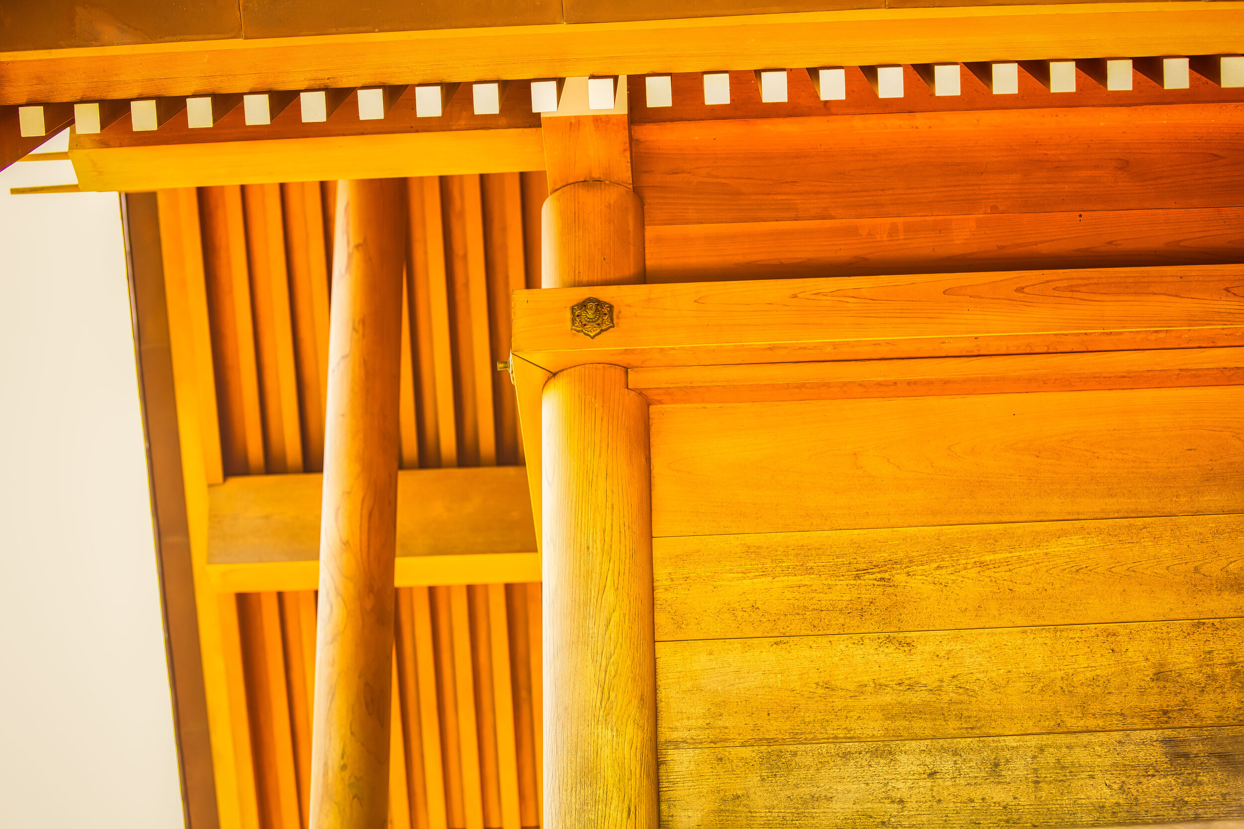
In this case, the Main Hall is designed in the ancient ‘Taisha-zukuri’ (大社造) style, which indicates that the building is elevated off the ground, usually by stilts, but in this case on a concrete base.

The current base of the shrine is the original one from 1931, which makes it the only original part of the shrine that still remains today. 

Like a lot of Japanese-style shrines, the roof of the building is considerably larger than its base.

Part of the genius of Japanese design is that the building, known as the moya (母屋) couldn’t possibly support the weight of the roof on its own, but thanks to a network of joints and trusses and the help of pillars along the veranda, the building is able to withstand the weight and ensure years of stability. 

Often going hand-in-hand with the elevated design of the building, the shrine makes use of the gabled kirizuma-zukuri (切妻造) style of roof.

This style differs from the typical four sided hip-and-gable style of roof that you would find at other Japanese-style buildings and consists only of two inclined surfaces on the front and back that form a ridge at the top.

Essentially, it’s meant to look like a book that is resting with its cover facing up.

In order to stabilize the roof and distribute its weight, there are two large pillars to the left and the right of the building that are kept in place by the cement base below. Both of the pillars are quite thick and have been crafted with cypress, like the rest of the building, which is known for its sturdiness.

Another important aspect of the design to pay attention to are the katsuogi (鰹木/かつおぎ) and chigi (千木) ornaments on the roof.

To the naked eye, they may just seem unimportant, but they have traditionally been used to differentiate Shinto Shrines from Buddhist Temples in Japan as well as indicating the ‘kami’ that are enshrined within.

The katsuogi are the long timber-like pieces of wood that rest on the flat base of the roof.

An even number indicates a female divinity while an odd number signifies a male.

In the case of this shrine, there are five of them, meaning that the kami enshrined within are male.  

Likewise the ‘chigi’ can be cut either horizontally or vertically, known as uchi-sogi (内削ぎ) and soto-sogi (外削ぎ) respectively.

How they’re cut likewise indicates the kami within, so It should then be no surprise that the ‘chigi’ at this shrine are cut vertically in the ‘uchi-soto’ style as the katsuogi mentioned above already indicates a male divinity. 

The chigi on the building are practically decorated with kazana (風穴), which are decorative holes in the tips of the finial, which allow for the passage of wind and for the stabilization of the roof.

Links: Katsuogi | Chigi (Wiki)

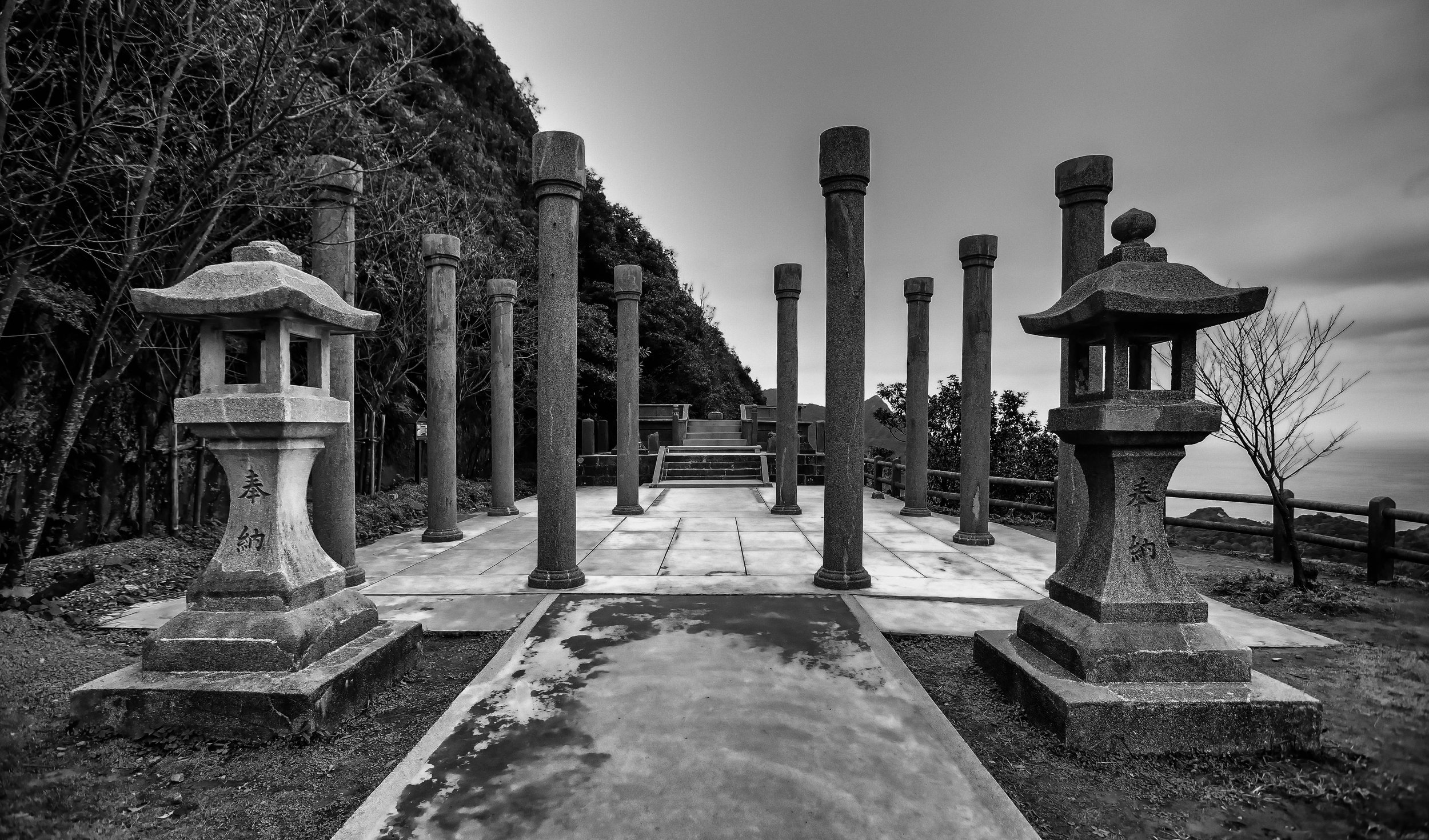
Currently the only pieces of the shrine that exist on the site today apart from the shrine itself are a couple of lanterns, an unfinished purification fountain and a shrine gate. 

Deities 

As was the case with most of Taiwan’s other shrines during the colonial era, the kami enshrined within were all familiar figures, which included the Three Deities of Cultivation and Prince Kitashirakawa Yoshihisa.

The ‘Three Deities of Cultivation’ (かいたくさんじん / 開拓三神), consist of three mythic figures known for their skills with regard to nation-building, farming, business and medicine. 

The three gods are as follows:  

  1. Ōkunitama (大國魂大神 / おおくにたまのかみ)

  2. Ōkuninushi (大名牟遲大神 / おおなむちのかみ)

  3. Sukunabikona (少彥名大神 / すくなひこなのかみ)

The first mention of these deities was in the ‘Birth of the Gods’ (神生み) section of one of Japan’s most important books, the ‘Kojiki’ (古事記), or “Records of Ancient Matters”, a thirteen-century old chronicle of myths, legends and early accounts of Japanese history, which were later appropriated into Shintoism. 

While these three deities date back well-over a thousand years, the other one that was enshrined within the Taitung Shinto Shrine was a considerably younger one. 

In fact, most of the over two hundred Shinto Shrines constructed in Taiwan during the colonial era, most were home to shrines dedicated to Prince Kitashirakawa Yoshihisa (北白川宮能久親王) 

Prince Yoshihisa had the unfortunate luck of being the first member of the Japanese royal family to pass away while outside of Japan - in more than nine hundred years.

The reason why his worship is so prevalent here in Taiwan is due to the fact that it is believed he died of malaria while on military campaign in Tainan in 1895.

Although it is also thought that he might have been shot by Taiwanese guerrillas on a mountain in Hsinchu.

Link: Prince Kitashirakawa Yoshihisa (Wiki) 

Restoration 

Suffice to say, when the Colonial Era ended in 1945 and the Japanese residents of Taiwan were sent back to Japan, this shrine, like so many others around Taiwan didn’t last very long.

Given its location, especially with regard to the locals schools, the Chinese Nationalists didn’t waste my time tearing it down as it would have been considered an obstacle to their authority.

Interestingly, even though the shrine was destroyed, the name of the village was never changed.

Instead of referring to it as ‘Kano’ in Japanese, it was simply changed to ‘Luye’, the Chinese pronunciation of the same Chinese characters. 

After the shrine was destroyed, not much happened on the land where it existed save for the construction of a Chinese temple named Kunci Hall. The temple later constructed a pavilion on the concrete base where the shrine used to exist, but for the most part nature took its course and reclaimed the area. 

In 2013, the local government in conjunction with the Ministry of Transportation (交通部) and the Tourism Bureau (観光局) started a two-year process of research and planning that sought a partnership with craftsmen in Japan to recreate and restore the Shinto Shrine to its original condition. 

Oddly, the only stipulation was that once the shrine was completed, that it not house any deity and it be used only for tourism-related purposes.

So even though the Luye Shinto Shrine today appears to be a ‘shrine’, you’d be wasting your time clapping your hands and praying in front of it as the deities never actually returned to their original home.

The most important fact that I could tell you about the reconstruction of this shrine is that when it was being restored, the Taiwanese government contracted a very elite group of carpenters in Japan, known as Miyadaiku (宮大工).

These carpenters have been honing their craft for well over a millennium and are masters at construction techniques that doesn’t use nails, screws, glue or electric tools.

Everything is hand-made, and like a puzzle, it all fits together thanks to a genius network of wooden joints. 

Link: Japanese Carpentry | 宮大工 (Wiki)

The unfortunate thing about this specialized style of Japanese carpentry is that it is something of a dying art. There are less than a hundred Miyadaiku carpenters still practicing their trade in Japan today and its an art form that is sadly on the brink of dying out within the next few decades.

One last thing I should note is that even though reconstruction on the shrine was “completed” in 2015, construction on the site is on-going with restoration still taking place on the purification fountain as well as on the landscape that surrounds the shrine. 

If you’ve seen photos of the shrine elsewhere on the internet, the environment surrounding the shrine probably seems completely different than what you’ve seen here as the local government continues to enhance the site. I was personally quite surprised when I showed up to check it out as the background didn’t appear to be even remotely similar to what I had seen prior to my arrival.

Nevertheless, the Kano Shinto Shrine is alive again and its existence is a great reminder of the history of this beautiful little tourist village on the east coast of Taiwan. 

Getting There 


Luye is a large township situated just outside of Taitung City and Longtan Village (龍田村), where the shrine is located, is probably one of the most popular areas to visit for tourists. 

Even though the shrine is a bit of a distance from Taitung City, getting there is rather straight-forward and once you’re there you’ll also be able to visit some of the other nearby attractions, which most likely means the famed Luye Plateau (鹿野高台), where the Taitung Hot Air Balloon festival takes place every year.

If you have your own means of transportation, getting to the shrine shouldn’t be much of an issue, but even if you don’t, there are more than enough public transportation options to help. 

If you’re driving a car or a scooter, simply input the address or coordinates below into your GPS or Google Maps, and you’ll find yourself there after a beautiful drive through the Taitung countryside.   

Address: No. 308, Guangrong Road, Luye Township, Taitung County.

(台東縣鹿野鄉光榮路308號)

GPS: 121.120620, 22.904150

If on the other-hand you’re relying on the public transportation option, you’ll have a number of options, but will have to keep in mind that you’ll likely have to walk a few kilometres to get to the shrine from the train station or the bus stop. 

Train

No matter if you’re coming from the north or the south, you’ll have to hop on a Local Train (區間車) and ride until you reach Luye Train Station (鹿野車站), where you’ll get off and make your way to the shrine from there. 

Bus

Taitung Bus (台東客運): #8161, 8163, 8165, 8166, 8167, 8168, 8170

For each of these buses (as well as the train), you’ll get off at Luye Train Station and from there the shrine is about a 2.5km walk passing by Longtan Park (龍田公園) and following Guangrong Road (光榮路) until you reach the shrine.

Even though it seems like a long walk, the road is absolutely beautiful and you’ll see quite a few historic buildings along the way. 

Taiwan Tour Bus (台灣好行): Luye Line (鹿野線)

This bus is probably the most convenient in terms of travel as it will bring you directly to the shrine where you’ll get off at the Kunci Temple (崑慈堂) bus stop. The only problem with this bus is that it doesn’t come all that frequently, so you’ll end up wasting a long time waiting for it to show up which pretty much makes the other bus options much more attractive.

Bicycle 

One of the most popular activities for tourists visiting Longtian Village is to take the bus or train to Luye Station and from there renting a bicycle from one of the many nearby vendors.

Renting a bicycle at one of these shops allows you to skip the long walk to the shrine and also allows you to enjoy some of the other attractive destinations in the area.

I’m not going to promote any of the specific vendors, but all of the prices should be relatively similar and the rental of a bicycle shouldn’t cost you any more than $100-200NT for the day, depending on the size of the bike you rent.

While in town, don’t forget to check out the nearby Luye Plateau (鹿野高台), the Longtian Green Corridor (龍田綠色隧道), the Tung Blossom Avenue (龍田桐花大道) as well as the various other Japanese era homes that are still located in the area.

If you’re lucky enough to be in town during the hot air balloon festival, you’ll be sure to have a great time as its one of the most popular times of the year to visit the area. 

The Luye Shinto Shrine is an excellent example of how Taiwan’s former Shinto Shrines can and should be restored. With the help of Japanese craftsmen, the shrine has been brought to life once again and even though it could be considered to be in a remote location, it has become one of Taitung’s most popular tourist attractions. With that in mind, I’m sure there are quite a few local governments around Taiwan thinking about following the same formula, which could possibly translate into even more reappearing over the next few years! 

Footnotes

  1. 鹿野神社 - 鹿野移民村神社 (神社殘跡)

  2. 日本移民村 (Encyclopedia of Taiwan)

  3. 台灣日治時期日本移民村 (Wiki) 

  4. 台灣神社列表 (Wiki)

  5. Taitung Japanese Immigrants Village - Longtian Village (Hakka Affairs Council)

  6. 神社の千木と鰹木の意味

  7. “Honden”: The Main Sanctuary Structure (Nippon)

  8. Modern system of ranked Shinto shrines | 近代社格制度 (Wiki)

  9. 台湾で完全な形で復元された「鹿野神社」が台東縣にあります (Meilytaiwan)

  10. 歲月的容顏 龍田老照片 龍田蝴蝶協會提供 (龍田歲月)

Sanxiantai (三仙台)

A while back I was having a chat with some friends who had just returned from a vacation to the East Coast of Taiwan. We talked about some of the locations that they visited and what they enjoyed most about their trip.

When they mentioned the most beautiful location on their trip, I instantly recalled my first trip to the Taitung more than a decade ago when I was also new to Taiwan.. 

It was one of those early experiences that helped to cement my lifelong love affair with this beautiful country. 

So when my friends mentioned that they really enjoyed visiting Sanxiantai, one of Taitung’s most popular tourist attractions, I decided to ask a bit more about their experience. 

You see, the last time I visited, the network of trails on the island were still under construction and if you wanted to actually walk around, you had to be adventurous, which obviously wasn’t a problem for me. 

To my surprise though, my friends replied that they just walked halfway across the bridge and then turned back. 

To which I replied: “So, you didn’t actually visit Sanxiantai then, did you?” 

Confused by my reply, I had to explain that the name  “Sanxiantai” actually refers to the island and not the bridge, which has become an iconic image in recent years. 

Unfortunately, my friends aren’t the only ones who missed out.

Quite a few travelers end up visiting the area, taking photos of the bridge and the surrounding landscape and then moving onto the next destination.  

If you ask me, that’s a shame - Sanxiantai is a geologically rich and historically significant island that provides tourists with some great photo opportunities, as well as the ability to quickly walk around and learn about its unique coastal ecology.  

Sanxiantai (三仙台)

Sanxiantai” as the island is known in both Chinese and English, is an ecologically rich off-shore island located in Northern Taitung’s Chenggong Township (成功鎮), and is one of the most popular tourist attractions on the east coast.

The island was originally named Nuwalian (最東之地) and Pisirian (牡羊之地) in the Indigenous Amis language (阿美語), translating as “The Far East” and “Shepherds Land”, respectively. 

Interestingly, it has also been referred to as Diaoyu Island (釣魚台) by early Chinese immigrants, which was a nod to its historical importance for local fishers. 

Note: “diàoyú” (釣魚) in Chinese is the verb “to fish” while “tai” (台) is a “platform.” 

What’s notable about this is that there are a group of islands located between Japan and Taiwan that are also referred to as the Diaoyu Islands (釣魚台) or the Senkaku Islands (尖閣群島) that have been the subject of a decades long territorial dispute between the governments of Japan, Taiwan and China. 

The current name of the island is a more recent one and is steeped in Chinese legend. 

The Legend of the Three Immortals (三仙傳說)

“Sanxiantai” (三仙台) or the “Platform of the Three Immortals” gets its name from the three giant rocks that define the landscape of the small island.

According to a relatively recent tale, each of the rocks represents the footprint of one of three Taoist deities, who are said to have landed on the island at some point in their travels. 

The “immortals” (仙) in particular are Li Tieguai (李鐵拐), Lu Dongbin (呂洞賓) and He Xiangu (何仙姑) and if you weren’t already aware, are important members of the much larger group of “Eight Immortals” (八仙), a source of inspiration and devotion for Taoists. 

Link: Eight Immortals (八仙) 

How the legend about the Three Immortals leaving their footprints on the island came about is something that I’m not really able to answer. There are disagreements about the legends as some people insist that the three giant rocks are “footprints” of the immortals while others argue that the rocks are the “immortals” themselves.

The positioning of the rocks however is an important part of the myth as stories tell of a ‘love affair’ between the only female immortal, He Xianggu and the notorious ladies man, Lu Dongbin, which ended up getting interrupted by the third-wheel on the trip, Li Tieguai, who wasn’t having any of Lu’s philandering and used his god-like powers to drive a wedge between them. 

For a bit of a backstory, the Eight Immortals live on a mythological island known as Mount Penglai (蓬萊仙島), thought to be located somewhere “east” of China. Even though Sanxiantai has never been considered the mythological island, local legends insist that it was simply a resting place for the three immortals on their journey.

Although the earliest mention of the Eight Immortals is thought to have been between the Tang and Song Dynasties (618 - 1279), it wasn’t until the Ming Dynasty (明朝), when Wu Yuantai (吳元泰) wrote “The Eight Immortals Depart and Travel to the East” (東遊記) that their legend started to become popular. 

Considering Taiwan is geographically “east” of China, stories like this, and of course “The Eight Immortals Cross the Sea” (八仙過海) are popular with Taoists here in Taiwan.

The story about the immortals crossing the sea to the east holds special meaning for people here considering that the legends typically focus on each of the immortals showing off their supernatural skills to help the others cross the sea. From this we get the Chinese-language idiom: “八仙過海,各顯神通” which literally translates as “The Eight Immortals Cross the Sea, Each Reveals its Divine Powers”, a metaphor for the ability to successfully work together to achieve a common goal.  

If you’re visiting Taiwan and you visit a temple, it’s very likely that you’re going to see something related to the Eight Immortals, even if you don’t actually realize it.

Likewise, if you keep traveling north of the island to Hualien, you’ll eventually arrive at the “Cave of the Eight Immortals” (八仙洞), another tourist destination dedicated to the Taoist deities.  

The Legend of the Chifawuan

In a legend about the island that pre-dates the tale of the Three Immortals, the indigenous Amis people have their own stories about the island, which I personally find much more interesting. 

According to the Amis, the island was home to a sea-dragon named “Chifawuan” (及發烏安).

Living within a cave, the dragon was considered a protector deity for the local communities, who believed that their fortune or misfortune, were a direct result of human action. 

The thing about this legend that makes it so meaningful is that the Amis people thought of the dragon as a spiritual protector of the environment, which would punish those who took too much from the land and the sea.

So, if you were a fisher and you took more than your fair share from the ocean, the dragon would appear to deal out some form of punishment. 

What we can take away from this tale is an admirable lesson that has remained an important part of Taiwan’s various indigenous cultures in that there should always be an ecological balance with the environment. 

As the tale goes however, the land was once home to an abundance of sea snails (大海螺), which became a prized commodity that the local people used for trading. As this ended up being a lucrative business opportunity, basic human greed took over and the population of snails on the island was quickly depleted.

The dragon was so enraged about this that it triggered a massive earthquake that created the island that we know today, which prevented people from trespassing on it.

Unfortunately, the power it took to achieve this ultimately killed the dragon.  

Official government literature on the subject describes both of these tales as an example of the imaginative legends of local indigenous people and the Taoists that immigrated here and “illustrates the different histories, religions, and cultures of these two ethnic groups.” 

The lessons learned from the Amis tale however remains important in a contemporary setting as humanity looks to find ways to find a better balance with our natural environment. 

Geography of Sanxiantai

As mentioned above, most tourists attracted to the area come under the assumption that the name “Sanxiantai” is actually referring to the beautiful bridge that connects to the island.

The twenty-two hectare island, which prominently features three large mountain-like rocks is estimated to have formed hundreds of thousands (if not millions) years ago.

Geologists link the creation of the island to the eruption of the now-extinct underwater Duluan Volcano (都巒山層), which also formed much of what we today refer to as the East Rift Valley (花東縱谷). 

Science it seems partially agrees with the Amis legend above in that Sanxiantai wasn’t always an island.

It was at one time connected to the rest of Taiwan as a headland, but thousands of years of sea activity eventually eroded away the low lying strip of land between the two. 

Still, when the tide is out, if you don’t mind getting your feet wet, it’s possible to walk across the coral beach to the island. 

But why would anyone bother when you have such a beautiful bridge to enjoy?

Link: 台灣東部知識單元資料庫 (National Museum of Natural Science)

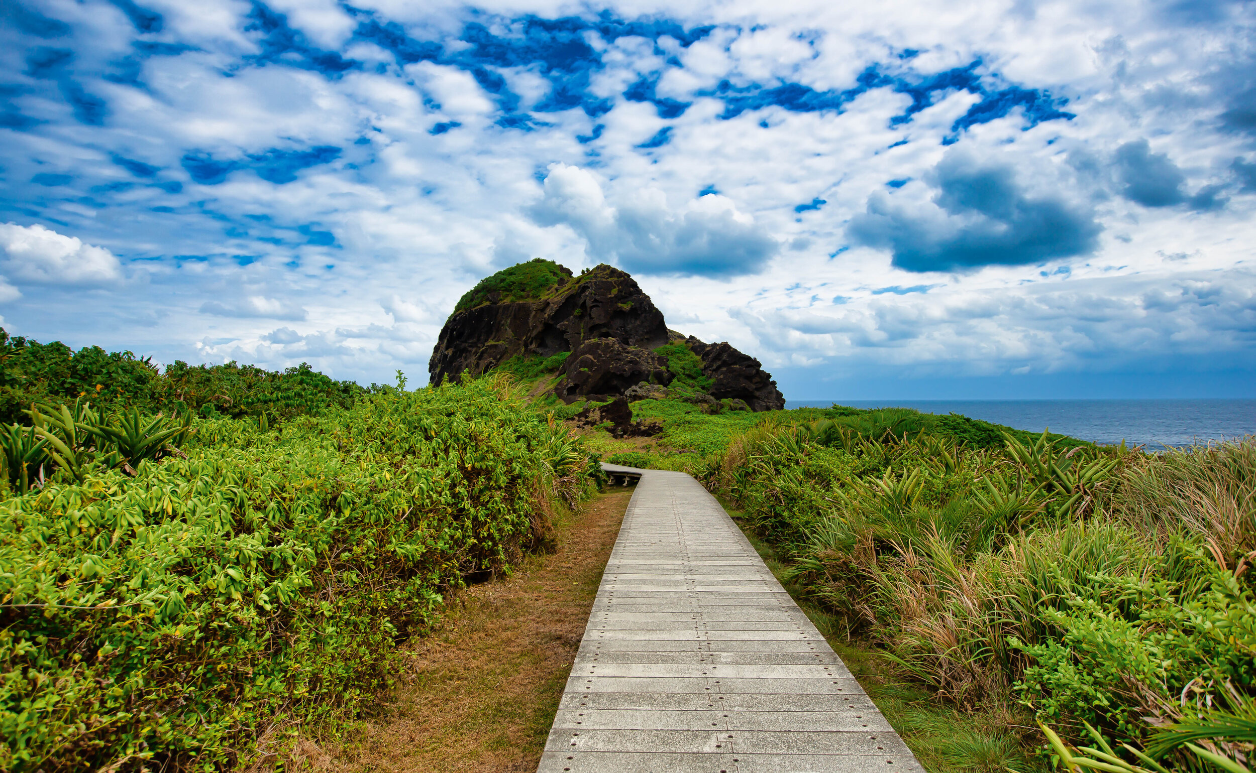
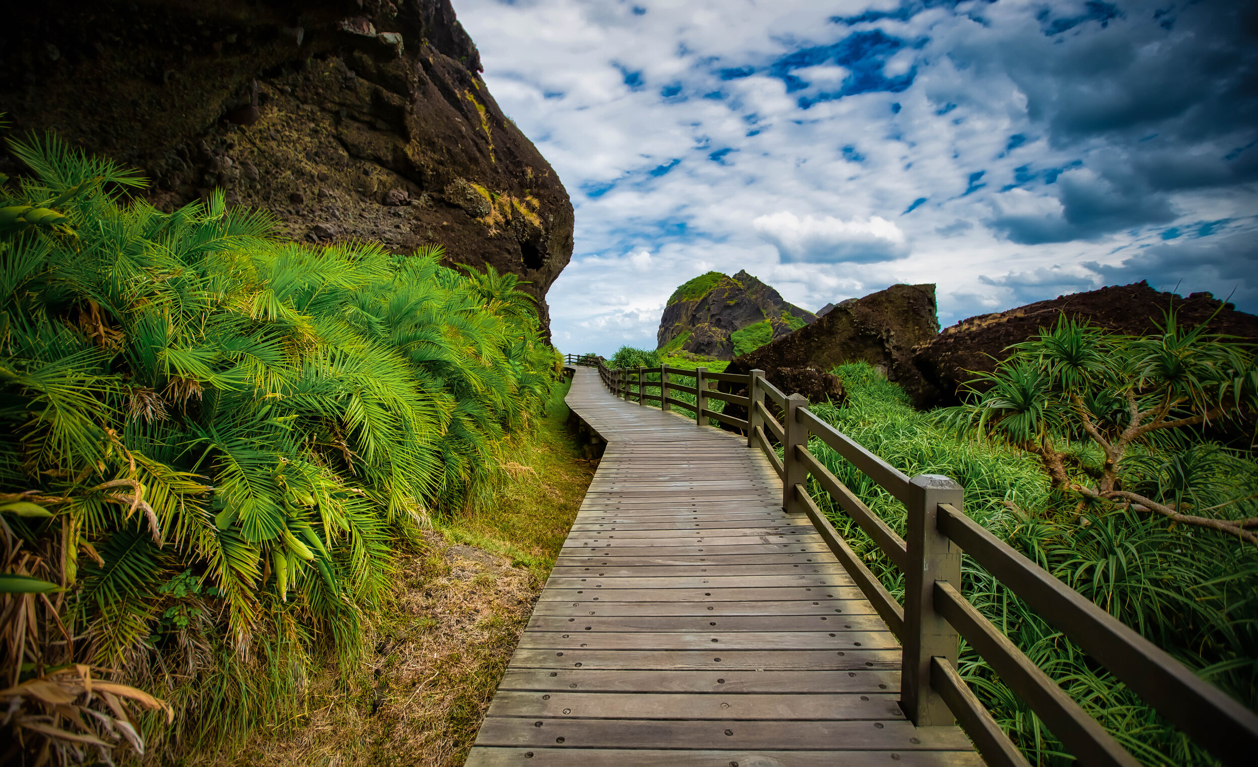
Currently, the island is well-connected with a network of footpaths that have been constructed allowing visitors the opportunity to hike around the island as well as to its highest point, the Sanxiantai Lighthouse (三仙台燈塔.) 

Apart from simply walking around the island, its important to note Sanxiantai is surrounded by coral reefs and has easily-accessible underwater caves that makes it a haven for tropical fish.

The area has always been a popular spot with local fishers, but recently it has also become popular with divers who come to enjoy one the underwater beauty of the island.

Whatever your preferred type of recreation, Sanxiantai is a geologically diverse island that features sea-eroded caves, rare coastal vegetation, a rocky moon-like surface, beautiful views of the Pacific Ocean and of course a great vantage point to look back at the beauty of Taiwan’s eastern coast. 

Unfortunately as I mentioned above, quite a few people show up to the area to check out the beach and the bridge before heading on to their next destination.

I highly recommend that if you are visiting this area that absolutely must walk across the bridge and take some time to walk around the beautiful island as well. 

Links: Sanxiantai (Taiwan Gods) | Sanxiantai (East Coast National Scenic Area)

Ba-Gong Bridge (跨海八拱橋)

Probably the highlight of most people’s visit to Sanxiantai is the famed bridge that connects the island to the rest of Taiwan. The four-hundred meter long arched bridge has become an iconic image for the east coast and any visit to Taitung would be incomplete without checking it out. 

Often confused with the island itself, the bridge is actually named Ba-Gong Bridge (八拱橋), which quite literally means “Eight-Arch Bridge,” but is a name that gets little mention in English-language literature.  

The construction of the bridge (and the success of Sanxiantai as a tourist attraction today) are the result of the hard work of Mr. Lee Hua-dong (李華棟), who is considered to be the Father of Sanxiantai (三仙台之父). 

With the opening of Sanxiantai as a recreational tourist area after Martial Law (戒嚴時期) was lifted in 1987, the construction of a bridge became essential.

Constructed that same year, the bridge is beautifully designed and was done so in an environmentally friendly way attempting to put as little burden on environment as possible. 

Designed to look like a dragon (possibly a nod to the Amis legend), the blue and red bridge also resembles the powerful ocean waves that the east coast is known for. 

Prior to the construction of the bridge, the only way to actually reach the island was to wade through the water at low-tide or go across in a keep. The latter caused quite a bit of ecological damage to the coral bed, so the presence of the bridge today helps the environment by allowing tourists to walk across to the island, without negatively affecting the coral. 

Although the bridge is four-hundred meters long, walking across it might take a while as it can be quite windy.

And because it’s also a great spot for taking photos!

Getting There


Getting to Sanxiantai should be rather straight-forward. 

It is situated directly along the Number 11 Coastal Highway (台11線) between Hualien and Taitung, which is probably one of the busiest and most identifiable roads on the entire East Coast. 

Unfortunately the island is quite far from both cities, which is why some tourists might run into trouble getting there.

Located around fifty kilometres north of Taitung City and over one-hundred kilometres south of Hualien, if you’ve got a car or a scooter, you shouldn’t have much of a problem, as it is hard to miss.

Address: #74 Jihui Road, Chenggong Township, Taitung. (臺東縣成功鎮三仙里基翬路74號)

GPS: 121.42168/23.126135

If you find yourself on the East Coast without a car or scooter however, you’re going to have to rely on public transportation, which truthfully isn’t all that convenient or reliable. 

Nevertheless, you do have a few options for getting there. 

  • From Hualien Train Station (花蓮車站) take Hualien Bus (花蓮客運) #1145.

  • From Taitung Train Station (台東車站) take Ting-tung Bus (鼎東客運) #8101, #8101A or #8102.

No matter what direction you’re coming from, make sure to get off at the Sanxiantai Bus Stop (三仙台站)

If you elect to take the bus option, I highly recommend you pay very close attention to the time tables linked above for each of the buses as they don’t come all that frequently.

If you’d prefer not to take a bus and waste time waiting around, there is also the option of booking a taxi for the day that will take you to Sanxiantai and some other locations for a set price.  

The Taitung County Government Tourist Bureau has a list of ‘trustworthy’ drivers that are available for booking, which I’ve linked below. This method might be a bit more expensive, but if you’re traveling with friends or family, it might be a more convenient option. 

Link: Taitung Taxi Tour Drivers (Taitung Tourism) 

Even though Sanxiantai is a bit of a distance from Taitung City, it is still one of those tourist destinations that you absolutely have to visit when you’re on the East Coast. 

With this one I don’t feel like I have to do too much pushing as the iconic bridge has become an iconic image used to promote Taiwan to the rest of the world. 

Unfortunately, if you hadn’t already noticed, the weather on the day I visited was pretty awful.

So, don’t be surprised if you see this space updated sometime in the future with prettier photos.


Hualien Martyrs Shrine (花蓮忠烈祠)

Here we go again. 

This is my fourth go at posting about Taiwan’s Martyrs Shrines this year. 

As I’ve already mentioned a few times over the past few months, when I was considering where I would focus as part of my yearly project for this blog, I came up with the idea to continue my work with regard to places of interest from the Japanese Colonial Era. 

Albeit with a bit of a caveat. 

I decided that I’d make a concerted effort to visit some of the various “Martyrs Shrines” around Taiwan, which were originally home to a Shinto Shrine.

It might be difficult to imagine, but Taiwan was once home to well-over two hundred Shinto Shrines. 

However, as the Japanese colonial regime was replaced by the “Republic of China”, the majority of the them ended up being destroyed, with only a select few of the larger ones retaining a semblance of their former selves. 

In my post about the National Revolutionary Martyrs Shrine (台北忠烈祠) in Taipei, I listed fifteen of these former Shinto Shrines scattered throughout Taiwan (and on Penghu) that continue to exist in some form today.

Some of which I’ve already posted about: 

  1. National Revolutionary Martyrs Shrine (國民革命忠烈祠)

  2. New Taipei City Martyrs Shrine (新北市忠烈祠)

  3. Taoyuan Martyrs Shrine (桃園忠烈祠)

  4. Tungxiao Martyrs Shrine (通宵忠烈祠)

  5. Taichung Martyrs Shrine (台中忠烈祠)

  6. Changhua Martyrs Shrine (彰化忠烈祠)

  7. Yilan Martyrs Shrine (宜蘭忠烈祠)

  8. Taitung Martyrs Shrine (台東縣忠烈祠)

That’s eight, so if your math is good, you’ll probably realize that I still have seven to go! 

Even though 2020 has been a pretty terrible year with regard to travel, here in Taiwan we’ve been lucky that the government was proactive and on the ball, saving us from a massive outbreak of COVID-19.

But instead of taking trips overseas, many Taiwanese (and myself included) instead traveled around Taiwan to enjoy all that this beautiful country has to offer. 

I took a several-week trip to the South East Coast to visit some places that have been on my list for a long as well as saving some time to hang out and relax on a beach. Two of the places on my list to visit were two of the Martyrs Shrines that I haven’t been to yet, namely the Taitung shrine and the Hualien shrine. 

Suffice to say, one of the shrines ended up being extremely disappointing, while the other ended up being a really great experience. Today I’m going to introduce the latter of the two.  

The Hualien Martyrs Shrine isn’t what you’d consider a popular tourist attraction by any means, but it is one of the prettiest of all the Martyrs Shrines in Taiwan, and was once home to an even more beautiful Shinto Shrine.

Let me start by introducing that shrine!

Hualien Shinto Shrine (花蓮港神社)

The “Hualien Shinto Shrine”, otherwise known as Karenko Shrine (花蓮港神社) or “Karenko jinja” was a Prefectural Level (縣社) shrine that existed on this site from 1915 until 1981, when it was demolished to make way for the current Chinese-style Martyrs Shrine. 

The shrine was officially opened to the public on August 19th, 1915 (大正4年) and before becoming the central shrine in the prefecture, it was known simply as the “Hualien Harbour Shrine,” and just so happened to be one of the most architecturally significant shrines in Taiwan. 

When I say architecturally significant, its not because the shrine was constructed in a way that differed from any of the other shrines around Taiwan or those back in Japan, but because at the time it opened, if you wanted to visit, you had to walk across a suspension bridge over the Meilun River (美崙溪). 

Link: 花蓮市區內神社舊址導覽 (ARCGIS)

This would have made the traditional “Visiting Path” that you find at Shinto Shrines one of the longest in Taiwan and also would have provided some spectacular views of the shrine as you approached.

You’d likewise also would have had even better views of the city when you looked back from atop the hill. 

Fortunately the shrine was so beautiful that there are a multitude of historic photos from various sources around Taiwan that I’m able to share with you today. 

As always though, the former Shinto Shrine consisted of the following: 

  1. Two large Shrine Gates or “Torii” (鳥居)

  2. A walking path or “Sando” with a suspension bridge (參道)

  3. Stone Lanterns or “tōrō” (石燈籠) on either side of the walking path.

  4. Stone Guardian Lion-Dogs or “Komainu” (狛犬)

  5. An Administration Office or “Shamusho” (社務所)

  6. A Purification Fountain or “Chozuya” (手水舍)

  7. A Hall of Worship or “Haiden” (拜殿)

  8. A Main Hall or “Honden” (本殿).

As the largest shrine in Hualien, the shrine was officially designated a Ken-sha (縣社) or “Prefectural Level” shrine a few short years after it opened on March 2nd, 1921 (大正10年). 

As a Prefectural Level shrine, the ‘kami’ (deities) enshrined within were quite important, but as was the case with almost every other large shrine of its kind in Taiwan, the deities were actually all familiar figures, which included the Three Deities of Cultivation (開拓三神) and Prince Kitashirakawa Yoshihisa (北白川宮能久親王.) 

The ‘Three Deities of Cultivation’ (かいたくさんじん / 開拓三神), consist of three figures known for their skills with regard to nation-building, farming, business and medicine. 

The three “Kaitaku Sannin” are as follows: 

  1. Ōkunitama no Mikoto (大國魂大神 / おおくにたまのかみ)

  2. Ōkuninushi no Mikoto (大名牟遲大神 / おおなむちのかみ)

  3. Sukunabikona no Mikoto (少彥名大神 / すくなひこなのかみ)

The first mention of these deities was in the ‘Birth of the Gods’ (神生み) section of Japan’s all-important ‘Kojiki’ (古事記), or “Records of Ancient Matters”, a thirteen-century old chronicle of myths, legends and early accounts of Japanese history, which were later appropriated into Shintoism. 

While these deities are also quite common among Japan’s Shinto Shrines, they were especially important in Taiwan due to what they represented, which included aspects of nation-building, agriculture, medicine and the weather.

Given Taiwan’s position as a new addition to the Japanese empire, ‘nation-building’ and the association of a Japanese-style way of life was something that was being pushed on the local people in more ways than one.

Likewise, since the economy in Taiwan at the time was primarily agricultural-based, it was important that the gods enshrined reflected that aspect of life. 

Coincidentally, even though the colonial era ended almost eight decades ago, this is something that remains somewhat of a constant as you’ll find that one of the most important deities in Taiwan is the Chinese folk religion “Earth God” (土地公/福德正神), who has a court that performs similar roles as the three mentioned above. 

Interestingly, even though the origins of the Three Deities of Cultivation dates back well-over a thousand years, the other ‘kami’ enshrined here was a much younger one. In fact, most of the larger Shinto Shrines constructed in Taiwan during the colonial era were home to shrines dedicated to this specific deity who was known in life as “Prince Kitashirakawa Yoshihisa.” 

Prince Yoshihisa, a major-general in the Japanese imperial army, was commissioned to participate in the invasion of Taiwan. Unfortunately for the Prince, he contracted malaria and died just outside of Taiwan making him the first member of the Japanese royal family to pass away while outside of Japan in more than nine hundred years.  

Shortly after his death he was elevated to the status of a kami under state Shinto and was given the name “Kitashirakawa no Miya Yoshihisa-shinno no Mikoto“, becoming one of the most prevalent deities here in Taiwan as well as being enshrined at the Yasukuni Shrine (靖國神社) in Tokyo. 

Link: Prince Kitashirakawa Yoshihisa (Wiki) 

As I mentioned above, when Taiwan’s Japanese Colonial Era came to an end in 1945, most of Taiwan’s smaller Shinto Shrines were torn down by the incoming regime, while the larger prefectural shrines were (for the most part) converted into Martyrs Shrines. 

The Hualien Shinto Shrine was surprisingly one of the few major Japanese-era shrines in the country to actually retain much of its original design for decades after the Chinese Nationalists took control of Taiwan. 

In 1950 though it was converted into the Hualien Martyrs Shrine (花蓮縣忠烈祠), with only minor changes taking place to the buildings on-site. 

In 1970 (民國59年), the suspension bridge, aptly named “The Shrine Bridge” (宮の橋) was destroyed by a typhoon and as Hualien had grown exponentially, the local authorities decided it was time to replace the pedestrian bridge with a much larger cement one which would allow more than just foot traffic to cross the river. 

Then, in 1972 (民國61年), the government of Japan signed a Joint Communiqué with the People’s Republic of China, starting formal diplomatic relations between the two countries.

One of the prerequisites for the agreement was that the Japanese government follow suit with America and the United Nations and drop relations with the Taipei-based government of the Republic of China.

The Japanese government’s decision to drop formal relations with Taiwan at that time was considered a major slap in the face to the people of Taiwan, which had up until then very favorable relations with their former colonial rulers.

Not only did this create quite a bit of anti-Japanese sentiment around Taiwan, but it also spurned the government into action with a retaliatory policy of tearing down anything related to Japanese culture or whatever remained from the Japanese colonial era.

Link: Japan-Taiwan Relations (Wiki) 

One of the victims of that anti-Japanese sentiment turned out to be this shrine, which was demolished and converted into a grand Northern-Chinese Palace style shrine, reopening to the public in 1981. 

Even though the Hualien Shinto Shrine outlasted many of its contemporaries in Taiwan, it still ultimately suffered the same fate and when it was demolished, not much was left of the original shrine. 

Today, one of the only pieces of the shrine that remains is the traditional “Shinme” (神馬/しんめ) or “Sacred Horse”, which is still standing near the shrine.

The “Kikumon” (菊紋) or the “Chrysanthemum Seal” of the Japanese Royal Family which typically adorns the belly of the horse however has been painted over with the star of the Republic of China.

Hualien Martyrs Shrine (花蓮忠烈祠)

As mentioned above, the Hualien Martyrs Shrine that exists today only dates back to 1981 (民國70年), making it a relatively young one by Taiwanese temple standards.

Having been around for the last four decades, you’d be forgiven for thinking that the shrine is even newer as it appears to be in pristine condition, thanks to the constant attention it receives from the local government. 

The shrine was constructed in the Northern-Chinese Palace Style (中國宮殿式建築), making its architectural style similar to many of the other Martyrs Shrines in Taiwan in that its design closely mimics that of the Forbidden Palace in the Chinese capital of Beijing.

Even though the shrine is open daily, it’s not likely that the actual shrine rooms will be open to the public as they are generally only open on special occasions. 

This shouldn’t be a huge surprise though - Martyrs Shrines aren’t really the typical kind of Taiwanese temple where people show up at regular intervals to show their respect and make a wish. They tend to be much more ceremonial in nature and are mostly used for propaganda purposes. 

So if you show up hoping to see inside the shrine room, you’re probably going to be disappointed. 

Nevertheless, in addition to honouring the war dead of the Republic of China’s Armed Forces, this shrine is also home to Spirit Tablets (牌位) for Koxinga (鄭成功) as well as Liu Yongfu (劉永福) and Qiu Fengjia (邱逢甲).

Liu was the commander of the celebrated Black Flag Army (黑旗軍), who later in life became the President of the short-lived Republic of Formosa (臺灣民主國). Qiu on the other hand was a Hakka poet, a renowned patriot, and the namesake for Taichung’s prestigious Fengjia University (逢甲大學). 

Despite the obvious disparity between the current Chinese-style design and the former Japanese-style design of the buildings, the landscape still maintains much of its original design, so as I introduce each of the different parts of the current shrine, I’ll do so in a way that looks at the shrine through the lens of the former Shinto Shrine to contrast and compare the older and current versions of the shrine. 

The Visiting Path (參道)

The Visiting Path, once one of the defining features of the Shinto Shrine has undergone significant changes since the shrine was converted into a Martyrs Shrine. 

First, it goes without saying (as I already mentioned above) that the original pedestrian bridge over the Meilun River has been replaced with a much larger bridge.

Today the path to the shrine is simply a set of cement stairs that bring you up to the main gate.

The left and right side of the stairs used to be adorned with cascading platforms of stone lanterns, but today they have all been removed, which has allowed for the staircase to be significantly widened.  

The Shrine Gate (鳥居) 

Upon reaching the top of the stairs, you’re be met with a beautiful red and white multi-tiered Chinese-style Pailou Gate (牌樓), which has a plaque in the middle that reads “Martyrs Shrine” (忠烈祠) in golden Chinese characters. 

This gate is a relatively newer addition to the shrine as the original gate that was constructed in 1981 was destroyed thanks to a magnitude seven earthquake, which I’ll talk about more later.

However, even though the current shrine gate is quite new, it is still beautifully designed and is probably one of the first things you’ll notice about the shrine as you approach from ground level. 

The Hall of Worship (拜殿)

The area where the Shinto Shrine’s Hall of Worship, or “Haiden” (拜殿) once existed has been replaced by another kind of ‘gate’, which you have to pass through to reach the main area of the shrine. 

This “gate”, which is officially known as the “Hall of Righteousness” (正氣殿) is elevated another level above where the Shrine Gate stands, so you’ll have to walk up another set of stairs to reach it. 

Before walking up the stairs though, you’ll likely notice the characters “英烈千秋” split into two on either side of its stairs. The phrase is loosely translated as “Eternal Heroes”, which is obviously a nod to the Martyrs enshrined within.

As you walk through the gate you’ll notice on one side that there is a door to an Administrative Office, which looks like it hasn’t been opened in a while. When you walk through the gate, you’re met with some more beautiful red pillars that lead to another set of stairs bringing you to the final level where the Main Halls are located. 

Interestingly, when the Shinto Shrine was first converted into the Martyrs Shrine, the “Haiden” was renamed “Hall of Righteousness” and retained its original design up until being torn down in the 1980s.

Today, the Chinese-style version retains the same name, which is a reflection of the history of this shrine. 

The Main Hall (本殿)

As is tradition with larger Shinto Shrines, the Main Hall, “Honden” area would have been off-limits to the general public. Today though the area where the hall once stood has been significantly altered to allow for three large Chinese-style buildings.

  1. The Main Hall or the “Martyrs Shrine” (主殿)

  2. The Left Hall or “The Hall of Benevolent Admiration” (仰仁殿)

  3. The Right Hall or “The Hall of Sublime Virtue” (崇德殿)

While the Main Hall is the area where you’d go to worship the Martyrs of the Republic of China’s Armed Forces who were killed in the line of duty, I’m assuming that the other two halls (which have different names) follow tradition and are Civilian Wings (文武忠烈祠), venerating the figures mentioned above as well as local heroes who died doing something “righteous.” 

If that is the case, the Literary Martyrs Shrine (文忠士祠) would be dedicated to the intellectuals who contributed to the ‘revolution’ that helped the Chinese Nationalists topple the Qing Dynasty, and is likely home to the Spirit Tablet for Liu Fengjia. 

Meanwhile the Martial Martyrs Shrine (武忠士次) would be dedicated to those martyrs who died during the early stages of the revolution and would include Koxinga and Liu Yongfu.

Unfortunately this is all just speculation as there is very little information about the shrine available, even in Chinese - and because you can’t actually even enter the shrine room to see.

Interestingly, while I was working on the photos for this post, I noticed something odd about the shrine.

It seemed no matter what I did, some of the photos weren’t straight. I was lining up the horizon with all the straight lines in photoshop and kept failing until I realized that none of it was my fault.

The shrine was actually sinking and tilted heavily to the right. 

I did some checking and discovered that in 2005, Typhoon Longwang (龍王颱風) caused significant damage to the shrine with a subsequent magnitude seven earthquake adding to the woes of the already weak foundation. 

Link: 花蓮忠烈祠修繕完工 即將開放參觀 (中時新聞網)

Still, even though the shrine is a bit slanted, it is a really nice place to visit and the colours of this palace-style shrine are really great for photos.

Getting There


Address: #82 Fuxing New Village, Hualien City (花蓮縣花蓮市970復興新村82)

The Hualien Martyrs Shrine is located near the busy downtown area of Hualien and is easily walkable from wherever you are coming from.

That being said, Hualien is a pretty big space, so some people might not really be in a hurry to go on a walking tour of the city.

Unfortunately, the English address I’ve translated above isn’t really going to offer you much help getting to the shrine. If you copy the Chinese though, you should have no problem.

The reason for this is because the address for the shrine is a little strange and it probably gives Google Maps a bit of a headache. 

The shrine is essentially located at the end of Linsen Road (林森路), where you’ll have to cross a bridge to get to the Meilunshan Park (美崙山公園). 

Unfortunately, when it comes to public transportation, you’re somewhat out of luck. 

There are city buses in Hualien, but none of them really bring you all that close to the shrine, and the route that travels the closest has recently terminated its service, so if you don’t have a car or scooter for your trip, you’re probably going to have to walk or take a cab to get to the shrine.

I could list a number of buses that get you within a ten to twenty minute walk from the shrine, but if you’re already in the downtown area, its probably better to just walk.

Of all the Martyrs Shrines I’ve visited thus far, the Hualien shrine is probably one of the prettiest. It probably goes without saying though that this is also thanks to the Shinto Shrine which once stood in its place.

From the outset, I didn’t expect that the final version of this article would turn out to be the most detailed resource available (in any language) about the shrine, but it was certainly frustrating to write as there is very little information available.

Nevertheless, it goes without saying that there are countless things to see and do while visiting Hualien, so even though this shrine isn’t probably very high on most people’s list of places to visit, I’d still recommend stopping by to check it out if you’re in the area.

It won’t take you too much time and if the weather is nice, the shrine absolutely shines.