Europe

Postcards from the Isle of Skye

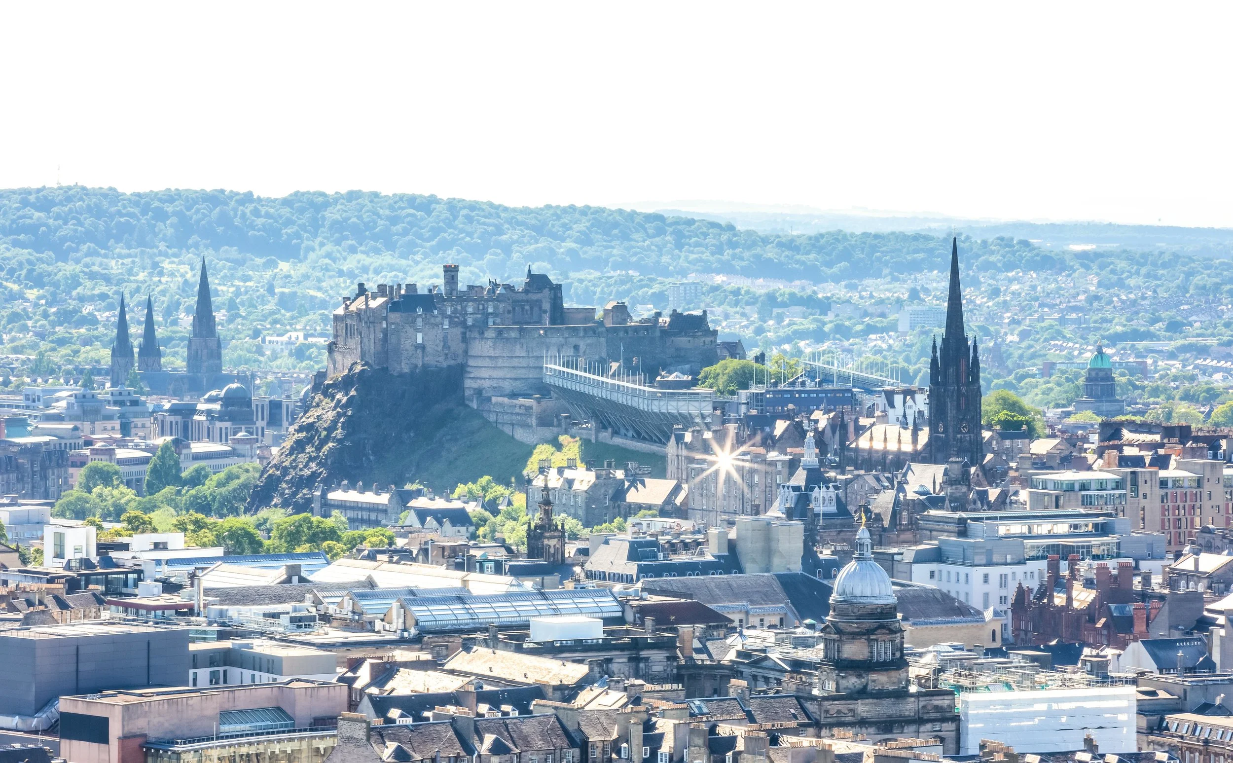
After a tiring two-week long trip to Iceland, we arrived in the Scottish capital of Edinburgh for the second leg of our Europe trip.

As we boarded the airport shuttle bus to the city I could hardly contain my excitement - It would be my first time to visit the country (as an adult) and would include stops in Edinburgh, Glasgow, the Highlands and the Isle of Skye. 

Admittedly I was also excited to be able to take a break from sitting in a car as the previous two weeks spent driving around Iceland were exhausting.

I figured I planned the trip quite well, we’d spend a few days exploring the capital, then we’d board a train to Glasgow and spend a few days there before once again picking up a rental car and driving around the beautiful Loch Lomond into the Highlands and ultimately ending up in the Isle of Skye where we’d spend a week. 

The Isle of Skye, was once one of Scotland’s best kept secrets but has in recent years become one of the country’s top tourist attractions. Every year, especially during the summer months, the island braces itself for the throngs of tourists who come to experience Skye’s breathtaking landscapes, rugged mountains, medieval castles and quaint seaside villages. 

The largest of the Inner Hebrides, a collection of islands just off the coast of the Scottish mainland, Skye has a total land area of 1,656 square kilometres and is home to just over ten thousand people with a population density of about six people per square kilometre. Taking into consideration that here in Taiwan the population density is on average around 650 people per kilometre, it was quite relaxing to drive around a place where there are more sheep than there are people! 

In my excitement to visit Skye, I did lots of research about where to visit, what to do and what to eat while hanging out on the island - One night however while watching Youtube I came across a news story that talked about how tourism was actually having a negative impact on the environment as well as the people who live on the island.

The main problem it seemed was that Skye is small and there aren’t enough hotel rooms available on the island to provide space for the amount of tourists visiting. This has led to many homeowners opening up their spare bedrooms and offering them to tourists on sites like AirBnB and has in turn caused rents and real estate prices on the island to skyrocket forcing many of the young people who grew up on Skye to move elsewhere.

With an estimated 500,000 visitors each year, the tourism industry on Skye has become unsustainable and local authorities are desperate to find solutions for a long-term tourism strategy that will improve the situation for everyone.

The lack of sustainability of the tourism industry and the detrimental effect it is having on Skye has led to several major travel publications, including CNN Travel and the BBC releasing articles that suggest tourists avoid the island altogether. 

Link: Skye islanders call for help with overcrowding after tourism surge (Guardian)

LInk: Tourism experts look to solve overcrowding crisis on Skye (The Scotland Herald) 

Knowing this, the enthusiasm I had for my trip to the island became somewhat subdued but having already booked accommodations at an AirBnB in Portree and renting a car in Glasgow, it was already too late to cancel my plans, which meant that our time on the island would be adding to the issues faced by the people of Skye. 

Being conscious of this, I decided to come up with my own solutions to be a responsible tourist, who would be able to enjoy the island like everyone else, but also contribute to the local economy and ensure that my trip wouldn’t be leaving a negative footprint on the beautiful island.

There are a lot of simple things every visitor can keep in mind to act responsibly while visiting Skye including supporting the local economy, buying local, taking local tours, making use of public transportation, visiting outside of peak times and taking your trash with you. 

Link: How to avoid Isle of Skye Tourism Problems (Wow Scotland) 

The Isle of Skye remains an amazingly beautiful place to visit and if you are thinking about travelling there, you should definitely make the most your opportunity to visit. It is important though that you take into consideration the issues faced by the locals and do your best to ensure that you enjoy the island as a responsible traveller.

Fortunately the time I visited wasn’t during the peak travelling season and I didn’t have to endure the traffic jams which have become quite infamous. It was also quite easy for us to support local businesses by eating at local restaurants and buying fresh local produce at roadside crofts without having to make reservations or stand in line for too long.

In the end, as we drove over the Skye Bridge back to the mainland, I was content with my trip to the island and it was a positive experience that I will always remember. The island is beautiful and the people are wonderful. It is definitely a trip that I would recommend to others but I do hope that the tourism industry on the island can sort itself out and in the meantime that the tourists who visit can practice responsible tourism by not contributing to the destruction of the environment. 

I may at some point dedicate a blog to each of Skye’s major tourist destinations in the same way that I wrote about the Quiraing, but the purpose of this blog post is just to offer up some snapshots that highlight the places I visited and simply provide a brief introduction. I was fortunate to be able to commit a bit more time to the island than most tourists, so you may notice a few locations below that aren’t exactly high on the list of tourist destinations, but are still really cool places to visit nevertheless. 


Old Man of Storr

The “Old Man of Storr” or just “Storr” is a short hike that has become one of the most popular destinations on the island as the so-called “old man”, a rocky crag, has in recent years become an image that symbolizes Scotland.

Situated on a rocky hill on the Trotternish peninsula, this short hike is likely where you’re going to encounter the most tourists on your Isle of Skye trip. The hike, which should take anywhere between an hour or two provides amazing picturesque views of the sea and the lakes below.

If you are visiting the Isle of Skye, this hike is probably going to be on the top of your list of places to visit. 

Unfortunately we had to do the hike on two separate occasions due to extreme changes in the weather on our first visit that turned our visibility from a clear day to almost 0% visibility with crazy amounts of fog rolling in from the sea.

Still, even if you have to do the hike more than once like we did, it is well worth your time and the pictures you’ll take will be one of the highlights of your trip!

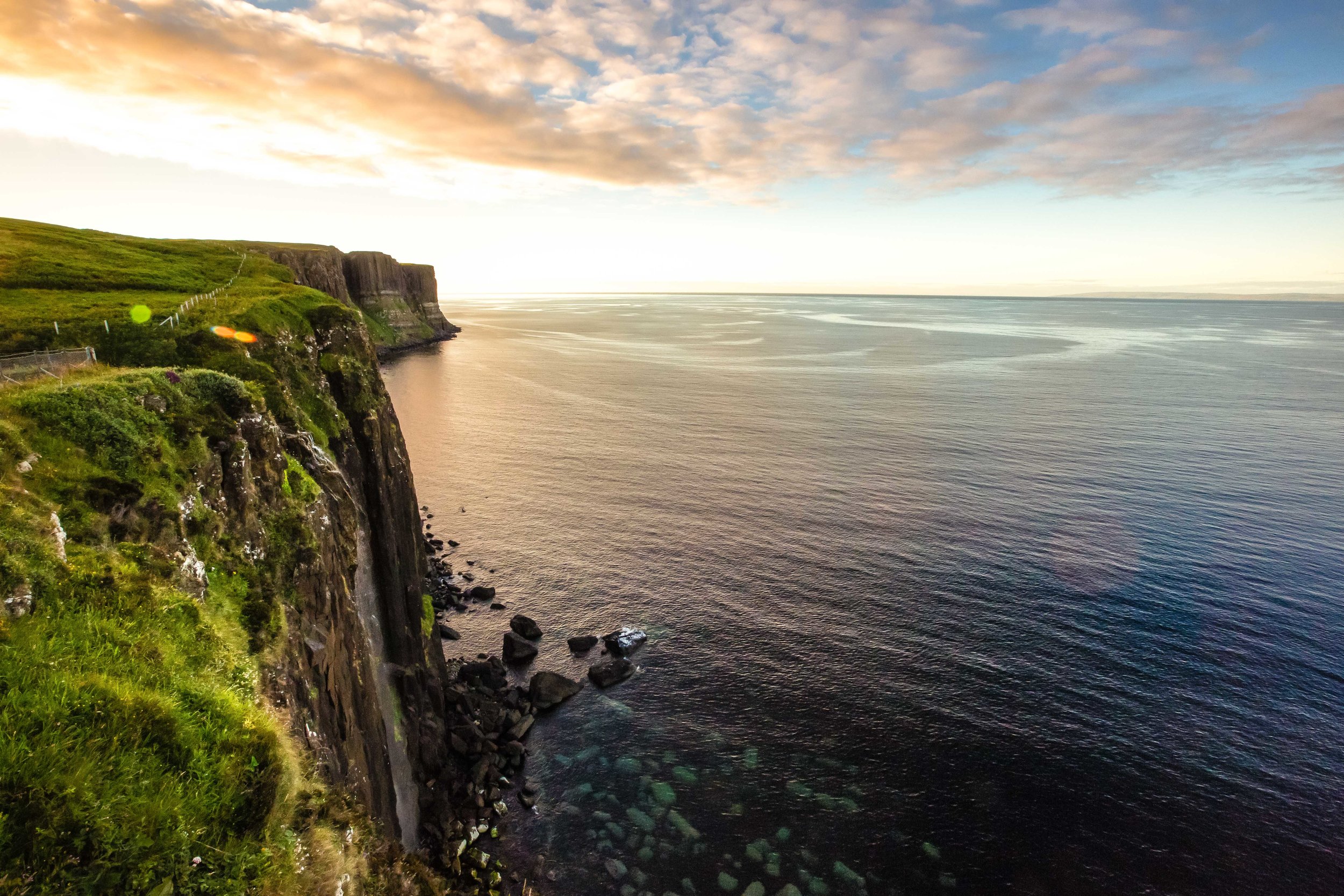
Kilt Rock and Mealt Falls

Kilt Rock is situated along the northern coast of the island on the road between the Old Man of Storr and the Quiraing.

When you stop here you’re rewarded with not only breathtaking ocean landscapes but a waterfall as well. 

From the parking lot, you’ll be guided to a platform where you’re able to view the rocky coastline in addition to Mealt Falls. The rocky cliffs known as “Kilt Rock”, which you view from a distance are said to appear strikingly similar to a Scottish kilt - I don’t have much of an imagination when it comes to rock formations, so I can’t confirm whether or not that’s true. 

Having just come from Iceland, the waterfall wasn’t really that impressive, but the falls, which flow over the cliffs and into the ocean are quite beautiful when combined with the rocky coastline.

Due to the angle of the platform and the cliffs however, its not easy to take photos of the falls but would be an ideal spot if you happened to bring a drone along with you.

One thing about this area I did enjoy however was the beauty of the landscape, which I think was comparable to the Qingshui Cliffs (清水斷崖), one of Taiwan’s most beautiful locations.

Even though I was a bit tired of waterfalls after a couple of weeks in Iceland, my girlfriend decided that after visiting the Quiraing that we’d stop by Kilt Rock for a second time to get nicer photos because we had better light. In the end I was quite happy that we did because the area looked much more beautiful on a day with better weather. 

The Quiraing

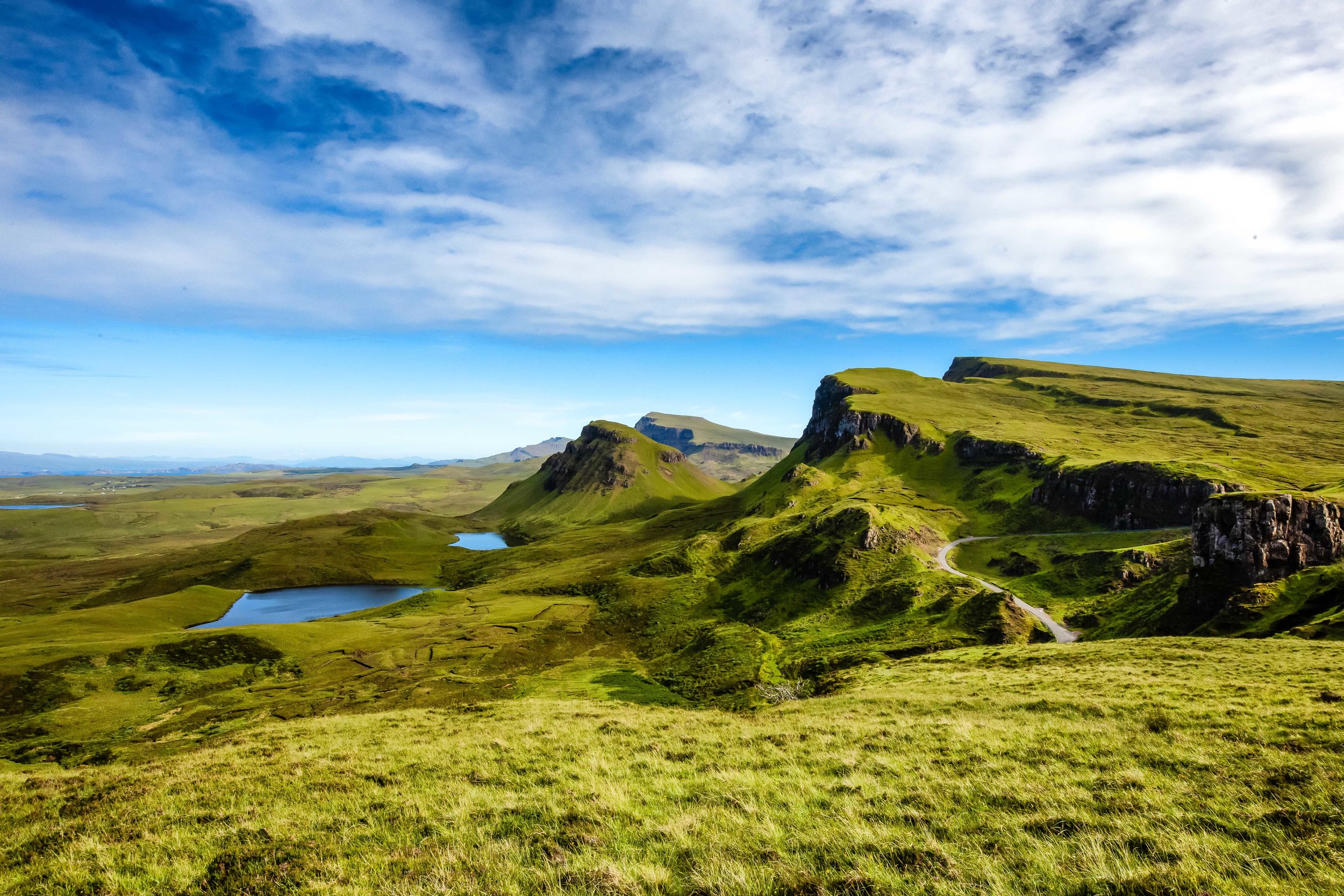
The Quiraing is arguably the top attraction on the Isle of Skye and is listed as one of the top hikes in all of Scotland - It also just so happens to be one of the more picturesque places in the entire country. 

If you haven’t already, I suggest checking out my dedicated post about the hike. 

Link: The Quiraing

To briefly explain though, the Quiraing is part of the Trotternish ridge, which encapsulates much of the northernmost portion of the Isle of Skye. The geography of the landscape is what makes the Quiraing so special with breathtaking scenery, jagged rock formations and mountainous lakes and valleys. 

The hike is actually quite an easy one, but the length really depends on how much time you’re willing to devote to it. For some, a short hike is enough, but for others, there is an entire circuit that will take you around and across the mountain. 

Whatever you decide you do, you’re sure to have a great time enjoying some of the best scenery this planet has to offer!  

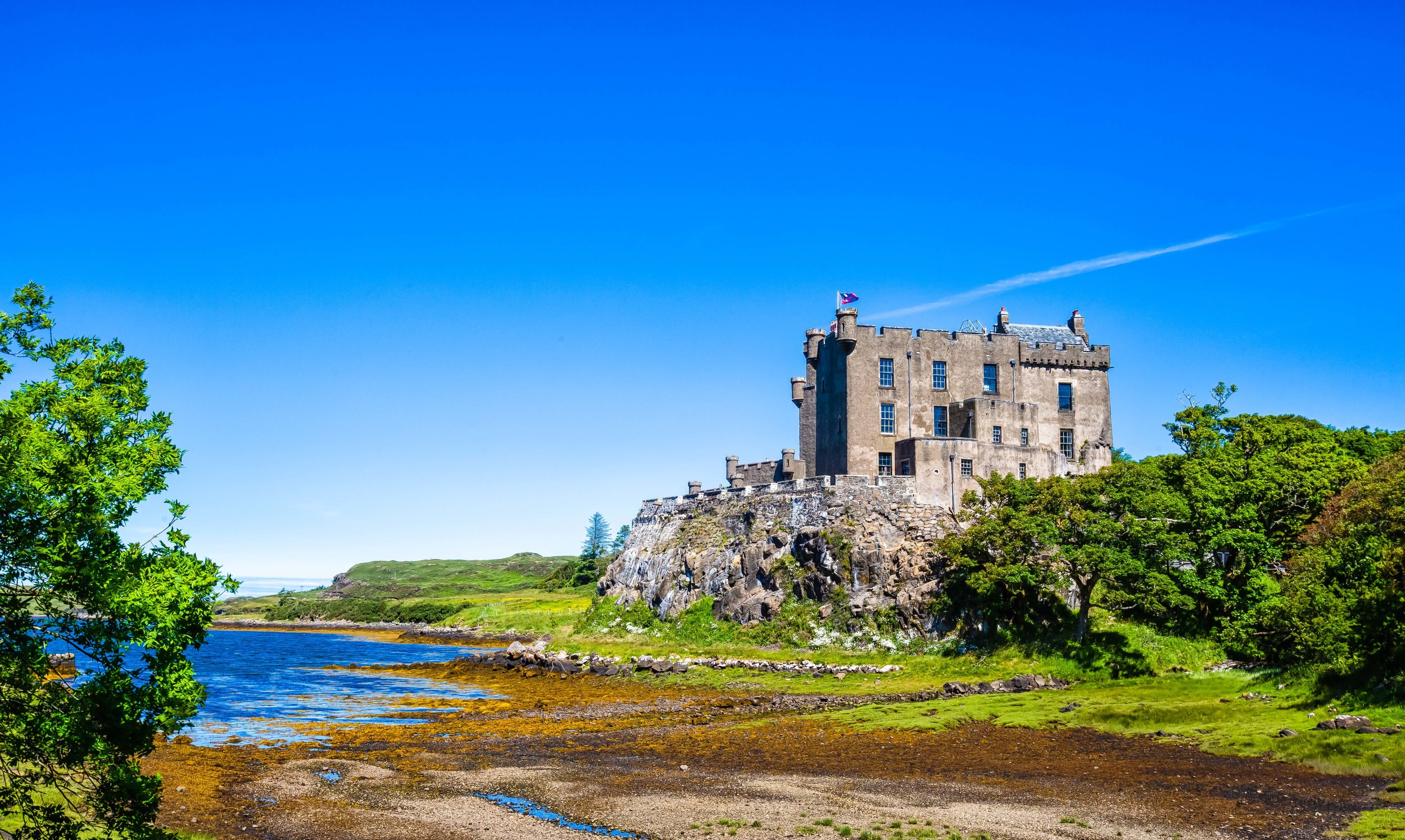
Duntulm Castle

Why not include a little Urban Exploration in your trip to the Isle of Skye? 

Duntulm Castle, a ruined 14th-15th century castle sits quietly on top of a hill overlooking the sea on the north coast of Trotternish. The castle was once the seat of the chiefs of Clan MacDonald of Sleat and was a strategic location in their age-old war against the rival Clan McLeod. 

The castle was abandoned in 1732 with the clan moving to a new residence, Monkstadt House, which used much of Duntulm Castle’s stone for building material. Today the castle sits abandoned and ruined on top of a rocky cliff and is a popular grazing area for local flocks of sheep.

There actually isn’t that much to see when visiting this spot, but it is a great location for taking photos of the coastal landscape with a bunch of ambivalent sheep. We also enjoyed sitting near the beach enjoying the sound of the ocean with the view of the Western Isles in the distance.  

Dunvegan Castle 

Dunvegan Castle and Gardens on the western coast of Skye is the historic home of Clan MacLeod and is one of the most popular tourist attractions on the island. The castle, which is a mixture of medieval and Victorian architecture is the Isle of Skye’s most well preserved castle and is home to many historic relics pertaining to the history of the island. 

The castle is open year round for tourists and the price of admission allows you to explore the interior of the castle as well as the beautifully maintained gardens. 

The interior of the castle was completely refurbished in the 19th Century and is probably not what you’re really expecting. The tour however is interesting and you can learn a lot about the history of the area and the history of the McLeod clan as well. 

The castle’s gardens on the other hand deserve your attention just as much as the castle as the groundskeepers have done an amazing job crafting and maintaining the area, especially with the multitude of plants, trees and flowers that are not native to Scotland’s climate. 

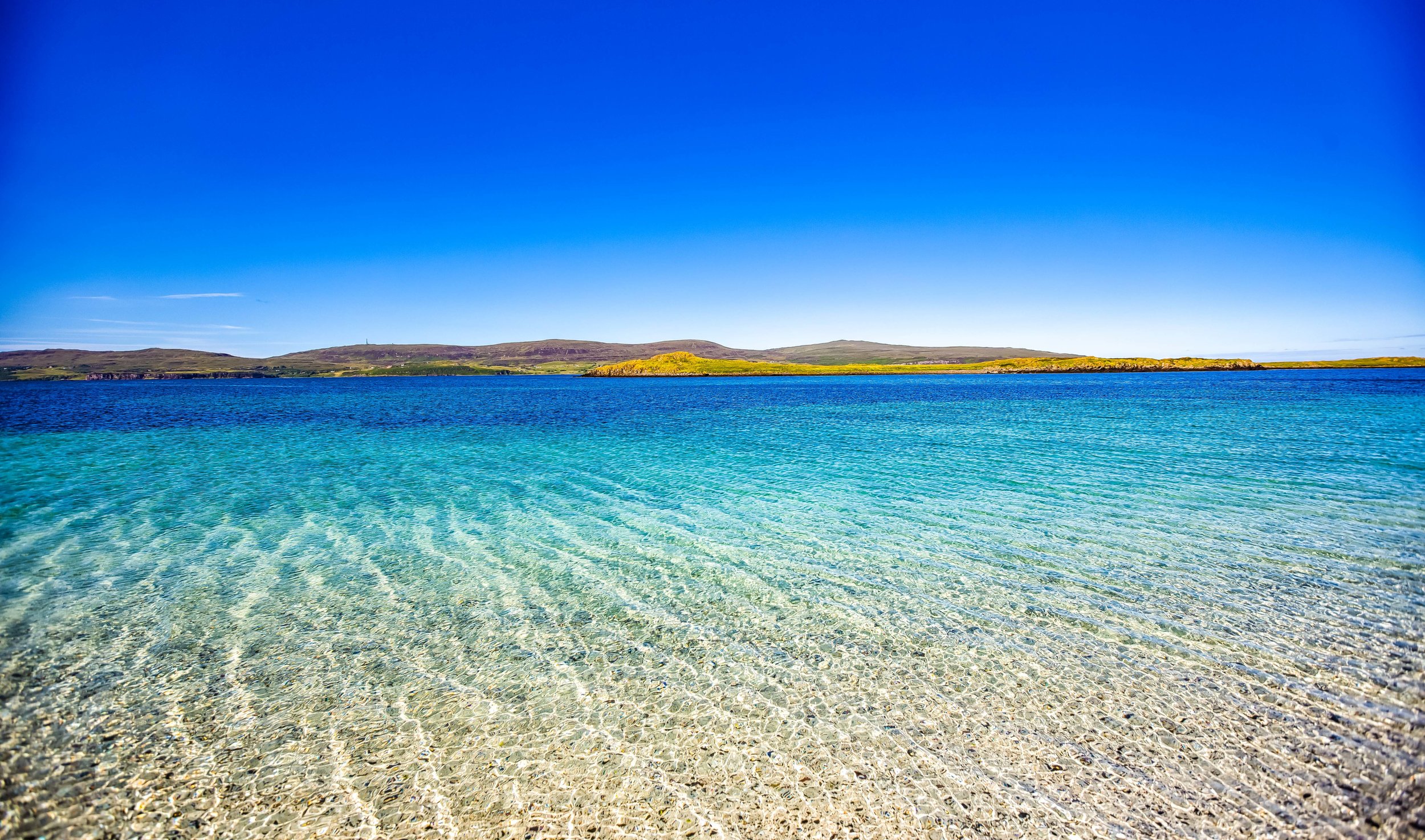
Coral Beach 

You likely weren’t expecting to find a tropical beach as far north as the Isle of Skye, but this coral beach, a short distance away from Dunvegan Castle is probably one of the prettiest beaches in the whole of Scotland. 

From the parking lot, you’ll have to walk for a short distance before arriving at the beach, but the short hike will be well worth your time as the white sand beach made up of broken coral is extremely picturesque, especially with the emerald green water. 

While this isn’t a popular stop for most tourists, the beach is well worth your time, especially since the walk takes you through an extremely quiet and peaceful coastal area. If I had of known how beautiful this place was going to be before going, I would have prepared a romantic picnic for my girlfriend!

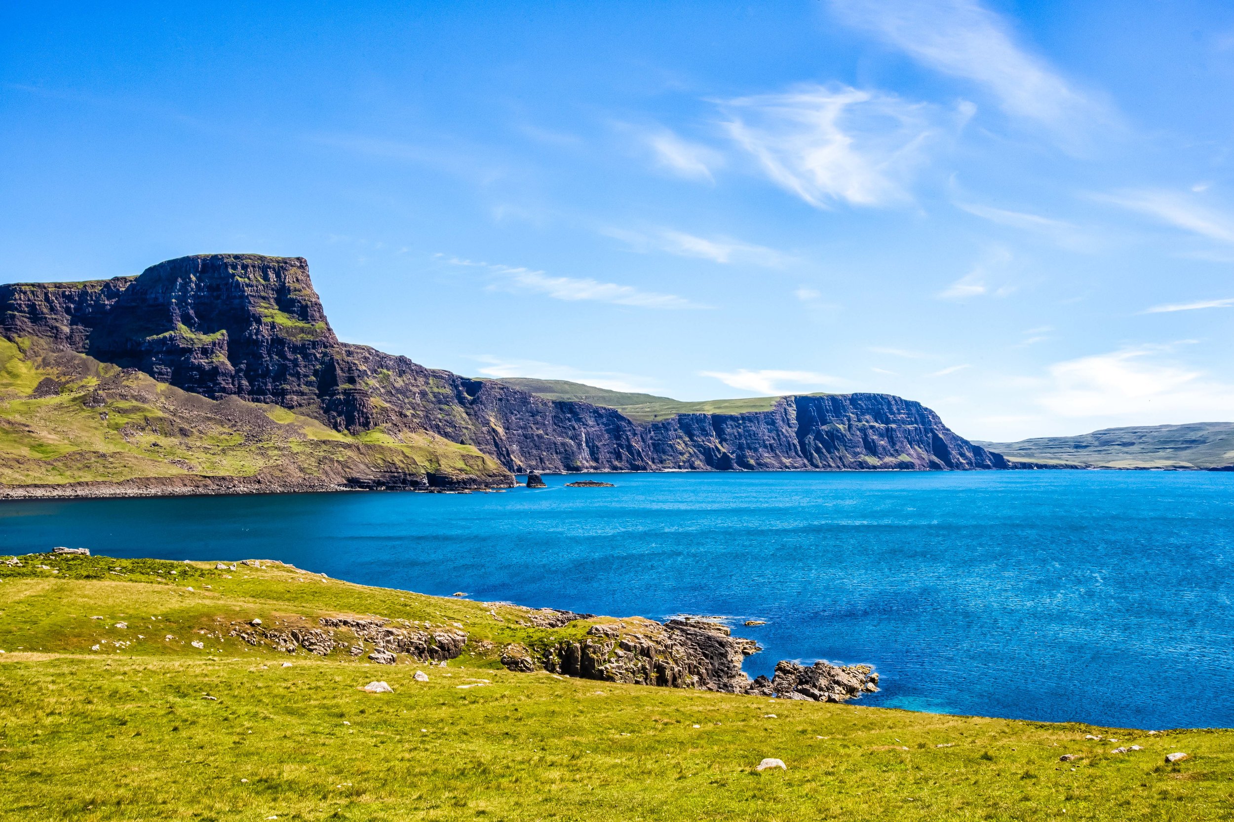
Neist Point

Neist Point is the most westerly area on the Isle of Skye and is home to one of Scotland’s most famous lighthouses, the century-old Neist Point Lighthouse. The point is one of the Isle of Skye’s most famous attractions as it looks out towards the expansive Atlantic Ocean. 

Visiting the area requires a bit of a hike down a steep hill but also rewards visitors with stunning landscapes, coastal scenery and the historic lighthouse. The area is also a popular spot for birdwatching with several species of seabirds making their homes on the cliffs near the lighthouse. If you’re lucky you might also be able to see whales and dolphins feeding in the cove.  

Taking into consideration the popularity of the area, the roads that lead up to it are a major concern and is an area where Skye’s infamous traffic congestion becomes an issue. Not only is there a lack of signage pointing you in the direction of Neist Point, the roads are narrow and are often full of cars on both sides in addition to (what seems like) thousands of grazing sheep. You need to be really careful while driving and make sure that you yield to on-coming traffic.

Once you arrive however the parking lot is quite large, so you don’t need to worry too much about not being able to find a space. The area is also quite large, so you don’t need to worry about a bunch of annoying tourists ruining your photos! 

Dun Beag Broch

Dun Beag Broch is one of the places I listed as a possible location to stop, but to tell the truth I didn’t really know what it was. On our way back to Portree from Neist Point we decided to stop by to check it out and as we approached we got a little more confused. 

Was it a castle? Was it a fort? We had no idea. 

I opened up the dictionary app on my phone and searched the word ‘Broch’ and this is what I found: A circular stone tower built around the beginning of the Christian Era, having an inner and outer wall, found on the Orkney Islands, Shetland Islands, the Hebrides and the mainland of Scotland.

So basically it was an Iron-Age tower-like fort? 

No one knows for certain when the broch was constructed, but what historians do know is that this style of fort became common around 500 BC and it was continuously occupied well into the medieval period and as late as the 19th century. Several excavations have taken place to find out more about it and although exact dates of its origins are still a mystery, archaeologists have discovered coins dating back to the 12th Century.

Today the broch is in ruins but what was once (probably) a ten meter tower with several floors and thick stone walls has been partially excavated to show the passageways of the interior of the building. 

Although there isn’t much to see here, its pretty cool to be able to so freely walk up to a several thousand year old fort where people from the iron-age once lived. 

Eilean Donan Castle 

While not actually located on the Isle of Skye, Eilean Donan Castle, one of Scotland’s most picturesque castles is situated a short distance away from the Skye Bridge and is a must-stop location for anyone making their way to the island. 

The 13th Century castle which literally sits on the ‘Island of Donnán’ was the historic home of the Clan MacKenzie and their allies, the McRae’s. The castle has a long and interesting history and it is said to have been one of the locations that sheltered Robert the Bruce while he was on the run during the early years of his reign as King of Scotland. 

The castle was destroyed in the early eighteenth century due to the MacKenzie’s involvement in the Jacobite rebellions but would be rebuilt between 1919-1932 by a member of Clan McRae who converted it into a memorial for the members of the clan that perished during the First World War.

Fun fact: The memorial is inscribed with the poem “In Flanders Fields” which was penned by John McRae, who would coincidentally become one of the clan’s most well-known figures. 

Today the castle is one of the most photographed places in all of Scotland and has been featured in films ranging from the Highlander to James Bond and has even made an appearance in a Bollywood film! 

As one of Scotland’s most widely photographed locations, it is also a popular tourist attraction with tours of the castle taking place year round for the admission of about £10.00 per guest. If you can afford the hefty price and the long waiting list, you could also hold your wedding at the castle! 


As I’m sure you can see, there is quite a bit to do while travelling around the Isle of Skye - I’ve only really touched on part of what the island has to offer. There’s so much more that you can see and do while on Skye including visits to whisky distilleries, dining at one (or more) of the several Michelin starred restaurants, boat tours, camping, hiking etc. 

You should of course take into consideration the fact that the island has been inundated with tourists, but if you do your part, you can help become part of the solution rather than part of the problem.

If you have the chance to visit, I hope you’re able to enjoy your adventure as much as we did!  


Hallgrímskirkja Church

After an exhaustive trip around Iceland, we arrived back in the capital city of Reykjavik for two nights of respite before flying out of the country and onto our next destination. The previous twelve days were a meticulously planned action-packed adventure enjoying some of the most beautiful landscapes you can find on this planet - and a lot of time driving..

We had started to plan our adventure more than six months before we even got on an airplane at London’s Gatwick Airport and ended up with an extremely detailed itinerary that ensured we made the most of our time in Iceland.

The last day and a half though? Yeah, we didn’t really plan that much.

We figured we’d be tired and we’d just mull about Reykjavik, check out a couple places of interest and possibly eat one of those famous hotdogs that everyone talks about (it was amazing).

Reykjavik isn’t really a large city and there isn’t all that much to see when you’re there, but if there is one thing that every tourist agrees on, its that a visit to the capital city’s iconic Hallgrimskirkja Church should definitely be on your list. The church, which is coincidentally the tallest building in the country is also Iceland’s most iconic structure and has become an image that has become synonymous with Reykjavik, defining the skyline of the capital city.

History

When we talk about the history of churches in Europe, we often think of places of worship that date back hundreds, if not a thousand years. The history of Hallgrímskirkja is much less complex - its actually only a few decades old and its story is easier to tell.

The history of the church starts with its designer, famed state architect Guðjón Samúelsson who played a key role in the urban planning of the Reykjavik and designing several other beautiful buildings throughout the country. Samúelsson, one of the first Icelanders to be formally educated in architecture was known for his genius combination of contemporary architectural styles with traditional Icelandic imagery that were inspired the landscapes and geology of the country.

The legacy created by Samúelsson designs have had a lasting effect on the shape of modern Iceland with many architects following in his footsteps, blending his style of modernism and naturalism into something that is intrinsically Icelandic.

With a collection of buildings already under his belt, Samúelsson was tasked with designing a parish church in the heart of Reykjavik which was envisioned to become the ‘grandest place of worship in the entire country’ and coincidentally also its tallest building.

Designs for the project were commissioned in 1937, but due to the disastrous effects of the Second World War, construction didn’t start until 1945. The delays in construction unfortunately ensured that Samúelsson would never live to see the finished product, which would become his most iconic.

Samúelsson passed away in 1950, five years after construction started, but the project which was completed in stages would ultimately take over four decades to complete.

Stages of Construction

  • 1948 - The crypt, which is beneath the chancel was completed and consecrated.

  • 1974 - The tower and the front wings were completed.

  • 1986 - The nave was completed and the church opened to the public.

  • 1992 - Construction and installation of the massive organ was completed.

Link: Historic Photos show Hallgrimskirkja church under construction 50 years ago.

Hallgrímskirkja opened to the public in 1986 to what would become mixed reviews from locals who considered it an eyesore and thought it far too old-fashioned. In the years since however, the church has become one of the city’s most iconic buildings and locals eventually warmed up to it.

What’s in a name?

I’m sure that the whole time you’ve been reading this, you’ve seen the word “Hallgrímskirkja” pop up and you’ve been thinking to yourself, “How am I supposed to pronounce this?” and “What does it even mean?

Well, I don’t speak Icelandic, so I’m clearly not an authority, but apparently it’s pronounced: “Hal-Grimes-Kirk-Yow” (ˈhatlkrimsˌcɪrca) and translates to “Church of Hallgrímur“ in English.

Don’t take my word for it though, if you really want to solve this linguistic mystery, learn from a pro that speaks the language with this helpful article and video: Iceland with a view - How to Pronounce Icelandic Words.

So who is Hallgrímur?

Hallgrímur Pétursson (1614 - 1674) was a renowned Icelandic poet, politician and clergyman who most notably wrote the “Passíusálmar“ or the “Passion Hymns”, a collection of 50 poems which chronicle the last days of the life of Jesus. The poems are a significant work of Icelandic literature and it has become tradition for them to be read in almost every home (and is broadcast on radio and television) every year during the Easter holidays. One of the Icelandic Lutheran churches most prominent figures, it is only fitting that the most important place of worship in the country be named after him.

In Iceland, the Lutheran Church is known as the Church or Iceland, or the “National Church” (Þjóðkirkjan) and consists of over 300 churches providing a place of worship for its 250,000 members. Interestingly though, even though Hallgrimskirkja is the largest, it is not the headquarters. The Bishop of Iceland lives much more modestly in the much smaller, but more historic Reykjavik Cathedral, which is only a short distance away.

Design

As mentioned above, residents of Reykjavik weren’t really all that thrilled about the design of the church. Even before it was completed, it was considered an “old-fashioned” eyesore that was designed to resemble an already outdated style of architecture.

Eventually they came around and started to see the genius in its design.

The genius in the design of the church cannot be underscored - Not only does it take inspiration from from the basalt columns found at Southern Iceland’s Black Beach and Svartifoss Waterfall, it does so in a way that also evokes an image of both a geyser rising to the heavens and that of the pipes of a church organ.

Once you realize the inspiration for the design and what it represents, you can’t help but respect its genius.

The 74.5 meter (244 ft) tower, which also serves as an observation desk rises high above every other building in the capital city. Its height is actually one of the reasons why people weren’t really too thrilled about it. Similar to the Eiffel Tower in Paris, there are few places you can go in Reykjavik where you won’t catch a glimpse of the church.

The interior, which encompasses 1,676 square meters, is a bit more subdued in its design and truthfully doesn’t really pop out at you like many of Europes other churches do. If you’ve seen the Lord of the Rings films, you might imagine the interior of the church resembling Gondor’s Minas Tirith castle which is also a simple stone hall with very little colour or warmth.

The interior keeps with traditional gothic-style cathedral architecture with large pillars rising up from the walls in order to support an arched ceiling. Staying true to Lutheran tradition which stresses simplicity, you’ll notice that there is a lack of decorations or designs on the walls throughout the interior. The lack of distinct colour or decoration is part of what adds to the feeling that you’re in an ice castle rather than a giant church.

The one feature of the interior of the church that stands out from everything else is the large pipe organ - Installed by the famed German organ designer Johannes Klais, the organ consists of over 5000 pipes, weighs over 25 tons and is 15 meters tall. Completed in 1992, it has become one of Hallgrimskirkja’s most prominent features making the church a popular site for musical performances.

If you visit Hallgrimskirkja and are expecting to see something like some of the other popular places of worship in Europe like Westminster Abbey or Archbasilica of St. John Lateran, you’re sure to be disappointed. The beauty of Hallgrimskirkja however is not for its lavish displays and decorations, but its adherence to traditional design while making it something that is truly Icelandic.

Getting There


Address: Hallgrímstorg 101, 101 Reykjavík

The area near the church is part of the popular downtown core of the city where you’ll find the best places to eat, drink and shop. Suffice to say, finding parking can be quite difficult and the church is located near the city’s most expensive parking zone. Keep in mind that parking in the city is scaled based on how close you are to the city centre.

Link: Reykjavik Parking Zones

If you’re not driving and want to make use of Reykjavik’s excellent public transportation system, there are several bus routes that will get you to the church. You’ll need to keep in mind though that the closest bus stops are at least a ten minute walk from the church.

Bus Link: How to get to Hallgrimskirkja by Bus

If you plan to do a bit of exploring around the city, your best bet is probably just to walk to the church. This way you’ll save yourself from getting stuck in traffic, wasting a bunch of time searching for a parking spot and a bunch of money on the parking meters. You’ll also get to enjoy the sights and sounds of this quaint little city and its wonderful people.

Visiting the church is free of charge, but if you’d like to check out the view of the city from the observation tower, you’ll have to pay an admission fee of ISK 1000 ($8.00 USD) to take the lift to the top. You can purchase your tickets in the church shop but the hours for the observation deck can be a bit difficult to understand, so make sure to check the website before going. We unfortunately missed out on the tower on the day we visited due to construction work on the elevator, which was really unfortunate!

Hallgrimskirkja and its popular observation tower are probably the most widely visited tourist destinations with Iceland’s capital city. The iconic church, while not all that old is a spectacular example of Icelandic architecture and is a design that gives a nod to the country’s spectacular landscape.

Most tourists who visit Reykjavik will find spend a bit of time enjoying the church and the amazing 360 degree views from the observation tower, so if you find yourself in the city don’t miss out on the opportunity to visit.


Goðafoss

While traveling around Iceland’s ‘Diamond Circle’, one of the last major stops before heading back to Reykjavik is the beautiful northern port city of Akureyri - Known as Iceland’s “Northern Capital” the city was a welcome respite after countless hours of driving through northern Iceland.

Coincidentally we happened to be travelling through Iceland at the same time as when the 2018 World Cup was being held and the Icelandic national team had earned a spot for the first time in its history. It was somewhat of a cultural thing for me as I’m from Canada and the whole football / soccer thing never really interested me. I find its to be a far too dramatic sport. The collective attention of the Icelandic people however was focused solely on the World Cup.

We knew that Iceland had a relatively small population, especially compared to what we’re used to living in Taiwan, but when almost half of the country had packed up and left for Russia, the small town of almost 20,000 seemed eerily empty.

Nevertheless Akureyri is a picturesque harbour-side city surrounded by mountains and the ocean and compared to the capital, has a much better system of urban planning, which means getting around is a lot less confusing for tourists.

Our accommodations in town were stunning and included a geothermal jacuzzi which was much appreciated after driving hundreds of kilometres from the rather desolate area where we stayed near Dettifoss.

Another highlight was having access to a nice supermarket where we picked up some fresh juice, Icelandic craft beer, fresh bread and more supplies for the road.

Due to time constraints we hadn’t planned many stops for the last leg of our trip between Akureyri and Reykjavik, so just before arriving in Akureyri we more or less made our final stop along the Diamond Circle at yet another waterfall, but not just any waterfall - The Waterfall of the Gods.

With a name like that, who wouldn’t want to stop and check it out?

Godafoss

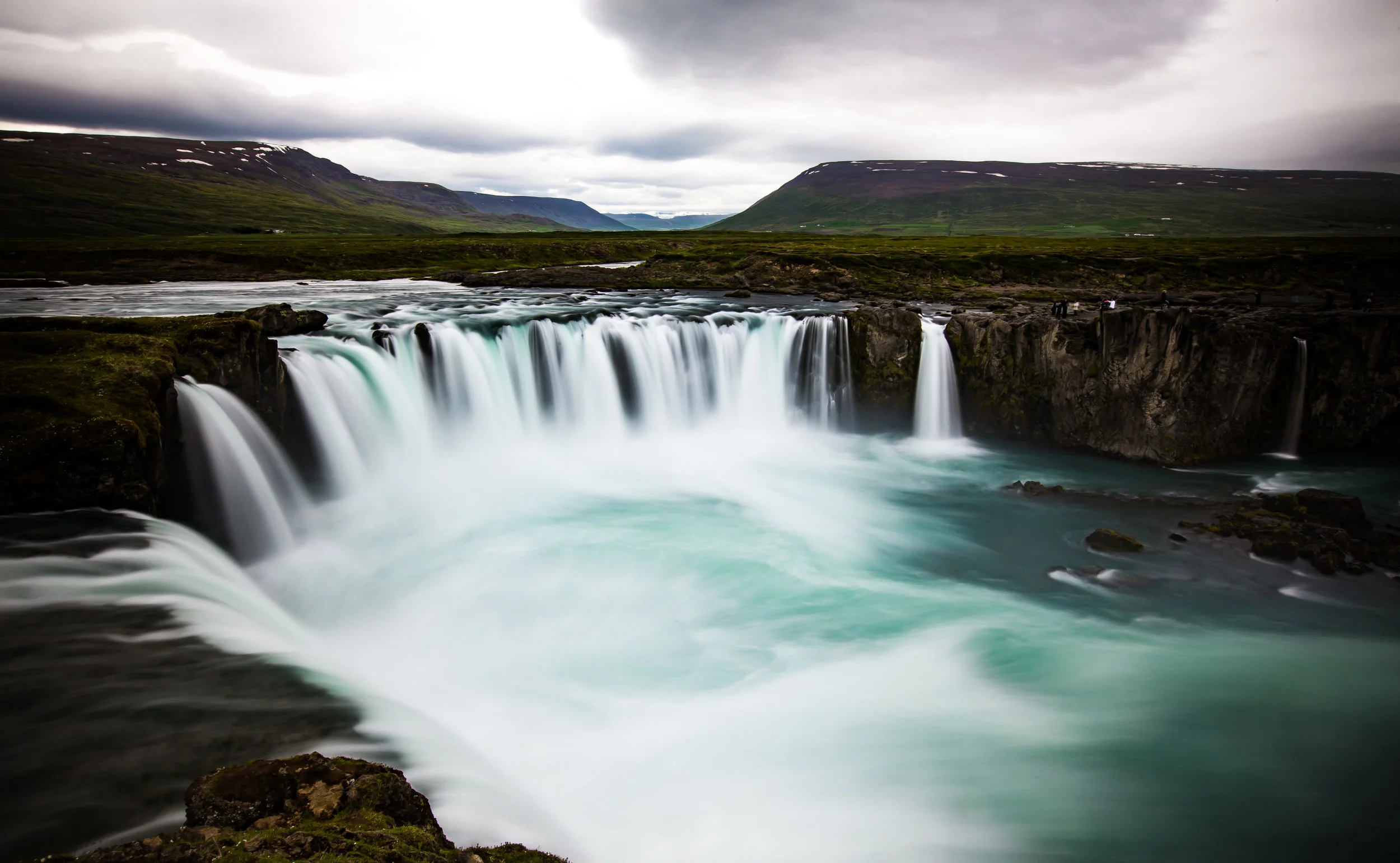
Goðafoss as it is known locally just so happens to be one of the most spectacular and well-known waterfalls in Iceland. Even though it is not as large, wide or powerful as all of the others it is certainly one of the most beautiful and that is true for every season.

There’s a reason why the waterfall is known as the “Waterfall of the Gods” but before I get into that I think I should talk about its physical attributes:

Godafoss is a 12 meter high, 30 meter wide set of cascading falls, similar to Canada’s Niagara Falls.

The water flows from the river Skjálfandafljót, one of Iceland’s longest rivers. Originating from the Vatnajökull Glacier, the river also happens to be the water source for several other waterfalls including Hrafnabjargafoss, Aldeyjarfoss, Barnafoss and Ullarfoss.

During the summer the area around the waterfall is lush with green grass which reflects in the colour of the water. In the winter the area is usually covered in snow, the falls may freeze and if you’re lucky you can see the Aurora Borealis in the night sky.

The waterfall is attractive year round and when I visited it was really beautiful.

However I would have loved to have the opportunity to watch the Northern Lights at the same time.

So how does it get its name?

Well, like a lot of things in Iceland, it has to do with a bit of a legend. Whether or not the story is true is up for debate, but in Iceland it is widely accepted as fact as it is chronicled in the Íslendingabók (Book of Icelanders), a 12th Century work that tells the early history of human settlement in Iceland.

The first people to settle in Iceland were Norwegian explorers, more commonly known as the Vikings. When they settled on the island they brought with them their culture and their old Norse religion which consisted of deities like Thor, Odin, Loki, etc.

No, not the superheroes that you’ve seen in the movies.

As Christianity spread throughout Europe, societies that practiced what was considered “pagan” religions were often forcibly converted. The Christianity of a thousand years ago was much different than it is today, no one bothered with slogans like “God is Love” to convert people - The good word was spread primarily by the sword.

By the time the Icelandic Commonwealth was established in 930AD, pressure to make Christianity the official state religion became an issue as Norway threatened to invade if the people of Iceland didn’t conform.

Around the year 1000AD, when the annual meeting of the parliament met at Þingvellir, it was decided that for the good of the people, Christianity would become the state religion with the caveat that pagans could still practice in private.

That decision was placed on the shoulders of an “Ásatrú” priest (or goði) named Thorgeir Ljosvetningagodi Thorkelsson who was said to have spent days meditating and praying to the Old Gods before it was clear what path would be taken. When the decision was made to make Christianity the official state religion Thorkelsson returned home to the north of Iceland where he tossed his idols of the Norse Gods into a beautiful waterfall.

Since then that waterfall has been named Goðafoss.

Photography

Like most other destinations in Iceland there are a few things you’ll want to take into consideration if you’re planning on visiting and taking photos at this waterfall.

Similar to Dettifoss, the last waterfall you’re likely to have seen before this one, there are two different sides to view Godafoss from. In this case however getting to either side doesn’t take an much time - You’ll just have to get in your car, cross a bridge and park at another parking lot to enjoy the view from the other bank.

Unfortunately due to the amount of people that visit, you’ll probably want to find a spot to set up your tripod away from the wooden platform - The problem with the platform is that when people walk it creates a shake which will ruin your long exposure shots.

To solve this problem you can walk a bit further past the waterfall onto the grass bank for a bit more stability. Likewise you could also consider taking the path down to water level.

If you do take the path down to water level though, you’ll be confronted with a whole new set of issues with the amount of spray and mist that will cloud up your lens. In this case you’ll need to bring something to safely wipe down your lens with between shots.

Most of the shots I’m sharing here today were taken on an overcast and somewhat dreary day with a wide-angle lens and an ND filter attached. The shots are a range of long exposures that are anywhere between 2-10 seconds each.

If you don’t have an ND Filter on-hand it is important that you know how to manually control your camera if you’re looking to take photos similar to these. You may be able to get up to around one second exposures if the light is right.

To do this you’ll want to ensure that your ISO is as low as possible. Preferably at ISO 100. You’ll also want to have your exposure set to -1 or -2 so that your shot won’t be blown out.

Take some test shots and play with the settings to find out what’s best and then have fun!

If you visit during the summer and want long exposure shots like the ones here, I highly recommend investing in a Natural Density filter for your lens. However if you visit during the winter when there isn’t much light, you could get away without one.

If you visit in winter you’re going to be in luck because it’s likely that you’ll have the added bonus of the Northern Lights overhead. You won’t need lens filters for taking photos of the waterfall and the Northern Lights, but you’re definitely going to need a tripod, a remote control (or cable shutter release) and a lens capable of f/2.8 apertures.

For a handy introduction on how to shoot the Northern Lights click this link - Northern Lights Photography Settings

Getting There


Godafoss is located in northern Iceland along the Ring Road that circles the country.

Situated along the ‘Diamond Circle’ sightseeing route it is about a 53 kilometre (45 minute) drive from the northern city of Akureyri.

If you’ve first travelled south along the Diamond Circle and made your way north, the waterfall is about a 50km drive west of Lake Mývatn or the town of Húsavík.

In both cases you will drive along Road N.1 which is the highway that circles the country. The waterfall is a simple stop along the road and there will be adequate signage on both sides that notify travellers that you’re approaching the falls.

If you’ve decided that you’re not going to bother renting a car while visiting Iceland, you’re going to have to rely on public transportation or tour groups to get to where you want to go. There are tours out of the capital offered by tour groups like Reykjavik Excursions or Arctic Adventures which offer tourists access to several different destinations. It is important to remember that if you want to book a tour that you should do so well in advance as the seats on the daily tours tend to fill up quickly.

There are public buses that run between Akureyri, Myvatn and Egilsstadir that you may want to consider but you should know in advance that these buses don’t come that often, so you may get stuck waiting around for quite a while which is probably not the wisest way to use your time in Iceland. 

Bus Link: SBA-Norðurleid route 62 and 62A.

As one of the highlights of any travellers trip through Northern Iceland, Godafoss is one of those must-visit locations when you’re in the area. The waterfall is beautiful all year long but even though it is one of Iceland’s most popular destinations, it is rarely packed with people. If you visit, make sure to check out both sides of the fall and enjoy the beautiful scenery. Likewise if you are in Iceland during the winter months, try to visit a bit later at night so that you can not only enjoy the waterfall but the beautiful Northern Lights as well.