Photo Post

Naminoue Shinto Shrine (波上宮)

How much do you know about Okinawa? If you’re like most people, you probably learned in history books that it was the location of one of the most devastating battles of the Second World War. That unfortunately might be the extent of your knowledge about this small, yet extremely beautiful archipelago of islands known as the Ryukyus.

What happened before the war? What happened after the war? 

These are questions that anyone planning a visit should be asking. 

Okinawa’s history is an extremely complex one and if you’re not well-versed, don’t worry, if you visit, you’re going to get a crash course. 

The Okinawa of today has developed into a modern, yet beautiful tropical island with excellent infrastructure and public transportation that provides easy access to all the other outlying islands and amazing beaches.

Its hard to fathom while walking down the clean, well-organized streets that half a century ago, the entirety of the island was reduced to a festering pile of rubble and human misery. 

In the aftermath of the war, Okinawa redeveloped at an amazing pace, but while homes and businesses can be rebuilt, something that the people of Okinawa continue to struggle with today is that they’ve lost so much of their culture, language and identity through all of the chaos.. 

This is something that the people of Okinawa have worked tirelessly at rectifying over the past few decades and now the fruits of their labor are taking shape as there has been a cultural revival of sorts when it comes to the local language, culture and customs, which the local people have become so very proud of.

What this revival also shows quite clearly is that there is a stark contrast between the Ryukyuan people and their Japanese compatriots and that while they might have a shared history, they’re not one in the same.

Link: Battle of Okinawa’s legacy lives on 70 years later as locals chase against Japanese rule, US arms (The Conversation) 

In the aftermath of the war, reconstruction efforts focused primarily on building modern infrastructure and homes for all of the people who were displaced. Suffice to say that many of the buildings of cultural or religious significance that were lost weren’t really high in priority.

This meant that the various Ryukyuan castles like Shuri Castle, Nakagusuku Castle and Zakimi Castle as well as various tombs and places or worship weren’t rebuilt.

The Eight Ryukyuan Shrines (琉球八社) for example, which were (for the most part) places of worship created for the Ryukyuan folk religion (and later converted into Shinto Shrines) were eventually rebuilt, but it would take until the 1990s (or later) Or for most of them to reappear in some shape or form. 

Links: Ryukyu Eight Shrines 琉球八社 (Samurai Archives)  | 琉球八社 (Wiki)

When reconstruction efforts on these shrines finally began, priority was given to the largest and most significant of them, namely, Futenma Shrine (普天滿宮) just outside of the capital. Next came Naminoue Shrine (波上宮), Okinawa’s “ichinomiya” (一宮), the highest-ranking shrine in the prefecture.

Naminoue Shrine, known simply to the locals as ‘Nanminsan’ has a long history dating back to at least the 1300s and today is the most widely-visited place of worship in all of Okinawa.

The shrine is not only one of the most important religious sites in the capital city, but is also a place of worship that is uniquely ‘Okinawan.’ Even though it maintains many of Japan’s traditional design elements, it is unmistakably something that you’re only going to see in Okinawa which makes it stand out from the 80,000 other shrines across the country.  

Naminoue Shrine (波上宮)

Literally, the “Above the Waves Shrine”, Naminoue Shrine, pronounced [Na-mi-new-oh-eh], sits high on its perch above the Naha Harbour. 

The internet is full of claims that the history of the shrine dates back almost a thousand years, but that is actually a bit misleading. There isn’t actually any recorded information or evidence that gives an exact date as to when a shrine was first constructed in this location. 

What we do know about the origins of the shrine are from local legends. The story goes a little like this: A shrine was constructed by a fishermen who one day came across a mysterious stone and, (as one does), began to pray to it, which caused the stone to start glowing. Soon after the fisherman started taking in record hauls which eventually caught the attention of the local gods who stole the rock. From that time on though, an oracle took up residence in the area and people started visiting for spiritual guidance. 

The first documented information about a shrine in the area comes from the “Ryukyu-Koku-Yurai-Ki” (琉球國由來記) or “the Record of Origin of the Kingdom of Ryukyu” which tells of a Buddhist Temple, the “Naminoue-san Gokoku-ji” (波上山護國寺), which was constructed in 1367 and would later burn to the ground in 1633.    

The shrine would then return to its folk-religious roots and as its reputation for spiritual greatness spread throughout the land, it became habit for the sailors coming in and out of Naha harbour to look up and say a prayer for protection on their journey. Lending credence to the claims of Naminsan’s spiritual power, the Ryukyuan Kings also made a yearly ritual of visiting the area to formally pray on behalf of the nation for peace and prosperity.

Note: The local folk religion, known as “Nirai Kanai” (ニライカナイ信仰) or simply as “Ryukyuan Shinto” (琉球神道) is similar in a lot of ways to Japanese Shintoism. The religion honours the relationship between the living and the dead as well as the gods and spirits of the natural world, but is also predominately a medium of ancestral worship. 

Nanminsan was dedicated to the local religion for hundreds of years, but that came to an end when the Japanese annexed the Ryukyuan Islands and formally put an end to the Ryukyuan Kingdom in 1879. From the outset, the Japanese treated the Ryukyuan people as second-class citizens and attempted to erase their culture and language. The local folk religion became one of the colonial powers first targets and Nanminsan being one of the most sacred spaces in the land was replaced by the “Naminoue Shinto Shrine” in 1890. 

The newly established Naminoue Shinto Shrine was classified at the time as the “Okinawa Sochinju” (沖繩總鎮守社), which mean that it was dedicated to the “protection and tranquility” of the entire prefecture. The problem for the Japanese however was that the local people resisted, so they capitulated and enshrined several of the Ryukyuan Kings as gods at the shrine in an attempt to appease the locals.

This in turn also helped the Japanese integrate the royal family into the Japanese Imperial structure. 

In 1923, the shrine was completely rebuilt and all of the traditional Okinawan design elements were replaced by traditional Japanese design. That version of the shrine however only lasted for a few decades though as it was completely destroyed during the Battle of Okinawa in 1945. 

In the years following the war, the shrine was slowly rebuilt with initial construction focusing on the Shamusho (社務所) and Honden (本殿), which were completed in 1953. It would take another four decades to raise enough money to complete the rest of the shrine (which is something I think in retrospect that we can be thankful for) as the Haiden (拜殿) and several other parts of the complex were completed and opened to the public in 1993. 

The reason why I suggest that we’re fortunate is because the completed structure that we see today is a beautiful fusion of Japanese and Okinawan traditional design that might not have been possible if it were completed sooner. The resurgence of the Ryukyuan cultural identity has fueled a need for local places of worship to better represent the local population, so the end result is a unique shrine that pays home age to the beautiful Ryukyuan islands. 

Link: Naminoue Shrine (The Samurai Archives) | Origin of Naminoue Shrine (波上宮) 

Kumano Worship (熊野三山)

Before we get into some of the different design elements of the shrine, I’d like to take a few minutes to explain Kumano Worship, which is something most people might find a bit a confusing about Okinawa’s Shinto Shrines. It is rare that you’ll find an article that touches on the subject, so I’ll try to explain it as best as I can, but it’s important to note that a lack of recorded history makes this stuff a little difficult to explain. 

One of the common features of all of Okinawa’s Shinto Shrines is that they are dedicated to Kumano Worship - which is a Shinto tradition that hails from the mountainous Kumano (熊野) region that spans the prefectures of Wakayama (和歌山縣) and Mie (三重), about 100 kilometres south of Osaka (大阪) on Japan’s main island. 

Kumano Worship might not attract as many followers as some of Japan’s other Shinto sects, but it is thought to predate all of Japan’s modern religions. Centered around the three UNESCO World Heritage Shinto Shrines: Hongu Taisha (本宮大社), Hayatama Taisha (速玉大社) and Nachi Taisha (那智大社) the area is considered to be a place of physical healing and is often mentioned in the mythology surrounding Japan’s founding.  

Today there are more than three-thousand shrines throughout Japan dedicated to Kumano worship, each of which goes through a special propagation process known as “bunrei” (分霊) where the spiritual power of the Kumano deities are shared with a new shrine. Over the past thousand years as Kumano worship spread throughout Japan, followers including Emperors, Samurai and commoners alike have all been attracted to the area to take part in the Kumano Kodo (熊野古道), one of the worlds most important religious pilgrimages.

There are numerous legends that deal with the origin of Kumano Worship, which all deal with the power of nature. Not only is the Kumano area credited with being the mythological birthplace of Japan, it is also known as the “land of the dead” where various kami retire in death - including the gravesite of Izanami (伊邪那美), the deity who created the earth together with her husband Izanagi (伊邪那歧).

Link: Finding the roots of Japan (BBC Travel) 

So how did Kumano Worship become such a big thing in Okinawa? 

That is actually quite a difficult question to answer due to the lack of recorded history. What we do know is that the Ryukyu Kingdom was a major player in the East Asian trade networks and that they learned a lot from foreigners, especially those from China, Japan and Korea. 

The influence these other nations had over the Ryukyus not only involved international trade but the sharing of technology, education, governance, religion, etc. 

What little we know about Kumano’s arrival in the kingdom comes from the Ryūkyū Shintō-ki (琉球神道記), a book authored by a Buddhist monk that documented the Ryukyuan religious experience in the early 1600s. We also know that the Futenma Shinto Shrine (普天滿宮), which was established in the 14th Century was one of the first shrines in the Ryukyus dedicated to Kumano worship, so its likely that Kumano worship spread to Okinawa well before the kingdom was established.  

In the book, monk Taichū Ryōtei (袋中良定) explains that the propagation of Kumano Worship in Okinawa was likely the result of traveling Buddhist monks who visited the islands. At that time, Buddhism and Shintoism were considered to be synchronized with each other, so it shouldn’t be surprising that Japanese monks spreading Buddhism also helped to spread Shinto beliefs as well.  

In one story, Monk Nisshu (日秀), who is credited with the establishment of the Kin Kannon Temple (金武觀音寺), used his supernatural powers to save the local village from a rowdy bunch of venomous snakes and from there stayed in Okinawa to spread Buddhism and Kumano Worship. 

Likewise there are several other stories of monks becoming shipwrecked or traveling specifically to Okinawa on exchange to spread Buddhism. None of these stories however fully explain why Kumano Worship in particular was so heavily promoted - It is safe to assume though that as Kumano was home to one of the more established Shinto sects in Japan as well being home to what many people considered to be the “Pure Land”, it was a major centre for Buddhist training which meant that many of the monks who later became missionaries would have trained in the area. 

Link: 沖縄の熊野信仰霊場を訪ねて (Japanese)

Points of Interest

There are quite a few small details to take note of when you’re visiting this little shrine and each of them serves a very specific and important purpose. Below, I’ll introduce some of the most important points of interest at the shrine that you’ll want to pay attention to, but if you’d like a more detailed introduction to Shinto Shrines, their history and architecture, I recommend checking  the link below to learn more about Japan’s traditional places of worship. 

Link: Shinto Shrine: History, Architecture, and Functions (Patternz) 

Shrine Gate (鳥居)

The gate to the shrine is known in Japan as a "Torii" gate, which simply translated into English as a ‘bird perch’. These gates are typically found at the entrance of a shrine and their purpose is to demarcate the transition from the outside profane realm to that of a sacred one. This means that once you pass through the gate, it is time to stop joking around and to be respectful. 

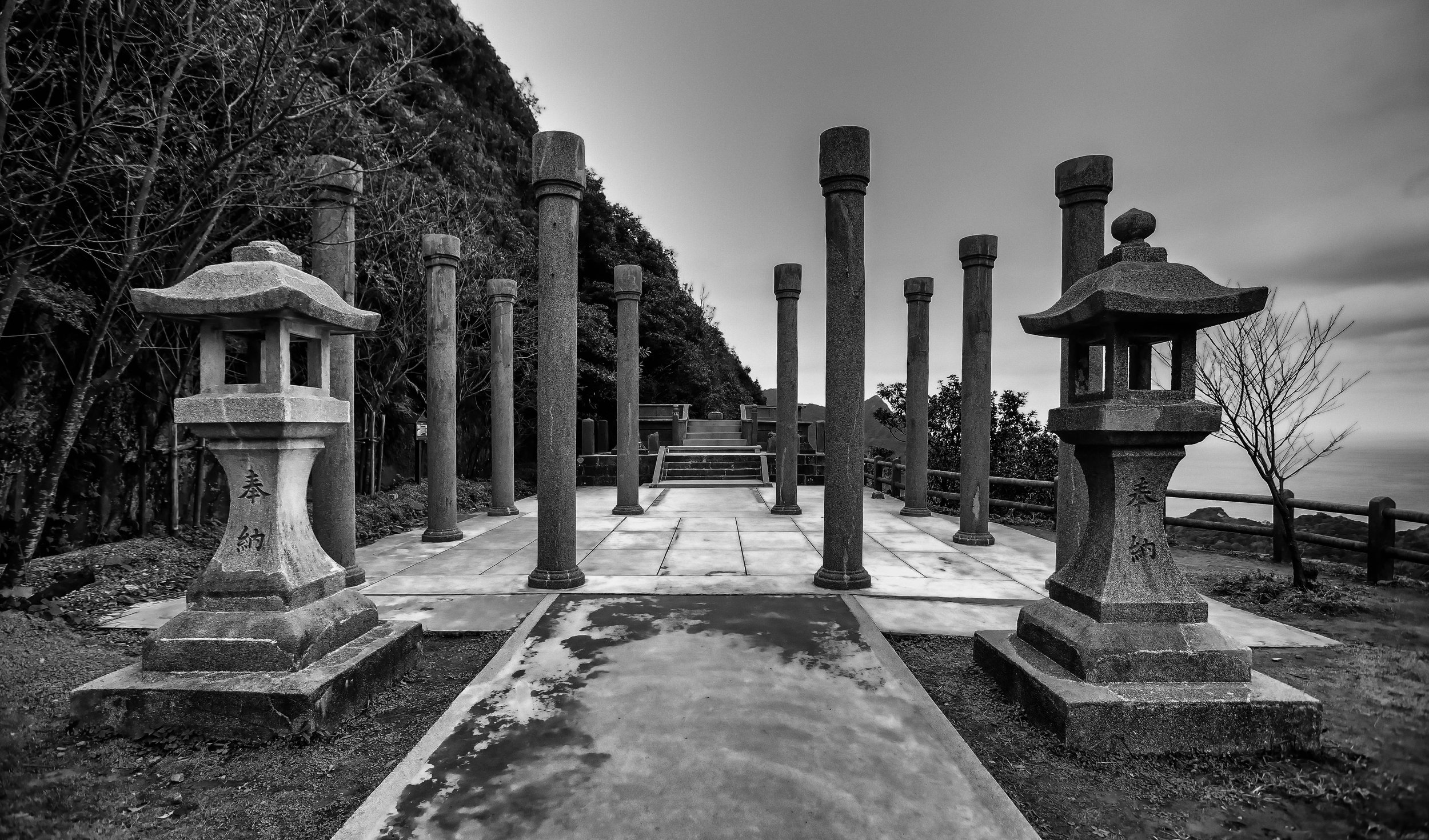
The Torii at Naminoue Shrine is known as a Myojin Torii (明神鳥居) which is one of the most common styles in Japan and simply means that its upper beam is curved while the lower beam is straight. Between the two beams there is a plaque that reads “Naminoue Shrine” (波上宮) and on either side of the gate you’ll find two large stone lanterns that light up the gate beautifully at night.

The gate is the largest of its kind in Okinawa and not only is it quite tall, its also wide enough to allow a lane for cars to enter on one side with pedestrian traffic on the other.  

Once you reach the top of the hill there is a second Torii gate that you have to pass through before reaching the interior section of the shrine. This gate is situated a level above the parking lot, so it allows people who have driven their cars into the shrine and parked their cars to also walk through a part of the visiting path to the shrine. This stone gate is much smaller than the first one and hung from the lower beam of the gate you’ll notice something known as the “sacred rope” or the “shimenawa” (標縄). The rope is thick and is decorated with “shide” (紙垂), which are beautifully cut paper streamers that are used in Shinto rituals. These sacred ropes are found all over Japan and have many different uses but here at the Shinto shrine it is used to help ward away evil spirits 

Visiting Path (參道)

The “Sando” (參道) or “Visiting Path” is a common feature with Japanese Shinto and Buddhist places of worship and acts as a path that leads to the Hall of Worship. The length of the path varies between shrine with some being quite short while others are several kilometers long.

The path at Naminoue Shrine is a short one that winds up a small hill and consists simply of a set of cement stairs with stone lanterns on the left and a small barrier fence on the right. As I mentioned above, the path is split into two with pedestrian traffic on the right and a road for cars to reach the shrines small parking lot. 

Once you’re at the top of the hill, you’ll pass through another Torii gate and the path to the main hall will come into view with the Purification Fountain on your left and the Administration Office on your right.    

Purification Fountain (手水舍)

An important aspect of Shintoism is something known as the "sacred-profane dichotomy". In terms of this temple, the Torii gate at the entrance of a temple separates the world of the 'sin' from that of the 'sacred'. When you walk through the gate you are leaving the world of the profane which means that you should do so in the cleanest possible manner. So in order to ready yourself for entrance into the sacred realm you would have to do so with a purified body and mind. 

As you approach the Purification Mountain or “chozuya”, you’ll notice a handy guide next to it that indicates the proper method of purifying yourself with a ceremony known as “temizu” (手水). The simple ceremony includes a few gestures that you’ll probably want to take part in if not just as a sign of respect, but because its hot in Okinawa and washing yourself with cold water is quite refreshing. 

  1. Pick up a ladle with your right hand, fill it with water and clean your left hand.

  2. Swap the ladle to your left hand and then wash your right hand.

  3. Swap hands again and pour some water into your left hand and take a drink.

  4. Wash your left hand again and then tilt the ladle vertically so that the remaining water runs down the handle.

What I really like about the Purification Fountain at this shrine is that it is situated within a tree covered area that offers visitors some respite from the sun. The fountain itself is beautifully decorated with the water spouts appearing in the shapes of dragons and the fountain itself made of a dark black coloured stone. 

Administration Office (社務所)

The “Shamusho” (社務所) is opposite the Purification Fountain and reaches as far as the Hall of Worship. The building is traditionally used to conduct the business of running the shrine and also acts as a place to allow the shrine personnel to rest. 

It is also where you’ll go if the shrine is holding a lecture or if the priests are holding special events or prayer ceremonies that aren’t held in the Hall of Worship. You’re likely to notice a long line of visitors at a window at the building as this is where you’re able to purchase good luck charms, amulets, ema, etc. from the shrine.

In the case of this shrine though, I gather that most of these public events are likely held at the Shrine Association building (神宮會館) which is directly across the street from the main gate. While not officially within the shrine area, the association building is frequently used for large public events and weddings and is where you’ll want to go if you want to rent a traditional Japanese yukata to get photos of yourself for your shrine visit.

Stone Guardians (狛犬)

One of the common features that you’ll find in the many of the places of worship throughout East Asia is that the temples and shrines are usually guarded by stone lion-dogs known in Japan as “Komainu” (狛犬). Thought to have originated in Korea, they typically appear in front of a temple and are meant to help ward off evil spirits.

Okinawa being Okinawa though, the traditional stone lion-dogs that guard the shrine have been replaced with the local version, the Shisa (シーサー), or “Shi-Shi” (獅子) in the local Ryukyuan language. The Shisa lions, I guess you could say are a distant cousin of the Komainu and are prevalent throughout the Ryukyuan islands acting as not only the guardians of temples and shrines, but also homes and businesses as well. 

The Shisa first appeared in Okinawa in the 15th Century and in the years since the lion has transformed into an image that symbolises the cultural identity of the people of the Ryukyuan islands and there are many legends in the area that tell of how they arrived.   

Link: Shisa: The Guardian Lions of Okinawa (Kampai) 

Hall of Worship (拜殿)

Shinto Shrines are renowned for their impressive ability to blend in harmoniously with the natural environment around them, which shouldn’t really be all that surprising considering that it is a religion that worships deities related to nature. 

If you weren’t already aware, the Shinto deities, or “kami” are almost always objects found in the natural environment such as animals, birds, rivers, mountains, trees, etc. For outsiders this can be a bit confusing, especially since there are eight million different kami - a number that is synonymous with infinity. 

For the Shinto, the relationship with the natural environment is extremely important given that the earth can bring both blessing and disaster. It is thought that if the kami are worshipped adequately and in a responsible way, then they will bring good fortune to the world. If on the other hand they are disrespected or neglected, they will react violently or bring misfortune. 

Essentially, respect for the environment is one of the main tenets of Shintoism and the construction of these shrines never fails to keep that in mind. With over 80,000 shrines in Japan, Shintoism contributes to society providing ecological sanctuaries that can be enjoyed by all. 

The thing is though, the natural environment in Okinawa is considerably different than what you’ll come across in other parts of the Japan. This means that what you’re going to experience at Naminoue Shrine is going to be a lot different than what you’d see anywhere else in Japan. The shrine of course keeps with tradition and is surrounded by nature, but as it is situated atop a cliff that overlooks a pristine beach, the area around the shrine is covered with palm trees and tropical plants.

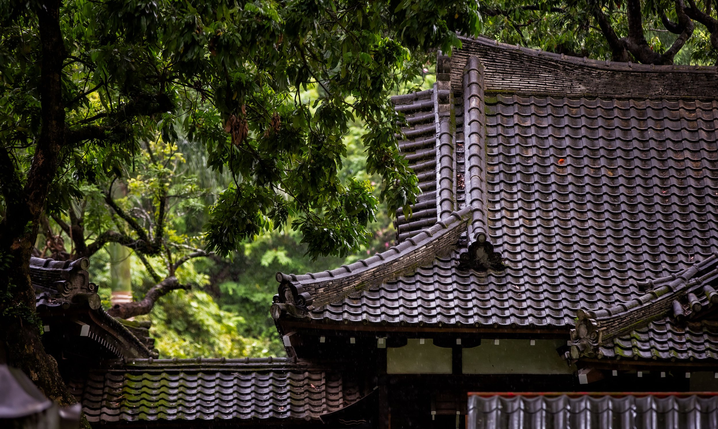
The design of the Hall of Worship, or the “Haiden” likewise is unique to Okinawa as it was constructed according to Japanese tradition but designed in a way that pays homage to the Ryukyuan people, especially with with its usage of the colour red and the beautiful red tiled “Aka-Gawara” (沖繩赤瓦) roof that has become synonymous with the architecture found all over Okinawa.

The combination of the three primary colour with the red on the shrine, the green palm trees and the beautiful blue Okinawan sky makes the shrine appealing to the eye and allows it to stand out in the sunlight. 

Link: Ryukyuan Architecture in Zamami: Red Tile Roofs (The Zamami Times)

As you approach the Hall of Worship, the first thing that will stand out to you is the beautiful red roof and pillars mixed with the painted white walls. The closer you get though, the smaller details become much more apparent. 

The first thing you’ll want to take note of are the three plaques placed just below the roof - The middle plaque reads “Naminoue Shrine” (波上宮) while the plaque to its left reads: “Peace reigns over the land” (萬民泰平) and the one on the right reads “National Protector” (國家鎮護). Given Naminoue’s position as the prefectural shrine as well as Okinawa’s unfortunate history, the plaques are quite fitting to the modern Japanese philosophy of non-aggression.

Hung from the lower beam of the gate you’ll notice something known as the “sacred rope” or the “shimenawa” (標縄). The rope is thick and expertly braided and is decorated with “shide” (紙垂), which are beautifully cut paper streamers that are used in Shinto rituals. These sacred ropes are found all over Japan and have many different uses but here at the Shinto shrine it is used to help ward away evil spirits. 

In front of the doors you will find some hanging curtains with a circular logo on each - The crest, known as a “shinmon” (神紋) is the “mitsudomoe” (三ツ巴), which appears to be a comma-like swirl that is commonly associated with Hachimon Shrines (八幡神社) in Japan. 

In Okinawa however the crest was adopted as the emblem of the royal family of the Ryukyuan during the First Sho-Dynasty around seven centuries ago. In Okinawa the crest is known as the “Hidari Gomon” (左御紋) and today you’ll find it not only at Shinto Shrines, but also at Shuri Castle and in most of the imagery that represents the islands. The crest is experiencing something of a resurgence in recent years as it was banned for several decades after the Japanese took control of the Ryukyus. 

Link: 'Hidari Gomon' The Ryukyu Symbol (Budo no Kukyo) 

The crest likewise has deeper connections with Okinawa’s Shinto Shrines as it is thought that the the origin of the design was inspired by the “Yatagarasu” (八咫鳥) or the ‘three-legged crow’, a common image throughout Asia, but is closely associated with Kumano worship. If you visit any of the Kumano Shrines in Japan, you’ll see images of the crow all over the place.

Link: The Legend of Yatagarasu, the three-legged crow and its possible origins (Heritage of Japan)

Most of what you’re going to want to see from the Hall of Worship is on the exterior, but if you’d really like to walk up to the doors to take a peak inside, you’re going to want to follow tradition and first follow a few steps which will impress the locals.

First you’ll want to walk up the steps to the wooden box in front of the main doors. You can drop in a small donation (there’s no set amount), then clap your hands twice to alert the kami of your presence, then with your hands clasped together, bow your head and make a wish. When you’re done, its tradition to bow. From there you can approach the open door and take a peak inside of the shrine room to see whats happening. 

When you look into the interior of the Hall of Worship, you’re going to see a large open room with very little in terms of decoration and tables in the middle where the kami are located.

As I mentioned above, the Shinto Shrines in Okinawa adhere to Kumano Worship, one of the largest denominations (if you will) of the religion. Most of the information you’ll find online does a great job explaining the three UNESCO World Heritage shrines in the area and their history but does a poor job of actually explaining the deities enshrined within. 

Officially, the shrine at Naminoue is dedicated to the ‘Kumano Deities’ but this becomes confusing as you can’t see the actual shrine. From my research, information suggests that the shrine consists of three mirrors which represent ‘Hayatama no kami’, ‘Kotosaka no kami’ and in the middle, the group of ‘Kumano deities’. 

Where this gets confusing is that both of the gods are commonly associated and included within the group of ’Kumano Deities’ that I listed above. In this case, Hayatama no Kami, who is a water god and Kotosaka no kami, a protection deity, are likely given more importance given the importance of the ocean and farming to Okinawa. I’m clearly not an expert on this subject though, so if I’m wrong, please feel free to correct me. 

  • Left -> Hayatama no kami -> 熊野速玉大神 (はやたまのをのみこと)

  • Centre -> Kumano Deities -> 熊野大神 (くまののおおかみ)

  • Right -> Kotosaka no kami -> 事解之男神 (ことさかのをのみこと) 

Naminoue Beach

It is safe to say that If it weren’t for the beach below the shrine, this shrine would never have been built. A sacred space for the local Ryukyuan people for hundreds of years, the high cliff above the beach was the perfect vantage point for people watching ships making port in Naha from all over Asia. 

Today the view of the ocean is blocked by an elevated highway over the beach, which kind of ruins the view, but the bridge does have its advantages as it allows people to take some pretty photos of the shrine sitting beautifully atop the high cliff. 

Most notably for locals however is that Naminoue Beach is the only beach in the capital that is open to the public for recreational activities. The long white sand beach is a popular spot for locals to enjoy the scenery, have a BBQ or a picnic, play volleyball or go for a swim. 

As mentioned above, the view at the beach is obscured by an elevated highway. While this does ruin the view for swimmers, it does provide an excellent opportunity for photos as there is a walking path along the highway where you’ll be able to get some shots of the shrine sitting atop the cliff above the beach.

If this interests you, you’re going to have to walk for about ten minutes to get to the bridge but getting there is fairly straight-forward. From the main gate to the shrine continue walking down Naminoue-dori where you’ll pass by a large driving school. Continue along the sidewalk until you reach the bridge where you’ll make a right turn onto the bridge.

Getting There

Guide Map to Okinawa's Confucius Temples and Naminoue Shrine. www.goteamjosh.com/blog/kumekong www.goteamjosh.com/blog/naminuoe

Naminoue Shrine: #25-11 Wakasa District 1, Naha (沖繩縣那霸市若狹町1丁目25-11)

MAPCODE: 33 185 023

Getting to Naminoue Shrine is quite easy and is even easier if you have access to the internet and Google Maps, given the difficulty of navigating Japanese-style addresses. I’d suggest though that you travel on foot as it will give you the best opportunity to explore as well as saving time and money.

If you’ve rented a car, you’ll definitely be able to find a car park nearby where you can drop off your car and check out the area. The problem with car parks though is that the parking fees are rather expensive and if you plan on checking out the shrine, the beach and the neighbouring Naha Confucius Temple, you’re going to need a bit of time. So, if you’ve got a car, the best thing to do would be to leave it where you’re staying, take the monorail and walk. 

If you choose the latter, you can conveniently take the monorail to either the Prefectural Office Station (縣廳前站) or Miebashi Station (美栄站) and walk from there. I’d personally recommend walking from the Prefectural Office as it is a short walk and doesn’t require making too many turns, making it the easier route to navigate. The routes I’m sharing below might not be the fastest, but they require very little in terms of turning and getting lost in alleys. If you have internet access on your phone, just use your GPS and you’ll arrive in 20 minutes. 

Directions from Prefectural Office Station

From the Monorail Station you’ll exit onto a large road named Onaribashi-dori (御成橋通り) where you’ll walk up the hill in the opposite direction from the Kokusai International Street (國際通). Simply follow that road until you reach the beach where you’ll make a left turn where you’ll quickly find the shrine. 

Directions from Miebashi Station 

From Exit #2 of the Monorail Station make a left turn onto Okiei Street (沖映通り) and then walk straight until you reach the end of the road along the ocean. From there turn left again and follow the coastal path until you reach Naminoue Beach and the Shrine. 

If you’d like to take a bus, the shrine is serviced by Naha City Bus #2, #5, #15 and #45 where you’ll get off at the Nishinjo Stop. To catch any of these buses, simply go to the Prefectural Office Monorail station where you’ll find the bus stops on the road below the station. 

Link: Bus Map Okinawa (Bus Routes / Schedules) 

Tourists..

One of the most noticeable differences you’ll find in Okinawa from the rest of Japan is the absence and concentration of Shinto Shrines - Given the Ryukyu’s unfortunate modern history, it shouldn’t surprise you that there are so few left standing nor should it be surprising that the local people don’t always share a similar love of Japan’s state religion as those on the mainland. The situation with regard to cultural identity in Okinawa is a complicated one and as time passes, it tends to be one that drifts further and further apart from the rest of Japan. 

Nevertheless, the lack of shrines does make the few left standing even more important. So, if you’re planning to visit Okinawa, you can expect that your visit to this shrine to be shared with quite a few locals. 

Nevertheless, the rarity of Shinto Shrines in Okinawa makes the few left standing today important places of worship for those who adhere to the religion as well as for travelers. 

As the highest ranking shrine in Okinawa Prefecture and the largest in the capital city of Naha, Naminoue Shrine has become an important place of worship for locals as well as a major tourist attraction, so if you’re visiting the city, you’ll definitely want to stop by to check it out. 


Qixing Mountain (七星山)

When people think of Taiwan’s capital city, Taipei, they often think of a modern metropolis with Taipei 101 dominating the skyline and showcasing the economic might of the country. What few realize however is that the city is almost completely surrounded by mountains and nature. This mixture of the ultra-modern with the natural environment is something that a lot of cities around the world would love to have access to, but here in Taipei, its just a part of every day life as the city is and has always been defined by its mountains. 

Most tourists who visit Taiwan are already aware of mountains like Elephant Mountain or some of the others on the Four Beasts Trail, but when we actually talk about the mountains the ‘define’ the city, you don’t have to look any further than those found within Yangmingshan National Park (陽明山國家公園).

 The reason for this is because Yangmingshan National Park is home to twenty or more volcanoes in the Datun Volcano Group (大屯火山群) which have over the past two million years erupted and helped to form much of the landscape of the Greater Taipei region. 

You’ll be relieved to know though that even though there is still some thermal activity taking place in the area, most of those volcanoes have since gone dormant and don’t appear to pose any danger. The post-volcanic activity however is something that we can all enjoy the area is now home to a large collection of natural hot springs and fumaroles which have been harnessed and converted into public baths. 

Despite their historic significance, it’s likely that most residents of Taipei would have a hard time telling you the names of any of the mountains in the Datun Volcano Group with the exception of Qixing Mountain (七星山).

This is because Qixing Mountain, which is often translated (quite literally) as “Seven Star Mountain” (I won’t be using this name here) is not only the highest mountain of the group, it is also the highest peak in the whole of Taipei.

And because it has become a popular local tourist attraction for hikers, bird watchers, photographers and nature lovers! 

The mountain, which at its highest stands at 1,120 metres (3,675 ft) above sea level gets its name from an event that took place more than 700,000 years ago when it last erupted and not from anything that has to do with ‘stars’ as the English name might suggest. It name is derived from what happened post-eruption when the crater at the peak eroded and after many thousands of years created seven separate peaks on the mountain.

Today the volcano lies dormant, but the steaming fumaroles that surround it (and often cover the mountain in a layer of mist) speak to its long history of geothermal activity. 

Prior to the arrival of the Chinese Nationalists, the area we refer to as “Yangmingshan” was simply referred to as “Grass Mountain” (草山). In 1950, President Chiang Kai-Shek decided to rename the area in commemoration of Ming Dynasty (明朝) scholar Wang Yangming (王陽明) and plans were made to create a national park to preserve the natural environment. 

In the years since the creation of the Yangmingshan National Park, the area has been developed for tourism and outdoor recreation and has become a popular place year-round for hiking, cherry blossom and flower viewing, bathing in hot springs, etc.

More important with respect to this blog post is that the local government has constructed a large network of hiking trails within the National Park area and you can rest assured that the city’s highest peak, Qixing Mountain is well-serviced by these trails. Visitors to the area are provided (free of charge) several well-developed trails where you’ll be able to safely hike to the peak. You’ll also find several rest stops along the way where you can have a seat and enjoy the scenery. 

Taipei has quite a few mountains but most people would agree that hiking Qixing Mountain is probably one of those things that every resident of Taipei should do at least once in their life. If you’re a tourist visiting the country, it is also highly recommended that you take some time to enjoy some of the best scenery Taipei has to offer. 

The problem for a lot of tourists though is that there isn’t really much useful information about hiking the mountain and what little is available rarely ever gives a complete picture of how to get there, how long its going to take you or any of the other pertinent information that you’re going to need to complete the hike. 

I hope that this guide helps out with that and answers any and all of the questions you might have. 

Hiking Qixing Mountain

So you’re probably here because you’ve decided to hike Qixing Mountain and you have a few questions. Usually those questions are: “How do I get there?”. “Where do I start?”, “How long will it take?”, “Where do I finish?” and “What will I need?

I’m going to try to answer all of those questions for you here. 

Where do you start and where do you finish? 

There are three different trailheads for this mountain - One that starts a short walk from the Yangmingshan Bus Terminal and two others that are much further away (and will likely require taking a shuttle bus to get to). 

You may be thinking to yourself that the closest trailhead is probably the best, but as you might expect, the trail is much longer and you’ll end up missing out on a lot of the great vantage points for scenery that you get on the other trails. The other two trailheads start at ‘Xiaoyoukeng’ (小油坑), an area with a giant steaming fumarole and ‘Lengshuikeng’ (冷水坑), another popular spot where you’ll find some public hot spring baths. 

When it comes to where you expect to finish the hike, once again, it depends on where you start and how much you plan on hiking - If you start your hike at Lengshuikeng for example, you can hike to the peak and then have the option of either heading back the way you came or making your way toward ‘Xiaoyoukeng’ or ‘Miaopu’ to complete your hike. 

I’ve hiked all three, so if you were ask me, I’d suggest taking the shuttle bus to Lengshuikeng, hiking to the peak and then descending to Xiaoyoukeng, which is considered the ‘full circuit’. Once you’re at the trailhead, you’ll be able to get on the bus much more easily than you would if you started in the opposite direction.

I’ll talk more about the routes a little later.  

How long does it take to complete the hike? 

That really depends on what trailhead you’re starting your hike on, where you plan on finishing and how long you stop to rest or take photos. If I were to give an estimate of the amount of time it would take to complete the hike, I’d probably say that you should be prepared for around three hours, but that includes time to stop as well as for enjoying some time on the peak.

One thing about Qixing Mountain that can be frustrating is the amount of mist that covers the mountain. If you’re hoping to take nice photos of the landscape, you might want to stick around for a little while until the mist clears up. This will add on a bit of time to your hike but it is well worth your time.

What will you need for the hike? 

I recommend wearing a good pair of water-proof hiking boots or sneakers and bringing a wind-breaker / raincoat as it is often windy and damp on the peak. Here is where I’d caution you - even if its a sweltering hot summer day and you plan on doing this hike, you should probably still bring a wind-breaker with you for the hike as the temperature at higher-altitudes (in addition to the strong wind) can be chilly. 

You should also bring some water and snacks, which you can easily purchase at the 7-11 across from the Yangmingshan Bus Terminal. You’re not going to need a bunch of hiking gear for this one as it is essentially a well-developed sidewalk that just so happens to bring you to the top of the mountain.

Just don’t show up in high-heels.  

Yangmingshan’s ‘Flower Seasons’ (陽明山花季)

One thing you’ll want to make a mental note of is that Yangmingshan is home to several annual blooming seasons for different kinds of flowers or blossoms. Flower viewing, or “Hanami” (花見) is an extremely popular activity in Taiwan and is only exacerbated by wannabe Instagram celebrities who travel around the country taking photos of themselves for all the likes on the ‘gram. 

During the various blooming seasons, traffic on Yangmingshan becomes quite unbearable with thousands of people visiting each day. This means that if you plan on hiking the mountain during one of these seasons, you may have to contend with quite a few other visitors which means longer lines for the buses and traffic jams on the road to the mountain.

It also means that you’re driving a car or scooter, you’ll have to be aware that the local government puts traffic control measures in place which limits all but local traffic from the mountain.   

Cherry Blossom Season (櫻花季) - February - April (2月 - 4月)

Calla Lily Season (海芋季) - February - May (2月~5月下旬)

Hydrangea Season (繡球花) - May - June (5月中旬~6月下旬)

Silver Grass Season (芒草季) - October - November (10月-11月)

  • Just for reference, almost all of the photos in this blog post were taken during Silver Grass Season.

The Yangmingshan National Park also holds an annual “Yangmingshan Flower Festival” (陽明山花季) which is generally held for a period of two weeks in mid-February and usually coincides with the Lunar New Year holiday. If you plan on hiking the mountain at this time, good luck!

Trailheads

As I mentioned above, there are three different trailheads for hiking Qixing Mountain for you to choose from, each of which comes with some pros and cons. I’m going to introduce each of the them below and try to give you a better idea of what to expect. 

Xiaoyoukeng - Qixing Main Peak (小油坑 - 七星山主峰) 1.6km 

If you’re taking the bus, the first trailhead you’re going to reach is the one that starts directly next to the ‘Xiaoyoukeng’ bus stop, which is situated next to the ‘Xiaoyoukeng Visitor Centre’ (小油坑旅遊服務站). As you approach the stop you’re likely to notice quite a bit of mist in the air - this is because ‘Xiaoyoukeng’ is actually a giant steaming fumarole in the side of the mountain.

If you’re getting off the bus here, I’d recommend taking a few minutes to go check out the fumarole viewing area, which is a short distance away from the trailhead.  

The Xiaoyoukeng portion of the trail has the added bonus of being able to walk past much smaller steaming fumaroles throughout the hike, which makes this something you won’t want to miss. The thing is though, you need to be really careful not to get too close to them and pay attention to the warning signs.

I completely understand that your brain might be telling you that you should touch one of the steaming rocks to see if they’re really hot, but believe me, they are.

You don’t want to burn yourself and ruin your day, so enjoy their geothermal beauty while staying safe. 

One of the reasons I like this trail so much is that as you hike to the top the environment changes and when it does, so do the varieties of trees and plants that you encounter along the trail.

You’re also likely to run into a completely ambivalent local species of partridge feeding along the trail.

The trail from Xiaoyoukeng to the peak of Qixing Mountain is by far the shortest of all the trails, but that doesn’t necessarily mean that it is a good thing. The trail is actually a lot more steeper than the other two trails, so if you hike to the peak on this trailhead, you’re likely to get a bit more of a work out.

Whether that is a pro or a con is up to you - What I will say though is that the trail is often shrouded in mist from the fumarole and even though there are places to stop and check out the view, you’ll have to be pretty lucky to be able to see much of anything. 

If hiking directly the peak is your thing though, this trail is probably your quickest, no-nonsense route. 

Lengshuikeng - Qixing Main Peak (冷水坑 - 七星山主峰) 2.1km

‘Lengshuikeng’, despite its literal name “Cold Water Valley” (冷水坑), is home to popular hot spring baths where you can bathe in the public pools at a high elevation. Even though the baths tend to be quite popular on weekends, they aren’t nearly as busy as what you’d find in Beitou, so the people who visit get to enjoy their time in relative seclusion.

And the general embarrassment of a public bath. 

The area is home to not only the hot springs and the trailhead for Qixing Mountain but also a historic suspension bridge, Milk Lake (牛奶湖), a waterfall and a path that brings you to the popular Qingtiangang Recreation Area (擎天崗).

For the purpose of this blog though, the important thing is that the area is home to the trailhead for Qixing Mountain (of which there are more than one), a bus stop, a large parking lot for cars and scooters and a visitors centre with (rather nice) public washrooms. 

The main trailhead is conveniently located directly across from the parking lot and is easy to find as it is marked by not only a trailhead marker, but also has large sign with a map of the trail and some information about the hike. 

The hike on this trail starts out rather steep, but after a few minutes of hiking you’ll reach a point where the incline is much more comfortable and you’ll be able to enjoy the amazing views behind you. When you’re about halfway up the hill, you’ll reach a large Chinese-style pavilion where you can rest or take photos.

A short distance from there you’ll find the Qixing Mountain Park (七星山公園) in one direction and the ‘Meng Huan’ Lake (夢幻湖) in the other. The lake is quite beautiful, so you might want to take a detour for a few minutes to check it out.

The park likewise is a popular spot for taking night photos of the Taipei cityscape, so if you plan on sticking around to take photos, this spot is probably a good place to park your tripod.

Once you pass this area, the incline once again becomes a bit steep and after a bit of time you’ll reach the Eastern Peak (七星山東峰) where you can stop for a break.

Once there though, you’re only about 10-20 minutes away from the Main Peak (七星山主峰). 

If you’re looking for recommendations, I’d highly recommend you start your hike at ‘Lengshuikeng’.

This might mean taking the bus much further, but it also means that you’ll get to enjoy some really beautiful scenery with an ample amount of spots to stop and take some really pretty photos.

Likewise, if you aren’t planning on backtracking, it would be much easier to complete the ‘full circuit’ hike (which I’ll talk about below) so that you can enjoy both sides and easily hop on the bus at ‘Xiaoyoukeng’ when you’re done.

Miaopu Trail - Qixing Main Peak (苗圃登山口 - 七星主峰) 2.4km

For most tourists, it seems like the most commonly taken route for hiking Qixing Mountain is to start the hike at the Miaopu Trailhead (苗圃登山口). The trail is a short distance from the Yangmingshan Bus Terminal and situated directly next to the Yangmingshan National Park Visitor Centre (陽明山國家公園遊客中心).

This means that if you start your hike from this route, you eliminate the need to take the shuttle bus from the bus terminal to the other trailheads and you won’t have to wait for the shuttle bus when you complete the hike. 

Sounds great, right?  

It should go without saying that if you take this route to the peak and back down, that you’re going to be hiking for a distance of around five kilometres - which is a much longer than the other trails.

You’re also going to miss out on some of the best vantage points with regard to scenery as well as missing the steaming fumaroles at ‘Xiaoyoukeng’ and the hot spring bath area at ‘Lengshuikeng’ as this trail more or less creates a “T” between the other trails. 

The great thing about this route is that for most of the hike, you are protected under the cover of trees, so if it is an excruciatingly hot day, or if it is raining, you’ll be able to complete most of the hike with a bit of protection from the elements.

This trail though is most popular with foreign tourists (as a lot of people don’t know how to get to the other trailheads) so you’re likely to come across quite a bit of tourists along the trail.

If you’re not new to Taiwan and you’ve hiked the mountain before, I’d say that this route is probably a pretty good one if you just want to hike to the peak without the fuss of dealing with buses, traffic or any of the scenic photo spots on the other trails. For me though, hiking a mountain is never a race to the top and I would hate to go all the way to Yangmingshan and miss out on the opportunity for taking photos. 

Qixing Mountain Circuit (小油坑 - 冷水坑) 3.7km

While some people might prefer hiking to the peak of the mountain from one of the trailheads and then heading back the way they came, I’d actually suggest that you instead complete the entire hike from one side to the other rather than backtracking.

If completing the entire hike sounds better to you, take it from me, you should hop on the shuttle bus from the Yangmingshan Bus Terminal and take it all the way to the ‘Lengshuikeng’ bus stop.

From there you’ll hike to the peak of the mountain and once you’re done you can complete your hike by heading down the mountain toward ‘Xiaoyoukeng’. 

The reason why I suggest taking this route is because it is considerably easier getting on the bus at ‘Xiaoyoukeng’ than it is at ‘Lengshuikeng’ which often has long lines.

I also don’t mention the Miaopu trailhead here because that specific trail takes you up the mountain in a different direction and means that you’ll miss out on some of the best scenery.  

I know, it might seem like completing the full circuit sounds longer in terms of the amount of time and the distance you’ll travel, but if you do the math, it is more or less going to be the same and you’ll get to experience the mountain from both sides.

So completing the entire circuit is probably your best option and is what I recommend. 

Getting There

Map of routes for hiking Taipei's Highest Peak, Qixing Mountain (七星山). www.goteamjosh.com/

Hiking Qixing Mountain might be a challenge for some, but getting there is a challenge for almost everyone.

The thing about hiking Qixing Mountain is that you first have to deal with the notoriously horrid traffic on Yangming Mountain - Whether it’s going up the mountain or heading down after your hike, you’re unfortunately going to get stuck in traffic. This is part of the reason why I don’t hike the mountain as often as I’d like.

So, let’s discuss some of the best ways to get to the mountain. 

The first thing you’re going to have to decide is what your hike is going to entail - Are you going to hike the full circuit? Or are you going to hike from one of the trailheads to the peak and then leave the way you came? These are important questions to ask yourself, because it is going to dictate the method by which you get yourself to the trailhead. 

If you live in Taipei and own a scooter, or have rented one for the duration of your visit, you can easily ride your scooter up Yangming Mountain to either one of the trailheads, park it and then be on your way. The thing is though, if you park it at one of the trailheads, you’re going to have to come back down the way you came, which means that you’ll probably not be able to hike the whole trail.

There is of course the possibility of hiking the full trail and then when when you arrive at the trailhead taking a bus to where you parked your scooter, but that might end up forcing you to wait quite a while. 

Likewise, if you have a car, you could drive to either Xiaoyoukeng (小油坑) or Lengshuikeng (冷水坑) and park in one of the public parking spots. The thing about this option though is that the standard Taipei parking fees apply, so if you park in either of the parking spots for several hours, you’re going to have to pay quite a bit.

You might also think that you could just park along the side of the road and avoid the fees, but I guarantee if you do, your car won’t be there when you finish your hike.

You’re also going to have to deal with terrible traffic jams on the way down as the traffic congestion on the mountain in the late afternoon is terrible.

Scooters are okay, but I’d really caution against driving a car. 

If you’re asking me, I think your best option is to just take public transportation. 

Sure, it might be a bit more of a pain in the ass, but you’ll be happier to not have to deal with all the traffic, you’ll have the option of completing the full hike and it will be a lot cheaper. 

If you’re going to make use of public transportation, you have a number of options: 

  1. Taipei Main Station (台北車站) - Yangmingshan Station (陽明山站) - You can catch Bus #260 at Taipei Main Station’s “North 2” (北二門) exit. The bus will take you to the Yangmingshan bus transfer station where you’ll transfer to Bus #108 which will take you to both trailheads.

  2. Jiantan MRT Station (劍潭捷運站) - Yangmingshan Station (陽明山站) - From the bus terminal just outside of the MRT station take Bus Red #5 (紅5) to the Yangmingshan bus transfer station where you’ll transfer to Bus #108 which will take you to the trailheads. Conveniently, a new route (S15/小15) has been added that takes you directly from Jiantian to Qingtiangang. If you prefer to start the hike from there, this one is pretty convenient

  3. Shipai MRT Station (石牌捷運站) - Yangmingshan Station (陽明山站) - From the bus terminal just outside the MRT station take Bus #8 (小8) to the Yangmingshan bus transfer station where you’ll transfer to Bus #108 which will take you to the trailheads.

  4. Beitou MRT Station (北投捷運站) - Yangmingshan Station (陽明山站) from the bus terminal just outside the MRT station take either Bus #9 (小9) or Bus #230 to the Yangmingshan bus transfer station where you’ll transfer to Bus #108 which will take you to the trailheads.

  5. Donghu MRT Station (東湖捷運站) - Yangmingshan Station (陽明山站) from the bus terminal just outside the MRT station take Bus #681 to the Yangmingshan bus transfer station where you’ll transfer to Bus #108 which will take you to the trailheads.

You’ll probably have noticed that no matter which option you take, you’re going to have to transfer at the Yangmingshan Bus Terminal (陽明山公車站) and then hop on the #108 shuttle bus to whichever trailhead you plan on starting at.

One thing that you’re going to want to keep in mind is that there are two bus #108’s and that if you get on the wrong one, you’re not going to get to any of the trailheads. So, to ensure that you get on the correct bus, make sure you get on Bus #108 (陽明山遊園公車) and not “Bus #108區” which takes you to Erziping (二子坪).

They have adequate signage on the bus that should prevent you from making the mistake, but it’s best to remind you anyway.  

One of the most important things to keep in mind is that Bus #108 runs every 30-40 minutes on weekdays and every 20-30 minutes on weekends between the hours of 7:00am - 5:30pm.

This means that buses tend to be few and far between and if you spend too much time on the mountain, you might get stuck if you come down too late. Make sure to keep track of time and don’t expect that there is going to be room for you on the last bus of the day, especially on weekends when the trails are busier. 

Link: Bus #108 (陽明山遊園公園) Route Map (中文)

Link: Yangmingshan National Park Public Transportation (中文)

You thought I’d forget a picture of the peak?

If you need real time info for the bus stops, check the Taipei eBus website for more information. You may also want to download the “台北等公車” smart phone app which uses GPS to let you map your route more easily.

If you decide to start your hike from the Miaopu Trailhead (苗圃登山口), you won’t have to transfer to Bus #108. You’ll instead just get off the bus at the Yangmingshan Bus Terminal, cross the road and make your way to the Yangmingshan National Park Visitor Centre (陽明山國家公園遊客中心) where you’ll find the trailhead nearby. Fortunately I don’t need to offer too much in terms of directions here as the directions to the visitor centre and the trailhead are very well marked for pedestrian traffic.

If you do decide to drive a scooter or a car, the addresses for both trailheads are below. You can input either the English or the Chinese into Google Maps or your GPS which will map the best route to the parking lots next to to the trailheads. 

  1. Lengshuikeng (冷水坑): No. 170, Lane 101, Jingshan Road, Shilin District, Taipei City (台北市士林區菁山路101巷170號)

  2. Xiaoyoukeng (小油坑): No. 60, Zhuzihu Road, Beitou District, Taipei City. (台北市北投區竹子湖路69號)

As far as hiking goes, even though Qixing Mountain is Taipei’s highest peak, it tends to be one of the easier mountains in the city in terms of difficulty. You’re not going to have much trouble hiking this one, so feel free to bring your family, friends, dogs and cats along with you to enjoy the beautiful scenery and the experience.

As far as the scenery goes, if you’re lucky enough to be blessed with good weather and clear skies, you’re going to be rewarded with spectacular views of the mountainous landscapes as well as the Taipei cityscape on one side and the northern coast on the other.

That being said, weather conditions in the area tend to change quickly and the view is often obscured by the mist created by the thermal activity taking place on the mountain. So, you need to remember that even if you start this hike on a perfectly clear day, you may not end up being able to enjoy the hike as much as you’d like. If you do end up hiking on a day where there is a lot of mist, don’t feel too bad as I think there is a certain beauty on Taiwan’s mountains when they’re covered in mist and clouds.

I tend to look on the bright side and I think that even though the varying conditions on this mountain might disappoint some, it makes for a much more interesting experience. If you’re in Taipei and you have a bit of time, I highly recommend hiking Qixing Mountain as it offers one of the best high-mountain experiences that you’re going to have without traveling south.

If you do climb the mountain, have fun, be safe and be careful of the partridges. 


2019 in Review

GTJ-2019-1206-8.jpg

As usual, while getting ready to write this year-end review, I took some time to go back and read over some of the previous ‘Year in Review’ posts. I hadn’t realized it, but this will be the fifth time posting one of these.

Time sure does fly.

When I started this site in 2014, I had never expected that I’d end up spending a countless amount of hours sitting in coffee shops all over Taipei, Taoyuan and Hsinchu writing blogs.

The thing is though, when I look back, I wouldn’t consider it time wasted. 

Sure, you could say that instead of spending all that time sitting around doing research, translating and writing, I could have been out taking more photos - but all those hours I’ve spent have also helped me learn so much more about Taiwan. 

And hey, I guess if I didn’t make the effort, I wouldn’t have been named one of ‘2019’s Hottest Influencers in Taiwan’, although to tell the truth, I’m not really sure how that happened.

If I’m an influence, its probably a bad one.

Raaaaaaaaaaarwwwhh Influencer!!

So, 2019 - What can I say? It didn’t absolutely suck. 

In terms of world events, things got a bit crazy, but as the year comes to a close it seems like we might be starting to rebound from some of the stupidity left over from the past few years. 

By the time you read this, Greta Thunberg has already been named Time’s “Person of the Year”, Trump is already on his way to being impeached and Sanna Marin has become the Prime Minister of Finland and consequently the world’s youngest head of state, leading a coalition of parties all run by women. 

All the crazy people on the internet are having aneurisms. It’s great.  

In terms of my own country, we had an election and (if you’re asking me) the right guy won - despite a bunch of moronic scandals and controversies. Justin Trudeau, who just might be the least terrible option we have was elected Prime Minister for a second term.

Sure, we could do better than him, but we almost could have done a lot worse with the other guy.

And hey, the other guy ended up getting the boot. (Canadian humour)

Here in Taiwan, the nation is starting to count down the days until an election that will take place in early January. President Tsai Ying-wen (蔡英文) is hoping for a second term while the goofy mayor of Kaohsiung, Han Kuo-Yu (韓國瑜) is running against her. Polling so far looks like President Tsai is sailing toward an easy win against the gaffe-prone Han, but polls are known to be wrong and who knows what will happen, so we’ll just have to wait until Election Day to know for sure.

In more important news, the long-thought extinct Formosan Spotted Leopard (台灣雲豹) made a few surprise appearances this year, giving hope that the species may be on the rebound. The government started the process of banning plastic bags and straws, which should be completely eliminated soon and after a long battle, Taiwan became the first country in Asia to legalize same-sex marriage! 

Scientists also made a bunch of cool discoveries, people did lots of cool, positive things and despite all the depressing stuff you see in the news, not everything sucks.  

When I looked back at my ‘Year in Review’ posts for 2017 and 2018, it seemed like we were all collectively waiting for those years to end so we could have a fresh start - It doesn’t seem like anyone really feels like that about 2019 though, which probably means that it wasn’t a total disaster. 

Personally though, when I read my 2018 post, I thought, “Holy hell, that was a pretty great year” - I travelled to England, Ireland, Scotland, Italy, France and Iceland.

This year? I’ve been too busy and the only vacation I had was a trip to Okinawa.

So what have I been so busy doing?

Well, this year has been the busiest year I’ve had as a so-called ‘working’ photographer.

I spent the first half of the year constantly on the road taking photos for various publications, which left me with little time for my own personal stuff. Once the summer hit, things eased up a bit for a short time and I was able to get out to do my own stuff.

That didn’t last very long though as photo requests kept coming in and I was back on the road.

When I look through my photo catalogue for this year, I’d estimate that around 85% of the photos I took were for commercial work. This isn’t all that bad though as commercial work pays the bills and in some cases affords me opportunities that I wouldn’t have had otherwise. 

Speaking of which, the highlight of my year (which I’ll talk about in more detail later) was when I was contracted to take photos of the ‘Mass Same-Sex Wedding Ceremony’ that was held in front of Taiwan’s Presidential Office. The historic event wasn’t open to the public and tickets were hard to get, so if I didn’t have a media pass, I wouldn’t have been able to attend.

As we move into a new decade, 2020 looks like it is going to be another busy year for me in terms of travel.

I’ll be starting the year with a few weeks in Vietnam and Thailand, which will then be followed by Japan a few months later and then either Nepal and/or Canada.

I’m also hoping to spend more time traveling through southern and eastern Taiwan.

In terms of personal projects, I’m still considering a few options, but as usual you can expect that I’ll be posting a bunch of blogs about temples, mountains, abandoned places and historic buildings and tourist sites around Taiwan as well as continuing to write travel posts from other countries.

As always, I enjoy hearing from people, so if you have any suggestions on how I can improve this site, questions, or places that you’d like to see me write about, feel free to get in touch with me by email or through social media.


2019 Favorite Blog Posts

This year I was busy as usual with a bunch of personal projects that included climbing a bunch of mountains, exploring temples and historic or abandoned buildings. So, I guess you could say that not much changed from years past, but I spent quite a bit of time updating, rewriting and adding new photos to old articles.

I also spent quite a bit of time writing about my two European adventures as well as my trip to Okinawa.

Below I’m going to highlight some of the work I did this year and as usual I’m going to take a look at my Website Analytics and identify the blogs that were the most popular with visitors.

1. Taipei Hikes

One of my projects this year was to write hiking guides to all of the mountains in Taipei that are considered hot-spots for taking photos of the cityscape. Although I had already published guides to some of the mountains that I featured in the guide, I went through all the individual articles, updated them and in some cases completely re-wrote them.

This also meant that I spent quite a bit of time hiking to get better photos. 

Although I had a lot of fun hiking, I did end up having to carry a lot of equipment with me, so it was a project that took a lot of effort!  

Below is a list of all the articles that I published, updated and re-wrote this year:  

Jiantan Mountain (劍潭山), Tiger Mountain (虎山), Bishan Temple (碧山巖), Fuzhou Mountain (福州山), Elephant Mountain (象山), Thumb Mountain to 9-5 Peak (拇指山 - 九五峰), Four Beasts Hiking Trail (四獸山步道), Taipei Cityscapes Guide

2. Asia’s First Mass Same-Sex Wedding

When Taiwan legalized same-sex marriage, the nation cemented itself (once again) as a beacon for human rights and democracy in Asia. The same-sex marriage issue is something that I’ve strongly supported for years, so when I received an email asking whether I was interested in covering the mass marriage event taking place in front of the Presidential Building in Taipei, I jumped at the chance to take part.

Having a media pass meant that I could freely walk around the coveted event, taking part in the festivities and sharing in the happiness of people who could finally exercise their right to marriage.

The marriage ceremony, which was set up in a traditional Taiwanese banquet-style was carefully planned to not only allow couples and their families to enjoy the experience of having a wedding, but also to allow the local and international media a chance to show how great Taiwan really is and that love is love.  

Needless to say, attending this event was one of the highlights of my year. 

Link: Asia's First Mass Same-Sex Wedding (凱道同婚宴)

3. Iceland Blogs

As I mentioned above, when I looked back at my ‘2018 in Review’ post, a lot of the photos that I chose were from the two trips I took to Europe that year. The thing is though, I didn’t actually get around to posting much on my blog about those trips until this year.  

My Iceland blog posts ended up attracting quite a bit of traffic as some of the locations I posted about don’t really have that much information online - despite Icelands popularity as a tourist destination. 

I’ve since completed the list of blog posts about the country, but I plan on adding another sometime in the new year which I’m thinking is going to act as an overall guide to travelling in Iceland with some of my personal thoughts (and criticisms). 

Below is a complete list of the Iceland blogs I posted this year:  

Hallgrímskirkja Church, Goðafoss, Dettifoss, Hengifoss, Skaftafell National Park, Jökulsárlón Glacier Lagoon, Reynisfjara (Black Sand Beach), Seljalandsfoss Waterfall, Crater Kerið, Faxi Waterfall, Gullfoss, The Geysir Geothermal Area, Öxarárfoss Waterfall, Iceland’s Golden Circle

4. Lukang Longshan Temple (鹿港龍山寺)

I guess you can file this one under my personal favourite blog post of the year.

The Lukang Longshan Temple just so happens to be the oldest of all the ‘Longshan Temples’ in Taiwan and is an architectural masterpiece. The temple, which is situated in the historic village of Lukang (鹿港) on the Western Coast of Changhua County is old - and unlike most temples that claim to be “old”, this one is actually old.

I spent a considerable amount of time researching and writing this article and learned quite a bit in the process.

If you haven’t already realized this, I’m a bit of a nerd, so when I write a blog that allows me to learn new things, I’m going to be pretty happy and I was quite happy writing this one.

Link: Lukang Longshan Temple (鹿港龍山寺)

Related: Changhua Confucius Temple, Changhua Sea-Shell Temple

5. Shuri Castle (首里城)

When I visited Okinawa in May, I planned an action-packed schedule of places to visit, things to see and most importantly places to eat. When visiting the islands, it goes without saying that one of the places you absolutely have to visit is Shujiro Castle, the former home of the Ryukyuan royal family and the capital of the kingdom. 

I was fortunate to visit the castle early in the morning which meant that I was able to take photos without a bunch of tourists getting in the way - which ended up turning out quite well. 

When I came back to Taiwan, I started writing up travel blogs about the various places I visited in Okinawa and when they were done, I scheduled them to be published. The sad thing is though, on the week I had scheduled my Shuri Castle article to be published, the historic castle burnt to the ground, in what would become one of the worst disasters to happen in Okinawa since the end of the war. 

I contemplated just scrapping the article, but after talking with friends, I decided to just update the article with information about the fire and post the photos of what the castle looked like before this unfortunate disaster took place. 

I hope that the castle can be rebuilt in a timely fashion as it is an important part of Ryukyuan culture and identity. 

Link: Shuri Castle (首里城)

Related: Futenma Temple (普天間山神宮寺), Futenma Shinto Shrine (普天滿宮), Naha Confucius Temple (那霸至聖廟), Okinawa’s Kouri Island (古宇利島)


Your Favourite Blogs of the Year

In previous years when writing these review blogs, I took a look at my Google Analytics and it seemed like the same few articles were hogging all the attention. This year there was a bit of a shift in the most highly-visited articles, but the list wasn’t actually very surprising - which tells me I need to go back and make an effort to update them with more relevant information.

The five blogs listed below were enjoyed by a total of 213,593 unique visitors this year.

And in total, traffic here has increased by about 25.8% from last year, which is always good news.

  1. Thousand Island Lake (千島湖)

  2. Beitou Thermal Valley (北投地熱谷)

  3. Pingxi Crags Hike

  4. Wanli UFO Village (萬里飛碟屋)

  5. Sacred Mother Trail (聖母登山步道)


My Favourite Photos of 2019

Whenever I look through my catalogue of photos to choose my ‘favourite’ photos of the year for these yearly review blogs, it’s always a painstaking process. It isn’t easy for me to choose the photos I like the most and to tell them truth, I’m probably not the best judge as I’m quite critical of all my work.

I’m thinking that in the future, I’m going to make a list of about fifty photos and let friends go through them and choose the ones they like the best, which should save me a bit of time!

Although some of my selections you may find strange, I think these photos pretty much tell the story of my year, so I hope you like them.

1. Zhulinshan Guanyin Temple (竹林山觀音寺)

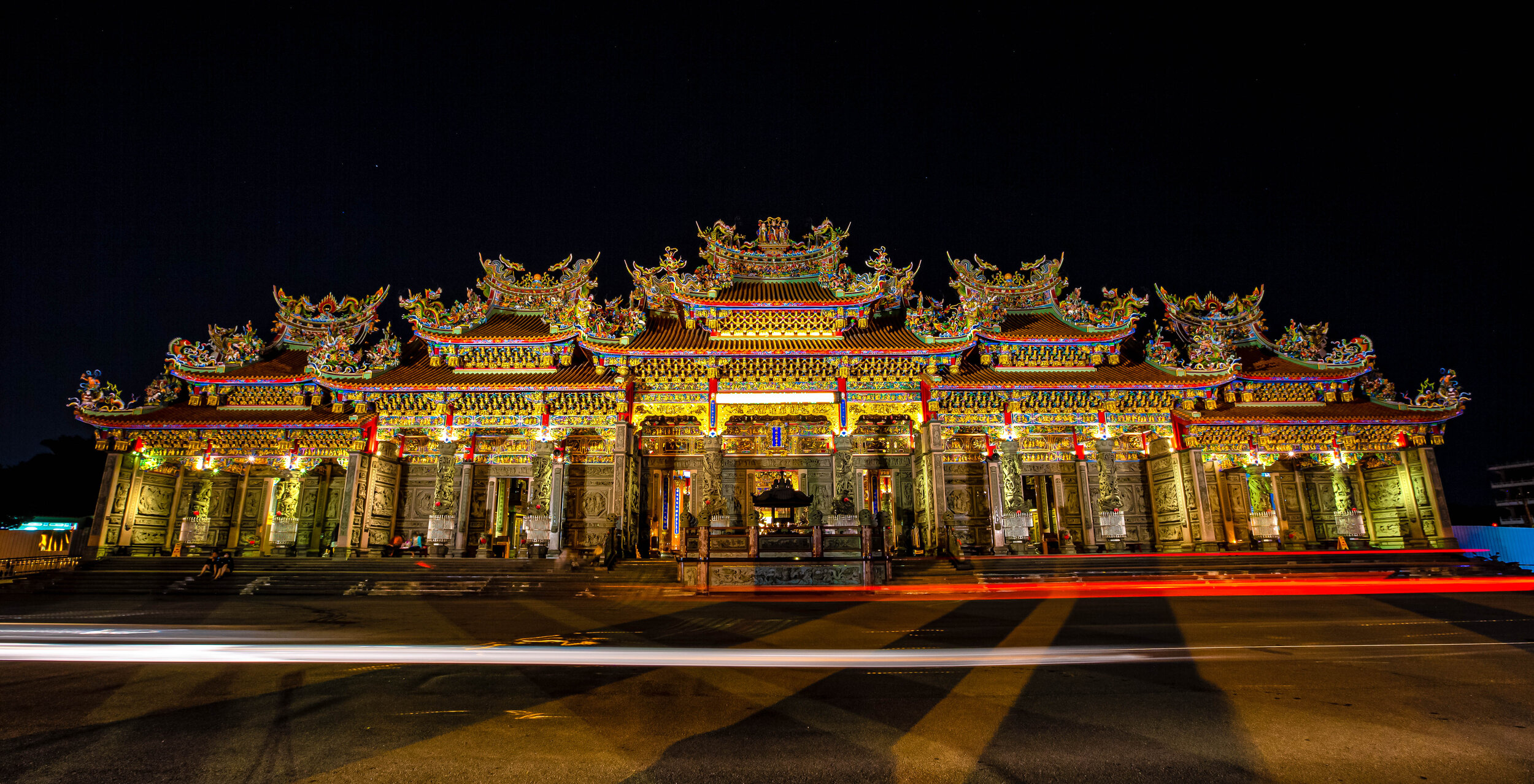
If there is one thing that Taiwan’s places of worship are great at, its showing off, and there is probably no temple that shows off better than the Zhulinshan Guanyin Temple (竹林山觀音寺) in New Taipei City’s Linkou District. 

The massive temple was completely reconstructed (at great expense) and reopened to the ‘oohs and ahhs’ of the general public in 2012.

In the years since, the temple has been recognized as one of the ‘Top 100 Places of Worship’ in Taiwan and has become a popular place of worship and for taking photos. 

Most of the time when I take photos of a temple, I walk in with a simple set up with my camera in hand and with a few extra lenses in my bag. That just wasn’t possible with this temple though - I brought pretty much everything with me - two cameras, several lenses, flash, tripod, etc. 

It should be easy to see why I’d make such an effort - This temple is probably one of the prettiest that you’ll ever visit. 

2. Qixing Mountain (七星山)

After spending quite a bit of time hiking Taipei’s mountains this year, I figured it was about time to write about Taipei’s highest peak - Qixing Mountain (七星山). Fortunately I timed my visit just right so that I could enjoy the mountain at its best - during the Silver Grass season. 

The area that we know today as “Yangmingshan” (陽明山) was once known as “Grass Mountain” (草山) thanks to the beautiful Silver Grass that grows in abundance on the mountain in Autumn, so when the grass (which is actually a weed) is blooming, people make a point to head to the national park to get photos - with the trail to Qixing Mountain being one of the prettiest places to get them.

My hiking guide for the mountain is likely to be published sometime in January, but the photos I ended up with were quite nice and I was really happy with them. 

3. Yunsen Waterfall (雲森瀑布)

I’ve made it a yearly tradition over the past couple of years to visit Yunsen Waterfall at least once a year.

The waterfall is one of the prettiest in Northern Taiwan and has become quite popular recently on social media, but to tell the truth, since I came back from Iceland, I haven’t had as much motivation to visit waterfalls. 

That being said, when Autumn rolled around and the maple leaves started changing colours, I figured that meant that it would be a great time to visit the waterfall to get some new photos. The waterfall, if you weren’t aware has some maple trees that branch over and obscure part of the waterfall, making for some pretty photos. 

Upon arrival though, I was disappointed to discover that the maples had yet to change colours, what I did find however were quite a few Instagram ladies posing for photos - some of them in bikinis (a bit strange) - so I just took some photos of them and some of them turned out nice. 

4. Silver Grass (芒草)

This year, I learned a good lesson - Never trust anything you see on Instagram! 

Despite the fact that I’m well aware that the annual Silver Grass season is between the months of November and December, I started seeing photos appearing on Instagram in October.

I thought it was a little weird, but the photos were quite nice, so I figured that it was possible that the season started a bit earlier this year, so I planned a trip to the mountains to go check them out. 

Upon arrival I quickly realized that people on Instagram are full of shit and that the Silver Grass was still needed several weeks before it would ready for photos. I did end up enjoying a nice hike, so not all was lost - and I did end up heading to the mountains a few weeks later to take this photo. 

Lesson learned. 

5. Flame Mountain (火炎山)

Flame Mountain (火炎山) became of the most popular hikes in Taiwan over the past year or two with flocks of Instagrammers heading there to take their sexy Instagram selfies. The mountain, which has been nicknamed “Taiwan’s Grand Canyon” (台灣大峽谷) is quite picturesque and is a great place for taking photos. 

The reason for the sudden popularity of the mountain is because it was off-limits for a few decades due to the fact that it became a protected nature reserve for several species of migrating birds. Now that it has re-opened, it has become one of the most popular weekend hikes and is now home to another rare species, the ‘Instragramus Celebritius’.

Link: Flame Mountain (火炎山) 

5. Chi Chia-Wei (祁家威)

One of my personal highlights of my year as a photographer was being contracted to cover the Mass Same-Sex Wedding Ceremony in front of Taiwan’s Presidential Palace the day after same-sex marriage was legalized in Taiwan. Marriage equality has been an issue that I’ve cared about for quite a long time, going back to my high-school years in Canada when we too were fighting for legalization at home. 

While covering the event I was busy running around getting photos of all the couples that were getting married and some of the smaller events happening inside. When Mr. Chi made his appearance though, I tried to get as close as possible and used the few moments I was allowed to take a couple of portraits of him. 

If you’re not aware, Mr Chi is a legend in Taiwan who has spent the majority of his life fighting for same-sex marriage and educating people about LGBTQ issues. He was one of the first people to come out in public and over the years has worked tirelessly to not only help change peoples perspectives on the issue, but lobby the government to enact change.

Link: Asia's First Mass Same-Sex Wedding (凱道同婚宴)

6. Taipei Popcorn

If you’ve read my blog closely this year, you probably know that I’ve developed somewhat of a ‘dislike’ for Instagram and the wannabe celebrities on it - especially all the “Internet Beauties” (網美) in Taiwan.

The thing is though, I like Instagram as a platform and there are quite a few people on there who are doing really cool things. One of those people is Taipei Popcorn, a New Zealand born expat living in Taiwan - who just so happens to be one of the coolest queens around.

I’ve followed Popcorn for quite a while and always enjoy the different styles of portraits and all the different costumes she wears, which are always so much different than the standard model poses you see all over the internet.

I was really happy to finally meet up in person at the Mass Same-Sex Marriage Ceremony that took place right after Taiwan legalized same-sex marriage. 

Popcorn was on stage that night performing with several other queens and put on a really good show. Even though I was there covering the event for a magazine, I took a bit of time to watch the performance and took some shots that I would later pass on to all the talented queens. 

I like this shot not just because of the pose, but the colourful background obscured by smoke.

Taipei Popcorn - Instagram | Facebook

Taipei Sunset

Could you call yourself a photographer and not take a photo of the Taipei cityscape at sunset at least once a year? I’m not sure.

I spent quite a bit of time this year hiking through the various trails around the city that allow for beautiful views of the cityscape for my Taipei Cityscape Guide - Each time I made a point to stick around at least until sunset to see if I was going to be lucky to catch a good one and on a few occasions I did! 

It is easy to see why taking photos of the cityscape is so popular - even though there are already thousands of photos like this, its always nice to have a stocked library in case someone comes wanting to buy one of these iconic photos. 

HAAAAAAAAAAAAAAAPY NEW YEAR

As always, I hope that despite all the weird and wonderful things that happened this year that you had a great one and I sincerely hope that this new decade is going to be a better one for all of us!

Happy New Year everyone! 新年快樂!

Josh.