Photo Post

Taitung Martyrs Shrine (台東忠烈祠)

In early 2020, when I was considering where I would focus on as part of my yearly project for this blog, I came to the conclusion that I would continue my work with the Japanese Colonial Era.

Albeit with a bit of a caveat. 

I decided that I’d make an effort to visit some of the various “Martyrs Shrines” around Taiwan.

But only those which were originally home to a Shinto Shrine.

Taiwan was once home to well-over two hundred Shinto Shrines, but as one colonial regime was replaced by another, the majority of them ended up getting smashed to pieces. 

In my post about the National Revolutionary Martyrs Shrine (台北忠烈祠) in Taipei, I listed fifteen of these former Shinto Shrines around Taiwan (and on Penghu) that continue to exist in some form today. 

Some of which I’ve already posted about: 

  1. National Revolutionary Martyrs Shrine (國民革命忠烈祠)

  2. New Taipei City Martyrs Shrine (新北市忠烈祠)

  3. Taoyuan Martyrs Shrine (桃園忠烈祠)

  4. Tungxiao Martyrs Shrine (通宵忠烈祠)

  5. Taichung Martyrs Shrine (台中忠烈祠)

  6. Changhua Martyrs Shrine (彰化忠烈祠)

  7. Yilan Martyrs Shrine (宜蘭忠烈祠) 

That’s seven, so if your math is good, you’ll probably realize that I still have eight to go! 

That means that this project is just going to be (yet another) one of my ongoing projects when the new year hits and 2020 is finally over. 

Before that happens though, I will be crossing another two off of my list!

If you’re reading this and aren’t entirely aware what a ‘Martyrs Shrine’ actually is, I recommend taking a few minutes to read my article about the National Revolutionary Martyrs Shrine (linked above), where I go into greater detail about what they actually represent.

But for those of you who can’t be bothered, they’re basically war memorials for fallen members of the Republic of China’s Armed Forces, and tend to be propaganda-like symbols of the several decades of authoritarian history that was imposed on the people of Taiwan. 

Having little to do with Taiwan, or the people of this country, the Martyrs Shrines you’ll find around the nation today (for the most part) memorialize the fallen members of the ROC military who died during the various conflicts that took place between 1912 and 1958.

Now that we’ve got that over with, Today, I’ll be introducing both the former Taitung Shinto Shrine and the Taitung Martyrs Shrine that stands in its place today. 

I’ll start with the history of the Taitung Shinto Shrine and provide some historic photos of the once beautiful shrine and then go into detail about the current Martyrs Shrine that replaced it.  

Taitung Shinto Shrine (臺東神社)

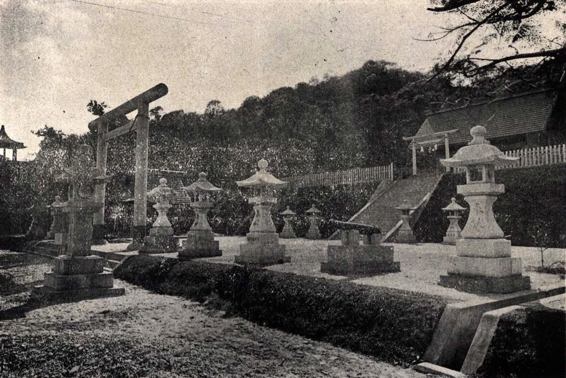
The Taitung Shinto Shrine (たいとうじんじゃ), otherwise known as the “Taito Jinja” was during its heyday regarded as one of the most beautiful Shinto Shrines in Taiwan.

Construction (on the first iteration of the shrine) started in 1910 (明治43年) and opened to the public a little over a year later on October 27th, 1911 (明治44年).

The original shrine however was located in an area in the western district of the city, which was simultaneously being developed for the various industries important to the economy, most importantly the sugar and timber industries.  

In 1924 (大正13), the shrine received an upgrade in its official status to a Prefectural Shrine (縣社), which meant that it was the most important of all the shrines in Taitung. 

Link: Modern system of ranked Shinto Shrines (Wiki)

Soon after the shrine received its upgraded designation, a number of accumulating factors forced the local government to re-locate it to another part of town. 

The first problem was that (as I mentioned above) Taitung was becoming highly developed thanks to the success of the commodity economy. The neighborhood where the shrine was located likewise became important as a residential space for many of the Japanese engineers and specialists who came to Taiwan, which is considered inauspicious for a shrine of its status. 

The next issue was a structural one, and a lesson learned for Japanese builders in Taiwan who quickly had to adapt to the very real problem of termites which were having a feast on their buildings.

Only a decade after opening, the termite problem had become so serious that structural issues became pretty much irreparable. 

The final factor contributing to the shrine’s relocation coincided with the celebrations of the succession of Prince Hirohito (裕仁皇太子) to the imperial throne as Emperor Showa (昭和天皇), ushering in a new era for the Japanese Empire. 

Once a suitable location was found, plans were made to build an even larger and more beautiful shrine.

Construction on the second generation of the shrine started in October of 1928, coinciding with the enthronement ceremony (即位禮 / 即位の礼) for the new emperor and was completed in the summer of 1930 (昭和5年).

Located on Liyu Mountain (鯉魚山), near the (former) Taitung Train Station (台東舊站), the completed shrine occupied around 70 acres of land (86,000坪.)

The newly consecrated shrine, which quickly became known as one of the most beautiful in Taiwan, consisted not only of an excessively large patch of land on the side of a small mountain, but everything you’d expect to find at a shrine of its importance:

  1. Two large gates or “Torii” (鳥居) 

  2. A beautiful walking path or “Sando” (參道) 

  3. Stone Lanterns or “Toro” (石燈籠) on either side of the walking path. 

  4. An Administration Office or “Shamusho” (社務所)

  5. A Purification Fountain or “Chozuya” (手水舍)

  6. Stone Guardians or “Komainu” (狛犬)

  7. A Hall of Worship or “Haiden” (拜殿)

  8. A Main Hall or “Honden” (本殿)

Biking down the old Walking Path

As was the case with most of Taiwan’s larger Shinto Shrines during the colonial era, the kami enshrined within were all familiar figures which included the Three Deities of Cultivation and Prince Kitashirakawa Yoshihisa.

The ‘Three Deities of Cultivation’ (かいたくさんじん / 開拓三神), consist of three mythic figures known for their skills with regard to nation-building, farming, business and medicine. 

The three gods are as follows: 

  1. Ōkunitama (大國魂大神 / おおくにたまのかみ)

  2. Ōkuninushi (大名牟遲大神 / おおなむちのかみ)

  3. Sukunabikona (少彥名大神 / すくなひこなのかみ)

The first mention of these deities was in the ‘Birth of the Gods’ (神生み) section of one of Japan’s most important books, the ‘Kojiki’ (古事記), or “Records of Ancient Matters”, a thirteen-century old chronicle of myths, legends and early accounts of Japanese history, which were later appropriated into Shintoism. 

While these three deities date back well-over a thousand years, the other one that was enshrined within the Taitung Shinto Shrine was a considerably younger one.

In fact, most of the over two hundred Shinto Shrines constructed in Taiwan during the colonial era, most were home to shrines dedicated to Prince Kitashirakawa Yoshihisa (北白川宮能久親王.) 

Prince Yoshihisa had the unfortunate luck of being the first member of the Japanese royal family to pass away while outside of Japan in more than nine hundred years.

The reason why his worship is so prevalent here in Taiwan is due to the fact that it is believed to have died of malaria in Tainan in 1895 - although it is also thought that he might have been shot by Taiwanese guerrillas.

Link: Prince Kitashirakawa Yoshihisa (Wiki) 

As the most important place of worship in “Taito Prefecture” (台東廳 / たいとうちょう), the shrine was frequently visited by civil servants, members of the military and schools that brought students on field trips.

This was especially the case during the latter years of the colonial era when the colonial government attempted to forcibly assimilate the local population into full-fledged Japanese citizens.

Link: Japanization (Wiki)

While I’m not going to delve too deeply into the arguments for or against such policies, if there was anything good that came out of these policies, its that when people visited the shrine, they often took group photos, like the one above.

Link: Yuliman (TIPGA)

Why would I argue that these photos are so important? 

Well, those photos all we currently have on record to show the beauty of the shrine. They also tell an important story about Taiwan’s modern history, which is something that should be discussed and debated.

When the Second World War ended and control of Taiwan was (ambiguously) relinquished to the Republic of China (中華民國), the shrine was converted into a Martyrs Shrine and was eventually torn down and replaced by a Chinese-style shrine. 

Even though the Shinto Shrine was torn down, it wasn’t completely destroyed.

You can still find fragments of the original shrine lying around and/or vandalized. 

Likewise you can still enjoy the original layout of the Walking Path as well as the various layers of the shrine that once existed.

So, even though a Chinese-style shrine exists in its place today,  a considerable amount of evidence remains of the beautiful shrine that it was once home to. 

Taitung Martyrs Shrine (台東縣忠烈祠)

Bear with me for a few minutes. I need to complain.

Researching this shrine has been a pain in the ass.

Factual, verifiable historic information about the Taitung Martyrs Shrine is excruciatingly difficult to find.

Websites in Taiwan are notoriously unreliable and most of the information that was once available, results only in server errors.

Unfortunately this is a problem that seems all too common with official resources in Taitung, especially those coming from the government.

So, I went to some libraries and found next to nothing worthwhile.

Additionally, from what little historical information I did find, it seems like the shrine has been renovated and reconstructed on several occasions.

Few of those important dates or historical facts are very well recorded.

All of this might seem a little strange, but after visiting the shrine, I have to say it’s also not particularly all that surprising.

How long the original Shinto Shrine lasted after the Chinese Nationalists arrival in Taiwan is unclear, but as early as the 1950s, things at the shrine started to change with the Japanese-style buildings gradually being torn down and replaced with Chinese-style structures.

In a government produced promotional video from 1966 (民國55年) about the development of Taitung, titled: “進步中的台東縣專輯” (Youtube), we can see people visiting the shrine, with several of the Shinto Shrine’s lanterns and much of the layout still intact.

That being said, by that time the gates, Hall of Worship and Main Hall all appear to have been replaced.

As early as 1953 (民國42年), the local government replaced the on-site monument dedicated to Japanese police (警察忠魂碑) with a monument dedicated to a local figure from the Qing Dynasty, Hu Tie-Hua (胡鐵花).

In 1961 (民國50年) the name of the shrine was officially changed to the “Taitung County Martyrs Shrine” (台東縣忠烈祠). 

The Martyrs Shrine continues to follow the same layout as the original shrine, but it should go without saying that there have also also been some significant changes.

In an attempt to hide the fact that there was once a beautiful Shinto Shrine here, an effort was made to remove anything “Japanese-related” from the site. To that effect, the original gates, lanterns and buildings were all torn down and replaced. 

The irony of this is that it’s rather obvious that someone went on a smashing spree, but when they were done they ended up leaving quite a few pieces of the original shrine lying on the ground and never really bothered to clean up their mess. 

So, even though this section is meant to introduce the Martyrs Shrine, I’m going to introduce it through the lens of the original shine.

The Visiting Path (參道) 

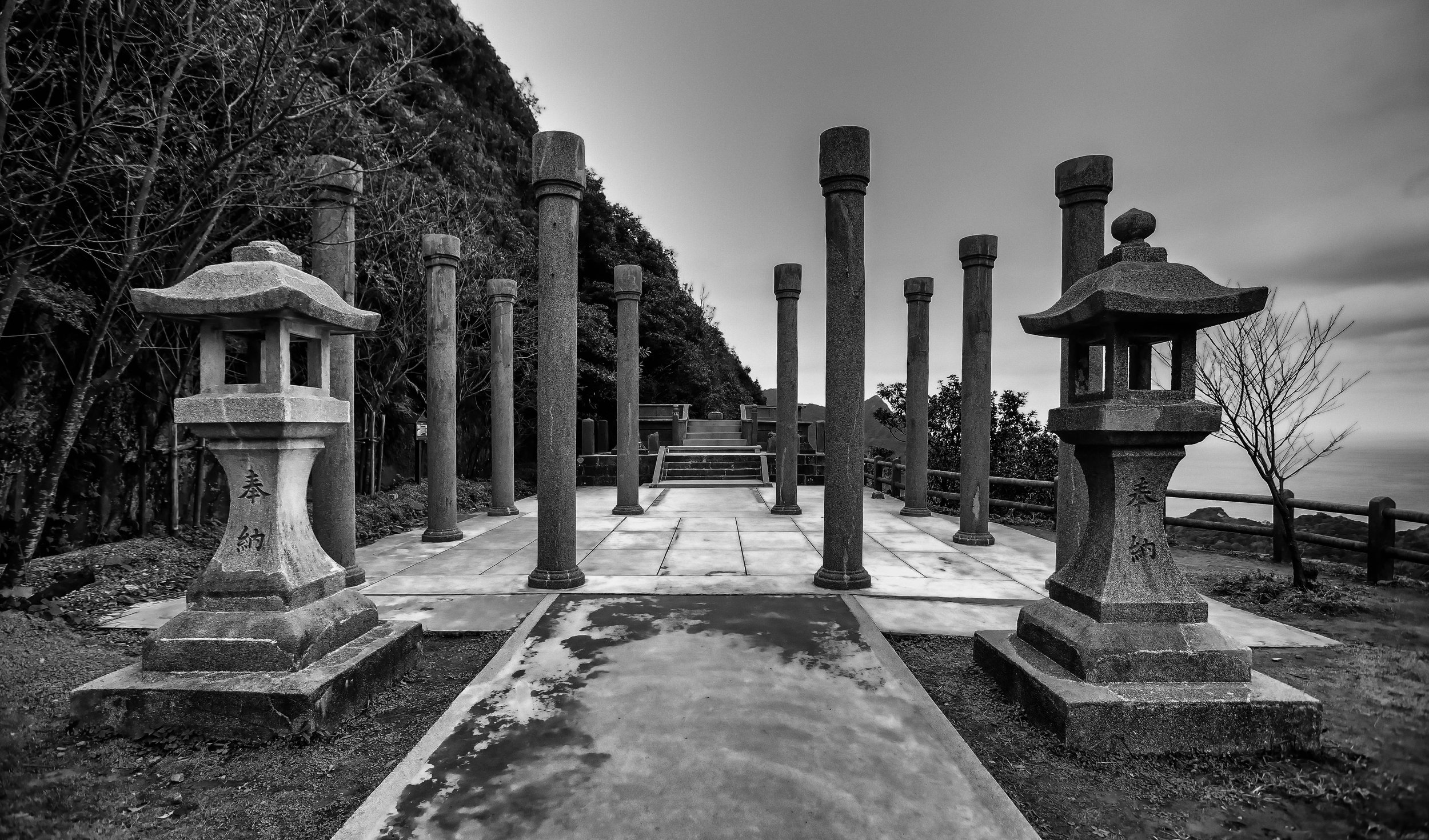
The original Visiting Path for the Shinto Shrine today retains quite a few of its original features and is still quite beautiful. The path is currently a tree-covered road that maintains its original width and the layered pedestals where the stone lanterns were originally placed, have since been replaced with floral arrangements.

the Stone Lanterns (石燈籠)

There’s not much on display here, except for some pettiness. 

The original stone lanterns have pretty much all been smashed to pieces. What little remains have been awkwardly painted over with the original dates and references to the “Showa” era filled in.

In terms of the remnants of the shrine that have been left lying around, the stone lanterns make up the majority and the way they have been disrespected is quite disheartening, but not entirely surprising, all things considered. 

The Shrine Gate (鳥居)

While the original Torii has been removed, it has been replaced with a beautiful Chinese-style Pailou (牌樓) gate and has kept two of the original stone lions which stand guard to the let and right of the gate

The gate is painted red with a golden temple-style roof on the top and has the Chinese characters “忠烈祠” in the centre, which means “Martyrs Shrine,” while the characters on the back read: “浩氣千秋” or “A noble spirit that lasts for eternity.”  

Once you’ve passed through the gate, you will be in the area where the Purification Fountain and the Administration Building would have been located.

Today, the area is used instead as a parking lot by the local people who show up to hang out with friends in the park near the shrine. 

It is also somewhat of a graveyard for the Shinto Shrine as you’ll find quite a few objects randomly laying around on the ground. 

As you continue along the path you’ll reach a wall with a set of stairs, which is where the inner-most parts of the original Shinto Shrine were located. 

Hall of Worship (拜殿)

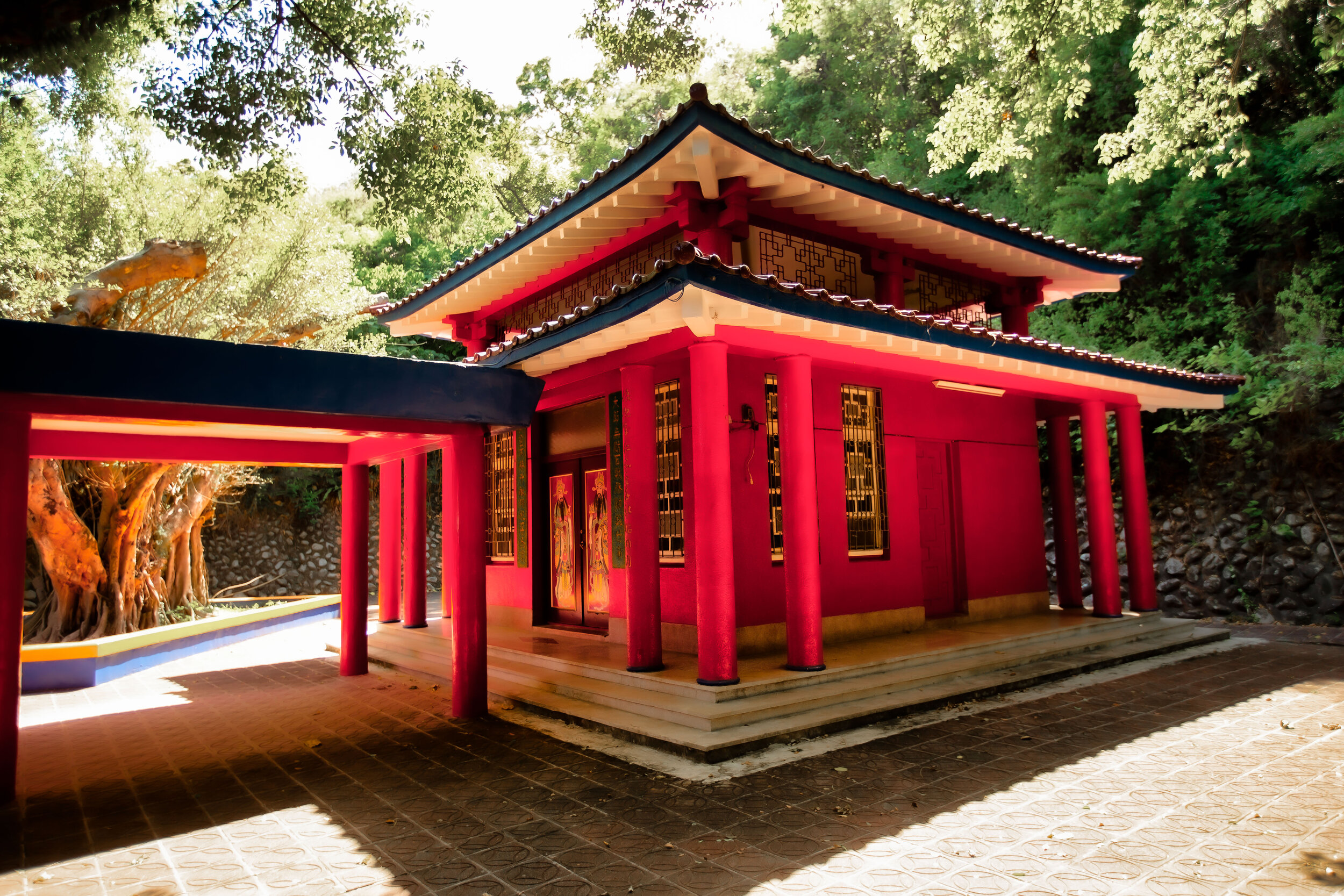
Once you’ve walked up the stairs to the next section, you’ll be met with a beautiful pavilion, known as the “Memorial Hall” (祠堂) where the Shinto Shrine’s Hall of Worship used to stand.

While it is a shame that the original building has been torn down, the current pavilion is quite beautiful and isn’t typical of what you’d usually find at Martyrs Shrines or at other temples in Taiwan. 

The pavilion is painted with the same colour scheme as the shrine gate below, but has a blue large placard (匾額) on the front with Chinese characters that read “正氣昭垂”, which translates literally as “Righteous Vigor” and is dedicated to the many martyrs of “後山” (back mountain), who died protecting their homeland from the Japanese. 

A few notes here with this one:

The ‘martyrs’ being memorialized here are both Chinese and Indigenous peoples alike, who were killed prior to or during the Japanese occupation.

These martyrs however ironically don’t include the indigenous people who were murdered by the Chinese who came to settle in the area prior to the Japanese Colonial Era.

A convenient omission.

Likewise, “Back Mountain” (後山) is the name Taitung was once referred to by the Qing and in English sounds a bit like “backwater” which isn’t all that flattering. If I was from Taitung and someone from Taipei referred to my home that way, I might want to knock their pretentious ass on the ground.

The Main Hall (本殿)

The Main Hall of the Martyrs Shrine and the Main Hall of the Shinto Shrine are actually located in the exact same spot.

In the past, the Main Hall of the Shinto Shrine, like all Shinto Shrines, would have been off-limits to the general public.

It was placed a level above the Hall of Worship and the only people that were able to ascend to that level would have been the priests who took care of the shrine. 

Today, we’re free to walk up and approach the Main Hall, but some things remain the same in that the shrine is pretty much closed to the public all year-long.

Why is the shrine room of the Main Hall shut with a pad-lock for most of the year? Well, there are probably a few reasons for this. 

My guess however is that it is because no one really wants to visit the shrine every day to open it up, clean the interior and close it up again at the end of the night.

My reason for thinking this might seem harsh, but from the condition of the rest of the shrine tends to point in that direction.

This shrine certainly needs a little bit more TLC than it is currently afforded, and if the Taitung City Government wants to make it a proper tourist attraction, they should probably take better care of it.

Unfortunately at this point, the shrine seems like somewhat of an afterthought for the local government.

The Main Hall is currently a Chinese-style structure and features the same colour scheme as what you’ve already seen below.

What stands out most is that as you walk up the stairs, you’ll be met with a roof-covered walkway that brings you to the front door of the shrine. 

The front door of the shrine has two Door Gods (門神) on the front with a pad-lock between them.

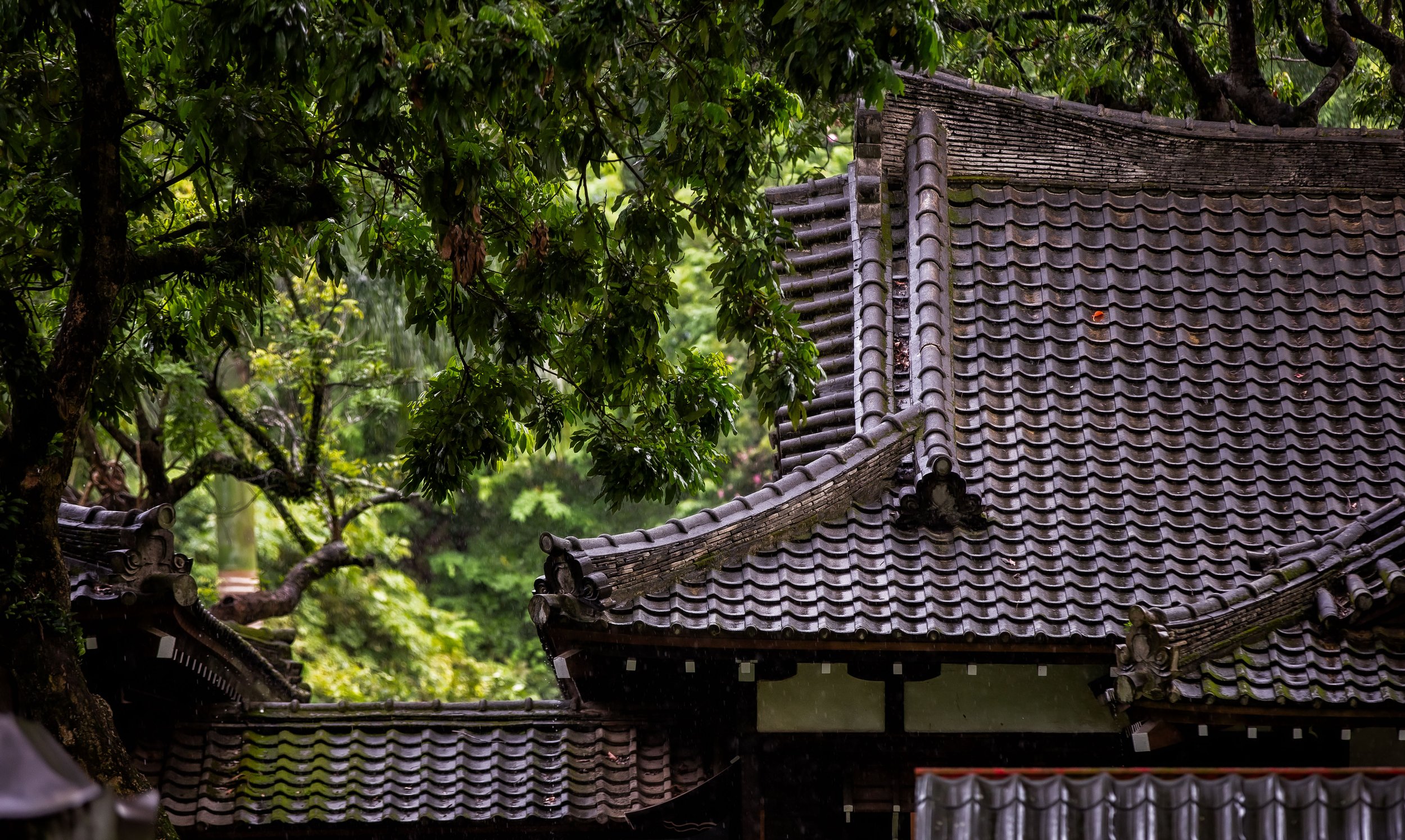
The rest of the building is quite small, but is nicely constructed with traditional architecture and a beautiful sloping roof.

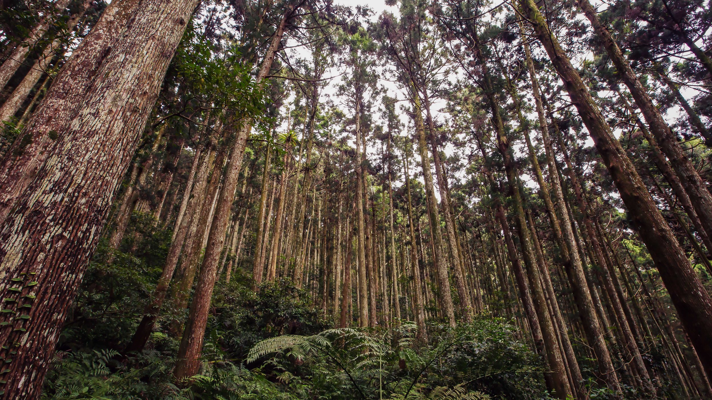
One thing you’ll want to pay close attention to when you’re on the same level as the Main Hall are the trees on the left and right of the building. These trees were planted at the same time as the construction of the Shinto Shrine and today are more than a century-old and tower over the building.

They also provide some beautiful shade for the building and some great light for photographers.

Even though I wasn’t able to take photos of the interior of the shrine, I was able to peer in through the windows at the small shrine.

The worship area of this Martyrs Shrine is considerably smaller than its counterparts around Taiwan and doesn’t feature as many Spirit Plates (牌位) as the others, but it probably still serves the same function. 

The fact that the shrine isn’t open to the public shouldn’t really deter anyone from visiting. You’re honestly not really missing out on very much with the room not being open.

The beauty of the shrine, which is surrounded by nature is something that is really nice and the separation between the “city” and the “mountain” here is quite relaxing. 

Getting There


Getting to the Taitung Martyrs Shrine is quite easy as it is located within the downtown core of Taitung City and is close to a number of other important attractions. 

Address: #500, Bo’ai Road, Taitung City (台東縣台東市博愛路500號)

If you’re staying in Taitung, getting to the shrine is quite simple and easily walkable. On the other hand, if you’re staying elsewhere (or not staying at all), never fear, the area near the shrine is easily accessible and has lots of parking for cars and scooters.

In terms of public transportation, the only bus that stops near the shrine is the Downtown Sightseeing Bus, which stops outside the Taitung Stadium across the street from the shrine.

There are also a number of other buses coming from all over Taitung and elsewhere that stop directly at the nearby Taitung Bus Station (台東轉運站), which is a short walk from the shrine. 

Unfortunately the most complete resource on the web about the buses that pass through the Taitung Bus Station can only be found on Wikipedia and only in Chinese.

For some strange reason almost all of the resources about the buses, including the bus station’s website itself have been taken down.

Link: 台東轉運站 (Wiki)

Located within the Liyu Mountain Park (鯉魚山公園), the shrine is directly across the street from the Taitung County Stadium (台東縣立體育場) as well as the popular Taitung Railway Art Village (鐵道藝術村).

Although locals tend to park (illegally) near the entrance of the shrine, if you’re driving a car or scooter, you should probably park along the road near the stadium where there are a generous amount of spaces. 

From there the shrine is just a short two minute walk up the hill at the base of Liyu Mountain. 

Once you’ve finished checking out the Martyrs Shrine, you’ll probably want to head to the right of the shrine to check out the Longfeng Buddhist Temple (龍鳳佛堂) as well as the pagoda that shares its name next door. 

Likewise, you may want to continue the short hike up the trails to the various viewing platforms on Liyu Mountain, where you’ll be able to enjoy excellent views of the Taitung City skyline and the Pacific Ocean in the distance. 

Although the Taitung Martyrs Shrine is located on the side of a picturesque mountain overlooking the city, retaining a similar layout to the once beautiful Shinto Shrine that stood in its place, today it is unfortunately unkept and uncared for.

I’ve visited quite a few of these Shinto Shrines that have been converted into Martyrs Shrines around Taiwan and I’m sad to say that this one was probably the most disappointing of the bunch.

Not only does it seem like no one really cares about its existence, the city government does little to take care of it or the landscape that surrounds it.

This is only exasperated by the fact that there are signs pointing tourists in the direction of the shrine, only to find the actual shrine bolted shut with no opportunity to look inside or even learn about its purpose.  

Should you visit the Taitung Martyrs Shrine? Of course.

You should definitely include a stop by the shrine during any tour of the historic area of downtown Taitung near the former train station. But it is a stop that won’t take too much time and will allow you to visit a bunch of other locations within the city.

Zhongli Elementary Teachers Dorms (壢小故事森林)

Having recently celebrated the 120th anniversary of its founding, Zhongli Elementary School finds itself on a very exclusive list of educational institutions in Taiwan with such a long and storied history. 

Plans for the construction of “Zhongli Public School” (中壢公學校) started in 1898 (明治31年), shortly after the Japanese took control of Taiwan. The school opened two years later in 1900 and became one of Taoyuan’s (and Northern Taiwan’s) first public educational institutions. 

To celebrate the 120 year anniversary of the school, festivities were held throughout the year and the school announced plans for some restoration projects that would modernize and beautify the campus. 

To coincide with the anniversary, the Taoyuan City Government started a restoration project on the historic teachers dormitories that were once used by the staff at the school during the Japanese Colonial era.

The plan was to have them ready to reopen to the public in conjunction with the celebrations for the school’s milestone anniversary. 

With such a long and storied history, you’d think that finding information about the school would be pretty easy, but that’s not actually the case.

From what little I’ve found from the school’s own literature is that “Zhongli Public School” opened in 1900 and as the number of students steadily increased over the years, several “branch” schools had to be constructed nearby communities - all of which still exist today.

In total, five branch schools were constructed around town, which have all since changed their names and are now known as Chung-Ping Elementary (中平國小), Hsin-Ming Elementary (新明國小), Hsin-Jie Elementary (新街國小), Longgang Elementary (龍岡國小) and Nan-Shih Elementary (南勢國小). 

If you’ve lived in the area as long as I have then you’re probably aware that these schools (in most cases) were the basis for the formation of a community that used the same name as the school.

Most notably “Hsin-Ming Elementary” is known for its popular neighbour, the Zhongli Night Market (新明夜市), which is actually named “Hsin-Ming Night Market” and the Hsin-Ming Traditional Market, which is home to two of the city’s most famous restaurants, Hsin-Ming Beef Noodles (新明牛肉麵) and Yong-Chuan Beef Noodles (永川牛肉麵). 

In the decades since the colonial era ended, the school has changed its name a few times, but no matter what it is called, it is still the first educational institution opened to the public and is an important part of the local history.  

Subtle name changes

  • 1947 (民國36年) - 中壢國民學校

  • 1968 (民國57年) - 中壢國民小學

  • 2014 (民國103年) - 桃園市中壢區中壢國民小學

The topic today however isn’t really about the school itself, but the Japanese-style teachers dormitories that were constructed nearby. 

As I’ve already mentioned, the growing number of students wanting to take part in the public education system, it became necessary to construct branch schools as well as homes for the staff working at the schools to live. 

Constructing “dormitories” (員工宿舍) for employees was a service that the Japanese Colonial Powers provided, especially for civil servants and those working within important industries.

There would have been dormitories that housed police, government officials, teachers, principals, railway workers and many of the engineers who came to Taiwan to help develop the island. 

Today, all over Taiwan many of these dorms are being restored and reopened to the public as tourist destinations in an attempt to help people learn more about an important part of Taiwan’s history.

So lets take a look at the newly reopened Zhongli Elementary School teachers dormitories, which have been (randomly) renamed the “Zhongli Forest Story House” (壢小故事森林). 

Zhongli Elementary Teachers Dorms (中壢國小日式宿) 

You might think that like most school dorms that the teachers dorms would have been constructed somewhere on campus, but in order to provide the teaching staff with a bit of privacy, they were constructed on a nice plot of tree-covered land nearby. 

Constructed in 1917 (大正6年), the three Japanese-style homes are on a plot of land that is about 871 square meters large and would have provided staff with easy access to the school as well as the nearby train station and whatever amenities would have been available in the downtown area at that time. 

Interestingly, from a design perspective, even though there are three buildings, each of them was constructed somewhat differently as they all served different functions. One of them was a typical Japanese style family home, while the other two were more dorm-like in their set-up.

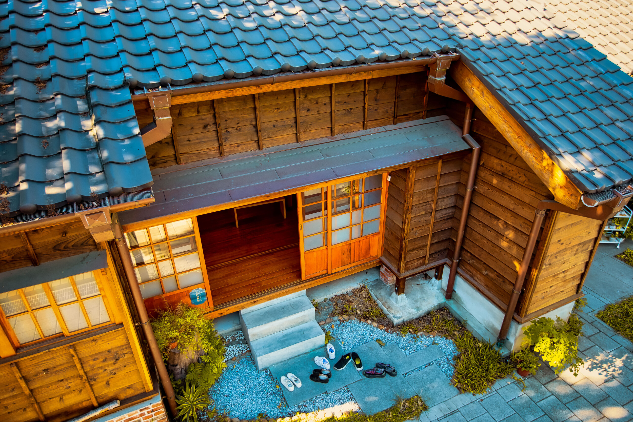
The two single-floor buildings, which are referred to as “Building A” (A棟) and “Building B” (B棟) are typical Japanese-style homes that were constructed with Taiwanese Cypress (台灣檜木) and have beautiful black Kyoto-style roof tiles (黑瓦). 

Building C” (C棟) on the other hand is a bit different from the other two and even though it maintains aspects of Japanese architectural design, it was constructed with brick, has two floors, a nice patio space on the second level and a roof that was constructed using the same type of red tiles (閩式紅瓦) that you’ll see on many older Taiwanese buildings. 

The buildings were used by the Japanese staff of the elementary school from 1917-1945 and then afterwards became dormitories for the teaching staff hired by the new regime for the next few decades before they were more or less abandoned.

Today the dorms have been completely restored and are part of a newly established culture park known as the Zhongli Forest Story House

Now that they’re no longer dormitories, the government had to find a use for the space, so each of the buildings now serves a specific purpose. 

  1. Building A” - A棟 (沐樂居)

GTJ-2019-1031-29.jpg

“Building A” was originally constructed as a dorm that would house two families under the same roof (雙拼日式宿舍), so the interior has several rooms and two large open spaces. It would have been a space for more senior teachers who brought their family with them to Taiwan.

The building is currently used as a revolving exhibition space that is likely to focus on the history of the local area, its people, language, cultures and cuisine.

2. “Building B” - B棟 (儒林所)

“Building B” is a smaller single family dorm (單棟日式宿舍) that was likely used by the principal of the school and his or her family. The home is complete with a couple of bedrooms, an open living room, kitchen and bathroom.

The building is currently used as a fun exhibition space for children to come and learn about Taiwanese history in a fun and interesting way.

3. “Building C” - C棟 (睦森館)

Building C” is the largest of the three buildings and was the space that was offered to teachers and staff with lower seniority. The building was constructed with bricks and as I mentioned above features a red tile roof, which is uncommon for Japanese-style buildings.  The living conditions would have been what you’d expect from a typical dorm but there would have been ample space for everyone living inside. 

The building is currently used as a multi-purpose space for exhibitions, meetings, public lectures, etc. It is also home to a small cafe where you can purchase some drinks and sit inside. The second floor patio is also open for guests to walk up to get a good look at the beautiful red tiles on the roof of the building as well as the exterior of the other two smaller buildings. 

During the week, the space can be a little quiet, but on the weekends there are always events taking place similar to weekend markets with hip vendors setting up mobile coffee shops with others offering a variety of foods. If you visit on the weekend, you should probably expect that there will be quite a few people and the opportunities for photos probably won’t be so good. 

Getting There


Address: #52 Bo-ai Road, Zhongli District, Taoyuan City (桃園市中壢區博愛路52號)

The Zhongli Forest Story House is located within the downtown core of the city and is easily walkable from the train station (中壢車站) or the inter-city bus terminal (中壢客運站).

If you’re in town, you can easily grab a Youbike and make your way to the dorms while also checking out many of the other historic destinations within the area.

Located directly across the street from Zhongli Elementary School (中壢國小) and a short walk from the Zhongli Police Dorms (壢景町), the Zhongping Story House (中平故事館) and several staple local restaurants, there is quite a bit to see and do in the space of a single city block, and a five minute walk from the train station. 

Hours: Tuesday - Sunday: 10:30-7:00 

Admission: Free of Charge

If you’re feeling hungry, take it from me, there are quite a few local restaurants nearby that should satisfy your tastebuds.

  • Tseng’s Steam-Fried Buns (曾記老牌水煎包) - A short walk away from the dorms, there is always a big line for these freshly cooked buns and for good reason - they’re amazing. 

Address: 桃園市中壢區康樂路61號

#61 Kangle Road.

  • Old Alley Hakka Noodles (老巷小館) - This Hakka noodle place serves up some cheap and amazing Hakka noodle dishes with the addition of succulent plates of duck. 

Address: 桃園市中壢區中正路243號 

#243 Zhongzheng Road.

  • Mama Liu’s Hakka Vegetable Buns (劉媽媽菜包店) - This take-away only store sells steaming hot sticky Hakka vegetable buns and are one of the things you absolutely have to eat if you’re in town. There are meat and vegetarian options, so make sure to let them know which type you want! 

Address: 桃園市中壢區中正路268號

#268 Zhongzheng Road.

  • Papa’s Secret Lover (阿爸的情人) - If you’re looking for some straight up amazing Hakka food, then look no further than this restaurant which has been open for half a century. 

Address: 桃園市中壢區中山路401號 

#401 Zhongshan Road.

  • Yong-Chuan Beef Noodles (永川牛肉麵) - If you’re a lover of beef noodles, then this restaurant should be high on your list. Its open 24 hours for your enjoyment and no matter what time of the day you visit, its always jam packed with people slurping up the spicy noodles. 

Address: 桃園市中壢區民權路61號

#61 Minquan Road.

  • The Peanut House (張豐盛商行) - While most locals visit this historic shop for their peanut fix, tourists have been coming from all over Taiwan for a taste of their peanut-flavoured ice cream which is surprisingly amazing. If you’re in town on a hot day, you’ll definitely want to visit. 

Address: 桃園市中壢區中正路349號

#349 Zhongzheng Road.

The restoration and reopening of the Zhongli Elementary School Teachers Dorms adds yet another location to the list of places for people to visit when they come to Taoyuan. These dorms, in conjunction with the nearby police dorms show off a bit of the city’s colonial history in an area that is rightfully very focused on and proud of its Hakka history and culture. 

A visit to the teachers dorms won’t take very long and it seems like there is always something interesting going on, so if you’re planning to visit the area, you should definitely add them to your list of places to visit. 


The Taoyuan Valley (桃源谷步道)

In a recent case, the Shilin District Court in Taipei ordered the Yangmingshan National Park Administration to pay NT$3.96 million (US $134,000) in compensation to a family whose mother had died as a result of injuries caused by being pushed over by a wild water buffalo.

The family’s lawyer argued that the park administration hadn’t provided adequate safety measures for tourists and that the thirty-or-so water buffalo that graze in the area were a danger to society.  

The ironic thing is that the water buffalo have been grazing on the grassy pasture since the Japanese Colonial Era (1895-1945), and are one of the main reasons why Qingtiangang (擎天崗) has become such a popular tourist destination in the first place.

Link: Court awards compensation to family of woman killed by water buffalo (Focus Taiwan) 

While I do have sympathy for the family, it was only a matter of time until one of the thousands of people who invade the personal space of the buffalos on a weekly basis were seriously injured. The mostly docile buffalo have had to put up with people approaching them (and their young) for photos for quite some time now. 

This, in addition to a general lack of understanding about the behaviour of wild animals is something that makes for a dangerous situation.

So, in order to ensure the public’s safety, large fences were erected to separate the ferocious buffalo and the visitors which ultimately limits the freedom that the animals have enjoyed for the past century, but also their grazing space.

Likewise, the fences that have been erected are somewhat of an eyesore on the extremely picturesque mountainous plateau.

This reminds me of the infamous Liebeck v. McDonald’s court case in America, where the restaurant was more or less sued for selling hot coffee. 

While this water buffalo case might not have been as frivolous, as adults, we should probably all be mature enough to understand the danger involved in approaching a wild animal for a photo. Unfortunately people these days get caught doing some tremendously moronic and dangerous things for a little bit of attention on social media.  

What happened at Qingtiangang is similar to what has also happened at Linkou’s beautiful Water Buffalo Valley (水牛坑), which became one of the hottest Instagram photo spots in Northern Taiwan a few years back. 

The local media describes the area as Taiwan’s “Grand Canyon”, but similar to Qingtiangang, that wasn’t particularly the main attraction - The valley also happened to be the grazing space for a much larger group of water buffalo than you’ll find at Yangmingshan

Today though, thanks to the irresponsible masses of Instagram, the land owner has had to erect signs in the valley that read “Restricted Area - No Entry Unless Authorized” and has to have security hanging out to ensure that none of the people who visit are approaching the buffalo.

Likewise, the large group of buffalo that once grazed there can only do so under the watchful eye of their owners - who obviously don’t feel like paying out a massive settlement to some Insta-fool who invades the space of one of the buffalo.

Now that both Qingtiangang and Water Buffalo Valley have been somewhat damaged as tourist destinations, the collective attention of Taiwan’s Instagram community seems to have descended upon a new location to ruin, New Taipei’s Taoyuan Valley (桃源谷).

I’ve had the Taoyuan Valley hike on my list of places to write about for quite some time, but now that it has become an Instagram hotspot, I decided that it would have to jump to the top of my list. 

This isn’t because I wanted to follow the trendy masses, but simply because I didn’t want to miss out on an opportunity to hike the beautiful trail and enjoy the space before it suffers a similar fate and ultimately gets fenced up. 

If you ask me, the main attraction to the valley should be the awesome hike and the amazing views you get when you arrive at the top - But yes, the trail is home to another large group of free-roaming water buffalo who (currently) have a massive patch of land to graze on. 

The Taoyuan Valley Trail (桃源谷步道) 

The famed Taoyuan Valley grassland stretches for more three kilometres along a beautiful sloped ridge between Wankentou Mountain (灣坑頭山) and Neiliao Mountain (內寮山) on the northern edge of the Snow Mountain Range (雪山山脈). 

From the top of the ridged grassy slope, visitors are treated to beautiful 360 degree views of Taiwan’s North-East Coast, including a birds-eye-view of Turtle Island (龜山島), as well as the mountains of New Taipei’s Pingxi District (平溪區) to the rear. 

The beauty of the valley lies in its combination of the sea, land and sky, giving hikers jaw-dropping views overlooking the Pacific Ocean while also enjoying the rare site of such a large patch of grassland, free roaming water buffalo and the mountainous terrain that makes Taiwan such a geographically diverse country. 

At an average elevation of around 500 meters (above sea level), the long stretch of grassland allows makes for an ideal location to sit along the ridge for a picnic or to just enjoy the view.

Originally named “Da’niu pu” (大牛埔) and “Kun’niuzai Mountain” (綑牛仔山), a nod to the historic usage of the grassland by farmers, hikers need to be careful where they’re walking while on the ridge as the water buffalo are prone to randomly unloading their droppings for hikers to step in.

Today the name “Taoyuan Valley” is a nod to “The Peach Blossom Spring” (桃花園記), a fable written by Tao Yuanming (陶淵明) in 421, which describes a chance discovery of a utopia where humans led an ideal existence in harmony with nature.  

Link: The Peach Blossom Spring (Wiki) 

What you should make sure to remember is that even though it is named “Taoyuan” in English, it’s not the “Taoyuan” (桃園) that you’re thinking of just south of Taipei.

Considering what I mentioned above, one would hope that the current name of the grasslands could inspire people to act a little more harmoniously with nature, and not harass its full-time residents. 

Hiking the Taoyuan Valley

Hiking Guide to the Taoyuan Valley www.goteamjosh.com/blog/taoyuangu

One of the saving graces for the Taoyuan Valley is that if you don’t have a car, you have to hike up the long trail to get to the valley. So, unlike the other destinations I mentioned above, (which are pretty easy to get to) this one actually requires a bit of effort. 

That being said, if you have a car, the ‘hike’ only takes about twenty minutes.

Fortunately, the road that takes you almost all the way to the top is quite narrow and offers very little in terms of parking spots. On weekends, it tends to be a dangerous route to take as (lazy) hikers end up stuck in their cars on a dead-end road that isn’t very easy to escape from.

When the only other alternative is to actually hike the trail, most of Taiwan’s Instagram celebrities don’t really even bother trying to make an attempt. So even though the trails can be busy at times, you should be able to take photos of the vast valley without large crowds of people.  

If you took a look at the map provided above, you may be thinking this hike seems like a long one, but it should relieve you to know that it is actually only a small portion of the much larger network of trails on the historic Caoling Trail (草嶺古道).

Links: Caoling Old Trail (草嶺古道) - Foreigners in Taiwan | Caoling Historic Trail - Taiwan Trails and Tales

Given that it is part of a network of trails, we’re blessed with a number of options when it comes to getting us to the valley:  

  • Taoyuan Valley Trail (Stone Guanyin) - 桃源谷步道(石觀音線)

  • Taoyuan Valley Trail (Neiliao) - 桃源谷步道(內寮線)

  • Wujuwushu Trail - 吾居吾墅步道

  • Wanshentou Trail - 灣坑頭山步道

  • Caoling Historic Trail - 草嶺古道

  • Tamlan Historic Trail (Ao-Di to Dali trail) - 淡蘭古道北路(澳底-大里段)

For this blog post however, I’ll only be focusing on the most commonly used trails:

  1. One that takes you up the mountain from one train station and ends at another.

  2. One that allows you to walk straight up the mountain to the ridge.

  3. One that allows you to cheat a bit and drive your car most of the way to the top.

The one I’ll focus on most though is the first one, which is generally speaking considered to be the “complete” Taoyuan Valley experience - giving hikers the best of what this hike has to offer.

The Taoyuan Valley Circuit Hike

Let me start by offering a few important details about the hike: 

  • Hiking Time: 5-7 hours

  • Total Distance: About 15-18 km

  • Elevation: 10m - 530m

  • Difficulty: Depends on the trail you take. It could be quite easy, or a rather difficult one.

  • Trails: Well-developed paths with periodic signs, rest stops and washrooms.

  • Best time to hike: Spring and Fall

This hike basically starts at one train station and ends at another, so if it wasn’t obvious enough already, what this means is that the best way to do this one is to simply leave your car or scooter at home and make use of Taiwan’s amazing public rail system!

From which station you start is more or less up to you, but I’d caution that the incline from the Daxi side going up is quite a bit more difficult.

Generally speaking, most hikers elect to start from Dali Train Station (大里火車站) and later finishing by hopping back on the train at Daxi Train Station (大溪火車站). 

  • Dali Train Station to Trailhead (大里火車站 - 登山口)

When you get off the train at Dali Station, the trailhead is a short walk north. 

From the entrance of the station you’ll find signs pointing you in the direction of the Dali Visitors Centre (大里遊客中心), the Dali Tiangong Temple (大里天公廟) and the Caoling Historic Trail (草嶺古道), which you’ll follow until you reach the temple. 

Getting to the temple should only take a few minutes from the train station and once you’ve arrived, you’ll simply walk up to the front and then follow the signs to the trailhead, which is near the rear of the building. 

Don’t be surprised that the trailhead says “Caoling Historic Trail” and not “Taoyuan Valley Trail” as the Taoyuan Valley is just a part of the overall network of trails. 

GPS: N24 58.220 E121 55.540

The incline of this hike is one that starts out relatively easy with a tree-covered trail, but eventually opens up once you’ve reached the entrance to the Taoyuan Valley trail requiring you to walk along an open ridge with lots of stairs that bring you the long way around.

Once you’ve completed the hike and you’re back down on ground level on the Daxi side, you’ll find signs pointing you in the direction of Daxi Train Station, which is about a kilometer south of the trailhead. 

  • Daxi Train Station to Trailhead (大溪火車站 - 登山口)

If you choose to start your hike from Daxi Train Station, the trailhead is about a fifteen minute walk north of the station taking you through the historic fishing village. 

From the train station, you’ll walk out of the entrance, turn left and start walking along the coastal highway until you reach Guishan Road (龜山路), where you’ll turn left and walk up a narrow road to the trailhead. 

GPS: N24 56.530 E121 53.770

If you’re worried that you won’t be able to find the trailhead, never fear, there are signs along the road that point you in the direction of the trail and once you get to the narrow road where you start walking up the hill, there are signs on both sides of the road pointing you in that direction. You can’t really miss it. 

One thing that you’ll want to keep in mind about the Daxi Trail is that it can be quite slippery. If it is raining, the five kilometer hike could be somewhat of a treacherous one. You’ll find signs reminding you about this, which you should take seriously as the stone steps can be quite dangerous.

Stone Guanyin Trail (石觀音線)

The “Stone Guanyin Trail” is another one of the trailheads that you can reach from Daxi Train Station.

The key feature of this trail is that it is a hike that allows you to go straight up the mountain and back down again (on the same trail) while saving a considerable amount of time and traveling a much shorter distance.

You’ll also be treated to a beautiful Buddhist Temple and an open-faced cave that has a shrine inside.

That being said, it shouldn’t surprise you that that the longer trail mentioned above has a much more gradual incline, while this one is a relentless set of stairs that you’ll hike straight up the mountain until you reach your destination.

To reach this trailhead, you’ll exit the Dali Train Station, turn right and walk about two kilometres until you reach the trailhead. Once you’ve reached the trailhead area, you’ll have to cross under a railroad bridge and then follow the road to the trailhead.

The signage here isn’t as prevalent as the main trail, so you’ll want to be careful not to get lost along the highway.

To help, there’s a bus stop next to the the road where you’ll cross under the train bridge named Fanshuliao Bridge. The bus that services this station, “Toucheng Ocean Line” doesn’t come all that often, so you’d have to be pretty good with your timing to actually make use of the bus. Still, it’s an option.

Neiliao Trail (內寮線)

The Neiliao Trail for the Taoyuan Valley is more or less the cheaters method of getting to the valley as it is merely a twenty minute walk from your car on a tree-covered path to the main attraction.

If you’re not really into hiking, have access to a car and want to get your Instagram photos, this trail is probably the one that you’ll want to use as it requires extremely little effort.

It also has a fully equipped restroom at the base of the trail and once you’ve reached the valley.

This is probably important for all those instagram celebs who don’t like to break a sweat and a need a safe place to change their clothes for their photoshoots!

Like I mentioned above though, if you’re visiting on the weekend, you’ll have to deal with quite a bit of traffic on the narrow mountain road where there is very little in terms of parking, so you might actually spend several hours in the car waiting for a parking spot.

I’ve marked (on the map above) the mountain road in Gongliao that you’ll have to turn on to get to the trailhead, but there’s also adequate signage in the area that should help you out if you’re driving and don’t have a GPS.

What to Expect

Now that you know how to get to and from the train stations to the trailheads, it’s probably a good time to prepare you for what to expect when you hike the Taoyuan Valley Trail.

So what should you expect?

To put it simply, stairs. Lots and lots of stairs. 

If you’ve hiked Taipei’s Elephant Mountain or any of the Four Beasts, you should more or less know what to expect. The Taoyuan Valley trail is a hike through the woods on a well-developed (mostly) cement path.  

Even though the trail is very well-developed and includes periodic rest stops (and even restrooms), the hike tends to be a long one. Still, despite the length of the hike, it is considered to be an easy one and none of this should prevent you from trying to hike it. 

You can also take solace in the fact that once you reach the valley, you’ll have a long walk along a beautiful (and most importantly) flat mountain peak that you’ll follow until you start your descent back to ground level. 

You’ll need to make sure to bring some snacks and more than enough water.

I brought a 2000cc bottle, but that ended up not being enough on a 35 degree day.

You should also have a good pair of hiking shoes and a raincoat in case the weather takes a turn for the worse. 

Apart from that, you won’t need much else for this one except for some money for your train tickets and maybe a little more for a feast of fresh seafood when you finish. 

At this point, I should mention that if the weather forecast isn’t looking good on the day that you’re planning on doing this hike, you’ll probably want to save it for another day. 

You’ll see why if you read this post about the hike from the always amazing, Tom Rook. 

Link: Taoyuan Valley Hiking (Over The City) 

How long this hike takes to complete is completely up to you. 

It obviously depends on your hiking pace, how much time you stop to rest and how much time you use to take photos of the beautiful landscape. 

I arrived at the Daxi Train Station at 10am and finished around 5pm.

I did take use up quite a bit of time taking photos as well as chatting with other hikers at the various rest stops.

It goes without saying that unless you plan on only hiking the Neiliao Trail, you shouldn’t be starting this one in the afternoon. You’ll need an early start, but the actual hiking portion of this trip goes by surprisingly quickly, despite the length of the trail. 

The Taoyuan Valley has always been a popular destination for Taiwan’s avid hikers, but in recent months it has also become popular with the Instagram crowd. This means that the crowd you’ll find at the valley on the weekend are a mixed bunch of senior citizens in rubber boots and wannabe models.

Thankfully most of the models don’t really stick around very long and for the most part don’t crowd up the trails as they prefer to endure the traffic jam on the road to the top. 

Still, as I mentioned above, the Taoyuan Valley is currently one of the few remaining places where Taiwan’s Water Buffalo are continued to graze freely amongst the crowds of tourists. 

All it takes though is one accident and that could all change.

Let’s hope that that doesn’t happen anytime soon.

If you visit, enjoy the buffalo, but please don’t invade their personal space.