One of my local photographer friends is someone who most people in Taiwan would refer to as an “auntie,” one of those strong-willed, no-nonsense types who says what she thinks and never holds back. As the boss of a noodle restaurant that people around here swear by, she’s used to shouting orders and controlling a well-oiled kitchen. So whenever we meet up, my Mandarin skills are put to the test because she speaks at about a mile a minute.
We’ve been meeting up for a few years at a local craft beer bar where we chat about photography, cooking and lots of other subjects. She’s always interested in the places I’m visiting and the photos I’m taking, because for her (and I guess a lot of other local photographers), I have a different perspective on things here in Taiwan.
Coincidentally, one of her absolute favorite things to shoot is trains, and she travels all over the country to these amazing locations to take beautiful photos of trains crossing bridges, coming out of caves, etc. She’s also taken this hobby on the road and traveled to Japan countless times over the years that I’ve known her to do exactly the same thing.
Personally, I’ve never been a big fan of trains - Back home in Canada it’s uncommon for us to take a train, and before leaving the country, I probably only took a train once in twenty years.
That being said, as my interest in searching out and researching remnants of the Japanese Colonial Era in Taiwan has grown, I’ve also started to look for anything rail-related from that era.
This is something that my friend is having a good time with, because I’ve often teased, “Why don’t you find something else to shoot other than trains?” to which she now says: “Why don’t you find something else to shoot other than train stations?”
Fortunately for her, the railway is something that will be a part of Taiwan for a long time to come.
I’ll probably run out of train stations to take photos of within the next year or two (depending on how quickly I visit them all). So, I’ll eventually be the person looking for other things to take photos of.
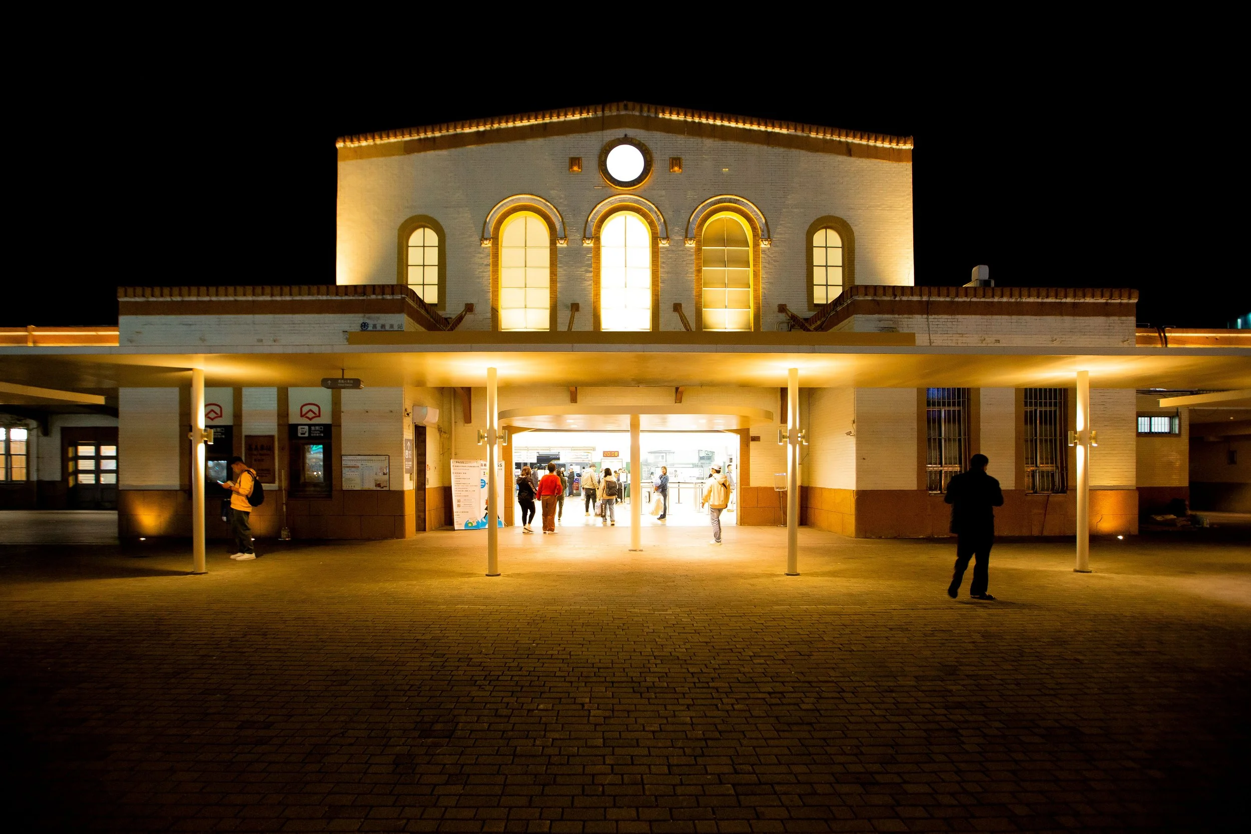
Today, I’m going to be introducing the third (and final) of Miaoli’s Japanese-era railway stations. As I’ve mentioned in previous articles, Miaoli County (苗栗縣) in Central Taiwan is home to three century-old stations along the Coastal Railway that amazingly continue to remain in operation today.
Known as “Miaoli’s Three Treasures” (苗栗三寶), these three historic stations have defied all the odds in a quickly modernizing Taiwan, and have stayed open forfar longer than anyone has ever expected.
Given that I’ve already introduced Dashan Station and Tanwen Station, this will be the last piece with regard to the Three Treasures. In the future however, I’ll be expanding from the “Miaoli Three Treasures” to the “Coastal Railway Five Treasures” (海線五寶), because there are actually two more of these historic stations just across the river in Taichung - and likewise there are a couple of other stations along the Mountain Line as well.
Before I start introducing Xinpu Railway Station, I should probably first briefly mention a bit about the history of the Coastal Railway. If you’ve already read about it in my previous posts, feel free to skip it.
Coastal Railway (海岸線 / かいがんせん)
The history of the railway in Taiwan dates back as far as 1891 (光緒17), when the Qing governor, attempted to construct a route stretching from Keelung (基隆) all the way to Hsinchu (新竹). Ultimately though, the construction of the railway came at too high of a cost, especially with war raging back home in China, so any plans to expand it further were put on hold.
A few short years later in 1895 (明治28), the Japanese took control of Taiwan, and brought with them a team of skilled engineers who were tasked with coming up with plans to have that already established railway evaluated, and then to come up with suggestions to extend it all the way to the south of Taiwan and beyond.
The Jūkan Tetsudo Project (ゅうかんてつどう / 縱貫鐵道), otherwise known as the ‘Taiwan Trunk Railway Project’ sought to have the railroad pass through all of Taiwan’s already established settlements, including Kirin (基隆), Taihoku (臺北), Shinchiku (新竹), Taichu (臺中), Tainan (臺南) and Takao (高雄).
Completed in 1908 (明治41), the more than four-hundred kilometer railway connected the north to the south for the first time ever, and was all part of the Japanese Colonial Government’s master plan to ensure that Taiwan’s precious natural resources would be able to flow smoothy out of the ports in Northern, Central, and Southern Taiwan.
Once completed, the Railway Department of the Governor General of Taiwan (台灣總督府交通局鐵道部) set its sights on constructing branch lines across the country as well as expanding the railway network with a line on the eastern coast as well.
However, after almost a decade of service, unforeseen circumstances in central Taiwan necessitated changes in the way that the western railway was operated, with issues arising due to typhoon and earthquake damage. More specifically, the western trunk railway in southern Miaoli passed through the mountains and required somewhat of a steep incline in several sections before eventually crossing bridges across the Da’an (大安溪) and Da’jia Rivers (大甲溪).
Issues with the railway in the aftermath of a couple of devastating earthquakes created a lot of congestion, and periodic service outages in passenger and freight service when the railway and the bridges had to be repaired.
Link: Long-Teng Bridge (龍騰斷橋)
To solve this problem, the team of railway engineers put forward a plan to construct the Kaigan-sen (かいがんせん / 海岸線), or the Coastal Railway Branch line between Chikunangai (ちくなんがい / 竹南街) and Shoka (しょうかちょう / 彰化廳), or the cities we refer to today as Chunan (竹南) and Changhua (彰化).
Link: Western Trunk Line | 縱貫線 (Wiki)
Construction on the ninety kilometer Coastal Line started in 1919, and amazingly was completed just a few short years later in 1922 (大正11), servicing eighteen stations, some of which (as I mentioned above) continue to remain in service today.
Those stations were: Zhunan (竹南), Tanwen (談文湖), Dashan (大山), Houlong (後龍), Longgang (公司寮), Baishatun (白沙墩), Xinpu (新埔), Tongxiao (吞霄), Yuanli (苑裡), Rinan (日南), Dajia (大甲), Taichung Port (甲南), Qingshui (清水), Shalu (沙轆), Longjing (龍井), Dadu (大肚), Zhuifen (追分) and Changhua (彰化).
(Note: English is current name / Chinese is the original Japanese-era station name)
The completion of the Coastal Railway was incredibly signficant for a number reasons - most importantly, it assisted with moving freight between the ports in Keelung and Taichung much more efficiently, especially when it came to moving things out central Taiwan given that one of the stations was located at the port in Taichung. Although the railway was primarily used for moving freight back and forth, another important aspect was that the railway allowed for the smaller communities along the coast to grow and become more economically viable.
On that last point, the construction of the railway along the coast not only provided passenger service to the communities that grew along the coast, but it also allowed for entrepreneurs in those areas access to a modern method of exporting their own products for the first time. If you know anything about the relationship between Japan and Taiwan, one of the things that the Japanese absolutely love about this beautiful country is the wide variety of fruit that is grown here.
The coastal railway helped to ignite that passion with the coastal area in Miaoli exporting massive amounts of watermelons and other produce.
Shin-ho Station (新埔驛 / しんほえき)
Coinciding with the official opening of service along the Western Coastal Railway, a number of railway stations simultaneously opened their doors for passenger and freight service, one of them was Miaoli’s Xinpu Station (新埔車站 / しんほえき).
Officially opened on October 11th, 1922 (大正11年), the station was originally named ‘Shin-ho Station’ (新埔驛 / しんほえき), and is geographically located closest to the coast of any of the stations along Taiwan’s Western Coast Trunk Line.
When you arrive at the station and look out the front door, the ocean is literally a short walk away.
In fact, as you look out the door there is a sign pointing you to the beach.
These days, when you mention “Xinpu Station,” most people around Taiwan are likely to think of the MRT station with the same name located in Banqiao (板橋), just across the river from Taipei. So lets get that out of the way first - this certainly isn’t an MRT station - it’s a century-old railway station in southern Miaoli, and as mentioned earlier is one of the nation’s oldest (still-in-operation) stations.
The interesting thing about Xinpu Station is that it was constructed in an area that only would have ever served a very small fishing community nestled along the coast while most of the other stations along the coastal line served practical purposes with regard to the export of fruit, produce and other goods.
I haven’t found any evidence that points to Xinpu Station serving any other purpose than acting as a mid-way point between ‘Hakushaton Station’ (白沙屯驛/はくしゃとんえき) and ‘Tsusho Station’ (通霄駅 / つうしょうえき), known these days as Baishatun Station (白沙屯車站) and Tongxiao Station (通宵車站).
One of the reasons why I think it’s so safe to assume that the station was never used for loading freight is because the road in front of the station is too narrow and the rear area of the station is home to a hill that would have prevented anything from happening there. If we look at both Dashan and Tanwen Stations further north, we can still see the areas where the freight would have been loaded on trains.
Anyway, despite being a century old, not much has really happened at Xinpu Station over the years - The Japanese era ended in 1945 and when the Chinese Nationalists took control, things pretty much stayed the same at this quiet little piece of Miaoli’s southern coast.
Compared to the first two of Miaoli’s “Three Treasures” that I’ve posted about, the timeline I’m providing below is evidence of how little has happened there over the years.
Timeline:
10/11/1922 (大正11年) - Shin-ho Station (新埔驛) opens for service.
06/01/1986 (民國75年) - The station is reclassified as a Simple Platform Station (簡易站) under the operational control of nearby Baishatun Station (白沙屯車站).
06/07/2005 (民國94年) - The station is recognized as a protected historic building (歷史建築).
06/30/2015 (民國104年) - The station switches to the usage of card swiping services rather than issuing tickets.
09/16/2017 (民國106年) - The station is reclassified as a Type B Simple Platform Station (乙種簡易站) and operational control is shifted from Baishatun Station to Tongxiao Station (通宵車站)
10/11/2022 (民國111年) - The station will celebrate its 100th year of service.
Over the past few decades, ridership at the station has gone up and down, but as it goes now the number of people getting on or off the train at Xinpu Station is on the decline. In 2021, for example only 41,527 people passed through the gates, making the daily average just a little over a hundred people per day.
While the daily ridership at Xinpu Station seems low, it is actually comparable with many of the other smaller stations along the Coastal Line, so it’s not like the station is close to death. Fortunately, even if ridership does continue to fall, the station will likely remain in service thanks to the fact that it is located directly next to the coast where you’ll find the popular Miaoli Bike Way (綠光海風自行車道) tourist bike path.
Before I get into the architectural design of the station, I should probably mention that the the area is home to a bit of a strange neighbor in the form of the Qiumao Garden (秋茂園). The semi-abandoned amusement park is full of all sorts of creepy sculptures and in the past was an attraction for a lot of tourists who were passing by with their children. These days the park has been gated off, but it remains popular with urban explorers, who hop the fence to take photos.
Click the link below to check out some photos from the park from almost a decade ago.
Link: 通霄秋茂園 ‧ 墓園變樂園也太妙了吧 (烏秋的天空)
Architectural Design
Interestingly, when we talk about the stations that make up Miaoli’s Japanese-era “Three Treasures”, the architectural design of each of the stations differ only slightly. I suppose this shouldn’t be too much of a surprise given that they were all smaller stations, each of which opened in the same year, meaning that they obviously saved some money when it came to architectural design and construction costs. These buildings are about as formulaic as you’ll get with Japanese architectural design, but don’t let that fool you - the simplicity of these stations still allows for some special design elements.
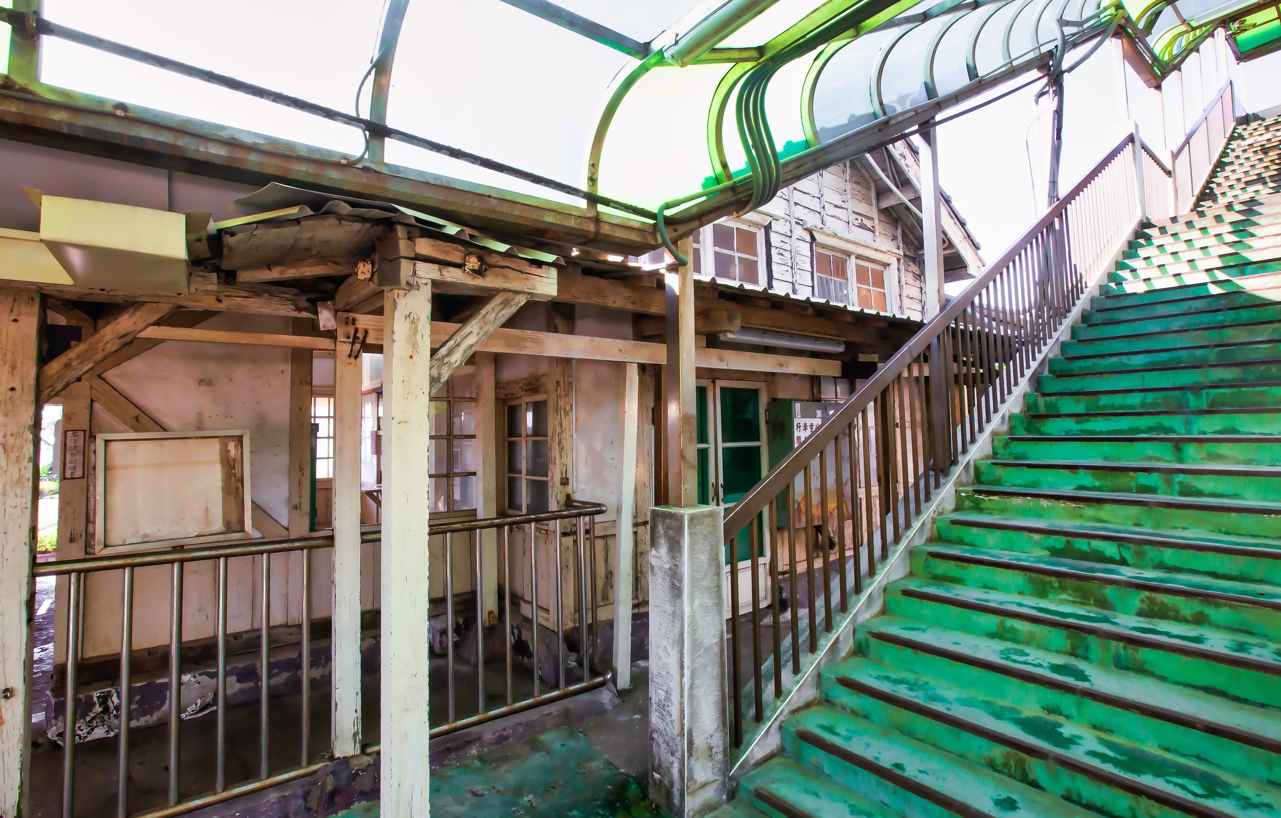
Compared with the other two stations, Xinpu remains in relatively good shape, but it certainly does show signs of age in a few areas. Tanwen is obviously in the worst shape of the bunch while Dashan probably would have been the best of the bunch, if it weren’t for a drunk driver driving his truck through the front doors.
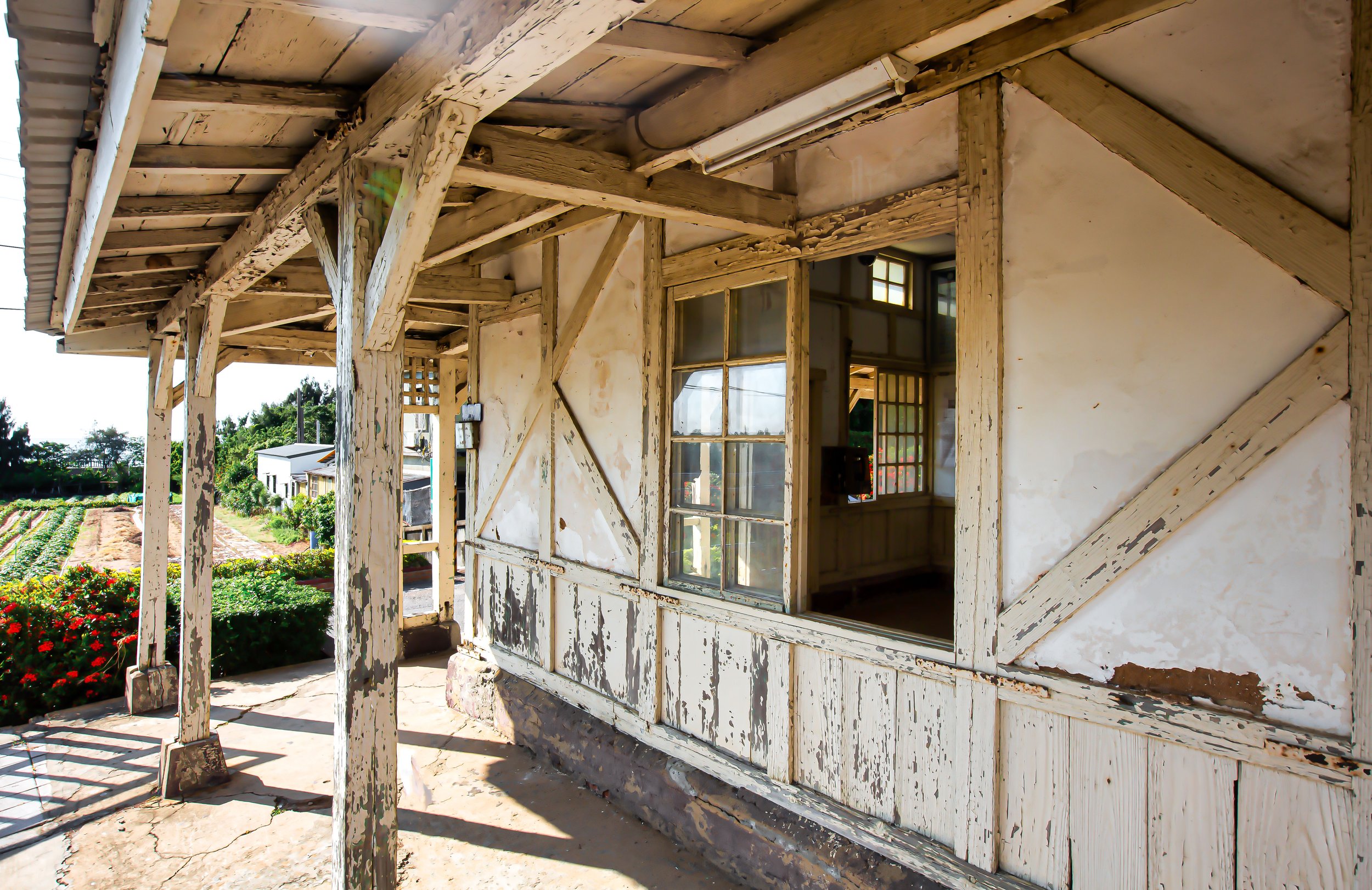
The station was constructed in a fusion of Japanese and Western architectural design, and one of the reasons it stands out today (apart from its age) is that it was built almost entirely of wood (木造結構), more specifically locally sourced Taiwanese cedar (杉木), making use of a network of beams within the building to ensure structural stability. The base of the building, and portions of the wall however make use of concrete to help reinforce the building.


The architectural design fusion in many of the buildings that were constructed during the Taishō era (大正) borrowed elements of Western Baroque (巴洛克建築), with those of traditional Japanese design. In this case however, the architectural design is somewhat subdued, which makes the traditional Japanese design elements stand out more. This was likely in part due to cost-saving measures as well as ensuring that the construction period of all the stations along the Coastal line would be completed between 1919 (大正8) and 1922 (大正11年).
The station was constructed using the traditional Irimoya-zukuri (入母屋造 / いりもやづくり) style of design, most often referred to in English as the “East Asian hip-and-gable roof,” one of Japan’s most common architectural styles, and is one that you’d commonly find used for Shinto Shrines, Buddhist temples, Martial Arts Halls, etc. However, even though the design of the station makes use of irimoya, it isn’t comparable with those other more official buildings, which would have been more grand in their architectural design (and the amount of money spent on their construction).
Nevertheless, keeping with the irimoya architectural style, the building was constructed with genius a network of beams and trusses located within the interior and exterior of the building that work in conjunction with the concrete base to allow the roof to (in this case slightly) eclipse the base (母屋) in size, and ensure that its weight was evenly distributed.
The genius in design, if not already obvious enough has allowed the base of the building to support the weight of the roof for a century.
The roof was designed using the kirizuma-zukuri (妻造的樣式) style, which is one of the oldest and most commonly used designs in Japan. Translated simply as a “cut-out gable” roof, the kirizuma-style is one of the simplest of Japan’s ‘hip-and-gable’ roofs. What this basically means is that you have a section of the roof (above the rear entrance) that ‘cuts’ out from the rest of the roof and faces outward like an open book (入), while the longer part of the roof is curved facing in the opposite direction.
The roof was originally covered in Japanese-style black tiles (日式黑瓦), but similar to both Dashan and Tanwen Stations, the tiles were replaced at some point (I haven’t found a specific date) with imitation cement tiles that appear similar to the original sodegawara (袖瓦/そでがわら), munagawara (棟瓦 /むながわらあ), nokigawara (軒瓦/のきがわら), and onigawara (鬼瓦/おにがわら) elements of traditional Japanese roof design.
One of the most notable ‘baroque-inspired’ elements of the building’s architectural design is the addition of the round ox-eye window (牛眼窗), located above the ‘cut’ section of the roof near the arch. The window helps to provide natural light into the station hall, and is one of those architectural elements that Japanese architects of the period absolutely loved.
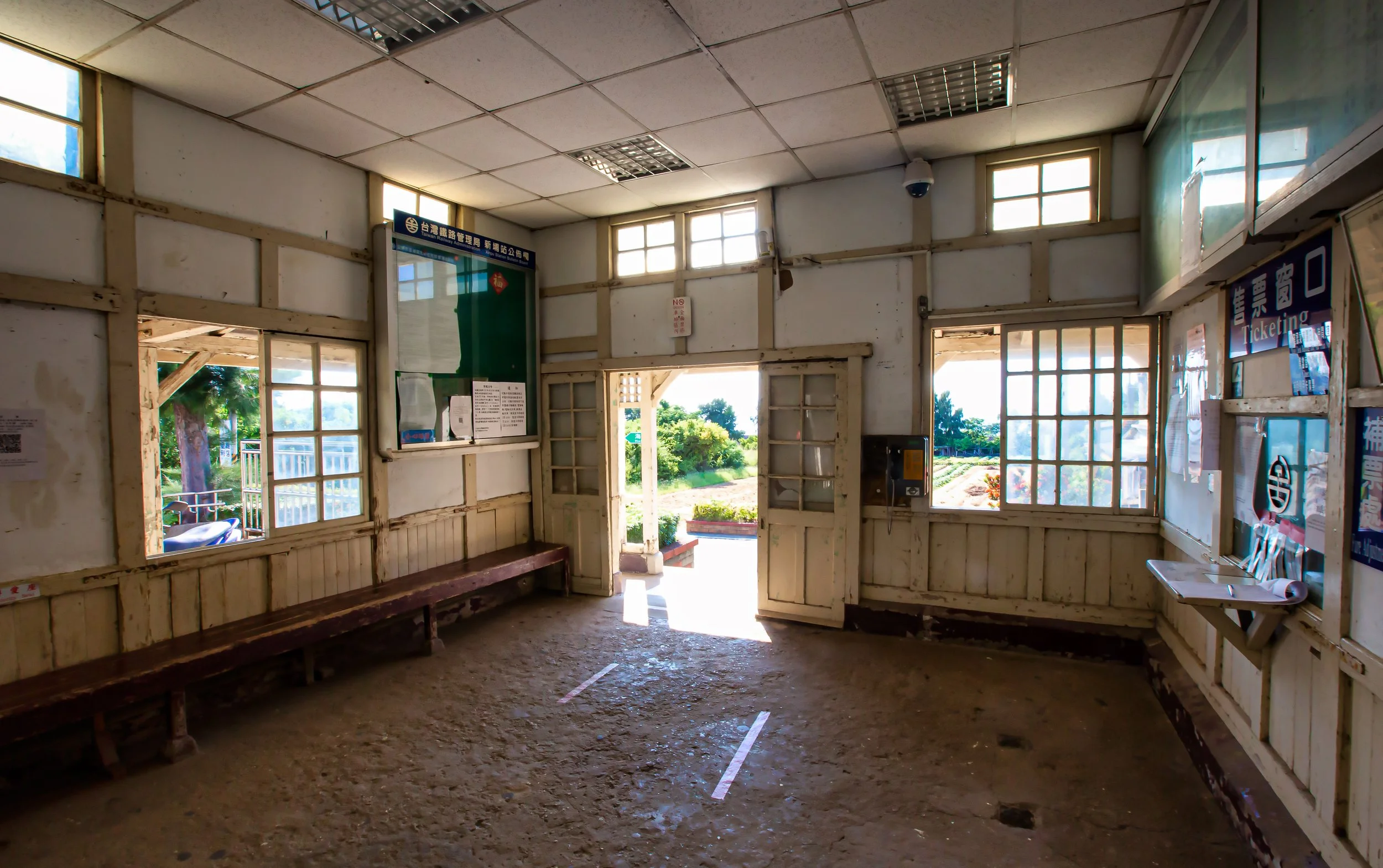
The interior of the building is split in two sections, much like what we saw the former Qidu Railway Station, with the largest section acting as the station hall while the other was where the station staff and ticket windows were located. Given that the station remains in operation today, only the station hall area is open to the public.
That being said, the daily operation of the station is (currently) coordinated out of nearby Tongxiao Station (通宵車站), so as I mentioned earlier, the only employee you’ll find working there is likely to be a volunteer hanging out. The station office is completely closed as is the ticket booth (the station shifted to card swiping for ticket purchasing) so you can’t even take a look at what the office looks like.
Given that the ticket booth and the office are closed, the station hall has been more or less stripped down and is pretty much empty, except for a few notices on the walls. The relative emptiness of the interior however allows you to appreciate the design of the building a bit more as you are free to walk around and look at everything very closely.
Personally, while I did appreciate that the station hall was empty, I thought its size, the open windows and the natural afternoon light made it a really comfortable experience - especially in comparison to the modern stations you’ll find throughout the country today. That in addition to the beautiful planted flowers in the station front, and the sound of the nearby ocean waves, make this a pretty cool place to visit.
Getting There
Address: #57, Hsinpu Village. Tongxiao Township (苗栗縣通霄鎮新埔里新埔57號)
GPS: 24.539850, 120.700350
As is the case with all of my articles about Taiwan’s historic railway stations, I’m going to say something that shouldn’t really surprise you - When you ask what is the best way to get to this train station, the answer should be pretty obvious: Take the train!
Xinpu Railway Station is the southernmost of Miaoli’s ‘Three treasures’, so getting there from the north takes a bit more time than the other two stations. There are two important things to remember about taking the train: The first is that the station is located south of Hsinchu Station on the Coastal Line (海線), and the second is that the station is only serviced by local commuter trains (區間車). What this means is that if you take an express train from Taipei, or anywhere north of Hsinchu, you’ll have to switch to a commuter train once you’re there.
Be very careful about this, because the majority of trains leaving Hsinchu will take the mountain line, and that’s definitely not where you want to be (on this excursion anyway). That being said, if you planned on visiting this station and then making your way back up north, you could take a faster express train (on the coastal line) to Tongxiao Station and from there transferring to one of the local commuter trains mentioned above to backtrack northbound from there.
If on the other hand you’re in the area and you’re driving a car or scooter, but still want to stop by and check out the station, that’s okay as well. You should be able to easily find the station if you input the address provided above into your GPS or Google Maps. That being said, my English translation of the address above isn’t likely to show up on your preferred GPS - This is because there isn’t actually a ‘street address’ for the station, so I strongly recommend you copy and paste the Chinese-language address so that you won’t end up getting lost.
The funny thing is that this address problem is something that happens quite often in Japan, but is a little less common here in Taiwan. The Hsinpu Station however is quite a small neighborhood, and the area where the station is located can be considered more or less the middle of nowhere.
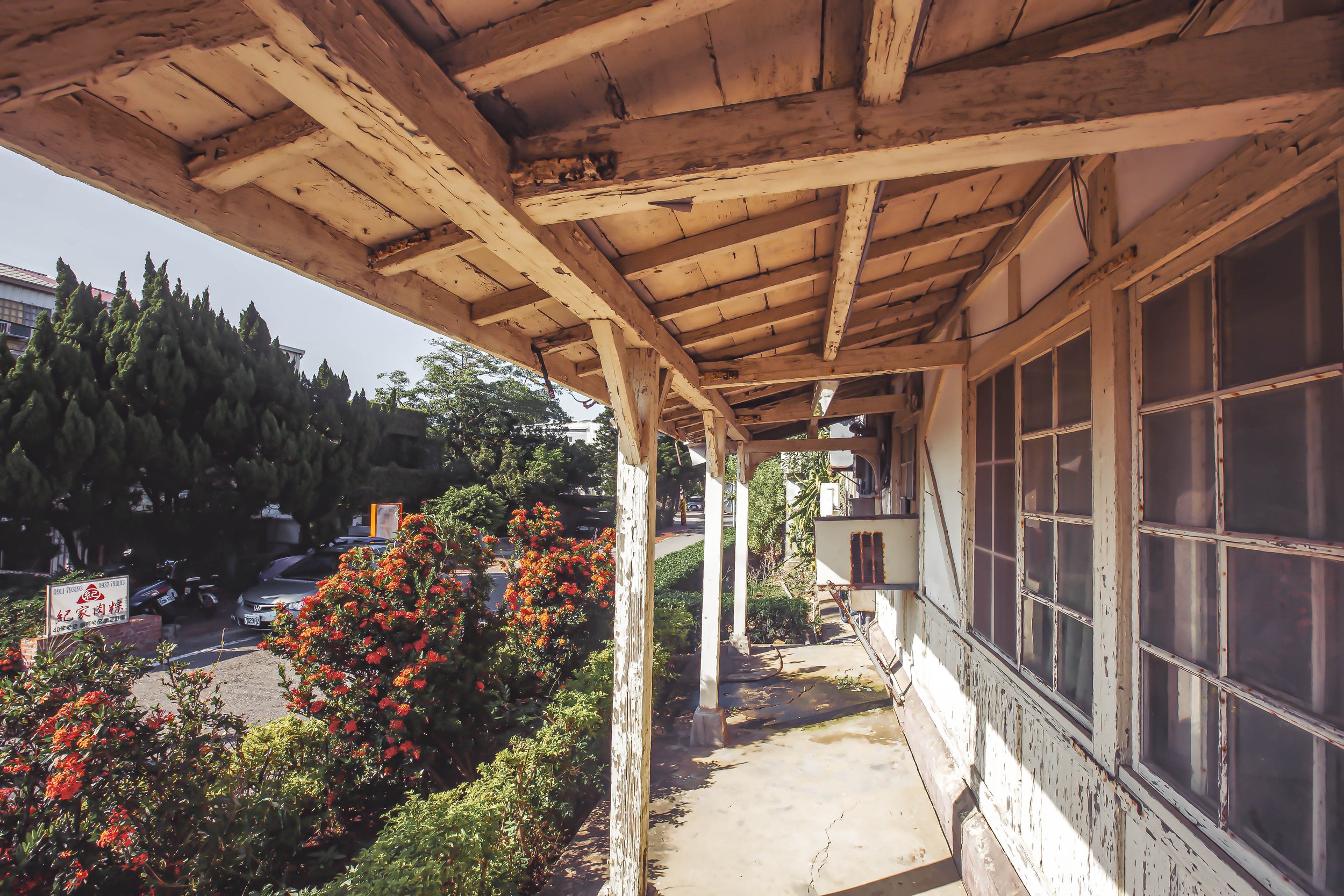
The station is located along the side of a very narrow road near the beach in Miaoli’s southernmost Tongxiao Township (通霄鎮). If you’re driving a car, you’ll have to cross the train tracks on a very small country road, so its important to remember to drive very slowly in case you come across some oncoming traffic.
When you arrive at the station, you’re free to walk around and check it out, it’s likely that you’ll only come across a volunteer keeping watch. Even if you’re not getting on the train, you can walk through to the back of the platform area without purchasing a platform ticket. So, you’ll be able to freely take photos of the front and back. That being said, the rear of the station is quite cramped as the original designers probably never figured that there would eventually be a sky walk platform constructed next to the station.
This makes taking photos there isn’t a little more difficult than Dashan and Tanwen Stations.


Of the so-called Three Treasures, Xinpu Station is probably one of the easiest to visit and is where you’re likely to find the most tourists. This is probably due to the fact that it is so close to the famed Baishatun Mazu Temple (白沙屯拱天宮), and the popular Cape of Good Hope (好望角). It is however probably safe to say that it is the less photogenic of the three century-old stations even though it does have its own unique charm.
If you’re going on a tour of these old Japanese stations, then it’s one that you have to visit. Otherwise, unless you’re in the area, its probably not one of those places that many would go out of their way to visit.
References
新埔車站 | 新埔駅 | Xinpu railway station (Wiki)
海線五寶 (Wiki)
新埔火車站 (文化部文化資產局)
細說苗栗「海線三寶」車站物語 (臺灣故事)
海線的老火車站 (二): 談文火車站 (Maggie’s Home)
木造車站-海線五寶 (張誌恩 / 許正諱)
海線僅存五座木造車站:談文、大山、新埔、日南、追分全收錄!(David Win)
Gallery / Flickr (High Res Shots)