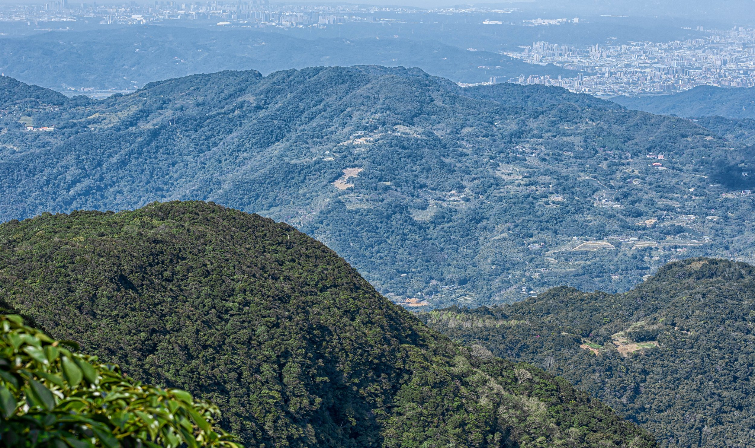
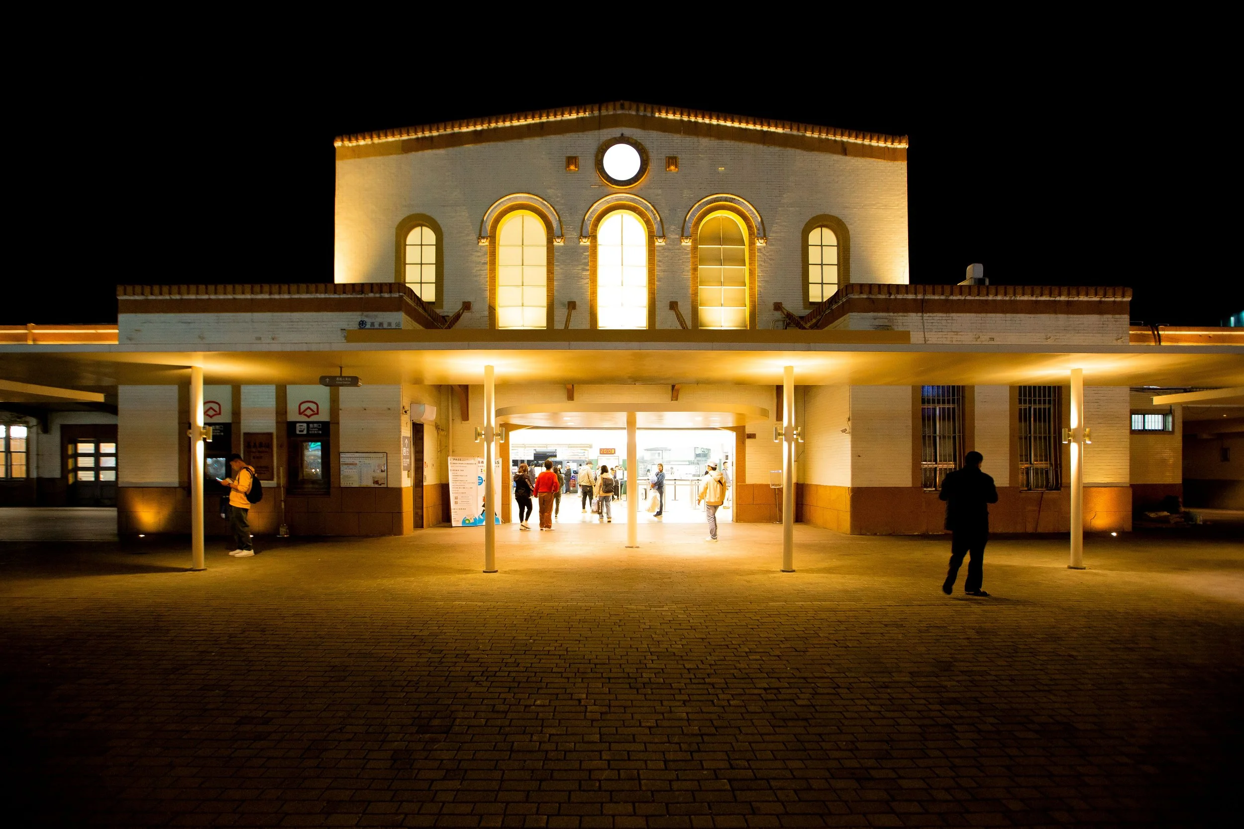
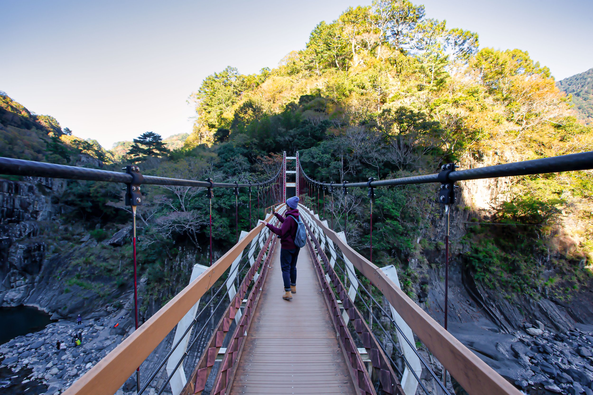
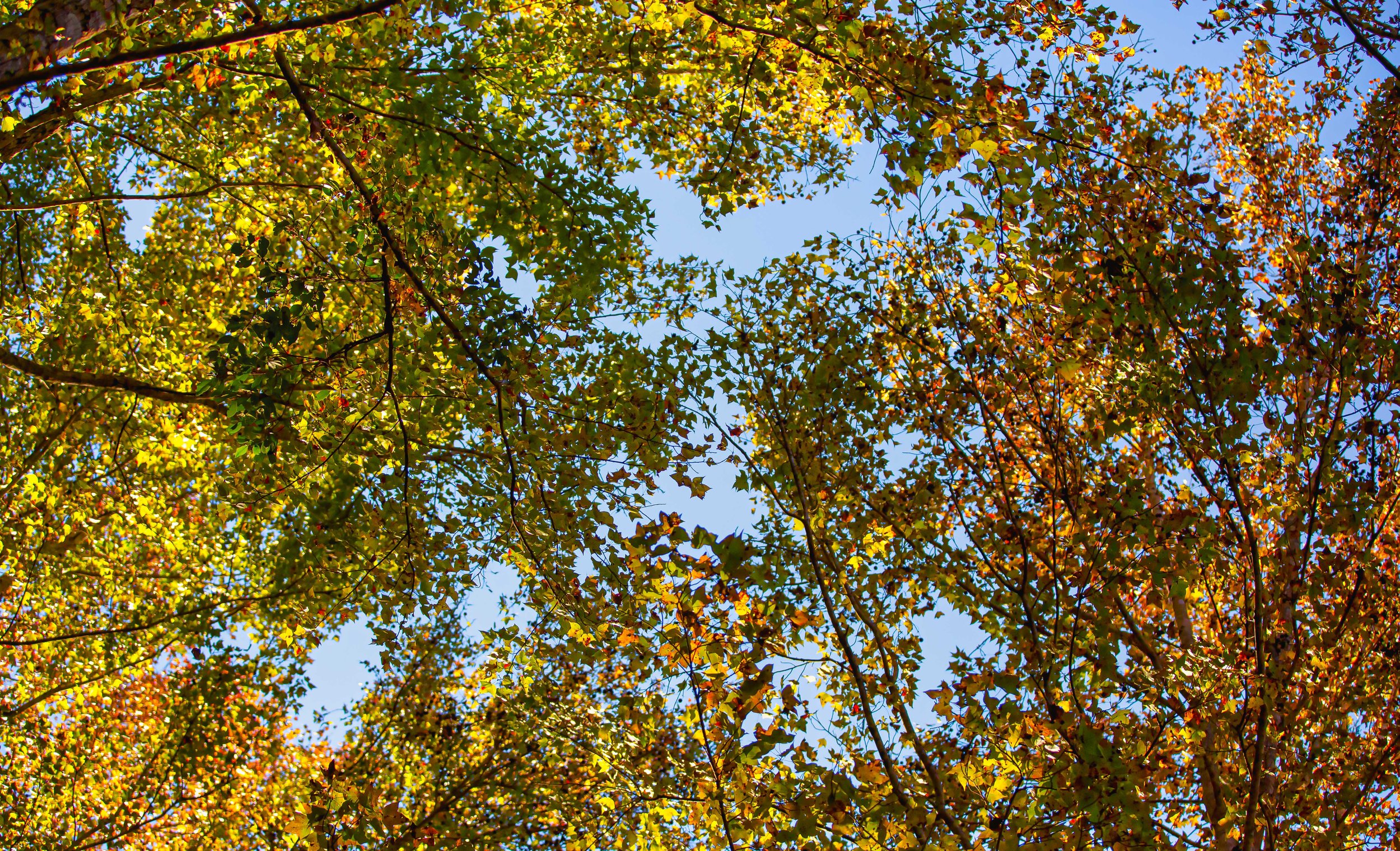
Photo Post

Dongyanshan Forest Recreation Park (東眼山國家森林遊樂區)

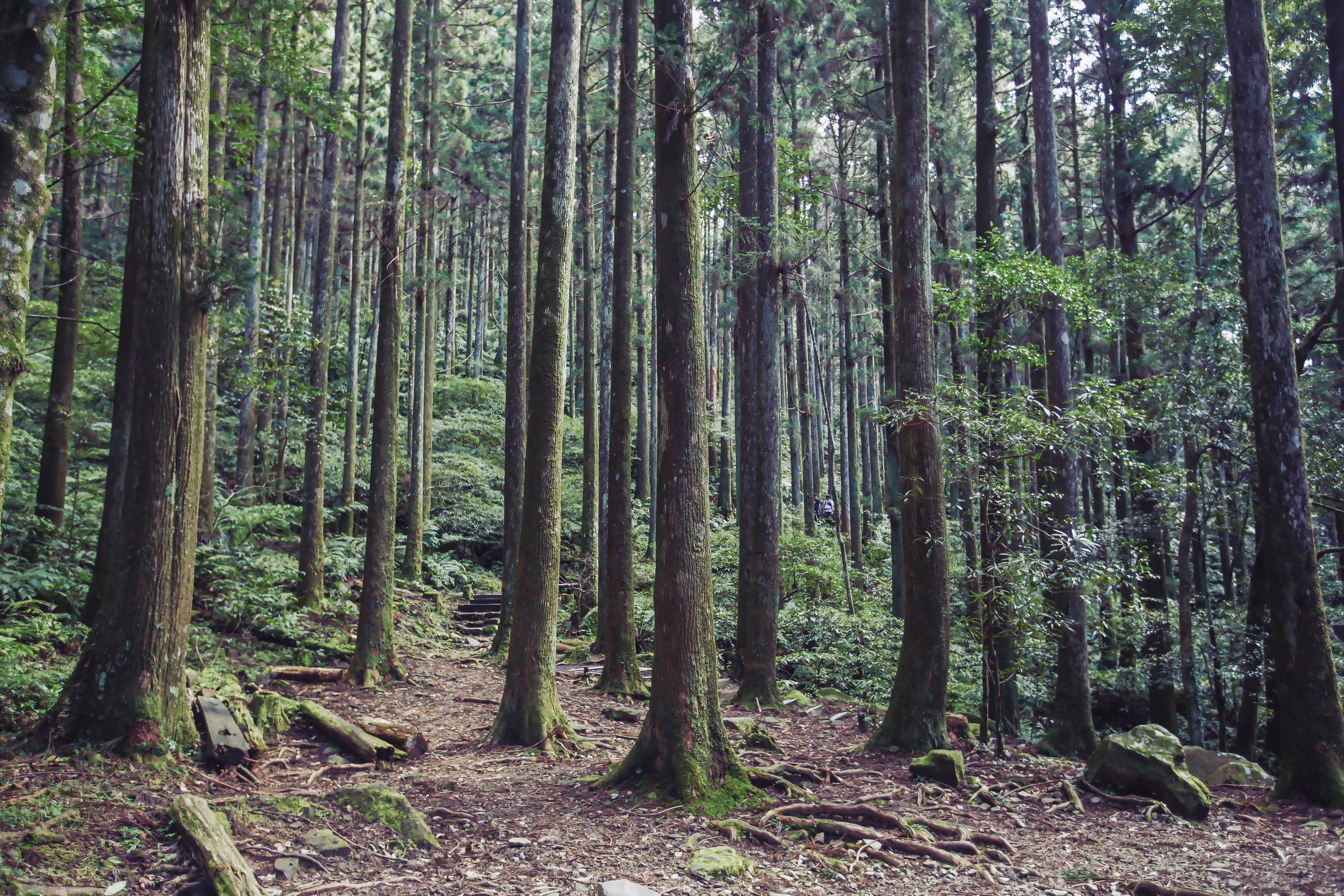
Translated literally into English as “Eastern Eye Mountain,” the Dongyanshan Forest Recreation Park in Taoyuan has gone through what many would consider a surge in popularity over the past few years.

With the COVID-19 pandemic putting international tourism to a sudden halt, people in Taiwan were (probably for the first time in their lives) forced to look at destinations within their own borders for places where they could enjoy a bit of travel, while also staying safe from the virus.

Amazingly, despite the pandemic dealing a pretty harsh blow to international tourism, with little other option, the people of Taiwan it seems have started to appreciate their beautiful country a little more than they did in the past. For years, I’ve been standing here with a megaphone trying to convince people that Taiwan is one of the most beautiful countries in the world, but apparently all it took was a global pandemic to push people to come to the same conclusion.

In truth, it doesn’t really matter what caused this seismic shift in attitude with regard to domestic tourism in Taiwan. The important thing is that people have become content traveling around the country and enjoying its natural beauty. This has become especially true for the youth of the country, who have taken to outdoor activities like hiking mountains, river tracing, rock climbing, snorkeling, scuba diving, etc. Weekends and holidays typically see people traveling from one end of the country to the other to enjoy the hundreds of hiking trails or to the few areas of the island where the coral reef remains alive and well.

This sudden surge in domestic tourism, especially with regard to outdoor recreation, has forced something of a ‘reset’ with regard to how tourism is marketed around here. The pandemic may have forced the unfortunate closure of a number of the nation’s international travel agencies, but it has spawned a growing number of companies that have adapted by planning events to the mountains, outlying islands and even offering scuba-diving packages to those wanting to learn. Similarly, even though the nation’s beautiful mountains have always been accessible, the surge in interest in hiking them has forced the government to improve infrastructure in these areas, allowing more and more people to enjoy all of the breathtaking beauty that Taiwan has to offer.

One of the areas that have benefited most from this surge in domestic tourism are the nation’s ‘Forest Recreation Parks,’ which tend to be large mountainous parks where people of all ages can enjoy leisurely walks through the forest or difficult hikes to alpine mountain peaks. Some of these parks, Alishan (阿里山) and Taipingshan (太平山), for example, have always enjoyed the love and adoration of the Taiwanese public, but with more a dozen of similar parks across the country, people have started to take an interest in the others as well.

As the only one of these parks located in Taoyuan, and one of the most easily accessible within Northern Taiwan, the Dongyanshan Forest Recreation Park is one of those destinations that has received a considerable amount of attention over the past few years.

That being said, as an avid hiker, and one of the few vocal lovers of Taoyuan, I have to admit that over all of my years of living in Taiwan, I’m guilty of being a bit like everyone else in that I’ve only recently discovered the beauty of this National Forest Park. Nevertheless, now that Taiwan has reopened for international tourism, its important that destinations like this receive the attention they deserve, especially from foreign writers like myself.

I hope that this guide to the park, and the photos I’m sharing today help to convince you that a day-trip to Dongyanshan, whether it be with a tour group, or on your own, is well worth the time and effort that it takes to get there. Before I start talking about the park though, it’s probably a good idea to briefly introduce these ‘National Forest Parks’ so that you have a better idea of what to expect.

Taiwan’s National Forest Recreation Parks

Established by the Forestry Bureau in 1965 (民國54年), the government has designated a number of Taiwan’s mountainous areas as protected ‘Forest Recreation Parks’ (國家森林遊樂區). Over the six decades since these protected areas were established, the number of parks on the list has grown significantly, with many of them once utilized by the Forestry Bureau for the purpose of extracting natural resources.

Currently there are twenty-two designated areas around the country that have established Forest Recreation Parks, but that list of parks can often be somewhat confusing, even for locals, given that they often receive slightly different designations, and may or may not be included within what are considered National Parks (國家公園) or National Scenic Areas (國家級風景特定區). Officially, the list includes some twenty-two established areas, which are classified simply as ‘Forest Parks’ or ‘Forest Wetland Parks’, making the actual number of these spaces slightly misleading, given that they differ greatly in size and scope.

Nevertheless, no matter how you classify them, these parks range from tropical monsoon forests in the south and east of the country to temperate high-mountain forests in northern and central Taiwan. In each case, the Forestry Bureau has developed a system of walking paths and hiking trails within where visitors are able to enjoy the natural beauty of Taiwan at their leisure.

Below, I’ve compiled a list of the (current) areas classified as 'Forest Recreation Areas,’ each of which have become popular with local and international tourists, with a few of them becoming rather iconic.

    1. Taipingshan Forest Recreation Area (太平山國家森林遊樂區)

    2. Manyueyuan Forest Recreation Area (滿月圓國家森林遊樂區)

    3. Neidong Forest Recreation Area (內洞國家森林遊樂區)

    4. Dongyanshan Forest Recreation Area (東眼山國家森林遊樂區)

    5. Guanwu Forest Recreation Area (觀霧國家森林遊樂區)

    6. Mingchih Forest Recreation Area (明池國家森林遊樂區)

    7. Wuling Forest Recreation Area (武陵國家森林遊樂區)

    8. Basianshan Forest Recreation Area (八仙山國家森林遊樂區)

    9. Dasyueshan Forest Recreation Area (大雪山國家森林遊樂區)

    10. Hehuanshan Forest Recreation Area (合歡山國家森林遊樂區)

    11. Aowanda Forest Recreation Area (奧萬大國家森林遊樂區)

    12. Alishan Forest Recreation Area (阿里山國家森林遊樂區)

    13. Tengjhih Forest Recreation Area (藤枝國家森林遊樂區)

    14. Kenting Forest Recreation Area (墾丁國家森林遊樂區)

    15. Shuangliu Forest Recreation Area (雙流國家森林遊樂區)

    16. Jhihben Forest Recreation Area (知本國家森林遊樂區)

    17. Siangyang Forest Recreation Area (向陽國家森林遊樂區)

    18. Chihnan Forest Recreation Area (池南國家森林遊樂區)

    19. Fuyuan Forest Recreation Area (富源國家森林遊樂區)

Dongyanshan Forest Recreation Park

The ‘Dongyanshan Forest Recreation Park’ was established in 1991 (民國80年) on 916 hectares of land within Taoyuan’s mountainous Fuxing District (復興區). Originally home to the Llyung Topa (拉流斗霸) of the Tayal Indigenous people (泰雅族), the park, which spans an elevation from altitude of 650 - 1,212 meters above sea level sits on the western edge of Taiwan’s Snow Mountain Range (雪山山脈), and acts as a natural barrier separating the east of the country from the west, protecting Taoyuan and New Taipei City from typhoons and the northeast monsoon.

More commonly known these days as the Dabao Tribe (大豹社), named after the Dabao River (大豹溪) that flows from the mountains into Sanxia, a lot closer to the Manyueyuan Forest Recreation Park. In the late 1800s, the indigenous people were essentially pushed out of their homes, fleeing into the mountains, first by the Qing and then the Japanese.

The sad story started when the Qing government removed its prohibition regarding entering Taiwan’s mountainous regions (開山撫番). Shortly after, the Chinese started making their way into the territory of the Dabao Tribe in order to extract the area’s rich camphor reserves, resulting in the Takoham Incident (大嵙崁社事件), a violent affair that left many on both sides dead.

Later, when the Japanese took control of Taiwan, a similar push into the mountains took place, resulting in guerilla warfare between the indigenous people and the Japanese loggers. Eventually, the Governor-General sent the army marching into the mountains and pushed the Indigenous people out of their ancestral homes.

Link: Sanxia Loyal Spirit Monument (三峽忠魂碑)

The encroachment of the Japanese on indigenous territories across the island often resulted in violence and misery for Taiwan’s indigenous people, but as they stood in the way of the empire’s ambition for the extraction of the island’s precious natural resources, the violence was relentless and unforgiving.

By 1907 (明治40年), the Japanese had pushed their way from Abohei (Amuping / 阿姆坪) all the way to Kappanzan (Jiaobanshan / 角板山 / カッバンソァン), and once the area was firmly under their control, they started to develop a number of facilities dedicated to ensuring the efficiency of the extraction of natural resources from the mountains. Obviously, camphor (樟腦) was at the top on their list of resources to extract, and the area we refer to as Dongyanshan today became an important one for the Timber Industry (林業).

Realizing the extraction of camphor from the area wasn’t a sustainable industry, the Japanese brought with them scientists who set up a research station in Kappazan to search for breakthroughs in the cultivation of cinchona (金雞納樹), a flowering plant known for its medicinal value, especially with regard to treating malaria. In the areas where the cultivation of the plant wasn’t feasible, they ended up reforesting these areas with Japanese cedar, which was also incredibly important for the future development and construction projects across Taiwan.

When the Japanese-era came to an end in 1945, the extraction of camphor continued throughout the post-war era, pretty much until the supply was depleted. Afterwards, the focus of the timber industry shifted to the extraction of cedar which, (ironically was predominately sold back to the Japanese) continued for several decades until it was decided to convert the area into a Forest Park under the 1965 (民國54年) law mentioned above.

As Northern Taiwan’s largest Forest Recreation Park, the Forestry Bureau has done an excellent job creating a network of hiking trails combined with educational resources about the area’s history, making a visit both educational and enjoyable at the same time. Famed for it’s tall cedar forests and it’s ‘sea of clouds’ (雲海), Dongyanshan is not only home to stunning hiking trails, but a large collection of fossils, dating back almost thirty million years to a time when Taiwan was still submerged in the Pacific Ocean.

The park is also home to a number of indigenous animal, insect, and bird species, which you might be lucky enough to encounter during a hike through the forest. Obviously, the most outgoing of the bunch are the Formosan Rock Macaques (台灣獼猴), but you may also be lucky to encounter Red-bellied Squirrels (赤腹松鼠), Formosan Hares (台灣野兔), frogs, snakes, and other smaller reptiles, such as the Formosan pangolin (台灣鯪鯉). The area is also a paradise for bird watchers, so if you’re into that kind of thing, you might want to bring some binoculars along with you!

Points of Interest (東眼山景點)

With the park’s surge in popularity over the past few years, it has also undergone some changes with the addition of some points of interest that help to ensure that a trip there is accessible for one and all. So, before I move on to introducing the trails within the park, I’ll offer a brief introduction of some of the facilities within, so that you have a better idea of what to expect when you visit.

It’s important to keep in mind that although I’m providing a map of the park, it’s essentially the most recent one that is available. Things may ultimately change with the park facilities in the future, so if you visit, I highly recommend grabbing a park brochure at the ticket booth, which will provide the most recent map.

Restrooms (廁所)

Never fear, Dongyanshan Forest Park is a very family-friendly space and unlike most hiking trail across the country, you’ll find that there are several washroom facilities available to hikers and tourists. There are restrooms located within the Tourist Visitor Center as well as several recently constructed facilities along the trails as well - If you find yourself in need, just check out the map of the park given to you at the ticket booth, which displays the locations of all the restrooms.

As I’m writing this article, there are nine different washroom facilities within the park, so you shouldn’t have much trouble finding a space to relieve yourself should you need to.

Pavilions / Picnic Spots / Rest Areas / Viewing Platforms

Within the park, you’ll find a number of spots where you can stop to rest and enjoy some snacks or drinks with your family, friends and fellow hikers. These spaces offer covered protection from the elements in case of rain, so if you need a space to rest, you’ll find these spots conveniently marked on the map. Similarly, along the Self-Guided Trail, you’ll find three different viewing platforms where you can enjoy some scenic views of Taoyuan and New Taipei City. These platforms aren’t covered, but they do allow hikers to sit and enjoy snacks at their leisure.

Tourist Visitor Center (遊客中心)

Located at the base of the hiking trailheads, the Tourist Visitor Center is an excellent place for groups to meet up prior to or after finishing a hike. The building features a small cafeteria where you can purchase some food, snacks or drinks. It is also home to a pretty nice restroom area where visitors can relieve themselves before or after a hike.

There’s also a free filtered water machine where you can fill up a water bottle with hot, warm or cold water for free.

The Visitor Center also comes equipped with some educational exhibition spaces with informative displays about some of the fossils found within the park as well as a description of the vegetation and animals that make their home within the park.

Dongyanshan Restaurant (東眼山食堂)

The recently opened Dongyanshan Restaurant is located within a beautifully designed building a short distance from the Visitor Center. Taking into consideration the location of the park, it shouldn’t really surprise anyone that the menu is quite limited. Offering set menus (with vegetarian options), fried snacks and various beverages, it’s certainly not a Michelin-quality restaurant, but if you’re hungry and in need of something to eat, it’s a pretty good option.

However, it’s important to keep in mind that the ‘Set Menu’ dishes are only available from 11:00am - 1:30pm while the ‘Afternoon Tea’ fried dishes are available from 2:00 until the restaurant closes.

Reforestation Memorial Stone (造林紀念石)

Located at the end of the Forestry Trail, you’ll find a memorial stone that commemorates the reforestation effort that helped to bring the forest back to life, giving us the beautiful park that we’re able to enjoy today. The memorial isn’t really that much to look at, and it essentially just marks the end of the trail, but it’s an important reminder that this are was once completely clear cut.

Dongyanshan Hiking Trails (東眼山健行步道)

Within Dongyanshan Forestry Park there are essentially three major trails, with a number of off-shoots that connect with other trails, and extend beyond to much longer and more challenging hikes. With a combined length of around sixteen kilometers, you’ll have to choose carefully which trail to hike on your visit, because you probably couldn’t finish them all in a single trip. Most visitors are likely to choose between the ‘Self-Guided Trail’, the ‘Scenic Trail’ or the ‘Forestry Trail’, but for those who are a bit more serious, they might simply be making use of the leisurely trails to extend their hike to ‘Dongman Trail’ (東滿步道) or onto ‘Mount Beichatian’ (北插天山), which aren’t for the faint of heart.

The Self-Guided Trail (自導式步道)

Starting at the Dongyanshan Visitor Center (東眼山遊客中心), the nearly four kilometer-long ‘Self-Guided Trail’ is a bit awkwardly named in that it might mislead some visitors into thinking that the other trails require a tour guide, which isn’t actually the case. This trail is essentially a loop through some of the most stunning natural scenery that Dongyanshan has to offer, and culminates at the highest point of the park, which is essentially the peak (三角點) at 1,212 meters.

View of the Taipei Basin from the peak.

Along the way you’ll get to enjoy ridge-lines with stunning views of Taoyuan and Sanxia, and if the weather is good, you may even catch a view of Taipei 101 in the distance. Keeping things interesting, the trail is home to a number of outdoor exhibits and educational signage that paints a pictures of the area and its history.

Trail length: 3.5 - 4km (1-2 hours) Highest elevation: 1,212 meters

The Scenic Trail (景觀步道)

If you’re looking for the most Instagram-friendly trail, the ‘Scenic Trail’ is probably the one you’re looking for. This short trail doesn’t take very long to hike and along the mostly flat trail you’ll find a number of Instagram popular installations that have been set up by the park staff and local designers to celebrate the history of the park. Along the way, you’ll also get a pretty good introduction to the natural environment that the rest of the park has to offer.

That being said, if you take a trip all the way to the park and only hike this trail, you’re missing out. If you’re traveling with young children though, it’s a friendly area that won’t tire them out too much.

Trail length: 350 meters (10-20 minutes)

The Forestry Trail (森林知性步道)

Looking at the official park map, the ‘Forestry Trail’ is more or less a trail that combines a number of smaller trails. Hiking this one allows you to experience the natural beauty of the park, while also allowing you to experience the re-forestation efforts that have taken place to help the natural environment come back to life in the areas where the logging industry did the most damage. Passing by the ‘Scenic Trail’ mentioned above, you’ll make your way through the forest covered Father-Son Peaks Trail (親子峰步道), which then loops around and connects with the Forestry Trail (森林知性步道), where you’ll make your way back to the Visitor Center at the end of your hike.

This hike is a much different one than the Self-Guided Trail above in that it doesn’t culminate in a ‘peak’ nor does it offer you scenic views of Taoyuan and New Taipei. The trail essentially just winds its way through a reforested section of the park where the tall Japanese cedar trees and the natural environment that has grown up around them make for some pretty beautiful photos.

Personally this trail was my favorite part of the park as it reminded me of some of the mountainous trails back home in Canada that I would cross-country ski through during my youth.

Trail length: 3km + 1.3km (2 - 2.5 hours) Highest elevation: 1,060 meters

The Dongman Trail (東滿步道)

The longest trail in the park is an interesting one because it is essentially a one-way hike that’ll take the entire day and connects you from one Forest Recreation Park to another. The name “Dongman” (東滿) is a combination of the first characters in “Dongyanshan” (東眼山) and “Manyueyuan” (滿月圓), which is another Forest Park located in Sanxia (三峽). Hikers are free to choose to start the roughly eight kilometer hike in the Forest Park of their choice, depending on personal preference, with one starting at a lower elevation and the other starting at a higher elevation.

The trail is known for its panoramic views of the northern mountain range, but is considered an advanced hike, and should always be done in a group for safety. The other thing that you’ll want to keep in mind is that since the hike starts in one park and ends in another, your method of getting there and getting home will be different, so it doesn’t make much sense to drive your car to one, do the hike, and end up stranded in the other.

Fortunately, there are hiking groups like Parkbus that coordinate hikes to the trail and conveniently provide drop off at one park and pick up at the other, solving those logistical problems.

Trail length: 8km (4-5 hours one way) Highest elevation: 1,130 meters

Park Admission Fees

It is somewhat uncommon for popular tourist destinations to charge an admission fee in Taiwan, but in this case for the purpose of maintaining the quality of the trails, the administration of the park, and most importantly the reforestation effort, a modest admission fee is collected at the entrance.

The current admission fee scheme is as follows:

Weekdays: Adults NT$80

Weekends & National Holidays: Adults NT$100

Group Rate (20 or more people): NT$80

Children: NT$10 (3-6 years), NT$50 (7-12 years)

Seniors (65+): NT$10

Parking Fee: Cars NT$100, Scooters NT$20

Getting There


Address: No.30, Jiazhi, Fuxing Dist., Taoyuan City (桃園市復興區霞雲村佳志35號)

GPS: 121.41761, 24.825110

Car / Scooter

If you have your own means of transportation, getting to Dongyanshan Forest Park is relatively straight forward. Located along the Northern Cross-Island Highway (北部橫貫公路), otherwise known as Highway 7 (台7線), you can make your way to the road from Taoyuan, passing through Daxi (大溪) and Cihu (慈湖) or from New Taipei City’s Sanxia District (三峽區). Even though the Cross-Island Highway is considered a ‘highway’ it’s not an expressway, so scooters and motorcycles are permitted to ride up and down the mountainous road.

Input the address or the coordinates provided above into your GPS or Google Maps and you’ll have the best route conveniently mapped out for you.

It’s important to note though that if you’re driving a car or a scooter (or a Gogoro), the last gas station (and battery swapping station) is located on the turn off to Jiaobanshan Villa (角板山公園), so you may want to fill up before you head to the park. It’s also your last chance to pick up some hiking snacks as there is a convenience store next to the gas station.

Public Transportation

Currently, the only option for taking public transportation to Dongyanshan Forest Recreation Park is to take a bus from the Daxi Bus Station (桃園客運大溪總站). Service is provided by the Taiwan Tourist Shuttle Service (台灣好行) on Route #506, but travelers need to keep in mind that during the week there are only three shuttle services a day and five on weekends and holidays.

It is important that you plan your trip wisely and make sure that you don’t miss the bus, otherwise you might find yourself stranded and waiting around for quite some time.

Weekday departures from Daxi: 8:00, 11:00, 15:00

Weekend departures from Daxi: 8:00, 9:00, 11:00, 14:30, 15:00

Weekday departures from Dongyanshan: 9:30, 13:00, 17:00

Weekday departures from Dongyanshan: 9:30, 12:00, 13:00, 16:30, 17:00

Link: Taiwan Tourist Shuttle Service #506 Dongyanshan Route Timetable (台灣好行)

The fare for the bus is NT$81 each way, or you can purchase a one day pass for NT$150 that’ll cover your trip there and your return trip for a discounted price.

Finally, if you’ve taken the effort to visit Dongyanshan, you’re in luck, because there are a number of other tourist destinations in the area that are also worthy of your time - You’ll find the Jiaobanshan Park (角板山公園), Xiao Wulai Waterfall (小烏來瀑布), Xinxikou Suspension Bridge (新溪口吊橋), Yixing Suspension Bridge (義興吊橋), Daxi Old Tea Factory (大溪老茶廠), Sanmin Bat Cave (三民蝙蝠洞), TUBA Church (基國派老教堂), Cihu Mausoleum (慈湖陵寢), Daxi Old Street (大溪老街), and Sanxia Old Street (三峽老街) all in close proximity to the park.

It doesn’t really matter if you’re visiting to check out some of the trails, or you’re one of those adventurous types making your way along the Dongman Trail. The great thing about a visit to Dongyanshan is that you’re provided access to some of Taiwan’s alpine natural beauty within a short distance from Taipei.

Each of the trails within the park offers stunning views, which are comparable to what some of us from North America are used to, but with the mixture of tropical vegetation at the same time. With beautiful cedar trees, thick vegetation and a variety of indigenous species like Formosan Rock Macaques and a wide variety of birds, the park has something for people of all ages and hiking abilities.

References

  1. 東眼山國家森林遊樂區 (台灣山林悠遊網)

  2. 東眼山國家森林遊樂區 (Wiki)

  3. 東眼山自導式步道 (健行筆記)

  4. 東眼山森林遊樂區 (桃園觀光導覽網)

  5. 國家森林遊樂區 (Wiki)

  6. 東眼山國家森林遊樂區.東滿步道 (Tony的自然人文旅記)

  7. 東眼山步道攻略|攻頂小百岳,享受舒服的森林浴 (不一樣的旅人)

  8. 健行一日遊 走讀桃園東眼山,淺山卻有高山的感覺 (微笑台灣)

  9. Dongyanshan Forest Recreation Area (Forestry Bureau)

  10. Dongyanshan Forest Recreation Area (Wiki)

  11. Dongyanshan National Forest Recreation Area (ParkBus)

  12. Dongyanshan (Taiwan Outdoors)

Battleship Rock (秀巒軍艦岩)

Over the years I’ve published quite a few articles about the mountains and hiking trails that encircle Taipei City - Starting with popular hikes like Elephant Mountain (象山) and the rest of the so-called Four Beasts (四獸山), I’ve also covered trails such as Fuzhou Mountain (福州山), Qixing Mountain (七星山), Jiantan Mountain (劍潭山), Jinmian Mountain (金面山) and Guanyin Mountain (觀音山). I’ve even published a guide that provides a comprehensive list of the best mountains and vistas in the city where you can take awesome photos of the city in my Taipei Cityscapes Guide.

With so many articles dedicated to the mountains that surround the capital of this great nation, some readers have asked why I’ve yet to publish anything about the popular ‘Battleship Rock’ (軍艦岩) hike in the city’s Beitou District (北投區) - Well, I’m here today to finally answer that question.

However, you may find yourself a little disappointed.

The ‘Battleship Rock’ I’m going to introduce today isn’t the popular hike in Taipei, but another tourist destination that shares the same name deep in the mountains of Hsinchu. Suffice to say, you won’t be getting instructions on how to hike the popular Taipei mountain this time round, but hey, you get to learn about and (possibly) enjoy photos of an entirely different ‘Battleship’ that rarely gets much attention.

The Battleship Rock I’m introducing this time is a lesser known, yet beautiful tourist stop high up the mountains of Hsinchu County’s Jianshih Village (尖石鄉). Instead of a beautiful cityscape, this location features a couple of beautiful suspension bridges, the confluence of two large rivers, wild hot springs, maple trees and a much larger ‘battleship' than the one in Taipei. However, while all of that might sound great, the biggest difference between this ‘Battleship’ and the one in Taipei is accessibility.

The hike in Taipei is one that is easily reachable via the city’s excellent public transportation network while this one is likely out of reach for most tourists. Nevertheless, even though Hsinchu’s Battleship Rock is more difficult to reach, if you are lucky enough to visit, likely on your way to Qalang Smangus (司馬庫斯部落), Cinsbu (鎮西堡) or the Syaroko Historic Trail (霞喀羅古道), you’re in for a treat.

As a travel-related article, I won’t be overloading you with information this time - I’m just going to spend some time introducing some of the cool things that you’ll see if you ever have a chance to visit the area. And hopefully the photos I share today might entice you to want to take some time to visit the area for a weekend, especially if Smangus is your final destination!

For those of you who landed here hoping to read about Taipei’s Battleship Rock, I hope I didn’t mislead you. I’ll eventually publish something about that hike - It’s on my list of places to write about, I just haven’t gotten to it yet, and these days I prefer to write about destinations that are off of the typical tourist’s radar.

Btunux Tukang (秀巒軍艦岩)

To introduce Hsinchu’s Battleship Rock, most writers would probably start with some scientific information about the geologic process that took place to form this beautiful rock. However, I feel like it’s a better idea to start out with an explanation of its name and the people who have lived in its midst for hundreds (if not thousands) of years.

Translated literally from Chinese as ‘Battleship Rock’ (軍艦岩 / jūn jiàn yán), it is known as ‘Btunux Tukang’ in the Tayal Indigenous language (泰雅語). Located a short distance from the rock, you’ll find the ‘Hbun-Tunan’ (控溪部落) tribe of Taiwan’s Tayal Indigenous People (泰雅族), whose ancestors settled along the river around four hundred years ago.

In the Chinese language, the tribe’s name is literally translated into English as the ‘River Control Tribe’ (控溪部落), a name which was given to them by the Japanese, and is something that might lead one to believe that they somehow nefariously controlled access to the mountains and river. However, in the Tayal language, ‘Hbun-Tunan’ instead refers to the geographic location where the two rivers intersected, and the traditional marketplace of goods that the tribe became known for.

Making their home in the river valley close to where Battleship Rock is located was geographically significant as the tribe played an important role within greater Tayal society for quite some time as the tribe was strategically located along the historic hunting trails used by the Indigenous people to traverse the mountains.

Crossing the river in front of Battleship Rock.

Acting as somewhat of a middle-man between the various tribes on either side of the river, the Hbun-Tunan, who are more commonly known these days as the Xiuluan Tribe (秀巒部落), created a marketplace that allowed the various tribes in the mountains to transport fruit, vegetables, meat and other commodities for trade.

That being said, the river valley was not only a strategic place to live, it was also filled with abundance as the river and the mountains provided the tribe with more than enough sustenance to get by on, and today that marketplace continues to thrive as Xiuluan Village (秀巒村) is the largest producer of peaches and pears in Taiwan.

Living in the midst of the giant rock, at some point, the Hbun-Tunan started referring to it as ‘Btunux Tukang’, which is likely pretty difficult for most native English speakers to even try pronouncing. Nevertheless, as the story goes, it was likely a name that was influenced by missionaries living in the area, because to the indigenous people, it was simply just a big rock. Thus, in Tayal, ‘Btunux’ is the equivalent of ‘rock’ (石頭) and ‘Tukang’ would have been a relatively new word to them that translated as ‘warship’ (軍艦).

Sadly, I spent quite a while trying to figure out the meaning of the name, consulting several Tayal scholars, who also thought it was funny.

The point where the confluence of rivers takes place.

Situated at the confluence where the Baishi / Sakyaking River (白石溪 / 薩克亞金溪) and Taigang / Takejin River (泰崗溪 / 塔克金溪) meet to form the Yufeng / Maliguang River (玉峰溪 / 馬里光溪), Battleship rock is said to resemble the bow of a giant warship. However, when it comes to (almost all of) Taiwan’s popular rock formation tourist destinations, my imagination tends not to be as wild as others. In this case though, I suppose you could argue that the sharp triangular shape of the rock cutting into the river actually does create the effect of a boat speeding its way through the water.

Admittedly, I’m not as knowledgeable about Taiwan’s river systems as others, but I was surprised to learn that two rivers that can see joining together here, eventually join with the greater Dahan / Takoham River (大漢溪 / 大嵙崁溪), which flows into Taoyuan, and is part of the river system controlled by the Shimen Reservoir (石門水庫).

Writing previously about the Youling Waterfalls (幽靈瀑布), Xiao Wulai Waterfall / Rahu-Ulay (小烏來瀑布) and other points of interest along the river, I was actually unaware that they were all part of the same tributary.

Note: For each of the location names above, I’ve included the name more commonly used on maps today as well as their original Tayal names for a bit of clarity.

Layers on the battleship.

Looking at Battleship Rock from a distance, you’re likely to notice the various layers in the rock, telling the story of its long history. Dating back to the collision of tectonic plates that allowed the land mass we known as Taiwan to emerge from the Pacific Ocean, the stripes in the rock are primarily comprised of silt, shale and white sandstone, each of which consists of a different shade.

Unfortunately, there is very little written about the area, and very few resources about provide any concrete estimation of how tall the rock is, but I’d estimate its anywhere between twenty to thirty meters tall.

Fortunately, for anyone visiting today, the local government constructed a sixty meter long Battleship Rock Suspension Bridge (軍艦岩吊橋) in 2015 (民國104年), just over where the two rivers meet up.

The suspension bridge not only allows visitors to get a view of the rock from vantage points above the river, but also provides with the opportunity to cross to the other side to make your way down to the river bank where there are even closer views.

Likewise, just above the Baishi River, you’ll find the Kongxi Suspension Bridge (控溪吊橋), which was originally constructed during the Japanese-era, and then later rebuilt in 1985 (民國74年). In this case, the bridge allow visitors to enjoy the maple trees that grow on this side of the mountain during the late fall and winter months in addition to allowing visitors to make their way to the Taigang Wild Hotsprings (泰崗野溪溫泉) where you can dip your feet in the water.

Maples on the mountain across the river.

That being said, it’s important to remind readers that (as I mentioned earlier) the Hbun-Tunan tribe sat at the crossroads of the so-called ‘ancient’ network of Tayal trails that allowed the various tribes to connect with each other - so when the Japanese arrived in Taiwan in 1895, these routes were thought to pose a risk to their control. The early years of the colonial era saw a heavy handed approach to suppressing any opposition to Japanese rule, and given the tribe’s strategic geographic location, the military converted the ancient trails into police patrol roads which were equipped with artillery batteries and police stations in remote mountain areas.

While attempting to control the movements of the Indigenous people, a number of violent massacres took place leaving a legacy of violence that pushed the indigenous people further into the mountains and completely changed their traditional way of life.

Today, if you cross the Kongxi Suspension Bridge and continue hiking several kilometers up the mountain, you can find the ruins of some of those historic outposts, which were spread throughout the mountains, especially along the Syakoro Historic Trail (霞喀羅古道), where some of them have recently been restored.

Note: During the same visit to the area, I hiked part of the Syakaro Historic Trail, but it was more of a volunteer experience that didn’t allow me to hike the entire trail, so I missed out on the parts of the hike that I was most interested in. Eventually I’ll hike the entire length of the trail and write a blog about it, but until then I recommend you check out Anusha Lee’s article about the trail

Syakaro Historic Trail: A Hike with History, Suspension Bridges and Fall Foliage (Taiwan Hikes)

Crossing over onto maple mountain.

Somewhat ironically, despite the area being referred to as Battleship Rock, the maple trees growing on the mountain on the other side of the Kongxi Suspension Bridge have become the star attraction in recent years. During the months when the trees are changing colors, you’ll find the parking lot full of shuttle vans bringing tourists up and down the mountains.

While the Battleship Rock area isn’t the best spot for maple viewing in Jianshih Village, it’s probably the easiest for most people to get to, making it a popular spot for weekend day-trippers. Coming from Canada, it’s difficult to impress me when it comes to maple trees, but after years of not seeing the leaves change colors back at home in the autumn, it was nice to see Taiwan’s mountains changing colors, especially in this area with the combination of the rivers and the mountains.

With that in mind, the best time to visit the area is in the autumn between October and January, but you’ll want to remember that the maples change colors at different times than they do in North America, so you should consider going a bit later in the year to see them, or simply check the recent photos from the area on Instagram to see if its a good time to visit or not.

Visiting the Battleship Rock area probably won’t require a whole lot of time, but if you plan on hiking the trail to see some of the ruins, or soaking your feet in the wild hot spring, you might want to schedule a bit more time to enjoy yourself. Either way, the parking lot next to the bridge is 100NT per visit for a car, and 30NT for scooters. Everything else is free, unless of course you decide to buy some delicious indigenous snacks from the vendors across the street.

Getting There


Address: Xiuluan Village, Jianshih Village, Hsinchu (新竹縣尖石鄉秀巒村)

GPS: 24.633680, 121.279510

As mentioned earlier, the biggest difference between Taipei’s Battleship Rock and Hsinchu’s Battleship Rock is accessibility. The hike in Taipei is pretty easy to get to, but this one is considerably more difficult.

Part of the problem, at least for most international tourists, is that there is no method of public transportation that will take you anywhere near the area. So, if you’re interested in visiting, your only option is to go by car or scooter, or arrange for a shuttle bus to get you there.

That being said, if you’re driving a car or a scooter, I recommend inputting the address or coordinates provided above into a GPS system to map out your route. Depending on where you’re coming from, you’ll want to get off of Highway #3 at the Zhulin Interchange (竹林交流道) and make your way towards Neiwan (內灣) on the #120 County Highway. Passing Neiwan, you’ll continue on towards Jianshih on the #60 rural road pretty much until you arrive.

As one of the stops along the road towards Smangus or the Syaroko Historic Trail, if you’ve planned a trip to either location, Battleship Rock is one of the must-stops along the road. Not only will you get a break from sitting in the shuttle bus, but you’ll also enjoy the opportunity to get a sneak peek of some of the amazing natural beauty that you’re going to experience on your trip. On the other hand, if you’re just enjoying a day-trip through the area, it makes an excellent place to stop, hike a bit and then turn back on your way home. Whatever your itinerary, a visit to Hsinchu’s Battleship Rock is a rewarding experience

References

  1. 秀巒軍艦岩步道 (健行筆記)

  2. 漫步新竹尖石「秀巒軍艦岩」、「軍艦岩吊橋」壯闊美景 (Jamie慢森活)

  3. 新竹景點 尖石鄉/秀巒軍艦岩/軍艦岩吊橋/大自然之旅一日遊/陡峭岩壁超壯觀! | 綠歐樂生活 (綠歐樂生活)

  4. 新竹尖石二日遊 玉峰村部落住一晚,沿途遼闊山巒陵線,凝聽老鷹溪步道溪流 (微笑台灣)

  5. 秀巒 Hbun-Tunan (霞喀羅國家步道)

  6. 控溪部落 Hbun-tunan (Taiwan Indigenous People’s Portal)


Erlin Martial Arts Hall (二林武德殿)

I can be a patient person, but in some cases, enough is enough.

I’ve had a skeleton of a post about the Erlin Martial Arts Hall in Changhua sitting in my blog queue since 2017, waiting to be published. With little more than a dozen of these historic buildings remaining in Taiwan today, I figured that I’d hold off on publishing anything about this one until it was fully restored and reopened to the public.

My patience though, has sadly worn quite thin.

It got to the point that I thought if I keep waiting for Changhua County to get its act together, I’d likely be a senior citizen by the time they actually get around to restoring this building.

When I originally wrote an article about this Martial Arts Hall more than six years ago, I was still quite new to this whole blogging thing, and was likewise still new to my exploration of Taiwan’s historic buildings from the Japanese era. So, if I compare what I originally wrote years back to what I’m publishing today, it’s not even close.

This article should prove to be a much more well-rounded one that benefits from my years of experience and research on the topic.

That being said, while all of the text has been completely updated, I’m sad to say that the photos I’m sharing right now are the going to be the same as those I had prepared five years ago due to the fact that myself, nor anyone else has really been able to get many photos of the building in recent years.

Essentially, I’m publishing this article today to simply have the information in place for (what I sincerely hope) what will eventually become an updated version, which will be complete with photos of the fully restored building.

Until that happens, I’ll make use of some of the blue prints and designs of the building that have been published by the Changhua County Government to better illustrate some of the things I’m talking about. The work they have done researching the building and it’s architectural design is incredible, and without it, we would know very little about the building, so cheers to them for that!

For those of you who have been following my writing for a while, especially with regard to my Urban Exploration-related work, barriers don’t usually prevent me from getting the photos I need - Sadly though, in the case of this Martial Arts Hall, several factors that have combined to ensure that people like me aren’t snooping around. The most obvious is that building is completely locked up and a barrier has been erected around its perimeter to prevent anyone from getting too close to the historic building.

The other reason is that it is located next door to the Erlin Police Station, which has cameras watching the grounds. So, even though I found a way of getting around the barrier, I wasn't about to go snooping around while the police would be able to see me in plain sight from the police precinct.

So what exactly is the problem with the Erlin Martial Arts Hall and why have we had to wait for so long for it to get fixed up? Well, that’s a bit of a complicated issue, but I’ll do my best to explain it as briefly as possible.

To keep things simple, it’s all about money. Isn’t it always, though?

However, that’s a bit of a simplistic argument as to what’s going on here. As I mentioned earlier, the situation is a lot more complicated than that, and there is an ample amount of blame to be thrown around.

It would be easy to focus our indignation at the Changhua County Government, which as one of the nation’s most cash-strapped municipalities, has had trouble coming up with funding for the restoration of the heritage buildings within its borders - With so little cash to throw around, the county tends to spend it restoring buildings in the coastal town of Lugang (鹿港), one of the areas’s most popular tourist attractions - Obviously hoping that there will be a trickle-down effect that will help bring tourist dollars into the county.

The focus on Lugang obviously has been of great benefit to the people of Lugang, and its tourism sector, but the other townships within the county have more or less been left behind.

The blame here though cannot be placed solely on the local government as there are land ownership issues taking place here that have complicated the matter. Currently there are six land owners, who, in addition to the government own pieces of the land where the Martial Arts Hall is located.

Several years ago, the landowners got together and made an offer to sell the land to the government for NT $850 million (about $2.5 Million USD), which is an outrageous amount of money for the 400 square meter plot of land.

Link: 恢復二林武德殿風采 地主開價8500萬 (自由時報)

Unable to fork over so much of the public’s funds for the land, the Martial Arts Hall’s designation as a 'protected historic site’ ensures that the land owners are also handcuffed, and are unable to do any sort of construction on the land, making the issue a contentious one for all parties involved.

The only option at this point is for the landowners to sell the property to the government, but with the government refusing to pay the asking price, both parties have decided to just wait the other out to see who concedes first.

The most dangerous aspect of this financial stalemate is that if the landowners eventually get tired of waiting for the government to pay up, they may just enlist the assistance of local gangs to have the buildings burnt to the ground, which is something that has sadly become far too common as of late when it comes to historic and protected properties.

For those of us who care about these heritage buildings, the only thing we can do is continue being patient. However, as I mentioned earlier, I’ve grown tired of seeing this article sitting in my blog queue.

With all of that being said, on May 18th, 2023, a ceremony was held in front of the Martial Arts Hall marking the start of the restoration of the building, with several local figures in attendance. It seems like the saga of the Erlin Martial Arts Hall’s status has been resolved, and work will soon get underway to have it opened up as a cultural park, and tourist destination within the downtown core of the historic village.

Link: 彰化文化資產容積轉移首例 二林武德殿等20年今動工整修 (lian he聯合新聞網)

I will make sure to keep up with any of the updates regarding the hall’s restoration, and when it’s opened, I’ll be sure to make my way down to visit.

Before I start explaining the history of the Martial Arts Hall, it’s important to note that I’ve streamlined the way I write about these spaces.

In this article, I’m only going to focus about the history and architectural design of this specific building - So, in order to keep it shorter, I’ve removed some of the original elements that focused on the ‘general purpose’ of these Martial Arts Halls - Even though it should be fairly obvious that this building was once a space for practicing Martial Arts, the original intent and the significance of these buildings requires a bit more reading to understand the role that they played in communities across Taiwan.

To better explain all of that, I’ve put together a general introduction to Taiwan’s Martial Arts Halls, detailing their purpose, their history and where you’re still able to find them today.

If you haven’t already, I highly recommend reading that article before continuing. 

Link: Martial Arts Halls of Taiwan (臺灣的武德殿)

If you’re up to date with all of that, let’s just get into it!

Erlin Martial Arts Hall (二林武德殿)

Unlike many of the other Martial Arts Halls that I have written about in the past, the Erlin branch is probably one of the few remaining Martial Arts Hall that requires an introduction to the town where it was constructed; Even for most locals, if you bring up the name ‘Erlin’ (二林), it’s unlikely that they’ll know where it is, and even more unlikely that they’ve ever been there. So, allow me start by explaining a bit of the geography of the area, which should shed a bit of light as to why a Martial Arts Hall was constructed there.

Known these days as Erlin Township (二林鎮), it’s the largest of Changhua County’s administrative districts, with an area of 92.8578 square kilometers. Erlin features a relatively small urban sprawl surrounded mostly by farmland, which is where the town’s economy has historically been focused. With massive rice, grape and dragonfruit fields, the area isn’t particularly known for its tourist crowds, so most people tend to pass through on their way to other destinations in the area.

Originally settled by the Tackay Tribe (二林社), a group of Taiwan’s Plains Indigenous peoples (平埔族), known as the Babuza (巴布薩族), the area is and always has been an important farming community throughout the history of human settlement on the island.

During the Dutch period, a considerable amount of trade between the Dutch and the Indigenous people took place between the two groups, resulting in the Dutch constructing berths for ships along the coast. However, after the expulsion of the Dutch by Koxinga’s forces, the situation remained more or less the same for the Babuza people, who maintained their control over the land from the late 1600s until 1895, as they continued their trade with the Han people.

All of that came to an end with the arrival of the Japanese, who quickly got to work at ensuring that they maintained complete control over the island, often with violent means of suppression, especially when it came to the indigenous people.

By the 1920s, ‘Jirin (二林街 / じりんがい), as it had become known to the Japanese was designated a township within Hokuto County (北斗郡 / ほくとぐん) within greater Taichu Prefecture (臺中州 / たいちゅうしゅう).

It was during this period that the Japanese had constructed numerous Sugar Plantations (糖廠) around the island, with the vast majority of them located within central and southern Taiwan where the temperate climate allowed for massive fields of sugar cane to be cultivated.

With over 3000 kilometers of sugar-railways across the island, Erlin just so happened to find itself located in one of the geographic hot-spots, and even though the factories were somewhat of a distance away, the town benefitted economically through the industry.

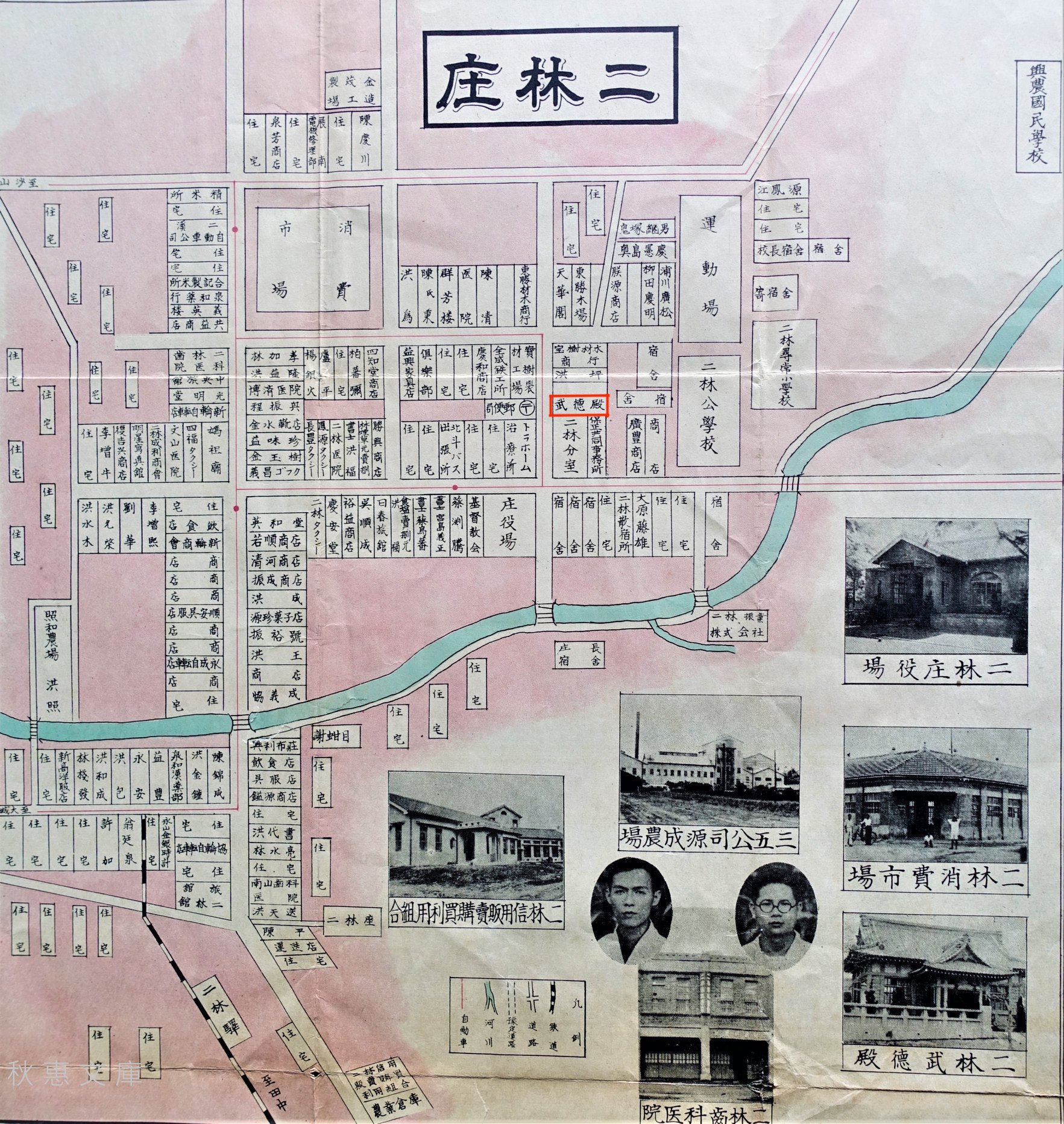
Japanese-era map of Erlin with the location of the Martial Arts Hall marked in red.

Much of Erlin’s urban development started during this period with the colonial government constructing a number of large administrative buildings, schools, hospitals and clinics, and modern markets within the ever-expanding downtown core of the town. In 1928, construction started on the Erlin Police Precinct (北斗郡警察課二林分室), located within the administrative district of the town, close to Erlin Public School (二林公校).

Located on a corner that shared an intersection with a hospital, the town hall and a long row of administrative housing, the police precinct would have been situated within what would have been considered the ‘Japanese’ area of town, with some separation from the local farming community.

In 1900 (明治33年), a few years after the Japanese took control of Taiwan, the first Martial Arts Halls on the island started being constructed, with the first branches in Taipei, Taichung and Tainan. Over the years, the ‘Taiwan Butokuden Branch of the Dai Nippon Butoku Kai’ (大日本武德會臺灣支部) slowly expanded across the island, but one of the key developments with regard to these buildings came in 1920 (大正9年), when the organization was given a directive (and more importantly funding) from the government to start construction on these buildings within each of Taiwan’s prefectures towns, villages and boroughs.

This resulted in the construction of about two hundred of them across the island (and in Penghu, too) between the 1920 and the early 1940s.

Of those two-hundred halls, thirty were constructed within Taichu Prefecture (臺中州), an area that spanned modern day Taichung City (臺中市) Changhua County (彰化縣) and Nantou County (南投縣). They consisted of two Prefectural Branches (支部), eleven town branches (支所), twelve borough branches (分會), two prison branches (刑務所) and three school branches (學校分會).

That being said, the area we know today as ‘Changhua County’ was only home to five branches: Lugang Martial Arts Hall (鹿港武德殿), Changhua Martial Arts Hall (彰化武德殿), Yuanlin Martial Arts Hall (員林武德殿), Beidou Martial Arts Hall (北斗武德殿) and Erlin Martial Arts Hall (二林武德殿). With the exception of the Martial Arts Hall in Lugang, which was constructed in 1911 (明治44年), the rest were constructed between 1930 (昭和5年) and 1933 (昭和8年).

However, one of the important things to remember is that even though a number of Martial Arts Halls were constructed across Taiwan during the early 1930s, not all of them were equal. As I noted above, the halls adhered to a hierarchical organizational structure which helped to determine their size, depending on their location and their function.

The Changhua Martial Arts Hall, for example was classified as a ‘city-level’ hall as it was constructed within Shoka (Changhua City / 彰化市 / しょうかし). A bit lower on the ladder would have been the Yuanlin and Beidou Halls, both of which were county-level (郡市級 / 支所), while the Erlin Martial Arts Hall would have found itself at the lowest level as a village-level branch (街庄級 / 分會).

Not only did these classifications help to determine the size of the buildings, but also the amount of money that would have been invested in their construction. According to historic records, the Changhua Martial Arts Hall was afforded a budget of ¥27,000, while the Erlin Martial Arts Hall had a budget of ¥7500. If we were to calculate these figures in the rates of the day, the construction costs would would be approximately ¥40.2 million ($290,000 US), and ¥11.1 million  ($80,000 US) respectively.

Note: Calculating pre-war Japanese currency against today’s standards is somewhat of a difficult process given that most records only date back to the restructuring of the Japanese economy and inflation in the post-war period. To calculate the number above, I used the following formula: In 1901, corporate goods price index was 0.469 where it is currently 698.6, meaning that one yen in then is worth 1490 yen now. (217,000 x 1490 = 323,330,000)

Link: 昔の「1円」は今のいくら?1円から見る貨幣価値·今昔物語

Suffice to say, with a considerable amount of economic development taking place within Erlin in the early 1930s, the construction of the town’s Martial Arts Hall was a no-brainer for the local authorities. Construction on the building started in 1932 (昭和7年), at a time when the neighboring police precinct was still under construction.  Located to the side of the police station, and close to the Erlin Public School, the hall, like many of its contemporaries was tactically located in a neighborhood where it could have the most effect. The building would serve as a training centre for the local police as well as providing instruction to the children as well.

Interestingly, despite both buildings being constructed almost simultaneously, the police station took a modernist approach to its architecture with an Art-Deco Baroque design. The Martial Arts Hall however, was a no-fuss traditional Japanese style building - and even though it is the smallest of all of the Martial Arts Halls that remains in Taiwan today, its architectural beauty is on par with the rest of them.

On August 4th, 1933 (昭和8年), the Jirin Budokuden (二林武德殿 / じりんぶとくでん), otherwise known as the ‘Erlin Martial Arts Hall’, officially opened for the instruction of Judo (柔道) and Kendo (劍道).

Initially the hall served as a space for the local police to hone their martial arts skills. However, as the Japanese became engaged in the Pacific War and the expansion of their empire, the colonial government in Taiwan instituted a policy of forced assimilation, known as kominka (皇民化運動), which forced the people of Taiwan to take Japanese names, speak only Japanese, and contribute to the empire through military service.

Taking effect in 1938 (昭和13年), the nearly two-hundred Martial Arts Halls across Taiwan played a major role in the assimilation process by promoting ‘Japanese Spirit’ (大和魂), ‘Martial Arts Spirit’ (尚武的精神) and ‘Patriotism’ (愛國的精神) and from then on, the scope of the instructors at the Martial Arts Hall expanded from simply training the police to providing classes to the general public and the nearby Public School as well. They were also tasked with planning speaking events that were meant to promote nationalist sentiment through the propaganda that was disseminated by the colonial government.

Nevertheless, the Second World War came to a conclusion less than a decade later, and as part of their surrender, the Japanese were forced to give up control of Taiwan (and any other territory gained through militarism).

Control of Taiwan was ambiguously awarded to the Republic of China, who sent a governor and military forces to Taiwan in 1945 (昭和20年) in order to set up shop. However, even though the Second World War had come to an end, the Chinese Civil War between the Nationalists and the Communists raged on. It was during this time that administrative control of Taiwan had become an authoritarian mess, resulting in an infamous event that would become known as the 228 Incident (二二八件事).

With the Communists establishing the People’s Republic of China in 1949, President Chiang Kai-Shek (蔣介石) was forced to flee to Taiwan with the remnants of his army, and anyone still loyal to the Republic of China.

The sudden influx of around two million foreign refugees created a housing crisis in Taiwan, and even though the Japanese had left all of their infrastructure intact, the first few years were a nightmare of governance.

Nevertheless, for the next half century, the Erlin Martial Arts Hall maintained its role as a Martial Arts training center with the Republic of China’s police taking over.

One of the areas that wasn’t entirely clear with regard to my research about the Martial Arts Hall is what happened when the Erlin Police Precinct was expanded in the early 1970s. What is clear is that when the expansion project took place, the lack of space in front of the hall caused some issues, so they ended up removing the ‘hafu porch’ that lead to the front door of the hall.

Digging a bit deeper, I discovered that the police station essentially expanded into an ‘L-shaped’ structure that completely blocked the Martial Arts Hall from view.

Even though the Martial Arts Hall remained as a training center for the police, it had essentially disappeared from the view of the general public for the next few decades after the expansion.

By 1999 (民國88年), the buildings utilized by the police in town were being reconstructed, so for a short time time, the Martial Arts Hall was used as an office space prior to their migration to a new building.

With the buildings that surrounded the Martial Arts Hall abandoned, it took a few years before the were demolished, thankfully, with careful consideration taken to preserve the condition of the hall, which had been recognized as a protected heritage property a few years earlier.

After being hidden from sight for almost four decades, the Martial Arts finally made its reappearance in 2008 (民國97年), but as mentioned earlier, its status remains a contentious one as it is a protected heritage property that just so happens to sit on land that is considered part private and part public.

This has understandably frustrated all of the parties involved, and is the main reason why the hall has yet to be restored, like so many of its contemporaries across the country. While I may be accused of a bit of bias on the subject, it really does come across as a missed opportunity for Erlin as the town has recently restored several other historic Japanese-era properties in the downtown area in addition to the promotion of its links to the historic sugar railway. These days there is more and more for tourists to see when the visit the area, so one would hope that at some point there will be a favorable solution to this stalemate.

Before I move onto the architectural design of the Martial Arts, I’m going to provide a brief timeline of events detailing the history of the hall.

Erlin Martial Arts Hall Timeline

  • 1895 (明治28年) - The Japanese Colonial Era begins in Taiwan and the ‘Dai Nippon Butoku Kai was formed in Japan in order to instruct ordinary citizens in the various Japanese Martial Arts disciplines.

  • 1900 (明治33年) - The first Martial Arts Halls start to appear in Taiwan with branches in Taipei, Taichung and Tainan.

  • 1920 (大正9年) - A governmental directive is made to construct Martial Arts Halls in each of Taiwan’s prefectures, towns, villages and boroughs.

  • 1920 (大正9年) - Due to the Colonial Government’s administrative redistricting plan, Erlin is upgraded into Jirin Town (二林街 / じりんがい), part of Hokuto County (北斗郡 / ほくとぐん) in Taichu Prefecture (臺中州 / たいちゅうしゅう).

  • 1928 (昭和3年) - Construction on the Erlin Police Precinct (北斗郡警察課二林分室) officially starts with a budget of ¥17,000.

  • 1932 (昭和7年) - Construction on the Erlin Martial Arts Hall with a budget of ¥7500 and is located next door to the police station.

  • 1933 (昭和8年) - Construction on the hall is completed in July and the munafuda (棟札 / むなふだ) raising ceremony is held a month later on August 4th, marking the opening of the hall.

  • 1936 (昭和11年) - The Colonial Government’s “Japanization” or ‘forced assimilation’ Kominka (皇民化運動) policy comes into effect in Taiwan.

  • 1938 (昭和13年) - Jirin Public School’s Auditorium (二林公學校禮堂) is constructed and a number of ‘kominka’ events take place within, including Judo classes provided by the instructors from the Martial Arts Hall for the students of the school.

  • 1945 (昭和20年) - The Second World War comes to a conclusion and Japan is forced to surrender control of Taiwan.

  • 1949 (民國38年) - Chiang Kai-Shek and the government retreat to Taiwan and bring with them several million refugees displaced by the Chinese Civil War.

  • 1972 (民國61年) - Due to the reconstruction of the Erlin Police Precinct, and a lack of space caused by a number of buildings constructed around the perimeter of the Martial Arts Hall, the traditional front porch in the front of the building is removed.

  • 1976 (民國65年) - The ceiling within the building is reconstructed and modern lighting is installed within the interior.

  • 1999 (民國88年) - Due to a lack of office space within the Erlin Police Precinct, the Martial Arts Hall starts being used as an administrative space for the local police.

  • 2004 (民國93年) - The Martial Arts Hall is officially recognized as a Changhua County Protected Heritage Site (彰化縣歷史建築)

  • 2007 (民國96年) - All of the buildings that were constructed around the Martial Arts Hall are carefully demolished, allowing the hall to be viewed by the general public for the first time in decades.

  • 2023 (民國112年) - Restoration of the building is set to get underway with public funds allocated for the creation of a culture park with a focus on the Martial Arts Hall.

Architectural Design

Over the year or two, I’ve written about two of Taiwan’s other smaller Martial Arts Halls, the Taichung Martial Arts Hall (臺中刑務所演武場) and the Hsinchu Prison Martial Arts Hall (新竹少年刑務所演武場), which share a number of similarities with this hall with regard to its architectural design. Each of the three buildings were constructed in the early 1930s, and although two of them were used as extensions of the Japanese-era prison system, in a lot of ways the other two restored halls offer a glimpse into how the Erlin Martial Arts Hall might appear when it is restored. So, today I’ll start by describing their similarities and end with their subtle differences.

One of the defining characteristics of the early Showa-era, the architectural design of these Martial Arts Hall was at heart, traditionally Japanese, but there were also considered east-west fusion-style buildings (和洋混合風格). Constructed with a mixture of brick, wood and reinforced concrete, the hall was constructed during a period of the colonial era where the colonial government had learned through trial and error that any building constructed in Taiwan would have to be able to withstand earthquakes, typhoons and termites. This approach led to traditional Japanese-style buildings having to adapt to a bit of modernity in order to ensure their longevity.

Nevertheless, keeping with tradition, the hall was designed using the irimoya-zukuri (入母屋造 / いりもやづくり) style of architectural design. I’m sure not a lot of you are very familiar with the term, so what that means is that the design features a variation of the ‘hip-and-gable’ roof. Similarly, the base of the building, known as the ‘moya’ (母屋) was constructed in a way that even though it is much smaller than the roof, it is easily able to support its massive weight.

Suffice to say, if you’ve ever seen a Japanese building with a roof that eclipses the size of the base by quite a bit, it’s very likely designed in the irimoya-style, or at least in one of its variations.

Similar to the two buildings mentioned above, the exterior of the building consists of washed stone, giving each of them their beige-like color. Likewise, given that these halls required bouncy floors, it was constructed with elevated footings that featured an intricate system of springs below the floor (彈簧地板), which allowed it to better absorb the shock of people constantly being thrown around while practicing Judo.

The original network of springs installed beneath the floor of the building.

The elevated base featured a number of covered ventilation holes, which would have allowed people to climb under to repair any broken springs, while also keeping animals and termites out.

Despite being considerably smaller than the two halls mentioned above, another one of their design similarities is that the mixture of brick and reinforced concrete allowed for a number of large wooden-panel glass windows on every side of the building.

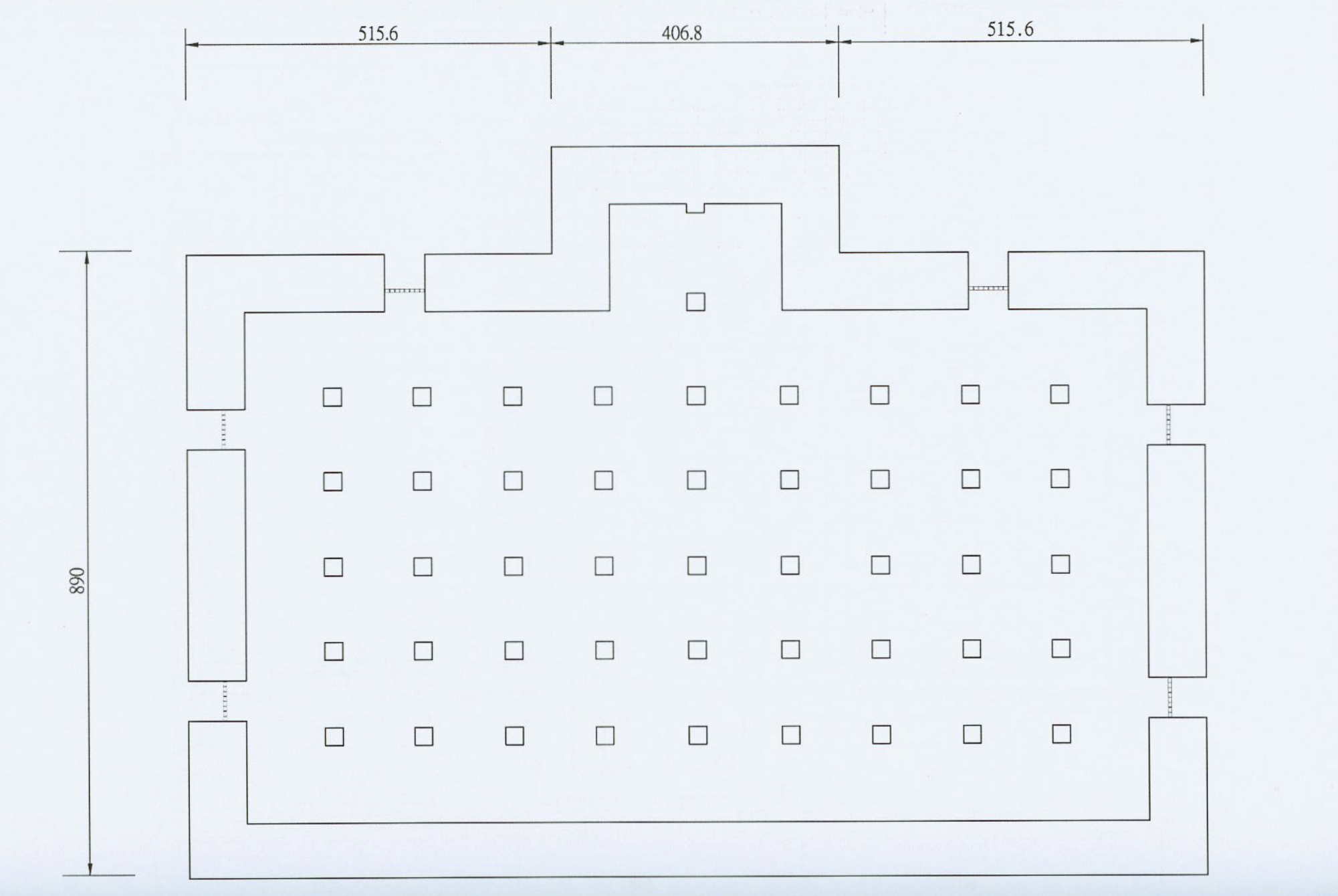
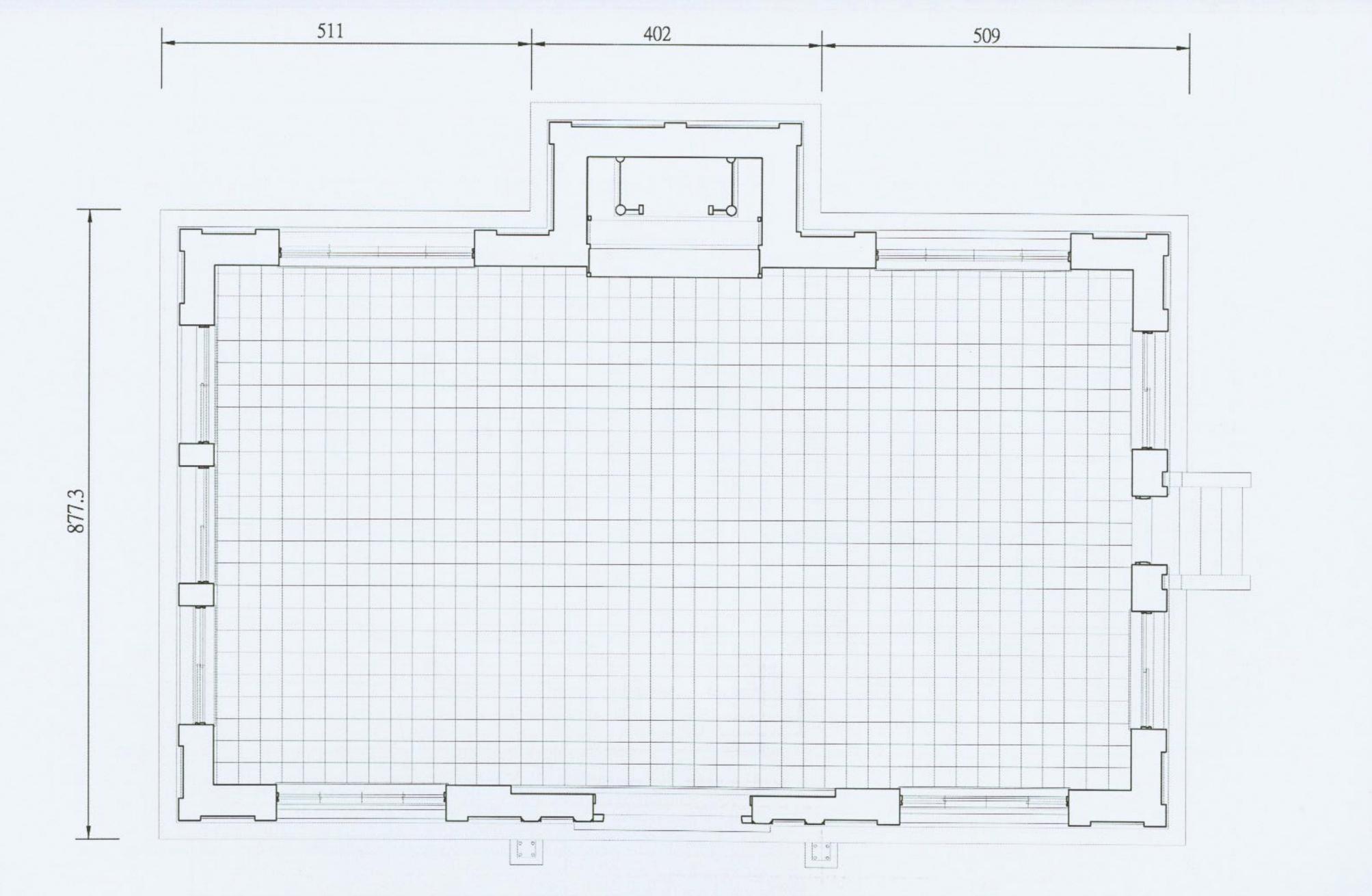
Even though access to the building has been blocked off, blue prints show that its design is essentially the same as every other Martial Arts Hall in Taiwan. The interior space was partitioned into two sides, with the west side reserved for Judo and the east side for Kendo.

Located in the center-rear of the room (directly facing the front door) you would have found a small space reserved for a shrine (神龕), and likely some decorative additions in addition to any trophies or awards won by members of the dojo. 

Interior floor space of the Martial Arts Hall

Now, let’s talk about two of the most important design differences from this hall, and the two mentioned above. Both of which, I’m sure you’ll agree make this one considerably more beautiful than the other two.

First, let’s start out with the piece that’s missing, the front porch. Known in Japan as a ‘kurumayose porch’ (車寄 / くるまよせ) porch, it was essentially a beautifully designed covered-porch that opened up to the front door of the hall. This particular design feature is a popular style of design indicative of Japanese architecture dating back to the Heian Period (平安時代) from 794-1185. While these porches are more commonly associated with Japanese castles, temples, and shrines, its inclusion makes the building stand out a lot more thanks to its addition.

As is the case with this style of porch, it blended in really well with the roof, creating a beautiful 3D-like curvy design. Sadly, as I mentioned earlier, it was removed in 1972 to make way for the construction of a building in front of the hall. On the other hand, we’re actually quite fortunate (compared to the Hsinchu Prison Hall) in that there are both well-preserved blue prints and photos of this hall, which should make reconstructing the porch relatively easy when the time comes.

The most obvious design difference between the Erlin Martial Arts Hall and the other two is with the design of the roof - In this case, the roof is the more traditionally designed and aesthetically-pleasing of the three, giving the building a lot of character. Amazingly, after almost a century, and the demolition of the buildings that surrounded the hall in 2008, the roof remains in pretty good shape.

Expanding on my explanation of irimoya-design earlier, the iconic ‘hip-and-gable roof’ that comes with this design doesn’t necessarily mean that the roof of each building constructed in this style will always appear the same. Introduced to Japan in the sixth century, a number of variations have appeared over the years, making the specific shape of the ‘hip’ and the ‘gable’ important.

Link: Irimoya-zukuri (JAANUS) | East Asian Hip-and-Gable Roof (Wiki)

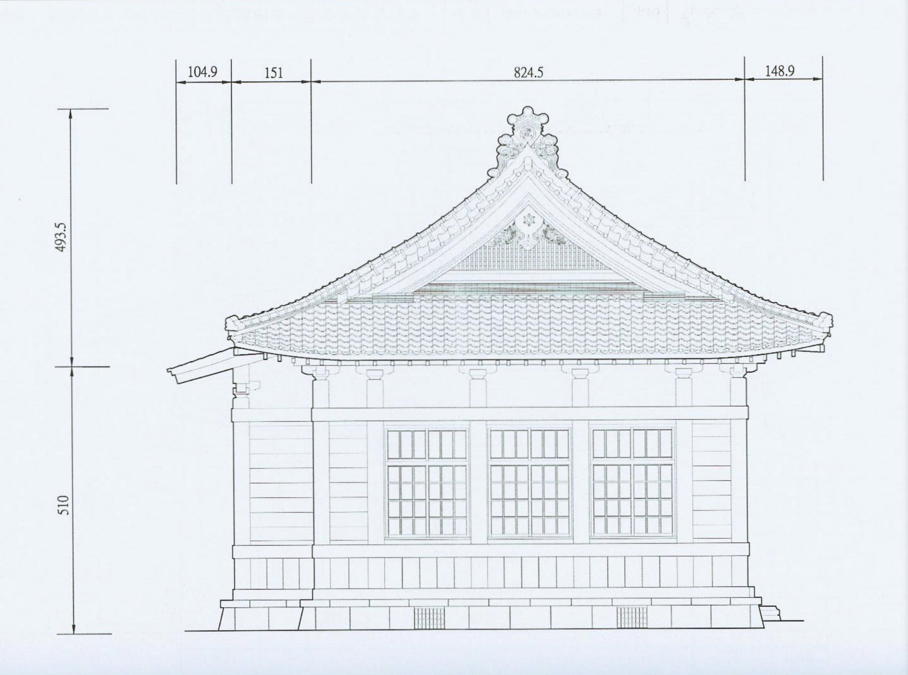
In this case we have a combination of kirizuma-zukuri (切妻造) and yosemune-zukuri (寄棟造), which is essentially a fusion of a ‘two-sided’ upper ‘hip’ section and a four-sided’ lower ‘gable’ section.

Looking directly from the front, the two-sided hip section of the roof, which is designed to look like the Chinese character “入,” or an ‘open book’, rises to its apex, and extends beyond the base of the building at the bottom. Supporting that part of the roof is the four-sided gable section below, which covers the base of the building and is where you’ll find the majority of the roof trusses that help to distribute the weight of the upper section and keep everything stabilized.

The shape of the roof however is not the only complicated part of its design. There are also a number of decorative elements that also play a very functional role. Using a diagram provided below, I’ll explain each of these important pieces and their purpose.

  1. Hiragawara (平瓦 / ひらがわら) - A type of arc-shaped clay roofing tile.

  2. Munagawara (棟瓦 / むながわらあ) - Ridge tiles used to cover the apex of the roof.

  3. Onigawara (鬼瓦 / おにがわら) - Decorative roof tiles found at the ends of a main ridge.

  4. Nokigawara (軒瓦 / のきがわら) - The roof tiles placed along the eaves lines.

  5. Noshigawara (熨斗瓦 / のしがわら) - Thick rectangular tiles located under ridge tiles.

  6. Sodegawara (袖瓦 / そでがわら) - Cylindrical sleeve tiles

  7. Tsuma (妻 / つま) - The triangular-shaped parts of the gable on the roof under the ridge.

  8. Hafu (破風板 / はふいた) - Bargeboards that lay flat against the ridge ends to finish the gable.

Link: 台灣日式建築的屋瓦 (空間母語文化藝術基金會) 

Finally, two of the special features with regard to the roof and its decorative elements are the ‘onigawara’ end tiles, which are beautifully decorated with the Chinese character for ‘budo’ (武), which is a bit of a deviation from tradition, but makes the building more easily identifiable.

Likewise, within the triangular ‘tsuma’ (妻) on the east and west ends of the roof, you’ll find what is known as gegyo (懸魚 / げぎょ), which are simply decorative wooden boards in the shape of a ‘hanging fish’ that are used as charms against fire, similar to porcelain dragons you’ll find on the roofs of Taiwanese temples.

Unfortunately, with the restoration of the building yet to take place, the missing front porch, and the inability to gain access to the interior, it’s difficult to say much else with regard to the buildings architectural and interior design.

I might be beating a dead horse here, but I’m eagerly anticipating visiting the area again in the relatively near future to check out the fully restored building. Fortunately, as I mentioned earlier, the original blueprints and designs for the hall have been well-preserved, and there are also a number of historic photos of both the exterior and interior that will greatly assist the restoration team when the time comes. So I’m very much looking forward to the future of this hall, which should be a bright one!

Getting There


Address: No. 110, Section 5, Douyuan Rd, Erlin Township, Changhua County (彰化縣二林鎮斗苑路五段110號)

GPS: 23.899570, 120.369830

Erlin Village (二林鎮) is located in south-western Changhua County (彰化縣), close to the border with Yunlin County (雲林縣). Considered a relatively rural town, getting there through public transportation certainly won’t be as convenient as it would be for somewhere like Lugang (鹿港).

It is not impossible though, so if you don’t have access to your own method of transportation, you still have some options.

If you have your own method of transportation, I’m not going to spend too much time offering directions here. Simply input the address or the GPS coordinates provided above into your GPS or Google Maps, and you’ll have your route mapped out quite easily for you.

Public Transportation

While getting to Erlin might be a bit confusing for some, one of the best things about taking public transportation to the area is that the local bus station is located directly next door to the Martial Arts Hall.

There are, of course a number of options for getting to the area, but you’re probably going to have to use a combination of train and bus to get there more conveniently. Below, I’ll provide explanations for how to get to Erlin from each of the closest train stations.

Link: Erlin Bus Station Timetable (員林客運)

Changhua Train Station (彰化車站)

From Changhua Train Station you’ll transfer to Yuanlin Bus (員林客運) bus #6713 or #6714. The shuttle bus doesn’t come that frequently, so you’ll want to be mindful of the time when you go.

From Changhua Station you also have the option of taking Changhua Bus #19 (彰化客運) directly to Erlin, but there are only ten departures per day, so, once again, you’ll want to keep track of the schedule, especially when you’re in Erlin so you won’t miss your bus back to wherever you’re headed.

Link: Yuanlin Bus #6713/6714 schedule | Changhua Bus #19 (彰化 - 二林)

Yuanlin Train Station (員林車站)

Located to the south of Changhua Train Station, your next option is to take the train to Yuanlin Train Station (員林車站) and from there taking Yuanlin Bus #6707 to Erlin. There are only a few shuttles every day, though, so this is probably not your best option.

Link: Yuanlin Bus #6707 (員林 - 二林)

Tianzhong Train Station (田中車站)

If you’re traveling north into Changhua, stopping at Tianzhong Train Station (田中車站) is one of your first options for getting to Erlin. From the station you’ll transfer to Yuanlin Bus (員林客運) bus #6709. However, the shuttle bus comes even less frequently than the option above, so you’ll want to be mindful of the time when you go.

Link: Yuanlin Bus #6709 (田中 - 二林)

Changhua High Speed Rail Station (彰化高鐵站)

Despite being named “Changhua” Station, the High Speed Rail station isn’t actually located within Changhua City, it’s located within Tianzhong Village (田中鎮). If you’re coming from a much further distance, the High Speed Rail is a pretty good option for getting to the area, but you’ll have to transfer from the HSR Station to a shuttle bus that takes you Tianzhong Train Station, and then you’ll follow the directions above and take Bus #6709.


Obviously, as it stands right now, I can't really recommend a trip all the way out to Erlin to see the Martial Arts Hall. There are of course a few other interesting tourist destinations in Erlin, but if you find yourself in Changhua, there are probably some better places for you to spend your time.

Hopefully though, at some point the ownership issues will be resolved and the government can start restoring the Hall to its original condition. When that time finally arrives, I'll make another trip down to check it out and will quickly update this article.

References

  1. 二林武德殿 (Wiki)

  2. 臺灣的武德殿 (Wiki)

  3. 二林鎮 | 彰化縣 (Wiki)

  4. 武德會與武德殿 (陳信安)

  5. 二林武德殿 (國家文化資產網)

  6. 彰化-二林 武德殿 (Just a Balcony)

  7. 二林武德殿:日本武士精神的遺跡 (京築居)

  8. 失而复得的大唐建筑-台湾武德殿 (Willie Chen)

  9. 台灣武德殿發展之研究 (黃馨慧)

  10. 武德殿研究成果報告 (高雄市政府文化局)

  11. 二林武德殿調查研究暨修復計畫 (黃俊銘 / 中原大學)