Travel

Qixing Mountain (七星山)

When people think of Taiwan’s capital city, Taipei, they often think of a modern metropolis with Taipei 101 dominating the skyline and showcasing the economic might of the country. What few realize however is that the city is almost completely surrounded by mountains and nature. This mixture of the ultra-modern with the natural environment is something that a lot of cities around the world would love to have access to, but here in Taipei, its just a part of every day life as the city is and has always been defined by its mountains. 

Most tourists who visit Taiwan are already aware of mountains like Elephant Mountain or some of the others on the Four Beasts Trail, but when we actually talk about the mountains the ‘define’ the city, you don’t have to look any further than those found within Yangmingshan National Park (陽明山國家公園).

 The reason for this is because Yangmingshan National Park is home to twenty or more volcanoes in the Datun Volcano Group (大屯火山群) which have over the past two million years erupted and helped to form much of the landscape of the Greater Taipei region. 

You’ll be relieved to know though that even though there is still some thermal activity taking place in the area, most of those volcanoes have since gone dormant and don’t appear to pose any danger. The post-volcanic activity however is something that we can all enjoy the area is now home to a large collection of natural hot springs and fumaroles which have been harnessed and converted into public baths. 

Despite their historic significance, it’s likely that most residents of Taipei would have a hard time telling you the names of any of the mountains in the Datun Volcano Group with the exception of Qixing Mountain (七星山).

This is because Qixing Mountain, which is often translated (quite literally) as “Seven Star Mountain” (I won’t be using this name here) is not only the highest mountain of the group, it is also the highest peak in the whole of Taipei.

And because it has become a popular local tourist attraction for hikers, bird watchers, photographers and nature lovers! 

The mountain, which at its highest stands at 1,120 metres (3,675 ft) above sea level gets its name from an event that took place more than 700,000 years ago when it last erupted and not from anything that has to do with ‘stars’ as the English name might suggest. It name is derived from what happened post-eruption when the crater at the peak eroded and after many thousands of years created seven separate peaks on the mountain.

Today the volcano lies dormant, but the steaming fumaroles that surround it (and often cover the mountain in a layer of mist) speak to its long history of geothermal activity. 

Prior to the arrival of the Chinese Nationalists, the area we refer to as “Yangmingshan” was simply referred to as “Grass Mountain” (草山). In 1950, President Chiang Kai-Shek decided to rename the area in commemoration of Ming Dynasty (明朝) scholar Wang Yangming (王陽明) and plans were made to create a national park to preserve the natural environment. 

In the years since the creation of the Yangmingshan National Park, the area has been developed for tourism and outdoor recreation and has become a popular place year-round for hiking, cherry blossom and flower viewing, bathing in hot springs, etc.

More important with respect to this blog post is that the local government has constructed a large network of hiking trails within the National Park area and you can rest assured that the city’s highest peak, Qixing Mountain is well-serviced by these trails. Visitors to the area are provided (free of charge) several well-developed trails where you’ll be able to safely hike to the peak. You’ll also find several rest stops along the way where you can have a seat and enjoy the scenery. 

Taipei has quite a few mountains but most people would agree that hiking Qixing Mountain is probably one of those things that every resident of Taipei should do at least once in their life. If you’re a tourist visiting the country, it is also highly recommended that you take some time to enjoy some of the best scenery Taipei has to offer. 

The problem for a lot of tourists though is that there isn’t really much useful information about hiking the mountain and what little is available rarely ever gives a complete picture of how to get there, how long its going to take you or any of the other pertinent information that you’re going to need to complete the hike. 

I hope that this guide helps out with that and answers any and all of the questions you might have. 

Hiking Qixing Mountain

So you’re probably here because you’ve decided to hike Qixing Mountain and you have a few questions. Usually those questions are: “How do I get there?”. “Where do I start?”, “How long will it take?”, “Where do I finish?” and “What will I need?

I’m going to try to answer all of those questions for you here. 

Where do you start and where do you finish? 

There are three different trailheads for this mountain - One that starts a short walk from the Yangmingshan Bus Terminal and two others that are much further away (and will likely require taking a shuttle bus to get to). 

You may be thinking to yourself that the closest trailhead is probably the best, but as you might expect, the trail is much longer and you’ll end up missing out on a lot of the great vantage points for scenery that you get on the other trails. The other two trailheads start at ‘Xiaoyoukeng’ (小油坑), an area with a giant steaming fumarole and ‘Lengshuikeng’ (冷水坑), another popular spot where you’ll find some public hot spring baths. 

When it comes to where you expect to finish the hike, once again, it depends on where you start and how much you plan on hiking - If you start your hike at Lengshuikeng for example, you can hike to the peak and then have the option of either heading back the way you came or making your way toward ‘Xiaoyoukeng’ or ‘Miaopu’ to complete your hike. 

I’ve hiked all three, so if you were ask me, I’d suggest taking the shuttle bus to Lengshuikeng, hiking to the peak and then descending to Xiaoyoukeng, which is considered the ‘full circuit’. Once you’re at the trailhead, you’ll be able to get on the bus much more easily than you would if you started in the opposite direction.

I’ll talk more about the routes a little later.  

How long does it take to complete the hike? 

That really depends on what trailhead you’re starting your hike on, where you plan on finishing and how long you stop to rest or take photos. If I were to give an estimate of the amount of time it would take to complete the hike, I’d probably say that you should be prepared for around three hours, but that includes time to stop as well as for enjoying some time on the peak.

One thing about Qixing Mountain that can be frustrating is the amount of mist that covers the mountain. If you’re hoping to take nice photos of the landscape, you might want to stick around for a little while until the mist clears up. This will add on a bit of time to your hike but it is well worth your time.

What will you need for the hike? 

I recommend wearing a good pair of water-proof hiking boots or sneakers and bringing a wind-breaker / raincoat as it is often windy and damp on the peak. Here is where I’d caution you - even if its a sweltering hot summer day and you plan on doing this hike, you should probably still bring a wind-breaker with you for the hike as the temperature at higher-altitudes (in addition to the strong wind) can be chilly. 

You should also bring some water and snacks, which you can easily purchase at the 7-11 across from the Yangmingshan Bus Terminal. You’re not going to need a bunch of hiking gear for this one as it is essentially a well-developed sidewalk that just so happens to bring you to the top of the mountain.

Just don’t show up in high-heels.  

Yangmingshan’s ‘Flower Seasons’ (陽明山花季)

One thing you’ll want to make a mental note of is that Yangmingshan is home to several annual blooming seasons for different kinds of flowers or blossoms. Flower viewing, or “Hanami” (花見) is an extremely popular activity in Taiwan and is only exacerbated by wannabe Instagram celebrities who travel around the country taking photos of themselves for all the likes on the ‘gram. 

During the various blooming seasons, traffic on Yangmingshan becomes quite unbearable with thousands of people visiting each day. This means that if you plan on hiking the mountain during one of these seasons, you may have to contend with quite a few other visitors which means longer lines for the buses and traffic jams on the road to the mountain.

It also means that you’re driving a car or scooter, you’ll have to be aware that the local government puts traffic control measures in place which limits all but local traffic from the mountain.   

Cherry Blossom Season (櫻花季) - February - April (2月 - 4月)

Calla Lily Season (海芋季) - February - May (2月~5月下旬)

Hydrangea Season (繡球花) - May - June (5月中旬~6月下旬)

Silver Grass Season (芒草季) - October - November (10月-11月)

  • Just for reference, almost all of the photos in this blog post were taken during Silver Grass Season.

The Yangmingshan National Park also holds an annual “Yangmingshan Flower Festival” (陽明山花季) which is generally held for a period of two weeks in mid-February and usually coincides with the Lunar New Year holiday. If you plan on hiking the mountain at this time, good luck!

Trailheads

As I mentioned above, there are three different trailheads for hiking Qixing Mountain for you to choose from, each of which comes with some pros and cons. I’m going to introduce each of the them below and try to give you a better idea of what to expect. 

Xiaoyoukeng - Qixing Main Peak (小油坑 - 七星山主峰) 1.6km 

If you’re taking the bus, the first trailhead you’re going to reach is the one that starts directly next to the ‘Xiaoyoukeng’ bus stop, which is situated next to the ‘Xiaoyoukeng Visitor Centre’ (小油坑旅遊服務站). As you approach the stop you’re likely to notice quite a bit of mist in the air - this is because ‘Xiaoyoukeng’ is actually a giant steaming fumarole in the side of the mountain.

If you’re getting off the bus here, I’d recommend taking a few minutes to go check out the fumarole viewing area, which is a short distance away from the trailhead.  

The Xiaoyoukeng portion of the trail has the added bonus of being able to walk past much smaller steaming fumaroles throughout the hike, which makes this something you won’t want to miss. The thing is though, you need to be really careful not to get too close to them and pay attention to the warning signs.

I completely understand that your brain might be telling you that you should touch one of the steaming rocks to see if they’re really hot, but believe me, they are.

You don’t want to burn yourself and ruin your day, so enjoy their geothermal beauty while staying safe. 

One of the reasons I like this trail so much is that as you hike to the top the environment changes and when it does, so do the varieties of trees and plants that you encounter along the trail.

You’re also likely to run into a completely ambivalent local species of partridge feeding along the trail.

The trail from Xiaoyoukeng to the peak of Qixing Mountain is by far the shortest of all the trails, but that doesn’t necessarily mean that it is a good thing. The trail is actually a lot more steeper than the other two trails, so if you hike to the peak on this trailhead, you’re likely to get a bit more of a work out.

Whether that is a pro or a con is up to you - What I will say though is that the trail is often shrouded in mist from the fumarole and even though there are places to stop and check out the view, you’ll have to be pretty lucky to be able to see much of anything. 

If hiking directly the peak is your thing though, this trail is probably your quickest, no-nonsense route. 

Lengshuikeng - Qixing Main Peak (冷水坑 - 七星山主峰) 2.1km

‘Lengshuikeng’, despite its literal name “Cold Water Valley” (冷水坑), is home to popular hot spring baths where you can bathe in the public pools at a high elevation. Even though the baths tend to be quite popular on weekends, they aren’t nearly as busy as what you’d find in Beitou, so the people who visit get to enjoy their time in relative seclusion.

And the general embarrassment of a public bath. 

The area is home to not only the hot springs and the trailhead for Qixing Mountain but also a historic suspension bridge, Milk Lake (牛奶湖), a waterfall and a path that brings you to the popular Qingtiangang Recreation Area (擎天崗).

For the purpose of this blog though, the important thing is that the area is home to the trailhead for Qixing Mountain (of which there are more than one), a bus stop, a large parking lot for cars and scooters and a visitors centre with (rather nice) public washrooms. 

The main trailhead is conveniently located directly across from the parking lot and is easy to find as it is marked by not only a trailhead marker, but also has large sign with a map of the trail and some information about the hike. 

The hike on this trail starts out rather steep, but after a few minutes of hiking you’ll reach a point where the incline is much more comfortable and you’ll be able to enjoy the amazing views behind you. When you’re about halfway up the hill, you’ll reach a large Chinese-style pavilion where you can rest or take photos.

A short distance from there you’ll find the Qixing Mountain Park (七星山公園) in one direction and the ‘Meng Huan’ Lake (夢幻湖) in the other. The lake is quite beautiful, so you might want to take a detour for a few minutes to check it out.

The park likewise is a popular spot for taking night photos of the Taipei cityscape, so if you plan on sticking around to take photos, this spot is probably a good place to park your tripod.

Once you pass this area, the incline once again becomes a bit steep and after a bit of time you’ll reach the Eastern Peak (七星山東峰) where you can stop for a break.

Once there though, you’re only about 10-20 minutes away from the Main Peak (七星山主峰). 

If you’re looking for recommendations, I’d highly recommend you start your hike at ‘Lengshuikeng’.

This might mean taking the bus much further, but it also means that you’ll get to enjoy some really beautiful scenery with an ample amount of spots to stop and take some really pretty photos.

Likewise, if you aren’t planning on backtracking, it would be much easier to complete the ‘full circuit’ hike (which I’ll talk about below) so that you can enjoy both sides and easily hop on the bus at ‘Xiaoyoukeng’ when you’re done.

Miaopu Trail - Qixing Main Peak (苗圃登山口 - 七星主峰) 2.4km

For most tourists, it seems like the most commonly taken route for hiking Qixing Mountain is to start the hike at the Miaopu Trailhead (苗圃登山口). The trail is a short distance from the Yangmingshan Bus Terminal and situated directly next to the Yangmingshan National Park Visitor Centre (陽明山國家公園遊客中心).

This means that if you start your hike from this route, you eliminate the need to take the shuttle bus from the bus terminal to the other trailheads and you won’t have to wait for the shuttle bus when you complete the hike. 

Sounds great, right?  

It should go without saying that if you take this route to the peak and back down, that you’re going to be hiking for a distance of around five kilometres - which is a much longer than the other trails.

You’re also going to miss out on some of the best vantage points with regard to scenery as well as missing the steaming fumaroles at ‘Xiaoyoukeng’ and the hot spring bath area at ‘Lengshuikeng’ as this trail more or less creates a “T” between the other trails. 

The great thing about this route is that for most of the hike, you are protected under the cover of trees, so if it is an excruciatingly hot day, or if it is raining, you’ll be able to complete most of the hike with a bit of protection from the elements.

This trail though is most popular with foreign tourists (as a lot of people don’t know how to get to the other trailheads) so you’re likely to come across quite a bit of tourists along the trail.

If you’re not new to Taiwan and you’ve hiked the mountain before, I’d say that this route is probably a pretty good one if you just want to hike to the peak without the fuss of dealing with buses, traffic or any of the scenic photo spots on the other trails. For me though, hiking a mountain is never a race to the top and I would hate to go all the way to Yangmingshan and miss out on the opportunity for taking photos. 

Qixing Mountain Circuit (小油坑 - 冷水坑) 3.7km

While some people might prefer hiking to the peak of the mountain from one of the trailheads and then heading back the way they came, I’d actually suggest that you instead complete the entire hike from one side to the other rather than backtracking.

If completing the entire hike sounds better to you, take it from me, you should hop on the shuttle bus from the Yangmingshan Bus Terminal and take it all the way to the ‘Lengshuikeng’ bus stop.

From there you’ll hike to the peak of the mountain and once you’re done you can complete your hike by heading down the mountain toward ‘Xiaoyoukeng’. 

The reason why I suggest taking this route is because it is considerably easier getting on the bus at ‘Xiaoyoukeng’ than it is at ‘Lengshuikeng’ which often has long lines.

I also don’t mention the Miaopu trailhead here because that specific trail takes you up the mountain in a different direction and means that you’ll miss out on some of the best scenery.  

I know, it might seem like completing the full circuit sounds longer in terms of the amount of time and the distance you’ll travel, but if you do the math, it is more or less going to be the same and you’ll get to experience the mountain from both sides.

So completing the entire circuit is probably your best option and is what I recommend. 

Getting There

Map of routes for hiking Taipei's Highest Peak, Qixing Mountain (七星山). www.goteamjosh.com/

Hiking Qixing Mountain might be a challenge for some, but getting there is a challenge for almost everyone.

The thing about hiking Qixing Mountain is that you first have to deal with the notoriously horrid traffic on Yangming Mountain - Whether it’s going up the mountain or heading down after your hike, you’re unfortunately going to get stuck in traffic. This is part of the reason why I don’t hike the mountain as often as I’d like.

So, let’s discuss some of the best ways to get to the mountain. 

The first thing you’re going to have to decide is what your hike is going to entail - Are you going to hike the full circuit? Or are you going to hike from one of the trailheads to the peak and then leave the way you came? These are important questions to ask yourself, because it is going to dictate the method by which you get yourself to the trailhead. 

If you live in Taipei and own a scooter, or have rented one for the duration of your visit, you can easily ride your scooter up Yangming Mountain to either one of the trailheads, park it and then be on your way. The thing is though, if you park it at one of the trailheads, you’re going to have to come back down the way you came, which means that you’ll probably not be able to hike the whole trail.

There is of course the possibility of hiking the full trail and then when when you arrive at the trailhead taking a bus to where you parked your scooter, but that might end up forcing you to wait quite a while. 

Likewise, if you have a car, you could drive to either Xiaoyoukeng (小油坑) or Lengshuikeng (冷水坑) and park in one of the public parking spots. The thing about this option though is that the standard Taipei parking fees apply, so if you park in either of the parking spots for several hours, you’re going to have to pay quite a bit.

You might also think that you could just park along the side of the road and avoid the fees, but I guarantee if you do, your car won’t be there when you finish your hike.

You’re also going to have to deal with terrible traffic jams on the way down as the traffic congestion on the mountain in the late afternoon is terrible.

Scooters are okay, but I’d really caution against driving a car. 

If you’re asking me, I think your best option is to just take public transportation. 

Sure, it might be a bit more of a pain in the ass, but you’ll be happier to not have to deal with all the traffic, you’ll have the option of completing the full hike and it will be a lot cheaper. 

If you’re going to make use of public transportation, you have a number of options: 

  1. Taipei Main Station (台北車站) - Yangmingshan Station (陽明山站) - You can catch Bus #260 at Taipei Main Station’s “North 2” (北二門) exit. The bus will take you to the Yangmingshan bus transfer station where you’ll transfer to Bus #108 which will take you to both trailheads.

  2. Jiantan MRT Station (劍潭捷運站) - Yangmingshan Station (陽明山站) - From the bus terminal just outside of the MRT station take Bus Red #5 (紅5) to the Yangmingshan bus transfer station where you’ll transfer to Bus #108 which will take you to the trailheads. Conveniently, a new route (S15/小15) has been added that takes you directly from Jiantian to Qingtiangang. If you prefer to start the hike from there, this one is pretty convenient

  3. Shipai MRT Station (石牌捷運站) - Yangmingshan Station (陽明山站) - From the bus terminal just outside the MRT station take Bus #8 (小8) to the Yangmingshan bus transfer station where you’ll transfer to Bus #108 which will take you to the trailheads.

  4. Beitou MRT Station (北投捷運站) - Yangmingshan Station (陽明山站) from the bus terminal just outside the MRT station take either Bus #9 (小9) or Bus #230 to the Yangmingshan bus transfer station where you’ll transfer to Bus #108 which will take you to the trailheads.

  5. Donghu MRT Station (東湖捷運站) - Yangmingshan Station (陽明山站) from the bus terminal just outside the MRT station take Bus #681 to the Yangmingshan bus transfer station where you’ll transfer to Bus #108 which will take you to the trailheads.

You’ll probably have noticed that no matter which option you take, you’re going to have to transfer at the Yangmingshan Bus Terminal (陽明山公車站) and then hop on the #108 shuttle bus to whichever trailhead you plan on starting at.

One thing that you’re going to want to keep in mind is that there are two bus #108’s and that if you get on the wrong one, you’re not going to get to any of the trailheads. So, to ensure that you get on the correct bus, make sure you get on Bus #108 (陽明山遊園公車) and not “Bus #108區” which takes you to Erziping (二子坪).

They have adequate signage on the bus that should prevent you from making the mistake, but it’s best to remind you anyway.  

One of the most important things to keep in mind is that Bus #108 runs every 30-40 minutes on weekdays and every 20-30 minutes on weekends between the hours of 7:00am - 5:30pm.

This means that buses tend to be few and far between and if you spend too much time on the mountain, you might get stuck if you come down too late. Make sure to keep track of time and don’t expect that there is going to be room for you on the last bus of the day, especially on weekends when the trails are busier. 

Link: Bus #108 (陽明山遊園公園) Route Map (中文)

Link: Yangmingshan National Park Public Transportation (中文)

You thought I’d forget a picture of the peak?

If you need real time info for the bus stops, check the Taipei eBus website for more information. You may also want to download the “台北等公車” smart phone app which uses GPS to let you map your route more easily.

If you decide to start your hike from the Miaopu Trailhead (苗圃登山口), you won’t have to transfer to Bus #108. You’ll instead just get off the bus at the Yangmingshan Bus Terminal, cross the road and make your way to the Yangmingshan National Park Visitor Centre (陽明山國家公園遊客中心) where you’ll find the trailhead nearby. Fortunately I don’t need to offer too much in terms of directions here as the directions to the visitor centre and the trailhead are very well marked for pedestrian traffic.

If you do decide to drive a scooter or a car, the addresses for both trailheads are below. You can input either the English or the Chinese into Google Maps or your GPS which will map the best route to the parking lots next to to the trailheads. 

  1. Lengshuikeng (冷水坑): No. 170, Lane 101, Jingshan Road, Shilin District, Taipei City (台北市士林區菁山路101巷170號)

  2. Xiaoyoukeng (小油坑): No. 60, Zhuzihu Road, Beitou District, Taipei City. (台北市北投區竹子湖路69號)

As far as hiking goes, even though Qixing Mountain is Taipei’s highest peak, it tends to be one of the easier mountains in the city in terms of difficulty. You’re not going to have much trouble hiking this one, so feel free to bring your family, friends, dogs and cats along with you to enjoy the beautiful scenery and the experience.

As far as the scenery goes, if you’re lucky enough to be blessed with good weather and clear skies, you’re going to be rewarded with spectacular views of the mountainous landscapes as well as the Taipei cityscape on one side and the northern coast on the other.

That being said, weather conditions in the area tend to change quickly and the view is often obscured by the mist created by the thermal activity taking place on the mountain. So, you need to remember that even if you start this hike on a perfectly clear day, you may not end up being able to enjoy the hike as much as you’d like. If you do end up hiking on a day where there is a lot of mist, don’t feel too bad as I think there is a certain beauty on Taiwan’s mountains when they’re covered in mist and clouds.

I tend to look on the bright side and I think that even though the varying conditions on this mountain might disappoint some, it makes for a much more interesting experience. If you’re in Taipei and you have a bit of time, I highly recommend hiking Qixing Mountain as it offers one of the best high-mountain experiences that you’re going to have without traveling south.

If you do climb the mountain, have fun, be safe and be careful of the partridges. 


Kin-Kannonji (金武觀音寺)

Okinawa is known for its beautiful beaches, amazing food and slow pace of life. This just might be why the local people have one of the longest life expectancies in the world. Nicknamed the “Land of the Immortals”, the islands have the highest rate of centenarians in the world.

Even though diet is probably the largest factor, it is also said that the slower pace of life and carefree attitude of the locals, despite all of the adversity that they’ve faced over the past few centuries has certainly contributed. 

Suffice to say, the past couple of centuries have been rather disastrous for the Ryukyan people. Once a powerful kingdom that made its riches from international trade, Okinawa fell under the subjugation of the Satsuma Clan, the Tokugawa Shogunate, the Meiji Empire only later to become one of the most important focal points of the Second World War.

Despite all of this, the people of Okinawa are resilient and are proud to display their culture and all that they’ve been able to accomplish in the decades since the war ended.

Sadly much of what Okinawa lost over the past few centuries has been difficult to completely restore and many of the places that tourists flock to today, including Shuri Castle, Naminoue Shrine, Futenma Shrine, etc. are all recent reconstructions that have allowed the local people to bring back some semblance of normalcy to their lives. 

Even though the Okinawa of today has been completely rebuilt and redeveloped, the fact remains that finding anything that pre-dates 1945 is extremely rare.

The Kin Kannonji Buddhist temple, located in the central area of the island was one of the few buildings lucky enough to survive the war and even though it is a bit of a distance away from the capital, should be one of those destinations on every tourists itinerary.

The temple is located within the small coastal town of Kin (金武町), which is home to Camp Hansen, one of Okinawa’s largest military bases. The town is a bit of weird one that seems almost completely devoid of life during the day, but apparently comes alive at night in order to cater to the American service men and women who live in the area. 

Known as the birthplace of Okinawan “Taco Rice” and for its production of the local Okinawan rice wine “Awamori”, there’s not much else in the area apart from its beautiful Buddhist Temple, which has been designated as a protected cultural relic.

Still though, a trip to Kin is well worth the short drive out of Naha, if only for checking out this historic place of worship which not only includes a Buddhist temple, but also a Shinto Shrine and a beautiful limestone cave. 

Kin-Kannonji (金武觀音寺)

Starting out with its name, “Kin Kannonji” (きんかんのんじ) literally means the ‘Kin Kannon Temple (金武觀音寺), which simply tells us the location of the temple and who is worshipped inside.

In this case, it is the Buddha of Compassion, known in Japan as “Kannon” (觀音). 

If you’re unaware, the ‘Buddha of Compassion’ is referred to by several different names in the many countries of Asia, but is one of the most commonly worshipped Buddhist figures.

Interestingly, even though most people in Asia regard ‘Kannon’ as a goddess-like figure, in Tibet,  the Buddha of Compassion manifests as the “Dalai Lama” who has traditionally been reincarnated as a male and historically has acted as a god king of sorts.

While Kannon most often appears in a female form in Eastern Asia, it is quite common to find statues that appear to be androgynous, leaving the gender of this all-important Buddhist figure somewhat unimportant.

Link: Guanyin (Wiki)

Kannon

The temple was established in the early 16th Century by a famous Japanese monk Shonin Nisshu (日秀上人) whose arrival in Okinawa is the stuff of legends. The most likely explanation is that he set off from Japan to search for the so-called “Pure Land”, a mountain island paradise, which is thought to be where Kannon lives. Unfortunately while on route he was shipwrecked by a typhoon and washed ashore in the Kin area, saved by the local villagers.

Upon his arrival, legends insist that he used his strength with the dharma to perform some miracles that greatly improved the lives of the local citizens (more on that later) which elevated his status in the community and allowed for him to start his missionary work and the construction of the temple. 

Although the actual date of the temple’s initial construction isn’t documented very well, most agree that its history dates back to 1522, which is relatively the same period as when Nisshu arrived in the area.

I suppose you could say that the exact date of the temple’s construction isn’t really all that important though. The original burnt to the ground in the 1930s and the building we see today was a pre-war re-construction.

When you walk down the visiting path, you are met with some standing statues of Amida Buddha, which are likely going to be wearing the popular floral pattern t-shirts that you’ll see everywhere in Okinawa. Once you’ve made it past them, the path opens up to a large tree-covered courtyard with a garden to your left, the cave entrance to your right and the temple directly in front of you. 

Keeping with tradition, the design of the temple is simplistic in nature and is constructed entirely of wooden columns that support a visually impressive curved roof. When it comes to Japanese temple architecture, there really is a tremendous amount of beauty in its simplicity and this temple is a stunning example of that. 

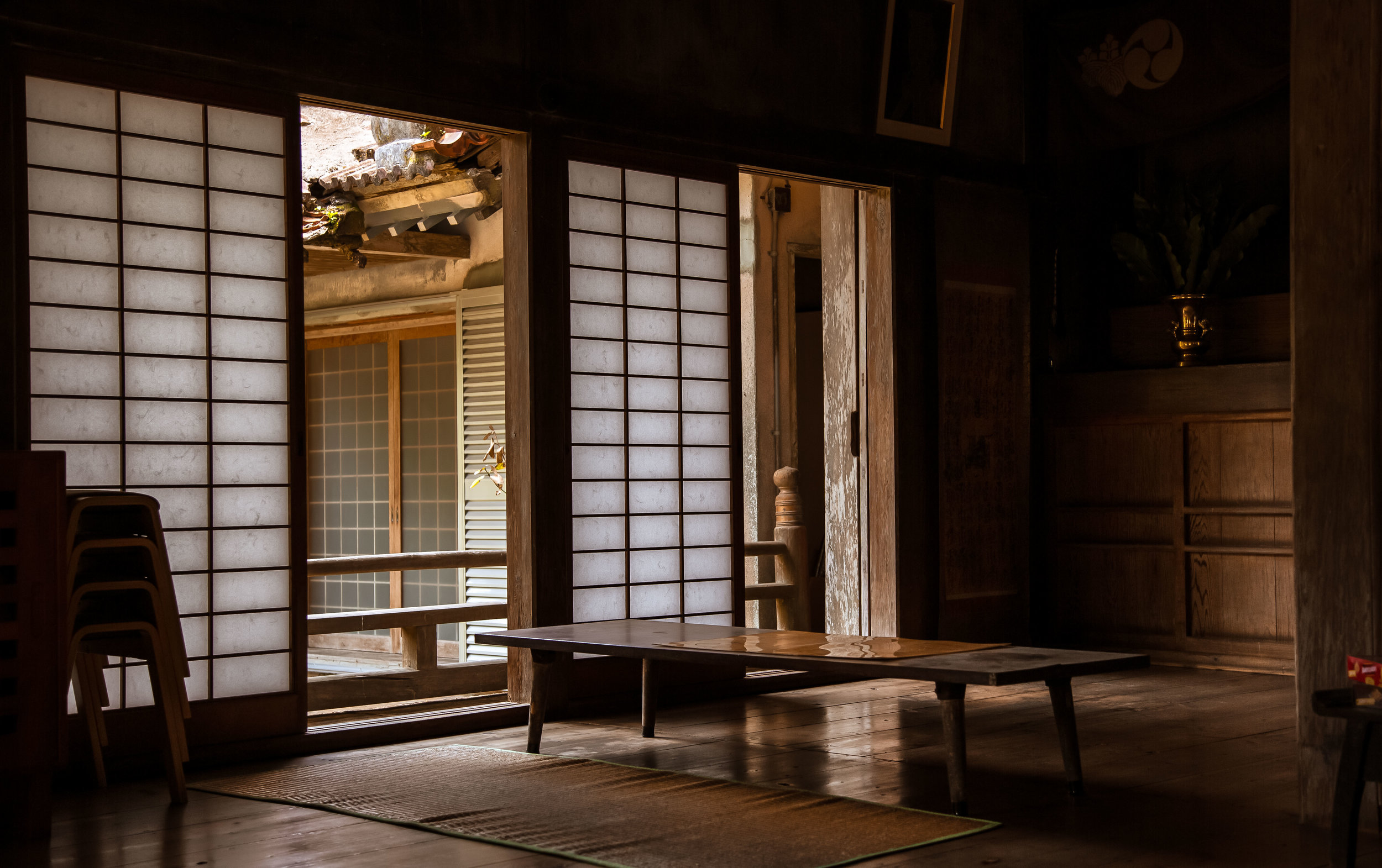
The foundation is elevated above the ground using stone and wooden planks that help to protect the structure from earthquakes. The interior is constructed entirely of local wood and is a large open space with only a few wooden pillars helping to support the roof. There are also sliding doors on all sides that (when moved) change the dynamic of the room and allow for fresh air and light to enter.

In terms of decoration they keep with tradition and take a very minimalistic approach to the design of the room - At the main door you will be met with an incense urn where you can purchase some incense or some lucky charms (based on the honor system) and say a little prayer.

You can’t actually enter the room on your own, but the doors are quite large, so you can get a pretty good view of the interior from the outside.  

You’ll find another altar sitting between two pillars which that opens up to the main shrine where the resident monks do their daily prayers.

The main shrine is a simple set up consisting of a statue of Kannon (觀音) with wood-carved statues of Amida (阿彌陀佛) and Yakushi (藥師佛) on either side.

In front of the shrine you’ll find two stone lanterns which help provide a bit of light in the room, but not really enough to take nice photos of the statues from a distance. 

The most notable aspect of the temple (design-wise) is the ‘Irimoya-zukuri’-style roof (入母屋造) which is the Asian version of a ‘hip-and-gable’ roof - but a hell of a lot cooler.

In this specific style of roof, there is a main section known as the “moya” (母屋) covering the central core of the building, while the hipped portion known as “hisashi” (廂) extends well beyond the interior portion and the outside veranda. 

The amazing thing about this design is that the size of the roof (in comparison to the lower part of the building) means that its weight has to be supported by a complex system of brackets and supporting blocks which expertly distribute weight and ensures that the building is structurally intact. 

While the design of the roof is quite typical for Japanese temple architecture, what sets this temple apart is the usage of native Okinawan red tiles known as “Aka-Gawara” (沖繩赤瓦), which is quite common for construction throughout the Ryukyu islands, but almost non-existent in Japan. The red tiles, which have faded somewhat over the years blend in quite beautifully with the wood that was used to construct the temple and makes the building shine in the sun. 

Next to the temple you’ll find the administration office where you can go to purchase some good luck charms, seek some spiritual advice or just have a friendly chat. The staff that work at the temple are often quite busy maintaining the grounds, but they are really friendly and appreciate visitors, especially tourists who want to learn about the area. 

While touring the grounds it‘s likely that you’re going to notice that the area is covered by a couple of really large trees. These trees are also considered sacred as they date back to the construction of the original temple and are anywhere between 350 - 400 years old. You’ll notice that the trunks have decorations on them and that the area around the tree is well taken care of. It is also quite common to see local visitors taking family photos in front of the trees.

Nisshu Cave (日秀洞) / Kin Shrine (金武宮)

A 270 meters in length and a depth of about 30 meters, the famous cave that sits directly beside the temple is named, “Nisshu Cave” after the monk who founded the temple. Considered to be hallowed space in Okinawa, the cave is highly regarded not only because it is the home of a small Shinto Shrine, but also because it is partly used as a storage area for locally produced Awamori rice wine (泡盛).

One of the main reasons why the cave is considered sacred to the local people however isn’t because of the shrine or the rice wine stored inside - It is thanks to a local legend that serves as the basis for the creation of the shrine and the temple. 

The legend tends to vary a bit but the more realistic story goes a little like this: In 1552, when Buddhist Monk Nisshu (日秀) was attempting to return to Japan after spending years in China on pilgrimage, he was washed ashore in Kin when a typhoon hit. Rescued by the villager, he wanted to show his appreciation, so he set out to vanquish a disorderly bunch of (extremely venomous) Habu snakes that had infested the cave and were blamed for wreaking havoc on the locals. It would take some time, but when he was finally successful in ridding the area of the snakes, he placed some hand-carved images of the Buddha, Yakushi (彌勒佛) and Kannon (觀音) in front of the cave to act as a protective seal.

The more imaginative version of the story on the other hand tells of a single giant Habu snake, which lived in the cave and would slither into town, drink all the water in the well and on its way back home would have its way with local farm animals. When Nisshu appeared he used his supernatural powers and chanted Buddhist sutras at the entrance of the cave which eventually drove the snake away permanently. 

Whichever story you prefer, the origin of the temple is a direct result of whatever happened at the cave back in the 1500s and the safety that the townspeople could finally enjoy was repaid through their gratitude and the construction of the temple.

The cave has a set of stairs that allow you to descend to the cave floor and explore the interior - The further you go down however the darker and damper it gets, so you’re going to want to watch your step. If you have a light on your cellphone, you might want to turn it on so that you can see where you’re going. Once you’ve made it to the bottom of the staircase, the view looking back at the surface is quite beautiful with all the limestone stalactites hanging from the roof of the cave. 

Once you get to the bottom you’ll notice there is a gated cave door that blocks you from walking any further. This dark cavern leads to the Awamori storage area and (unfortunately) isn’t part of the free tour. 

Since 1949, the Kin Tatsu-no-Kura (龍の蔵) company has stored bottles of their locally produced rice wine in the cave for anywhere between five and twelve years. The company offers three daily tours of their section of the cave, which is filled with thousands of bottles of expensive wine.

The rice wine is as a popular local gift with many people electing to buy a bottle of the wine and having it stored at their own cost for well over a decade for special occasions. If you’d like to visit this section of the cave, you’ll have to pay an entrance fee of ¥400 for one of the tours (11am, 2pm, 3:30pm). 

Link: Tatsu-no-Kura (Okinawa Travel Info) 

The Kin Shinto Shrine (きんぐう) is a quaint little shrine located within the Nisshu Cave next to the temple. Despite the fact that it is not a full fledged shrine like Futenma Shrine or Naminoue Shrine, it is considered to be one of the ‘Eight Shrines of Okinawa’ (沖繩八社) meaning that it is still quite important. Enshrined within the hokora (祠) are the three popular deities worshipped as the “Kumano Sanzan” (熊野神) and are also worshipped at most of Okinawa’s other shrines. 

The history of this little shrine doesn’t seem to have been very well recorded, but what I’ve been able to find is that the legend of the monk Nisshu’s arrival in the area dates back to 1552 and the Buddhist Temple outside was established shortly after. It is also thought that this shrine was the first in Okinawa to worship the Kumano deities, so if that were true, it would have to pre-date the Futenma Shrine, which was constructed shortly after the Kin Buddhist temple under the patronage of the same king.

It is important to note that when the temple was constructed in the 16th Century, the relationship between Buddhism and Shintoism was considered to be symbiotic in nature, so when Nisshu arrived in Okinawa, he brought with him his knowledge of Buddhist philosophy, but he is also credited as the person who started ‘Kumano Sanzan’ worship in the Ryukyus. 

Unfortunately during the Meiji Era (明治), the government made Shintoism the state religion and instituted a policy known as “Shinbutsu Bunri” (神仏分離) which forced the separation of Shinto and Buddhism (which was regarded as a foreign influence). This meant that shared spaces within shrines were no longer permitted. 

This policy however had little effect on this temple and the two continued their symbiotic relationship allowing worshippers to visit to pay their respect to Kannon and the Kumano Sanzan as well.

Unfortunately when most tourists descend into the cave, they tend to pay more attention to their beautiful surroundings and easily pass by the small shrine without paying much attention to it. It might be small, but it is one of Okinawa’s most historically significant shrines, so stopping for a minute to check it out and pay your respects is always a good idea. 

Getting There


Address: 222 Kin, Kin Township District, Okinawa (沖縄県金武町金武222)

MAPCODE: 206 140 144

If you’re driving a car to the temple, simply input the Map Code provided above and your GPS will navigate the best route to the temple. The drive is quite simple as you’ll just need to get yourself on the Okinawa Expressway heading north eventually exiting at the Kin IC

From there you’ll follow Route 329 into the downtown area of Kin and will make a left turn when you see signage for the temple. You can park your car in the free parking lot directly opposite the entrance to the temple. 

You’ll want to keep in mind that the expressway in Okinawa requires a toll, so when you get on the highway you’ll have to grab a ticket and you’ll pay when you exit. If you are driving directly from Naha to the Kin Exit, you can expect to pay about ¥600-700 each way. 

Link: Okinawa Expressway Tolls

If you plan on visiting the temple and want to use Okinawa’s public transportation network, getting there is actually quite straight forward. From the Naha Bus Terminal you’ll want to board  Bus #77, which should take about 110 minutes to arrive at the Kin (金武) stop. From there you’ll almost instantly notice a large white road sign that reads: “Kin-Kannonji” which is about a 230 meter walk away from the main road. 

Link: Okinawa Bus Route List

Before heading back, you might want to take some time to walk around the streets and explore the alleys of Kin, which seem to cater exclusively to the US Army stationed at nearby Camp Hansen. The area is full of seedy bars and pubs and during the day most of the town is boarded up with little to no activity which is a bit odd compared to the rest of Okinawa. 

Coincidentally one of the only places in town that is open during the day is Okinawa’s famous “King Tacos” which serves up extremely filling Taco Rice dishes. If you’re hungry and want to get something to eat before heading to your next destination, you may want to consider stopping by and trying out this tasty yet weird Okinawan specialty.  

If you’re heading to Okinawa to spend most of your time on the beach, you’re sure to be delighted as there are over a hundred world class beaches to choose from. If you’re like me however and enjoy taking in a bit of history during your travels, you might end up feeling a bit disappointed.

The sad reality is that there are currently few buildings that pre-date the war, but this little temple was one of the lucky ones that was spared and has been able to withstand the test of time. It is easy to visit Naminoue Shrine or Shuri Castle, but if you want to see something truly historic, you’ll definitely want to make your way out to the small coastal town of Kin to check out its beautiful Buddhist temple


Shen’Ao Elephant Trunk Rock (深奧象鼻岩)

Note: It has been brought to my attention that authorities have recently started condoning off areas in front of Elephant Trunk Rock. This is meant to prevent people from getting too close to the high cliffs or on top of the Elephant Rock itself. This could be a preventative measure but it could also be a permanent one - If your sole purpose of visiting is to get on top of the “head” for a photo, you may want to hold off for a bit.

Shortly after my arrival in Taiwan, my friends and I planned a trip to the offshore Penghu Islands for a national day long-weekend of island hopping. On our second day we hopped on a boat and headed to beautiful Qimei Island (七美島) where we were led around on a scooter tour to see some of the sights. 

I could hardly contain my excitement as we were led to one rock formation after another. 

The first stop was “Little Taiwan” (小台灣), a rock formation that looked like Taiwan. Shortly after that we arrived at the “Waiting Husband Reef” (望夫石), a giant rock that we were told was supposed to look like a woman waiting for her husband to come back from the sea. Finally we were taken to the “Twin Heart Weir” (雙心石滬), a collection of rocks cleverly arranged in the shape of a pair of hearts that was at one time used to catch fish, but today catches more Instagram likes than seafood.

Suffice to say, I was unimpressed. 

I was of the opinion that instead of wasting time checking out boring rock formations, I could have been lying a beautiful beach or learning about the local area and its long and interesting history. 

Even though it was a long time ago, I still remember the day quite clearly as it was the day that cemented my aversion to anything that has to do with Taiwan travel and rock formations.

Its not that there aren’t cool-looking rock formations, I think the Nanya Peculiar Rocks (南雅奇石) are pretty cool, I just have a lack of imagination when it comes to claims that these rocks are taking the shape of anamorphic objects.

But hey, thats just me. To each their own, right? I might not be a fan, but that doesn’t mean you’re not going to find large groups of people filling tour buses to go check this stuff out. 

If you’re interested in knowing where almost all of those ‘rock-formation tour buses’ have been heading recently, its almost always going to be to Shen’Ao (深奧漁港), a small fishing harbor on the northern coast of Taiwan.

Thanks to a bit of Instagram magic, this once off-limits destination has become a hot spot thanks to a rock formation that just so happens to look like an elephants head. 

I’m not afraid to admit that when a hiking trail becomes popular on Instagram, I’ll join in on the action to see what all the fuss is about - When its a rock formation though, I’m going to be stubborn and take my time.

So here we are, after several years of avoiding it, I’m finally writing about the Elephant Trunk Rock.

I might be a bit late to the game here, but this post isn’t for Instagram fame, its for those wanting to visit and not having any idea how to get there.  

Elephant Trunk Rock (象鼻岩)

So, ‘Elephant Trunk Rock’ - What exactly is it? 

I’m not a geologist, so let me try to explain: It is a rock-arch on the top of a high cliff overlooking the ocean that just so happens to look like an elephant with its trunk lowered into the ocean for some water. 

Does it really look like an elephants head? Well, yeah, actually it does. 

And that is why it has become such a popular location for weekend travelers. 

When you visit the area, not only can you take photos of yourself standing in front of the ‘elephant’, but you can also scale up the back of its head and get photos of yourself standing on top, which is Instagram gold. 

The “Elephant Trunk” is officially named the “Shen’Ao Promontory” (深澳岬角) and is part of Fanzi’Ao Mountain (番子澳山) which separates the harbor port and the cape. Once a military-controlled zone, the area only opened to the public around the year 2000.

It would take quite a few more years however for it to become an internet sensation. 

The lower portion of the mountain near the shoreline features rocks that you’ll notice are similar to those that you’ll find at Yehliu (野柳), Peace Island (和平島) and many other areas on Taiwan’s north coast - These rocks, which often appear in the form of honeycombs and other shapes are the result of thousands of years of weathering and erosion.

Link: Yeliu Natural Landscape (Yeliu Geopark) 

Once you’ve finished checking out all the cool rocks and have progressed a bit further up the mountainside you’ll notice that the cape offers great views of the northern coast with Keelung to your left and Ruifang to your right. You’ll also be able to see the popular tourist town Jiufen (九份) in the distance next to Jilong Mountain (雞籠山)

The main attraction however isn’t the beautiful coastal landscape, it is the Elephant Trunk. 

Once you’ve arrived, there are is a long flat area where you’re likely to find a bunch of people taking photos. This area is the best for taking wide angle shots of the rock as well as for taking photos of your friends who are standing on its “head”. 

If you want to get on the “head” area, you’ll have to climb down a small rock area and then walk up a flat incline. If you decide to try to get on the head, be careful when you’re going up and down as you don’t want to slip and fall into the ocean. 

A gentle reminder that you’ll want to be careful when visiting this area - There have been fatal accidents in the past few years with people taking photos. (See link below) 

Link: 夫拍照轉身驚見妻墜海 瑞芳秘境「象鼻岩」傳憾事 (TVBS) 

Even though Elephant Trunk Rock has become a popular photo spot for local Instagrammers, the area was already quite popular with local snorkeling and diving groups for quite some time. The waters at the base of the trunk area feature a tunnel where you can enjoy some spectacular scenery and beautiful coral.

The current in the area is quite strong though, so if you want to try your hand at snorkeling, you should go with friends and be exercise caution. .

Link: Elephant Trunk Rock (Follow Xiaofei)

Before you arrive at the entrance to Elephant Trunk Rock, you’re going to notice signs pointing you in the direction of “Indian Chief Rock” (酋長岩), another rock formation that (if you’re into stereotyping) is supposed to look like the head of an “Indian Chief.”

Let me blow off a bit of steam here. 

Taiwan is a great country, but there are occasions, like this one, where I have to scratch my head at some of the stuff I see - If you take into consideration the persecution that the local indigenous peoples have had to endure over the past few centuries, you would think that a modern Taiwan would be a little more sensitive to this kind of racial stereotyping, especially when it comes to native peoples.

I could be accused of being a bit sensitive here, but if it were only the rock, I might just forget about it. Unfortunately there are also quite a few signs and images in the area that point to North American indigenous peoples being savage war-like killers. Its not cool and is completely unnecessary. 

Needless to say, I won’t be sharing photos of any of that stuff here. 

Getting There


Getting to the Elephant Truck Rock can be a bit of a hassle if you don’t have your own means of transportation. If you’re lucky enough to be traveling with someone who has a car or a scooter though, you shouldn’t have any problem. 

To get there all you have to do is follow the Northern Coastal Highway (北部濱海公路) until you reach Shen’Ao Fishing Harbor (深奧漁港) where you’ll drive in and find a parking lot. If you’re coming from Keelung, you’ll just want to follow the coastal highway until you arrive. If however you’re coming from Taipei, the fastest way to arrive would be to take Highway Number One and then switch to the #62 Expressway that will take you all the way to the coast. Once you reach the end of the highway, you’ll just have to make a left turn and the harbor is a few minutes from there. 

Once you’ve arrived at the harbor, drive your car all the way down the narrow road until you reach a newly constructed (paid) parking-lot where you’ll have quick access to the trail that leads to the Elephant Trunk Rock. 

If on the other hand you’re relying on public transportation to get there, you’re going to have a bit more of a difficult commute. It shouldn’t be that difficult, but you’re going to have to take a train or a bus, and then walk. 

The first thing you’ll want to do is either take a train (or a bus) to Keelung Station (基隆車站) where you’ll then transfer to a bus that will take you along the beautiful coastal highway. 

You have the option of taking either bus #791 or #1051 from the train station to the Shen’Ao bus stop. From there you’ll simply walk through the fishery harbour until you reach the entrance to where you’ll find the Elephant Trunk. 

Link: Bus Schedule - Bus #791 / Bus #1051

You could likewise take the Pingxi - Shen’Ao rail line’s (平溪深奧線) tourist sight-seeing train to Badouzi Station (八斗子車站) and from there walk to Shen’Ao harbor, which should only take about 15-20 minutes. If you’re not a fan of walking, you could likewise hop on one of the buses mentioned above which are both served outside the train station. Keep in mind though that you’ll want to get on the bus on the train station side to save yourself from heading back to Keelung. 

A few years back when fellow blogger Alex Kunz visited the area, he noted that getting to the rock was a bit difficult and that the trail was more or less unmarked. The sudden popularity of the area over the past few years however has completely changed all of that. The area is now clearly marked with an excessively large paid parking lot constructed near the entrance. 

Likewise, the trail is quite easy to follow and is well-travelled meaning that you’ll be able to safely walk up with trail and won’t get lost. From the entrance, you can expect around a five minute walk to the viewing area for the rock, but depending on the amount of people visiting, you may have to wait in the narrow sections of the trail.

Jilong Mountain and Jiufen in the distance.

You may have noticed that I’ve been a bit tongue in cheek with this blog post - Its true that I’m not a big fan of rock formations, but I’m willing to admit to you that if you’re looking for a rock formation that actually looks how its advertised, then you’ve come to the right place. There is an uncanny resemblance.

That doesn’t mean I’ve changed my mind about rock formations though, I’m going to continue to avoid them. If you like them though, Taiwan’s northern coast is full of them and you’re going to really enjoy yourself if you take a tour of the area.