Travel

Xinxikou Suspension Bridge (新溪口吊橋)

From the perspective of a foreigner living in Taiwan, I have to say that this country can a be a bit weird when it comes to it’s fads; If you’ve been in the country over the past couple of years, you’re likely to have noticed a sudden obsession with claw machines - almost every city, town and village across the country has been rather annoyingly been overrun with the noisy machines. Similarly, when it comes to food, we’ve gone through periods where you’d find a sudden influx of hamburger, pineapple buns and egg tarts places making a quick buck, before closing up shop and moving onto the next sensation. 

When it comes to tourist destinations, social media trends tend to drive most of the interest in specific locations, but one of the more noticeable tourist fads in recent years has been with the appearance of a bunch of newly constructed suspension bridges in picturesque mountain areas.

I can’t particularly speak to the motivations for building these bridges, or their popularity, but with recent trends in domestic tourism shifting toward getting out and enjoying the natural beauty of the country, you’ll discover that mountain destinations are likely to be packed with weekend tourists, looking for something new to do! 

That being said, some of the suspension bridges that have been making an appearance as of late aren’t actually all that ‘new’. Sure, you’ll find some that have glass floors, constructed with modern engineering techniques, but in a lot of cases they’re just modern replacements for a much older bridge.

Case in point, the bridge I’m going to be introducing today! 

Before I start introducing the bridge, I should take a minute to explain something, especially since this is the second article I’ve published covering a suspension bridge in the mountains of Taoyuan in recent months. 

Link: Yixing Suspension Bridge (義興吊橋)

Have I succumbed to the suspension bridge fad? No, I promise you I haven’t.

There’s a reason why I’m writing about these popular tourist spots.

Basically, these articles are meant to be an extension of the work I published in my article, The Daxi that Japan left behind (日本留下的大溪), where I’ll be continuing my research on the development of Taoyuan during the Japanese-era, with Daxi acting as the processing centre for much of the natural resources taken from the mountainous areas. In the next few months I’ll be publishing further work that focuses on the various aspects of the mountainous village of Jiaobanshan (角板山), known during the Japanese-era as Kappanzan (カッバンソァン), where this suspension bridge is located.

So, even though this bridge was completely reconstructed a few years ago, it has also been an important part of the village for the better part of a century, connecting two sides of the Dahan River (大漢溪). and the communities that existed on both sides for well over a century!

Xikou Suspension Bridge (溪口吊橋)

The ‘Jiaobanshan’ area as it is known today has been home to sparse groups of Atayal Indigenous tribes (泰雅族) for hundreds if not thousands of years, referring to it in the their native language as “Pyasan” (北亞山).

Having settled in the area for so long, you might be surprised to learn that the majority of the tribes that exist in Taoyuan’s Fuxing District (復興區) today have actually only occupied space there since the late 1800s.

In fact, many of the ‘tribal areas’ that have been set up in the district today were forced to resettle there as they were forced to abandon their homes in the nearby mountains of Wulai-Sanxia (烏來-三峽) when the Qing started encroaching on their lands, and then following with the arrival of the Japanese in Taiwan. 

Despite armed resistance against both the Qing and Japanese forces, the Atayal people suffered considerable losses, and ultimately succumbed to resettling in areas much deeper in the mountains where they thought they’d be safer. 

Link: Sanxia Loyal Spirit Monument (三峽忠魂碑) 

One of those resettled groups were the Rahaw (拉號), known in Mandarin as the Xikou Tribe (溪口台部落), who settled on the remote opposite side of the river from Kappanzan, which was developed early on during the Japanese-era for the extraction of camphor and tea. Living on the other side of the river, the tribe likely figured that they’d be left alone, but the Japanese had other ideas.

Marching into the area with an armed force of over two thousand soldiers in 1907 (明治40年), the colonial government sought to pacify Indigenous resistance to their rule, and for a three month period the army advanced from Abohei (Amuping / 阿姆坪) all the way to Kappanzan, following the river, in what would become known as the Chinto-zan Conflict (枕頭山戰役). 

Once the area was firmly under Japanese control, construction started on a number of facilities dedicated to ensuring the efficiency of the extraction of natural resources from the mountains.

Ironically, with major hostilities at an end, and taking into consideration the importance of Taiwan’s mountainous areas for the colonial government’s extraction of natural resources, initiatives were taken to attempt a ‘softer’ approach to the sword in dealing with Taiwan’s Indigenous people. Doctors, dentists and educators sent to Kappazan ((and other predominately indigenous areas around the island) and schools and medical stations were constructed in an attempt to usher in ‘improvement’ in the quality of life for these groups.

Of course, it should go without saying that this farcical ‘softer approach’ wasn’t entirely altruistic, as much of the educational system was meant to erase Indigenous cultural values, traditional customs and identity.

The bridge is a bit blown out in this photo, but you can see where it connected to the rice terrace.

At the same time, scientists came to the area looking for breakthroughs in the cultivation of cinchona (金雞納樹), a flowering plant known for its medicinal value, especially with regard to treating malaria, which was a huge problem in Taiwan prior to the arrival of the Japanese. 

In 1922 (大正11年), construction on a steel suspension bridge that spanned the Dahan River was completed, connecting Kappanzan to the tribe, known at the time as ‘Raho-sha’ (拉號社). Referred to by local historians as the ‘First Generation Xikou Suspension Bridge’ (第一代溪口吊橋), the bridge brought economic opportunity to the tribe soon after its completion as engineers constructed a genius irrigation system on the plateau for the cultivation of rice. 

When Super Typhoon Gloria (颱風葛樂禮) swept through northern Taiwan in the summer of 1963 (民國52年), it left a considerable amount of damage and hundreds dead in its wake. Another of its victims was the suspension bridge, which once again cut off the Rahaw from the community in Jiaobanshan. 

Soon after, the Second Generation Xikou Suspension Bridge (第二代溪口吊橋) was constructed for the ‘benefit’ of the tribe across the river, which was gifted the unfortunate nickname the ‘Presidential Tribe’ (總統部落) due to President Chiang Kai-shek’s (蔣介石) affinity for the area. (He had a villa in Jiaobanshan).

The newly bridge had an improved capacity of fifteen people at a time, and was used from 1963 until 2015, when it was dismantled to make way for the third generation bridge, a much grander version of it’s predecessors.

Xinxikou Suspension Bridge (新溪口吊橋)

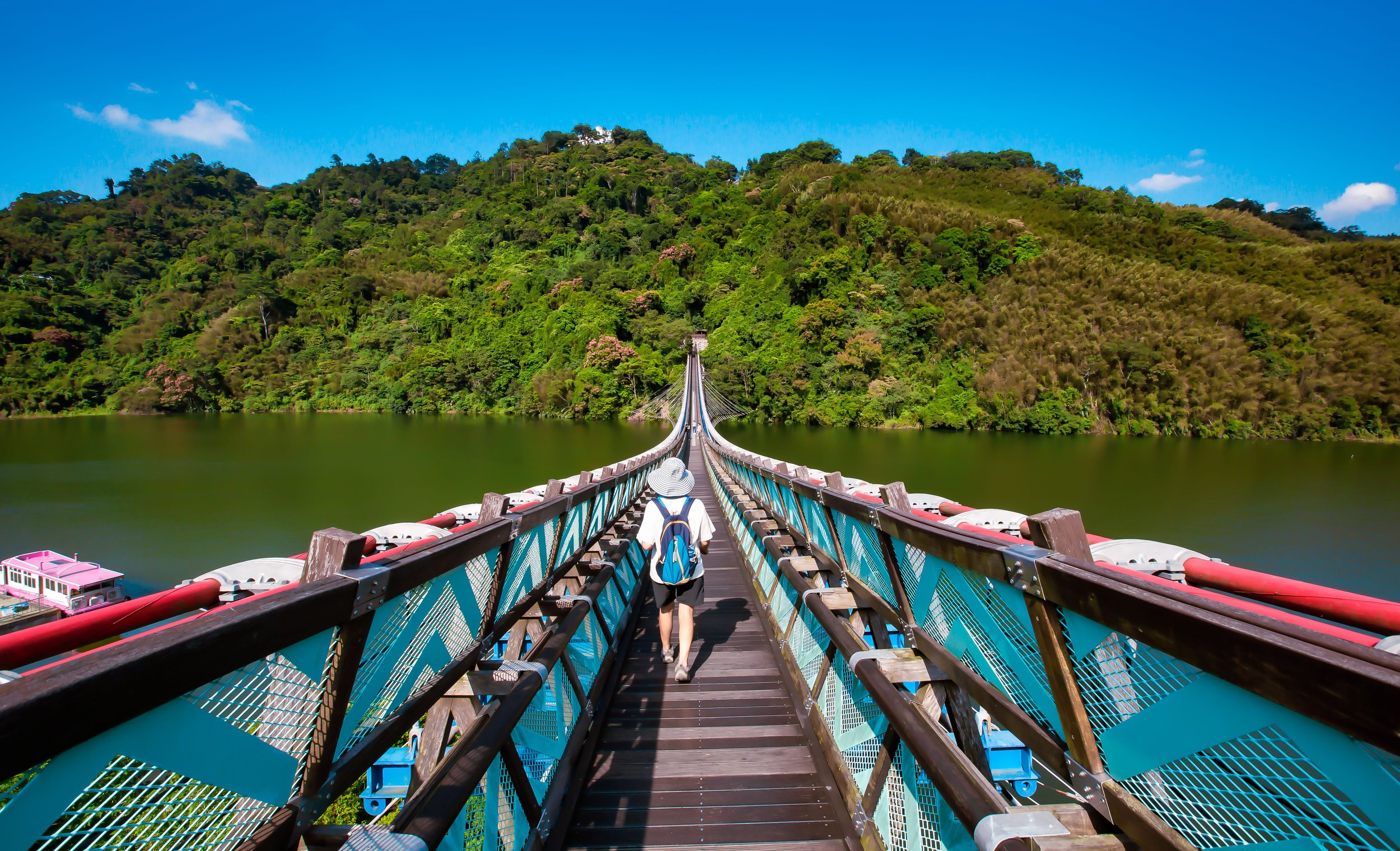
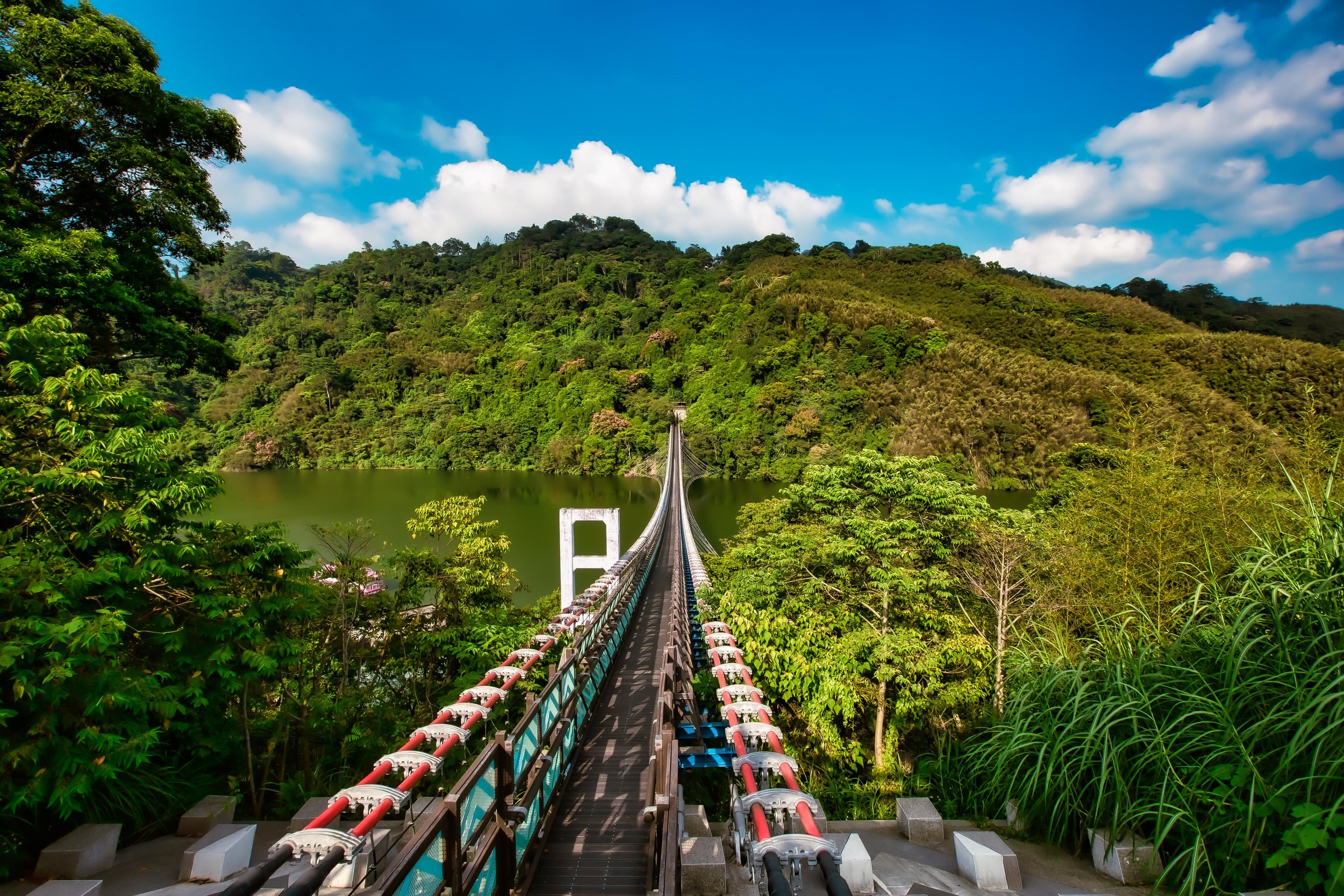
The latest version of the Xikou Suspension Bridge opened to the public in January 2018, measuring at a length of 330 meters, and is (currently) the nation’s longest suspension bridge. Located next to where the original bridge was located, the new version is almost double the length, and is 23 meters above the river, much higher of the original. Where the second generation bridge could only safely sustain about fifteen people at once, the new bridge can easily accommodate more than a hundred, and is wide enough for people to walk back and forth, rather than single file. 

By 2010, it was decided that after a half century, the old Xikou bridge had become far too unstable after years of abuse to continue using for much longer, so the Taoyuan City government came up with a plan to replace it for the third time. This time however, the focus would be on providing a more enjoyable experience for the locals, while also creating a new tourist destination in the mountains that would compliment Jiaobanshan Park (角板山公園).

Instead of referring to it as the 'Third Generation Xikou Bridge’, authorities decided instead to call it the ‘Xinxikou Suspension Bridge’ (新溪口吊橋), which is just the romanized pinyin version of “New Xikou Bridge,” which if you ask me is a bit of a head-scratcher. If it were up to me, I would have taken the opportunity to just rename it completely to better reflect the Indigenous community that it serves, but apparently no one thought about that. 

Nevertheless, where the bridge does reflect the Atayal Indigenous community is in its color scheme and the designs along the sides. Likewise, the side opposite of Jiaobanshan currently features a Tribal market (溪口部落市集廣場), where you can sample some local cuisine (mixed in with typical night market fare) as well as stalls set up to sell arts and crafts, allowing the local community to benefit from the increased tourism in the area. 

In Mandarin, the bridge is known officially as a hammock-style suspension bridge (懸吊式吊橋), in engineering terms, its technically an ‘underspanned suspension bridge’ in that it is anchored deep into the ground on both sides with cables spreading out (in a hammock-like fashion) across its underbelly, with the deck raised on posts above. With this type of bridge, visitors are better able to enjoy the beauty of the natural environment without a bunch of cables getting in the way, but it is a less stable engineering style that does allow for a bit of rocking back and forth when people are walking across the bridge. 

As an extension of the Jiaobanshan Park, which attracts quite a bit of weekend and holiday tourist traffic, most people visiting the bridge are going to do so from that side of the river. Jiaobanshan however is located on a plateau high above the river, so there is a bit of a nature hike involved if you’d like to cross the bridge.

The tree-covered walk is a nice one, but there are quite a few stairs, so once you walk down and cross the bridge, it’s actually really great that there’s an Indigenous market on the other side where you can buy some snacks and drinks before heading back up the hill.

When the bridge first opened to the public a few years back, it was so popular that an online reservation system had to be set up to ensure that long lines of cars wouldn’t be clogging up the narrow mountain highway. Thankfully, some of that popularity has died off as time has passed, so if you are visiting the area today, you shouldn’t have much problem checking out the bridge. 

Oh, and before I finish, I should probably let you know that if the weather is cooperating on the day of your visit, you’re going to be rewarded with some pretty spectacular mountain landscapes with the beautiful turquoise Dahan River (大漢溪) flowing below. You may notice that I’m sharing photos from two different visits to the bridge. On my first visit, the bridge was closed (due to COVID protocols), and the river below was pretty much empty due to a massive drought that we were having at the time. I was much luckier on my second visit as the bridge was open, the weather was perfect and the river was flowing beautifully. 

If you have the opportunity to visit, I hope you’re lucky enough to go on a beautiful day! 

Hours: Wednesday - Monday (8:00 - 15:30)

Admission: $NT 50 per person. 

Website: 新溪口吊橋 (Facebook)

Getting There


Address: #8 Zhongshan Road, Fuxing District, Taoyuan. (桃園市復興區澤仁里中山路8號)

GPS: 24.814489, 121.350792

The great thing about bridges is that they connect two sides of a river, right?

Well, that’s ironically also the confusing thing for a lot of tourists who want to visit this bridge. 

You can access this bridge from either the Jiaobanshan (角板山) side, or the Xikou Tribe (溪口部落  / Hbun Rahaw takan) side, with a list of pros and cons for both. For anyone taking public transportation to the area, you’re going to be forced to visit the bridge from the Jiaobanshan side, which features the steep walk down a set of stairs to the bridge mentioned above, something you’ll have to repeat when you’re done. 

On the other hand, if you have access to your own means of transportation, you have the option of starting from the opposite side of the river, but parking on that side is more expensive, and spaces are limited, so you may end up having to wait in line on weekends.

That being said, parking within the Jiaobanshan area can often be difficult to find and expensive as well.

If you’re driving a car or scooter you have the choice of parking anywhere within Jiaobanshan and walking the rest of the way to the bridge. If you choose to start from the other side, you’ll have to pass by Jiaobanshan and continue along the Northern Cross-Island Highway (北橫公路), crossing the Fuxing Bridge (復興大橋) into Luofu Village (羅浮), where you’ll make a right turn onto the famed “Roman Road” (羅馬公路) on your way to the Xikou Tribal area, finally stopping at the Xikou Tribe Cultural Square (溪口部落文化廣場). 

The address here is different than the one provided above, so to make your way to the bridge on the opposite side, I recommend inputting this address into your GPS or Google Maps: 

Address: #59-1 Xikoutai, Fuxing District, Taoyuan (桃園市復興區澤仁里4鄰溪口台59-1號)

Public Transportation

If you don’t have access to your own means of transportation, there are a few different bus routes that you can take from the Daxi Bus Station (大溪客運站) to get to the area. In each case you’ll take the bus from Daxi all the way to the Fuxing Station (復興站) within Jiaobanshan Village and from there you’ll walk to the trail that brings you to the bridge. 

  • Taoyuan Bus (桃園客運) Bus #5104 (Daxi - Luofu / 大溪 - 羅浮口)

  • Taoyuan Bus (桃園客運) Bus #5105 (Daxi - Xiaowulai / 大溪 - 小烏來)

  • Taoyuan Bus (桃園客運) Bus #5106 (Daxi - Xiayun Village / 大溪 - 霞雲里)

  • Taoyuan Bus (桃園客運) Bus #5109 (Daxi - Gaorao / 大溪 - 高遶)

For those of you unfamiliar with the Daxi area, you’ll also have to find public transportation to get to the bus station there. There are a number of options for taking the bus to Daxi either directly from the railway stations in Taoyuan or from Taipei. I’ll provide each of the buses that you can take below with links to where you can find the bus, their route map and their schedule.

  • Taoyuan Bus (桃園客運) #5096 (Taoyuan - Daxi / 桃園 - 大溪)

  • Taoyuan Bus (桃園客運) #5098 (Zhongli- Daxi / 中壢 - 大溪)

  • Taoyuan Bus (桃園客運) #9103 (Banqiao - Daxi / 板橋 - 大溪)

  • Taoyuan Bus (桃園客運) #710 (Yongning MRT Station - Daxi / 永寧捷運站 - 大溪)

  • Taiwan Trip Tour Bus (台灣好行) #501 (Taoyuan HSR Station - Daxi / 桃園高鐵站 - 大溪)

Links: Taoyuan Bus (桃園客運) | Taiwan Trip Shuttle (台灣好行)

The Xinxikou Suspension Bridge is just one of a long list of interesting tourist destinations within the Jiaobanshan area in addition to nearby Xiaowulai (小烏來). If you find yourself in the area on a day-trip, I highly recommend you stop by to check out the bridge, which (if the weather is cooperating) can be a beautiful experience. You’ll want to make sure to check out some of the other cool places to visit while you’re in the area, and I recommend you take some time to try some of the Indigenous fried mushrooms and peach smoothies when you’re in town! 

I’ll have quite a bit more about the area over the next little while, so watch this space if you’re interested in what the area has to offer! 

References

  1. 新溪口吊橋 (桃園觀光導覽網)

  2. 溪口吊橋 (Wiki)

  3. 溪口吊橋 (國家文化記憶庫)

  4. 新溪口吊橋‧站在台灣最長的懸索橋欣賞大漢溪谷的風光 (旅遊圖中)

  5. 桃園】復興-羅馬公路:溪口台部落 (湘的部落格)

  6. 第139章[桃園市復興區] 樟香勾勒起的百年大夢 (William的旅行筆記)

  7. 臺灣國定古蹟編纂研究小組 (National Historic Monuments of Taiwan)


Agenna Shipyard Relics (阿根納造船廠遺址)

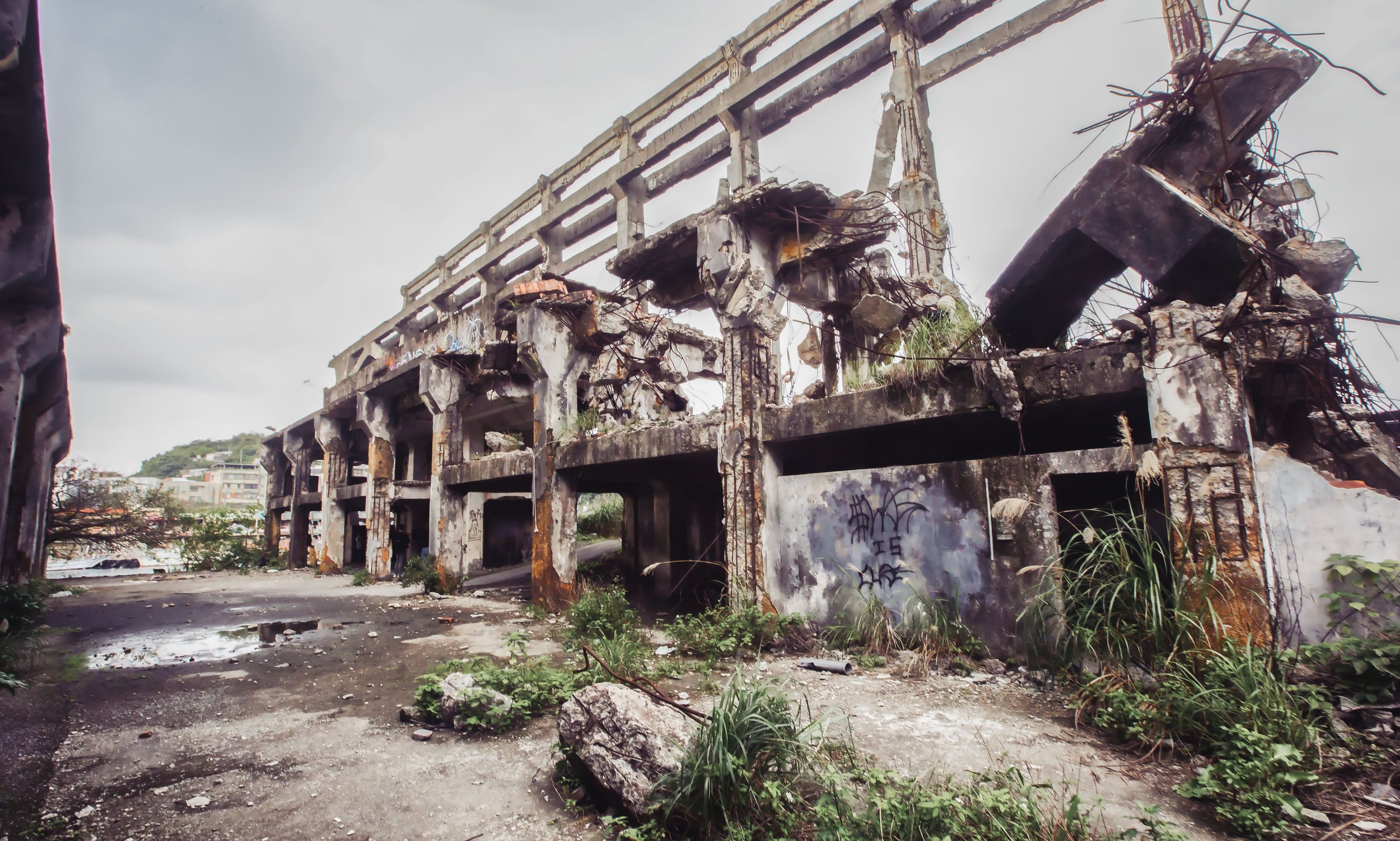
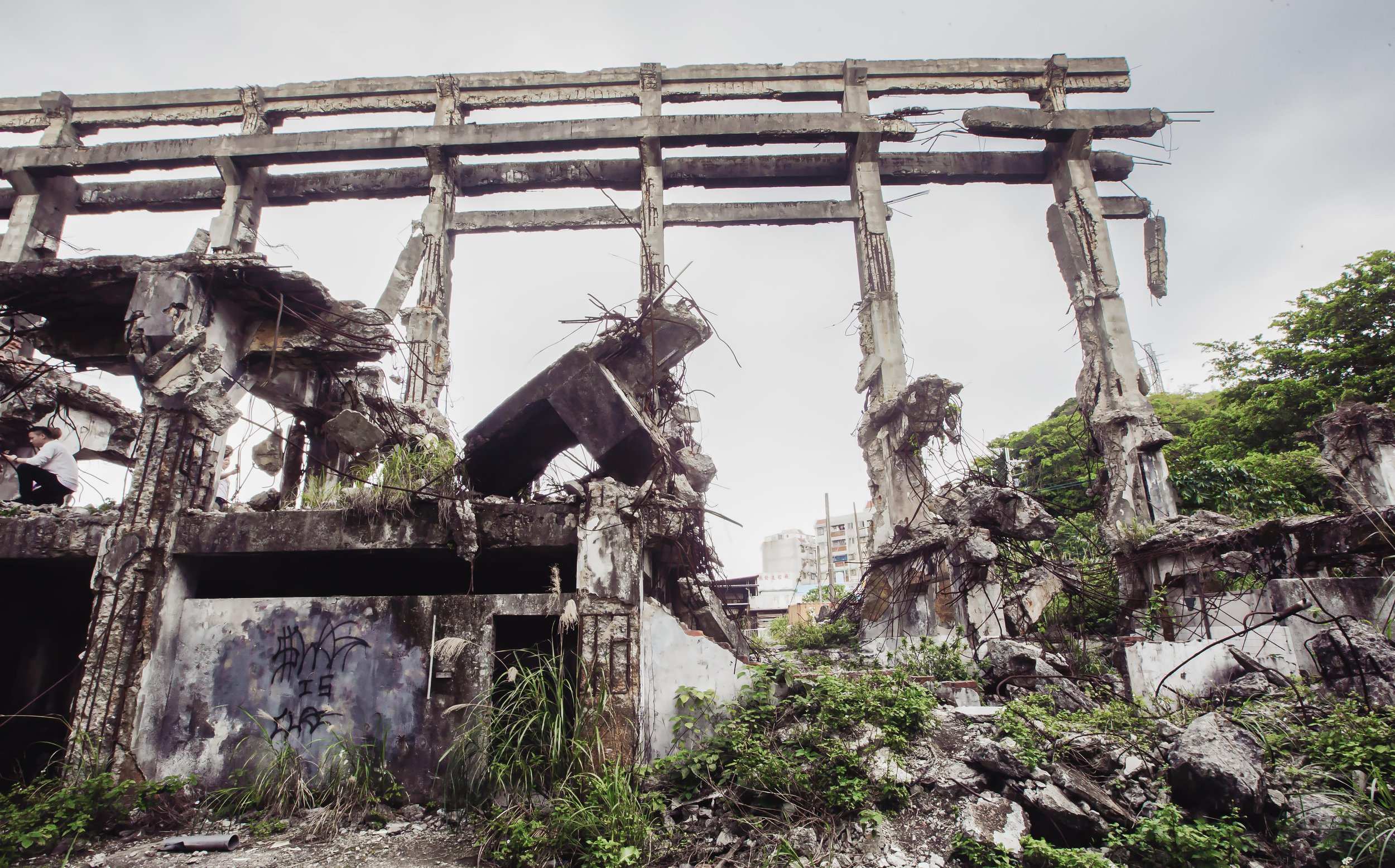
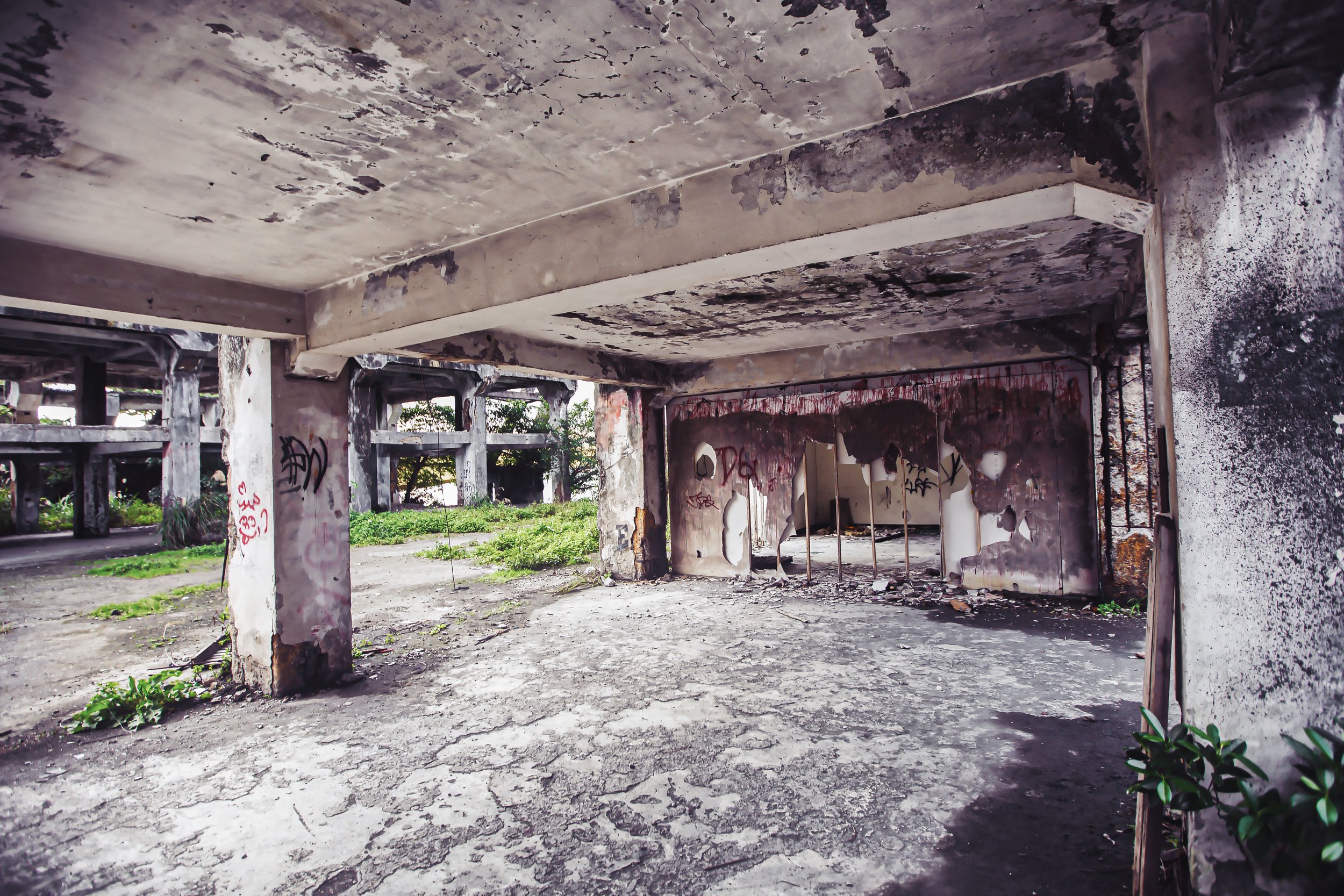
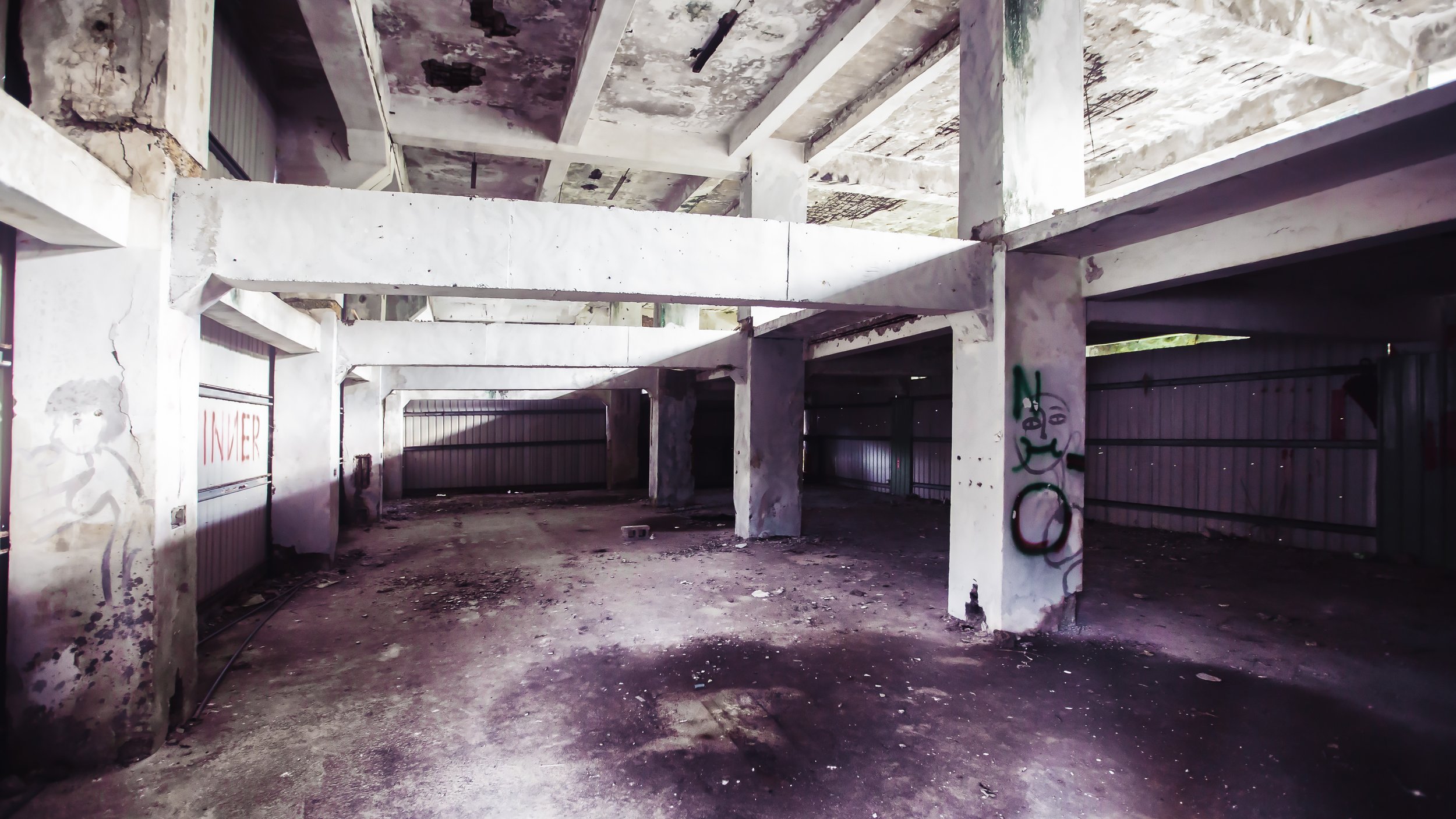
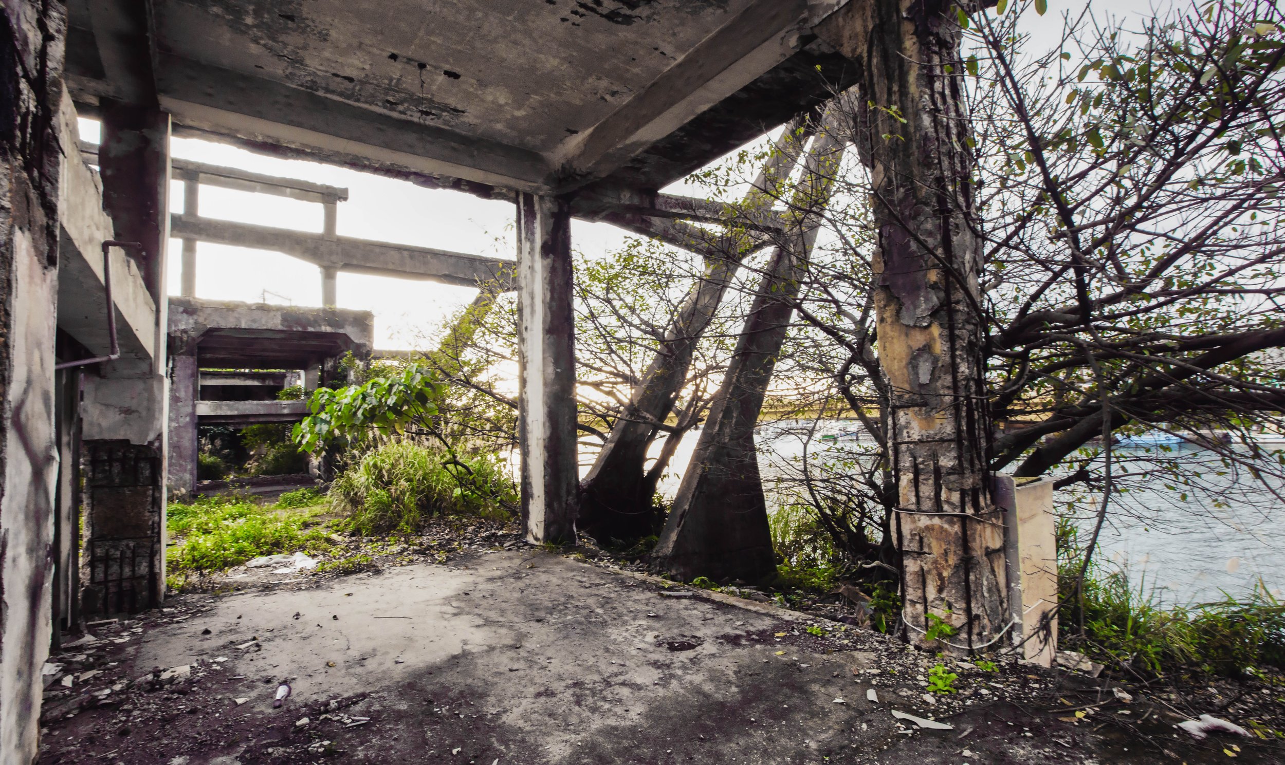
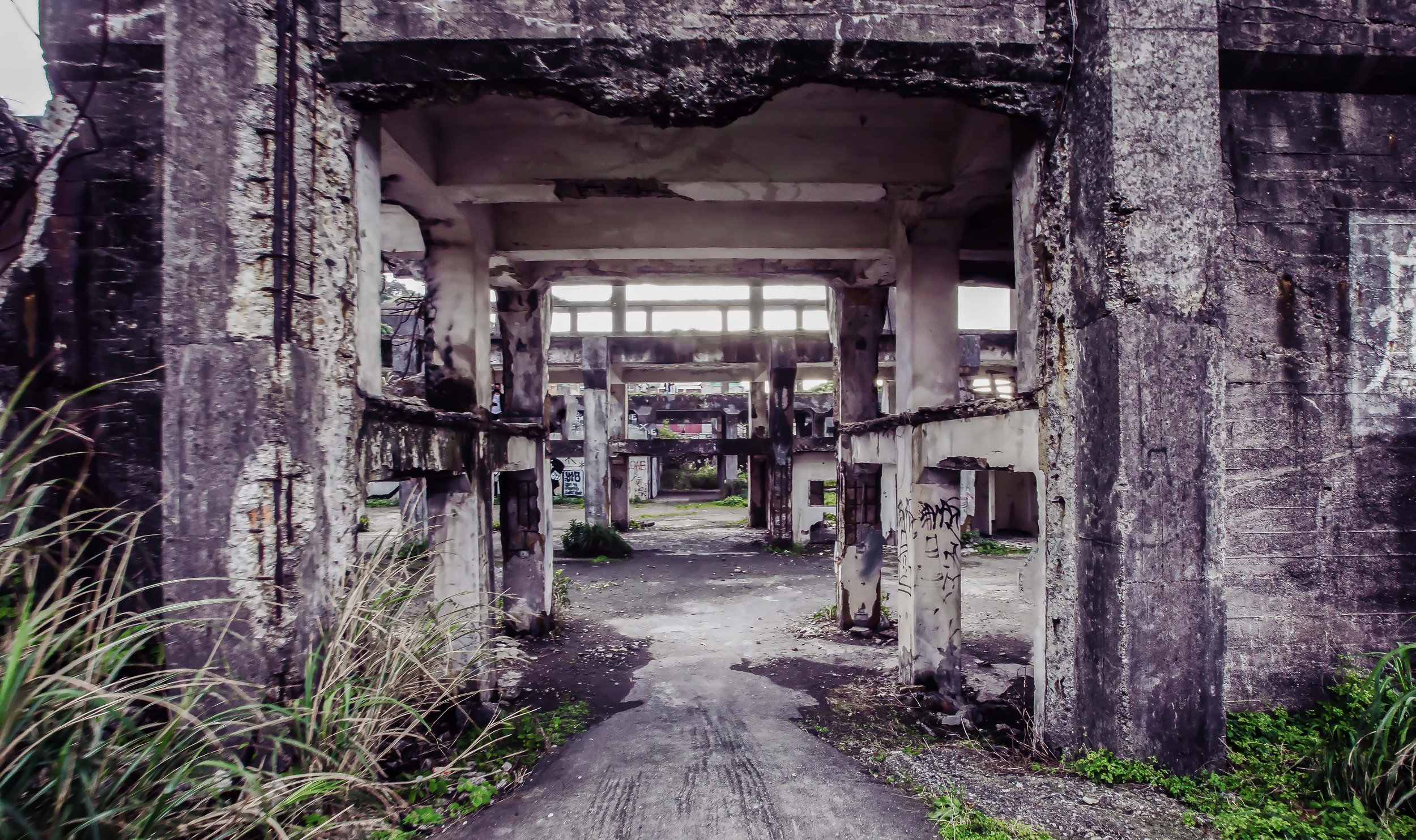
Today, I’m going to introduce a historic shipyard in northern Taiwan that has been abandoned for quite some time - and was for quite a while been a favorite for local urbex photographers.

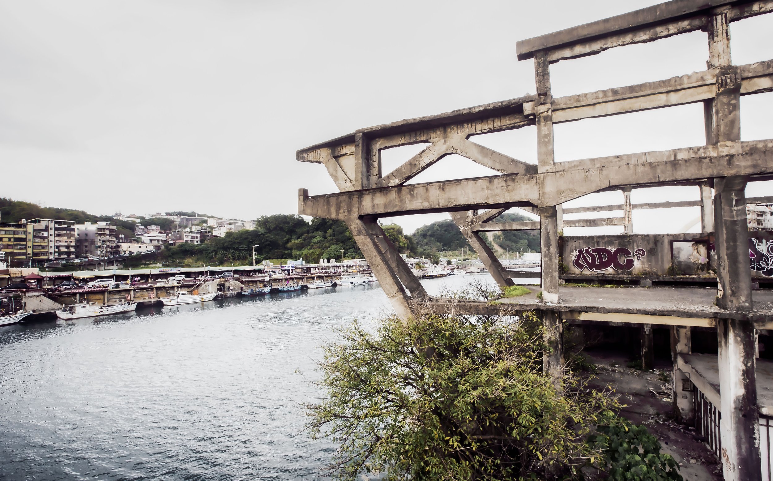
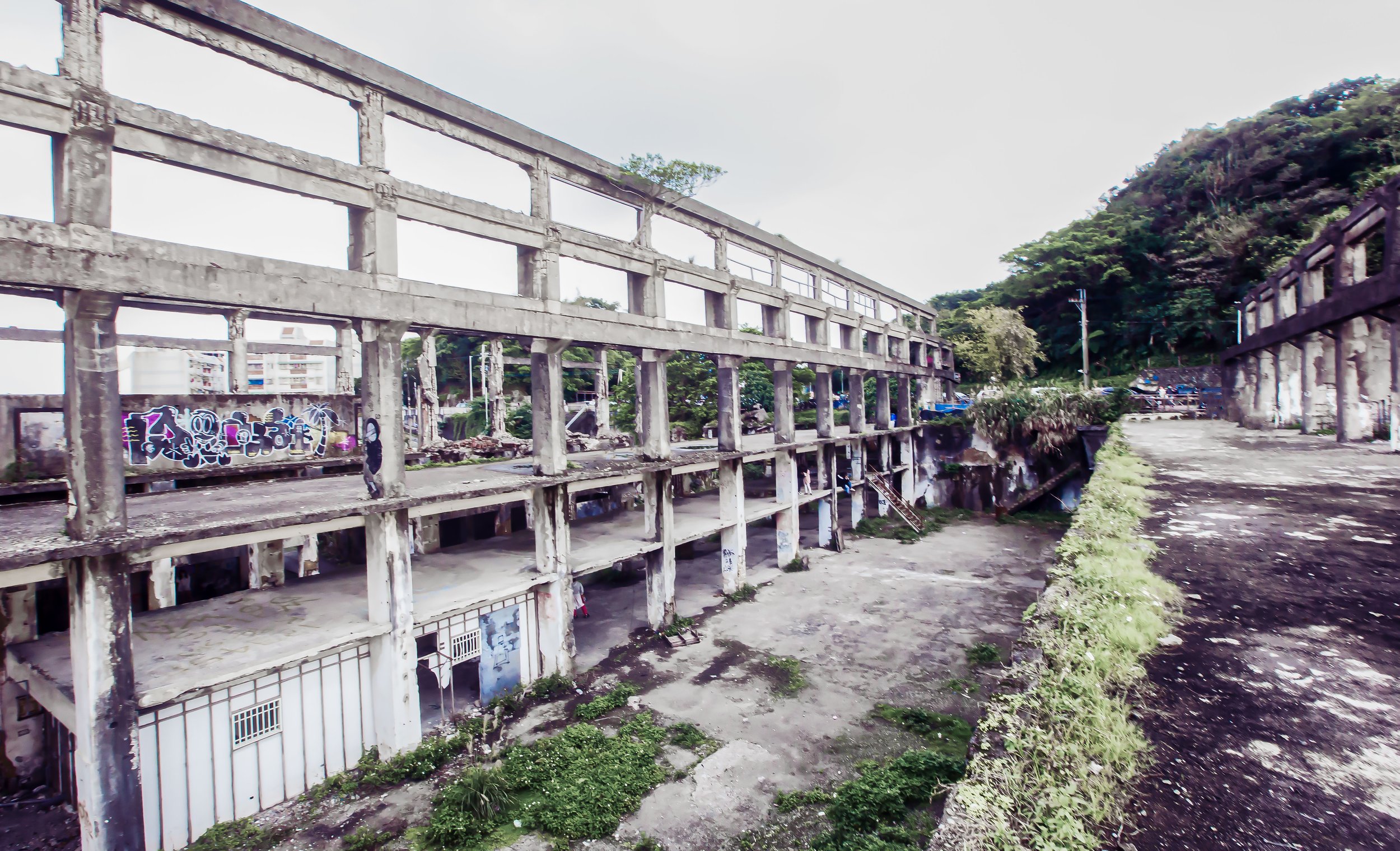
In recent years, this ‘secret’ location (which has been hiding in plain sight) came to the attention of the world at large, and has arguably become the most popular abandoned site in the entire country. It’s transformation from an obscure property into an overnight social media sensation however has been interesting to watch while it has also become somewhat of a contentious issue for the local government, given that there are some serious safety concerns involved.

It’s safe to say that a number of factors contributed to turning this ruin into a social media sensation, but what I find most interesting is that in a city that features a long list of beautiful tourist attractions - this dilapidated structure has the ability to attract a wide range of visitors ranging from local Instagram celebrities to tour buses full of senior citizens. 

It has also helped to promote the Urban Exploration hobby, with a growing community of local explorers, who have started out here and gone on to discover some very photogenic ruins across the country!

Nevertheless, with the shipyard’s newfound popularity as a tourist attraction, you’d think that there would be a multitude of resources available with information about its historical significance, yet even though you can find numerous Chinese-language articles about it, few of them feature little more than basic facts.

While I’d like to help alleviate that problem with this article, I first have to give some major props to my friend and fellow blogger, Alexander Synaptic, who was one of the first people (in any language) to write extensively about the shipyard with an article (linked below) that I strongly recommend you take some time to read.

I highly doubt that my attempt could ever be as good as his article, but I’ll do my best!

Link: Agenna Shipyard 阿根納造船廠 (Spectral Codex)

Below, I’ll provide an introduction to the history of the shipyard, and its current predicament and conclude by providing some info about getting to the area, which is something I rarely do when it comes to my urbex-related posts. Although, I’m not really sure if this one can really be considered urban exploration anymore.

Feel free to debate that one amongst yourselves!  

The Agenna Shipyard Ruins (阿根納造船廠遺址)

Located within Keelung’s Zhengbin Fishery Harbor (正濱漁港), just next to the bridge that crosses the Bachimen Channel (八尺門海峽) to Peace Island (和平島), the Agenna Shipyard was constructed on a historically significant plot of land that dates back as far as the Qing Dynasty.

Predating the shipyard by almost a century, the development of the shoreline along the channel is somewhat unclear, but archaeological evidence suggests that industrial activity started in the area decades prior to the arrival of the Japanese in Taiwan in the late 1800s.

Looking at maps of the area from the 1920s however, we can see that a branch railway was constructed to transport coal from nearby mines to the first iteration of a port, which shipped the coal back to Japan. 

As the amount of shipping traffic increased at the primary port of Keelung, the colonial government planned to have the commercial and fishery industries split between two ports with the “inner" port of Keelung servicing commercial traffic, and a newly re-developed “outer” port area near (what was then known as) the ‘Hasshaku-mon Channel’ becoming the newly established 'Keelung Fishery Port’ (基隆漁港 / きいるんきーるん) in 1935, which at the time was Taiwan’s largest fishery port having enough space to dock four hundred boats in addition to processing facilities and a market along the shoreline. 

Note: Today, several of the larger buildings constructed during in the 1930s for the fishery port are in the process of being restored and re-opened to the public as tourist attractions, making this area of the city an attractive one that will provide an excellent experience for tourists. 

While construction on the fishery port was taking place, the Nippon Mining Company (日本礦業株式會社) was simultaneously in the process of constructing a twelve kilometer-long branch railway, which became known as the ‘Kinkaseki Branch Line’ (金瓜石線 / きんかせきせん). The narrow-gauge line stretched from Suinando Station (水湳洞駅 / すいなんどうえき) to Hasshaku-mon Station (八尺門駅 / はしゃくもんえき), running along the northern shoreline transporting gold and copper ore to the harbor, where it was loaded onto barges to be sent across the harbor and then back to Japan. 

The significance of the branch railway, especially with regard to this article, is essentially because Hasshaku-mon Station was strategically located next to where the shipyard would eventually constructed. During the Japanese-era, the land was used as an ore dock, creating the first iteration of a dock in this location.

Interestingly, the Japanese authorities had some lofty development plans for the area, especially with regard to Sharyo-to (社寮島 / しゃりょうとう), the island we know today as Peace Island (和平島), with maps from the 1930s showing how the area would have been developed. Coincidentally, the island we know today was originally a collection of three islands, Sharyō-to (社寮島), Nakayamako-tō (中山子島), Okeban-sho (桶盤嶼).

If you look at the historic map provided above, you can see the red lines that indicate planned development, which would have artificially connected two of the islands. In the decades since, it’s apparent that those plans carried over with the new regime as it is currently a single island. 

When the Japanese-era ended in 1945, and the Chinese Nationalists took control of Taiwan, the newly established regime sought to continue to capitalize on the island’s natural resources, with the assistance of the already established infrastructure. Yet just over a decade or two of Chinese Nationalist control, almost everything of value had already been taken from the ground and with the mines depleted, the branch railway became unnecessary with the section between Badouzi Station (八斗子車站) and Bachimen Station (八尺門車站) suspended. 

With service on the branch railway officially coming to an end on August 26th, 1962 (民國52年), the ore dock and the space that Hasshaku-mon-turned-Bachimen Station occupied was suddenly freed up, and the Taiwan Metals Mining Company (臺灣金屬鑛業股份有限公司) lost interest in maintaining the property. 

The solution to their problem came a few short years later when in 1966 (民國55年), Thomas Hsueh (薛國航), an US educated engineer and entrepreneur, leased the land and opened the ‘Argonaut Shipbuilding Company’ (阿根納造船廠). Specializing in the construction of luxury yachts, Hsueh made use of his network of business contacts in America, and Taiwan’s cheap and skilled labor to earn a fortune with the shipyard.

Working as a sub-contractor for the Florida-based Chris Craft Industries, the shipyard specialized in the construction of smaller pleasure-craft, and was able to quickly adapt to Chris Craft’s transition to constructing ships with fiberglass in the 1970s and 1980s.

Note: There is a bit of confusion with the naming of the site, so let me take a minute to explain: The name we currently use for the site, “Agenna Shipyard” is simply the romanization of the Chinese-language name. More specifically the pinyin is ‘ā gēn nà zào chuán chǎng’ (阿根納造船廠). Does that name have any meaning in Chinese? No, not really. The name was actually a direct transliteration of the English word “Argonaut” into Chinese. The Taiwanese-American owner of the business essentially required an official Chinese-language name to register the company here in Taiwan, as well as an English name to register the company in the USA. This is a common business practice for multi-national corporations in Taiwan.

Architectural Layout of the Shipyard

Working primarily with Chris-Craft since its inception, the shipyard constructed several of the company’s flagship yachts for a number of years. Unfortunately, the fate of the Argonaut Corporation, and the shipyard were tied too close to that of Chris-Craft back in the USA. So, when economic recession hit the US in the late 1970s and global sales declined, that company was forced to restructure, with its assets and trademarks sold to another investment group in 1981. 

Link: Chris-Craft Corporation (Wiki)

Faced with a loss of its most important partner, and coupled with a worldwide economic downturn, the Argonaut Corporation was left frantically searching for new partners. Ultimately, the company’s poor management structure served as the final nail in its coffin, and after a couple of years of inactivity it closed its doors completely in 1987 (民國76年).

With the end of Argonaut’s business operations, the land once again became a burden to the Taiwan Metals Mining Company, which had also fallen on hard times and was going through bankruptcy in the late 1980s. With most of that company’s assets sold off to pay off their creditors, what little remained of the company was merged with the prosperous Taiwan Sugar Corporation (台灣糖業公司), the current owner of the property.

In the four decades since, the land has been leased to a number of businesses, each of which didn’t end up last very long. Then, in 2008 (民國97年), the land was put on a 20 year lease to a local industrial company (阿諾瑪實業公司), which made national headlines when they did what many other corporations around the country had done in the past, and rolled up onto the property with a bunch of construction equipment and started an illegal demolition of the shipyard.

Link: Agenna Shipyard demolished for safety, firm says (Taipei Times)

The sudden demolition of the historic property was widely condemned, with the mayor of Keelung threatening hefty fines for failing to secure construction permits. The Keelung City Council likewise moved quickly to have the site granted heritage status under the Cultural Heritage Preservation Act (文化資產之保存), which was passed by the Taiwanese legislature that same year.

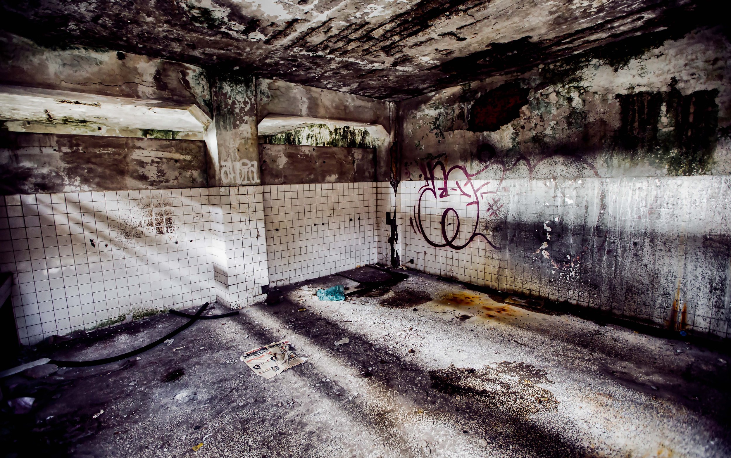
Unfortunately, by the time demolition was halted, considerable damage had been done to the shipyard, which is one of the reasons why the site is considered to be unstable and unsafe for the amount of people visiting on any given weekend. 

The future of the historic shipyard remains unclear with the Keelung City Government hoping to eventually have it restored, but given that the land remains is the property of the Taiwan Sugar Corporation, there are a number of legal matters to be resolved before anything can be done. The shipyard has lingered in its current condition for a number of years and is essentially one or two large earthquakes from falling over on its own.

As I mentioned earlier, there were a number of factors that contributed to the shipyard becoming Taiwan’s most widely-visited and most popular abandoned ruin. One of those factors was the widespread media attention (and condemnation) that came as a result of the short-lived demolition of the ruins. What was probably the number one factor in bringing the shipyard to the attention of the public at large was when Captain America himself, Chris Evans filmed a trailer for one of the Call of Duty games on-site in 2014.

All it took after that were some clever Instagram posts to help the ruin achieve overnight popularity. 

Link: Actor Chris Evans spotted in Taiwan filming commercial at Keelung Shipyard (ICRT) 

To conclude, it’s important to remind readers that a visit to the area doesn’t have to be just to see the abandoned shipyard - While there you can also enjoy the view of the equally Insta-famous rainbow colored buildings at Zhengbin Harbor (正濱港口彩色屋). You could also visit the historic Sheliao East Fort (社寮東砲台), Peace Island Coastal Park (和平島海角樂園), and many of the other tourist attractions within the downtown core of Keelung City. Don’t make a trip to the area just to visit the shipyard, make sure you enjoy some of the city’s other excellent tourist spots! 

Getting There


Address: Lane #116 Zhengbin Road, Keelung City (基隆市中正區正濱路116巷)

GPS: 25.153660, 121.771810

Something I rarely do when I write about urbex-related ruins is provide an address or a location.

With this one, there isn’t much point in not sharing that info with you - The shipyard has become so popular that there is a spot marking its location on Google Maps, making it relatively easy to find on your own.

Located next to Keelung’s Zhengbin Harbor (正濱港口), just before you cross the bridge to Peace Island (和平島), the shipyard is a relatively easy one to reach, but is a bit of distance from the city’s railway station.

This means that if you don’t have access to a car or a scooter you’ll have to make use of public transportation. It’s important to note that the narrow road along the harbor is home not only to the shipyard, but also the popular Zhengbin Harbor Rainbow Buildings (正濱港口彩色屋), and acts as the entrance to the Peace Island Coastal Park (和平島海角樂園). The area can be quite busy on the weekends and during national holidays. 

With that in mind, I’ll preface this by letting you know if you’re driving a car, you’re likely going to have some trouble finding parking near the harbor - The very narrow road that leads you to the harbor and across the bridge to Peace Island wasn’t ever set up with cars and buses full of tourists, so I’d highly recommend you find somewhere to park well before you arrive at the harbor. 

Of course, it’s not impossible to find a spot when you arrive, so if you are traveling to the area and are feeling brave, you can turn into the harbor, and then make another turn on Lane #116 where the shipyard is located and attempt to find a roadside parking space near the Keelung City Indigenous Cultural Hall (基隆市原住民文化會館), a short walk past the shipyard. Given that there are a number of buses that stop at the harbor, the traffic situation can be quite precarious meaning that if you turn in, you may find yourself stuck in a line of traffic that moves very slowly.

If on the other hand you’re in the area with a scooter, you shouldn’t have too much trouble finding a spot on the side of the road near the shipyard where you can park for a short time.

Now that we’ve gotten that out of the way, it’s time to talk about public transportation. 

Once again, I’m going to preface this by saying that I love Keelung, it’s one of my favorite cities to visit in Taiwan - It is however a far cry from what most tourists would consider a convenient place to visit.

The traffic in the downtown core of the city is often congested, and unlike other major Taiwanese towns and cities, you (currently) don’t have access to YouBikes, GoShare, WeMo, etc.

If you have a drivers license, I highly recommend renting a scooter for the day near the train station. If not, you’ll be stuck relying on public transportation, which isn’t very efficient or reliable.

Below, you’ll find a list of bus routes that’ll get you to Zhengbin Harbor. I’ll provide links to each of the buses so that you can click on them to find their route map and schedules: 

Zhengbin Harbor Heping Bridge Bus Stop (和平橋頭站)

Located next to the harbor, you’ll simply get off the bus at the station before crossing the bridge to Peace Island and walk up Lane #116 to find the shipyard. 

  • Keelung Bus #101 (Peace Island 和平島)

  • Keelung Bus #102 (Peace Island 和平島)

  • Keelung Bus #109 (Tianxian Temple 天顯宮)

  • Keelung Bus #205 (Peace Island 中信 - 和平島)

Zhongzheng - Zhengbin Intersection Bus Stop (中正路正濱路口站)

Located along an important road between Keelung and Badouzi, getting off at this stop requires you to walk into the harbor area and then up Lane #116 to the shipyard. The distance between this bus stop and the one above is only about a two minute walk, but not all buses turn into the harbor area. 

  • Keelung Bus #103 (Badouzi 八斗子)

  • Keelung Bus #104 (Xinfeng Street 新豐街)

  • Keelung Bus #108 (Chaojing Park 潮境公園)

  • Taipei Bus #791 (Guojia New Village to Fulong 國家新城 - 福隆)

  • Keelung Bus #1051 (Rueifang to Guojia New Village 瑞芳─國家新城)

I can’t personally vouch as to whether or not you’ll be able to enter the former shipyard and explore the ruins as they’ve started preventing people from visiting. Whether or not this is constantly enforced, I’m not particularly sure. Still, you need to keep in mind that a visit to the shipyard might result in disappointment.

You can still view it from afar, but descending the old stairs to the old workshop area might not be an option.

If that’s the case, don’t worry too much. While in the area you’ll also be able to enjoy the beauty of the harbor as well as crossing the bridge over to Peace Island, which is pretty cool place to visit. 

As a historic structure, it would be nice to see the local government do something to fix the area up in order to keep the ruins available for the foreseeable future. That being said the structure would likely require quite a bit of public funds to clean up. Currently, its existence and popularity are an accident waiting to happen and an insurance nightmare for the city, so if its closed when you arrive, don’t be too surprised. 

There are an incredible number of abandoned structures throughout Taiwan, so if this kind of thing interests you, I suggest you start exploring and finding things on your own! It’s actually surprisingly easy to find some really cool places to visit. Stay safe if you do, and most importantly remember to keep these places to yourself, otherwise they might end up like the shipyard. 

To conclude, I’m going to doing something I rarely ever do, show a picture of myself striking a pose at the ruin.

Yours truly.


The Fairy Cave Temple (仙洞巖 + 佛手洞)

Taiwan’s northern port city of Keelung has always been one of the nation’s most international cities. Having experienced periods of Dutch, Spanish, Chinese and Japanese rule, control of the northern port has always been the gateway to Taipei and the rest of Taiwan.

The Keelung of the modern era is a vibrant international port city with cruise ships from around the world docking in the harbor as well as a large number of cargo container ships coming and going.

With a history dating back several hundred years, the city has a number of historic destinations for tourists to visit and to learn about the special city, and its development over the centuries.

Unfortunately, something I’ve come to realize over the years is that Keelung rarely ever receives a fraction of the attention in the English-language as other areas of the country. I’ve always wondered if this was because some of the history in the area isn’t as well-documented or well-preserved, of its simply because it rains so much that most tourists prefer to just check out the night market whenever they’re in town.

Suffice to say, as a history buff, I’m a big fan of Keelung and over the next few months I’ll be introducing a number of the city’s tourist destinations. In this one I’m going to introduce a pretty cool, yet somewhat obscure Keelung tourist destination that (like so many other of the city’s attractions) has received little-to-no attention, or promotion in English-language tourism spheres. Obviously not every foreign tourist is as interested in Taiwan’s places of worship as I am, but when it comes to this one, I’m surprised that the tourist bureau hasn’t put in a little more effort given that it is located within a large cave next to the ocean.

If advertised properly, it could be one of those ‘mystical places of worship’ that foreign tourists are attracted to, especially since it is reminiscent to the beautiful Tham Khao Luang Cave (ถ้ำเขาหลวง) just outside of Bangkok in Thailand.

The so-called ‘Fairy Cave temple’ and the ‘Buddha’s Hand Cave,’ are both part of the same network of mountainous sea caverns located next to the port of Keelung and just like the rest of the city, this place of worship has a history that both spans the several eras of Taiwan’s colonial history, and even though it has evolved throughout the years, you’ll find that history written all over its walls.

No matter how much has changed at the cave throughout the years, it has always remained a place of worship steeped in local legend, and with the calming sound of the waves crashing against the shoreline, it can be a quiet place of refuge for anyone seeking a bit of solitude in the busy international port city.

Fairy Cave Temple (仙洞巖最勝寺)

With thousands of places of worship throughout Taiwan, tourists and locals alike are afforded a wide variety of religious destinations to visit. It’s safe to say however that only a handful of them have been constructed within a natural sea cave, allowing them to stand out from the rest.

The so-called ‘Fairy Cave’ (仙洞巖) as it is currently known has gone by a few different names over the past few centuries, but it has been a place of worship for much of Keelung’s recorded history.

Prior to becoming a place of worship, the cave was regarded as a natural refuge for local fishers when the weather turned foul, as it so often does along Taiwan’s north coast. Eventually setting up a shrine within the cave, the fishers made use of the space to pray for safety while out on the water.

It’s unclear as to when organized worship at the cave officially started, but in renowned poet Lee Feng-Shih’s (李逢時) poem titled “The Eight Scenic Wonders of Keelung” (雞籠八景詩), he references the cave by saying “You don’t have to have the ability to fly to become a fairy” (不必飛昇人亦仙), with references to the cave from other scholars to around sometime in the mid-nineteenth century.

View from the main entrance.

Note: The Chinese characters used for “Keelung” in the poem mentioned above is pronounced “jī lóng” (雞籠) in Mandarin or “Ke-lâng” in Taiwanese. While the Mandarin pronunciation remains the same today, the original characters are loosely translated as “Chicken Cage” (雞籠), and was the original name used for the area prior to 1876, when it was officially changed to the name we use today.

To answer an age-old question that many foreigners have - the reason why we refer to the city today as “Keelung” in English instead of “Jilong” is because that is the Taiwanese-Hokkien pronunciation (Ki-liông / Ke-lâng) of the city rather than the Mandarin one.

Link: 【臺灣地名真相】基隆叫基隆,是因為長得像雞籠嗎?

Without a clear recorded history prior to the Japanese-era, it is understood that the place of worship within the cave has gone by several names over the years being referred to as “Zuisheng Temple” (最勝寺), Rinzai Myōshin-ji Zuisheng Zen Temple (臨濟宗妙心寺派最勝寺), Dai-Ming Temple (代明宮) and Benten Shrine (辨天宮), among others.

These days it is referred to simply as the “Fairy Cave Temple” (仙洞巖), but formally retains its full name “Zuisheng Fairy Cave Temple” (仙洞巖最勝寺).

In 1872 (清同治11年), during the latter stages of the Qing Dynasty, a formal place of worship was constructed within the cave known as Dai-Ming Temple (代明宮), dedicated to Buddhist practice.

A few decades later when the Japanese took control of Taiwan in 1895, Keelung, or “Kiirun” (きーるん) as it became known, was one of the first areas where the Japanese were able to set up official administrative agencies. This was in part due to the port, Taiwan’s northern-most, becoming instrumental in transporting people and supplies to the island, in addition to already having an established, yet rudimentary railway link between the port and the capital.

Praying to one of the carved images on the cave walls.

The early years of the colonial era saw a considerable amount of Japanese nationals coming to the island for work (on a temporary or long-term basis), bringing with them knowledge and expertise as well as their cultural and religious practices. So, in addition to several Shinto Shrines constructed in the port area, a number of Japanese Buddhist groups started setting up roots in the city, most notably the Jodo (淨土宗), Soto (曹洞宗), Shingon (真言宗) and Rinzai (臨濟宗) sects.

Most notably for the Fairy Cave, the Myōshin-ji (妙心寺 / みょうしんじ), headquartered in Kyoto and the largest group within the Rinzai sect, initially seized upon the opportunity to set up shop in the ‘Fairy Cave’ but there are conflicting reports as to how long that shrine within the cave lasted.

Links: Huguo Rinzai Temple (臨濟護國禪寺) | Puji Temple (普濟寺)

There are differing accounts on what happened in the early 1900s, as there are claims that the shrine within the cave has always remained a Buddhist place of worship while others argue that the Buddha’s were re-located elsewhere in 1906 (明治39年), and a Shinto Shrine constructed on the site shortly after. The surprising thing is that the official records on the subject aren’t actually as clear, leading to debate within academic circles. Photographic evidence of the site makes it ‘somewhat’ clear that the Fairy Cave was converted into a Shinto Shrine in the late Meiji era.

With the consecration of a Shinto Shrine on the site taking place in 1911 (明治44年), it’s highly unlikely that any of the Buddhist-related materials remained within the cave as there are accounts that the statues of Shakyamuni (釋迦佛) were removed and sent elsewhere.

As a Shinto Shrine, Benten Shrine (仙洞弁天宮 / べんてんみや), predated the Keelung Shinto Shrine (基隆神社 / きーるんじんじゃ), and was one of a dozen shrines constructed in the Keelung area during the Japanese era.

Similar to the Keelung Shrine, the shrine was dedicated to Amaterasu (天照皇大神), the Three Deities Of Cultivation (開拓三神), Ōmononushi (大物主命), Emperor Sutoku (崇德天皇), and Prince Kitashirakawa Yoshihisa (北白川宮能久親王) in addition to Benzaitian (弁才天 / べんざいてん), or ‘Ichikishima-hime-no-mikoto’ (市杵島姫命 / “Heavenly Princess Ichikishima”), the goddess of water, music, arts, wisdom, wealth and fortune, whom the shrine was named after.

Link: Keelung Martyrs Shrine (基隆忠烈祠)

With a several decade history as a Shinto Shrine from 1911, until the colonial era ended in 1945, I’d venture to guess that some of the confusion with regard to the Fairy Cave is due to the fact that some of the Buddha statues enshrined there today originated in Japan and date back to the colonial era. What gives people the biggest headache trying to figure all of this out however was that the Goddess Benzaiten is a figure that was introduced to Taiwan with the arrival of the Japanese, and is worshipped interchangeably as both a Buddhist figure and a Shinto kami (deity).

Location of the cave marked on a Japanese-era map of the port of Keelung

Note: Belonging to a group known as the “Seven Lucky Gods” (七福神 / しちふくじん), Benzaiten is one of the most prominent deities within Japanese religious traditions that is worshipped in both Buddhism and Shintoism. Representing the syncretistic mixture of influences that have defined Japanese religion over the last thousand or more years. Originating as the Hindu Goddess Saraswati, and then incorporated within Buddhism and China and moving onto Japan, she has been a popular figure within Japanese religious traditions since the 6th Century. Given her prominent role within both religious traditions, worship of Benzaiten was one of the few ‘foreign’ influenced religious practices that was able to escape the separation of Buddhism and State Shinto during the Meiji Restoration (明治維新 / めいじいしん).

Academics point to historic photos of the exterior of the Fairy Cave taken during the Japanese-era with a torii gate (鳥居), and a traditional ‘walking path’ (參道) leading toward the cave as evidence that the place of worship was converted into a Shinto Shrine, given that these types of gates are almost always an indication of a Shinto Shrine. With regard to this specific goddess, that actually isn’t the best indicator as her worship is often the exception to the rule when it comes to these gates. As a syncretic goddess, both Shinto Shrines and Buddhist temples dedicated to her worship feature a torii gate. Fortunately, there’s a photo of the interior of the shrine (below) which clearly indicates that it was a Shinto Shrine as there is a ‘shintai’ (神体), known as a sacred mirror and is the repository of a Shinto deity.

Shrine located within the cave during the Japanese-era featuring a ‘sacred mirror.’

Interestingly, when the the colonial era came to an end and the Fairy Cave was converted back into a Buddhist temple, nothing changed with regard to the worship of Benzaiten, which continues to this day.

In the post-war era, the place of worship within the Fairy Cave was restored to its original name ‘Zuisheng Temple’ (最勝寺), and over the years it has been restored on a few occasions becoming a Keelung City Protected Heritage Site (基隆市古蹟) in 2006.

Now, let’s get into some specifics about the Fairy Cave in its current form.

As mentioned above, the cave was once a safe haven for fishers in the Keelung area, and as it predates the port, its formation took place over many thousands of years with erosion caused by seawater. As we know it today, it has a depth of about 80 meters and varies in width in the various sections of the cavern, but has a total space of about 1650㎡ (500坪).

Having recently gone under a period of restoration, the path to the Fairy Cave features a newly constructed ‘paifang’ gate (牌坊), a Chinese-style gate that demarcates the name of the cave and the temple within. Amazingly, the path that leads to the main entrance remains the same as the original ‘visiting path’ from its days as a Shinto Shrine, although the walkway was recently restored as well.

At the entrance to the cave you’ll find what looks like the facade of a typical Chinese-style place of worship that adds a bit of traditional decoration to the entrance as well as serving a practical role of stabilizing the cave-front, which could easily be destroyed by a land slide or an earthquake. The artificially constructed cave-front ‘temple facade’ features beautiful golden calligraphy that reads “仙洞巖” (Fairy Cave), and has a double-layered temple roof with a dharma wheel on the apex, indicating that a Buddhist place of worship is found within.

To the right of the main entrance you’ll find a large cement pedestal with a giant statue of the Buddha on it, but what interested me the most about the cave-front are the remnants of the Japanese-era Shinto Shrine on the opposite side of the giant Buddha where you’ll find some objects dating back to the early years of the Showa era.

Although the temple within the cave is primarily a Buddhist place of worship, like so many other temples throughout Taiwan, you’ll find a mixture of figures from both Buddhism and Taiwanese folk religion, with several interesting shrines inside. While space is obviously quite limited in the cave, you’ll find almost as many shrines as you would in a typical several-floored temple indicating a pretty good use of space.

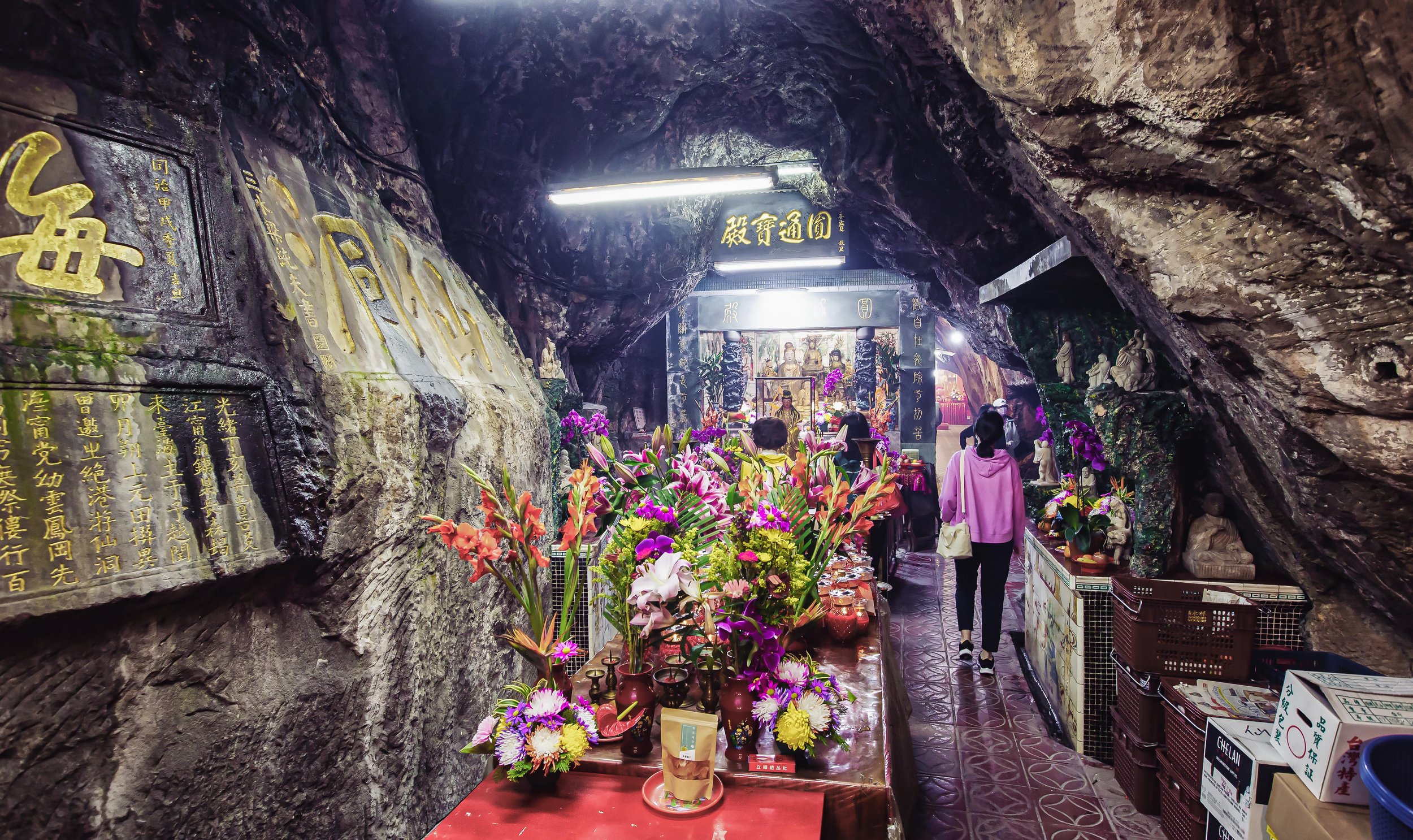
The interior is essentially divided into three sections or ‘halls’ with the two largest known as “Yuantong Hall” (圓通寶殿) and “Mahavira Hall” (大雄寶殿), with a much smaller offshoot cave featuring a small shrine.

As soon as you enter the cave you’ll find yourself in the ‘Yuantong Hall’, with a shrine devoted to the Maitreya Buddha (彌勒佛), an offering table and an incense table very close to the front door. On both the left and right sides of the shrine you’ll find statues of the Four Heavenly Kings (四大天王), who are generally regarded as protector deities.

Passing by the first shrine, you’ll walk down a set of stairs and will find another shrine dedicated to a number of important Buddhist figures, including a couple variations of Guanyin (觀世音菩薩), accompanied by Skanda (韋馱菩薩), Samgharama (伽藍神) and the Earth God (土地公), a folk religion deity. On either side of the shrine you’ll also find a display of the famed eighteen arhats (十八羅漢), the Buddha’s most important disciples.

To the direct left of this shrine you’ll find the entrance to the smallest shrine room in the Fairy Cave, an extremely narrow several meter long path that is only wide enough for one-way traffic, and in parts becomes so small that you’ll have to crouch and twist and turn to get yourself through.

If you’re even a little claustrophobic, this path isn’t for you as it’s likely to give you a panic attack.

All of the hard work getting through the narrow path doesn’t really pay off for most people as once you get to the end you’re met with a simple shrine in a dark room where the air is a bit stagnant. The shrine at the end of the cave is dedicated to Benzaiten (弁才天 / べんざいてん), the Buddhist and Shinto figure mentioned above and is a fitting tribute to the Fairy Cave’s history.

The Benzaiten Shrine

Passing from the first part of the cave into the main area, you’ll find some beautifully carved images along the cave wall. These images took several years to create, and you’ll often find visitors praying next to them as they depict important Buddhist figures, including Manjusri (文殊菩薩), Ksitigarbha Buddha (地藏菩薩) and four images of Guanyin (觀世音菩薩). Unlike some of the other carvings on the cave wall that date back hundreds of years, these are relatively new as they were created in the early 1970s.

The Guanyin Shrine

As I mentioned earlier, the largest and widest section of the cave is home to the main shrine, known as “Mahavira Hall” (大雄寶殿), which doesn’t sound very Chinese, right? It is actually one of the most common titles used for Buddhist shrines throughout East Asia, translated directly from Sanskrit and literally means “Precious Hall of the Great Hero,” but is often translated simply as “Great Hall,” which I think loses a bit of its intended meaning.

In the dim-lit cave, the main shrine almost glows as you approach it with the large golden ‘Three Treasure’ Buddha statues (三寶佛). In the middle you’ll find Shakyamuni (釋迦牟尼佛) with the Medicine Buddha (藥師佛) and Amida Buddha (阿彌陀佛) on either side, accompanied by dozens of smaller Buddha statues surrounding them to the rear and sides. As the main attraction of the Fairy Cave temple, this area is usually the busiest with visitors stopping by to pray while others grab a cushion to sit on the floor to meditate.

It can be a busy place, but also quite peaceful at the same time.

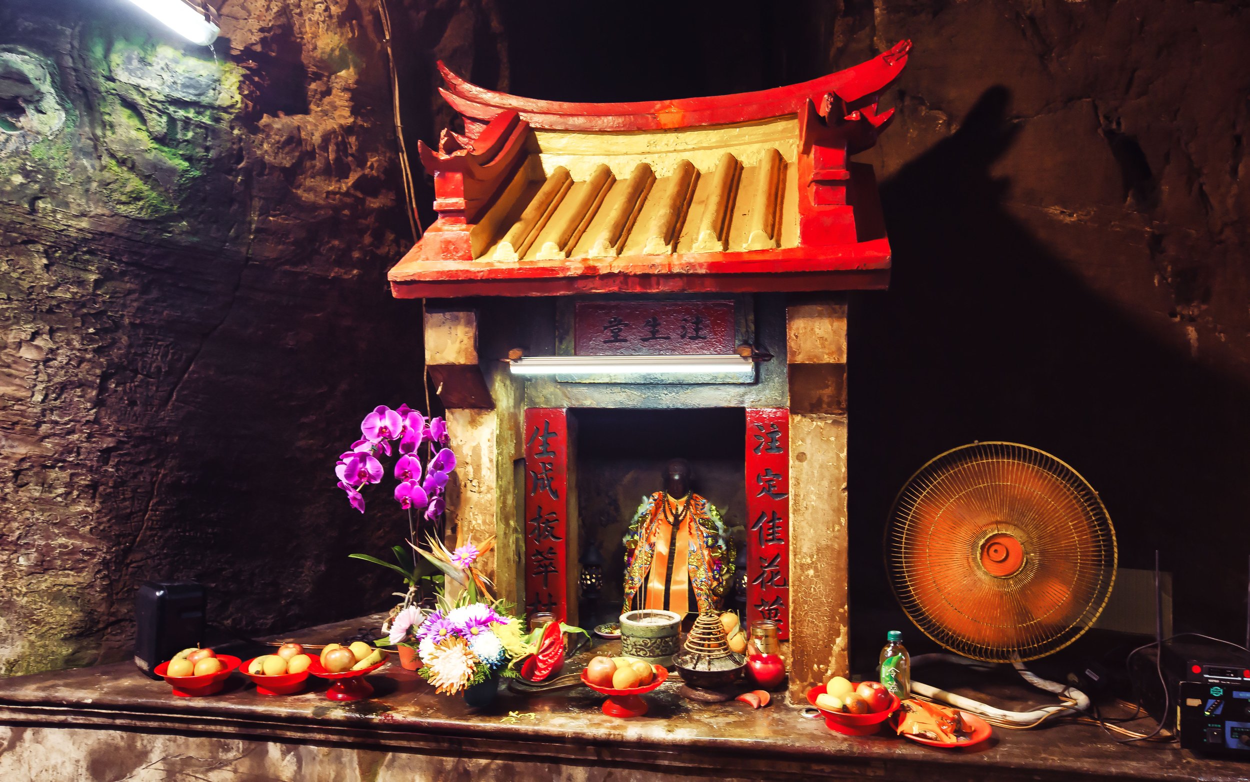
Within the main cave you’ll also find three smaller shrines, two of which are housed in cute miniature temple-looking buildings. To the left of the shrine you’ll find the Goddess of Childbirth (註生娘娘), a local folk religion deity. The other miniature temple is dedicated to the legendary Chinese scholar and poet, Lu Dongbin (呂洞賓), who is most well-known today as one of the ‘Eight Immortals’ (八仙).

The Japanese Jizo statue

Finally, the last of the smaller shrines is located on the right of the main shrine - a nod to the cave’s history there is a small shrine to Ksitigarbha Buddha (地藏菩薩), better known in Japan as ‘Jizo’ (じぞうぼさつ), and is one of the nation’s most loved and respected religious figures. In this case, it’s important to note that the Jizo that appears in this shrine is a Japanese-style Buddha, although its history is unclear, it might possibly be one of the original statues from the Japanese-era.

Calligraphy etched into the walls

Finally, I think it’s important to mention that there are a number of carvings on the walls throughout the cave, some of which are not only historic, but are quite beautiful in the calligraphy that they present. With a collection of almost two dozen phrases and idioms ranging from the late Qing Dynasty through to the Japanese-era, it would honestly take me far too long to translate each of them for you, so I’m not going to bother at this point, but if you find yourself in the cave, I highly recommend taking some time to check them out even if you can’t understand what they say.

Buddha’s Hand Cave (佛手洞)

Entrance to the Buddha’s cave

Located less than thirty meters away from the entrance to the Fairy Cave, you’ll find a footpath that wraps around the mountain to reveal another cave entrance, this time to the ‘Buddha’s Hand Cave’ (佛手洞).

Prior to receiving its most recent name, the cave was home to a habitat of bats, and locals simply referred to the caverns as ‘the bat cave’ (蝙蝠洞). During the Second World War, the cave was used as an air raid shelter while allied bombing runs targeted the nearby port, and other military installations in the area. With so much human activity in the caves, the number of bats declined and eventually they had enough of all the humans invading their space and moved out.

Consisting of a number of caverns, at some point the local government poured a bunch of concrete on the cave floor and electrified areas to provide some extra light within the cave in order to better promote it to local tourists. While not entirely necessary, given the amount of natural light that comes into the caves, it probably saves people from injuring themselves on wet days, which lets face it is most of the time in Keelung.

Walking through the lit caverns of the Buddha’s cave

Remarkably quiet, save for the sound of tourists, the natural sea-eroded cave features a high ceiling and smooth cave walls thanks to thousands of years of weathering and erosion. With natural mountain water dripping from the ceiling, the cave can be damp at times, but the sound of water drops is sometimes all that you’ll hear while exploring the cave, which is a welcome break from the busy city.

The current name of the cave is derived from a naturally designed pattern on part of the cave ceiling that appears similar to a giant hand, similar to the image of the Buddha’s hand, which has become a well-known image within Buddhist iconography, signifying generosity and peace. The design, caused by natural weathering in the rock has turned somewhat green and is easily noticeable while exploring the cave.

If you find yourself visiting Keelung on a hot summer day, the cave can be a great place of refuge from the sun as the various entrances allow for a nice amount of air to blow through proving a natural air conditioner for visitors.

Can you see it?

If you’re like myself and aren’t particularly impressed by all the rock formations that are popular tourist destinations with the locals in Taiwan, never fear, exploring the cave is already a cool enough experience that you don’t really have to spend too much time checking out the so-called Buddha’s hand, even though I have to admit, it does actually look like a hand.

Getting There


Address: No. 1, Renan St, Zhongshan District, Keelung City (基隆市中山區仙洞里仁安街1號)

GPS: 25.145208°N 121.748374°E

Located on the western side of Keelung Harbor, both the Fairy Cave and Buddha’s Cave are located within a historic area of the city, but also a pretty remote section of town. As a somewhat popular tourist attraction, you’ll often find quite a few visitors on weekends and national holidays. However, unless you have your own means of transportation, getting to the cave is somewhat of a hassle for anyone unfamiliar with the city.

If you have access to your own means of transportation, simply input the address provided above into your GPS or Google Maps and you should have no problem arriving at the cave. Fortunately, there is an ample amount of parking nearby, so you shouldn’t have much trouble finding a spot, even if the cave is busy. It’s important to keep in mind though that the area is often frequented by large trucks transporting things back and forth out of the port, and the road conditions are often a bit difficult with what seems to be perpetual construction between the area where the station and the cave are located. If you’re driving a car, you may find yourself stuck in traffic while road work is taking place.

If you’ve ever read any of my articles about Keelung, you’ll probably have already seen my complaints regarding public transportation in the city - I absolutely love visiting Keelung, but without access to sharable bicycle and scooter systems like YouBike and GoShare, it makes getting around somewhat difficult for anyone coming from out-of-town without a car.

So if you’ve arrived in Keelung and are looking for a way to get around on your own, I recommend visiting one of the scooter rental shops opposite the train station where you can rent a scooter for the day.

If you don’t have a scooter license, your options will more or less rely on walking, taxi’s or city buses.

From the train station, the cave is about a thirty-nine minute walk, making a visit a major time investment, especially if you have other places to visit on your itinerary. Taking a taxi there and back can also be quite expensive, so your best option is to simply take one of the public buses that stop nearby.

To get to the Fairy Cave, you have the option of the following three bus routes:

  1. Keelung Bus (基隆公車) 301 (Taibaizhuang 太白莊)

  2. Keelung Bus (基隆公車) 302 (Zhongshan Senior High School 中山高中)

  3. Keelung Bus (基隆公車) 304 (Gaoyuan New Village 高遠新村)

For each of the buses, you can hop on at a bus station near the Keelung Train Station (基隆火車站), and you’ll get off at the Fairy Cave Stop (仙洞巖站) where both caves are a two minute walk away.

When you’re done, simply hop on one of the buses back to the train station.

For bus 301 and 304, you’ll find the bus stop at the South entrance to Keelung Station (基隆火車站南站) while 302 can be taken from the Keelung City Bus Station (基隆火車站總站) nearby.

While it might seem like somewhat of an obscure tourist destination, exploring a place of worship within a cave is actually a pretty interesting experience. The Fairy Cave is damp, and the air inside is a constant haze of incense, but the temple certainly stands apart from all of the others that you’ll come across in Taiwan.

A visit to both the Buddha’s Cave and the Fairy Cave will only require about an hour of your time, so if you’re in town to check out the famed night market, a stop over at these caves will be a cool adventure.

References

  1. 仙洞巖 | Xian Dong Yan (Wiki)

  2. 仙洞巖 | Fairy Cave (基隆旅遊網)

  3. 仙洞巖 (國家文化資產網)

  4. 仙洞巖 (台灣宗教文化資產)

  5. 仙洞巖與佛手洞 (地球上的火星人)

  6. 仙洞巖.佛手洞.大武崙海灘 (Tony的自然人文旅記)

  7. 佛手洞 (基隆旅遊網)