Travel

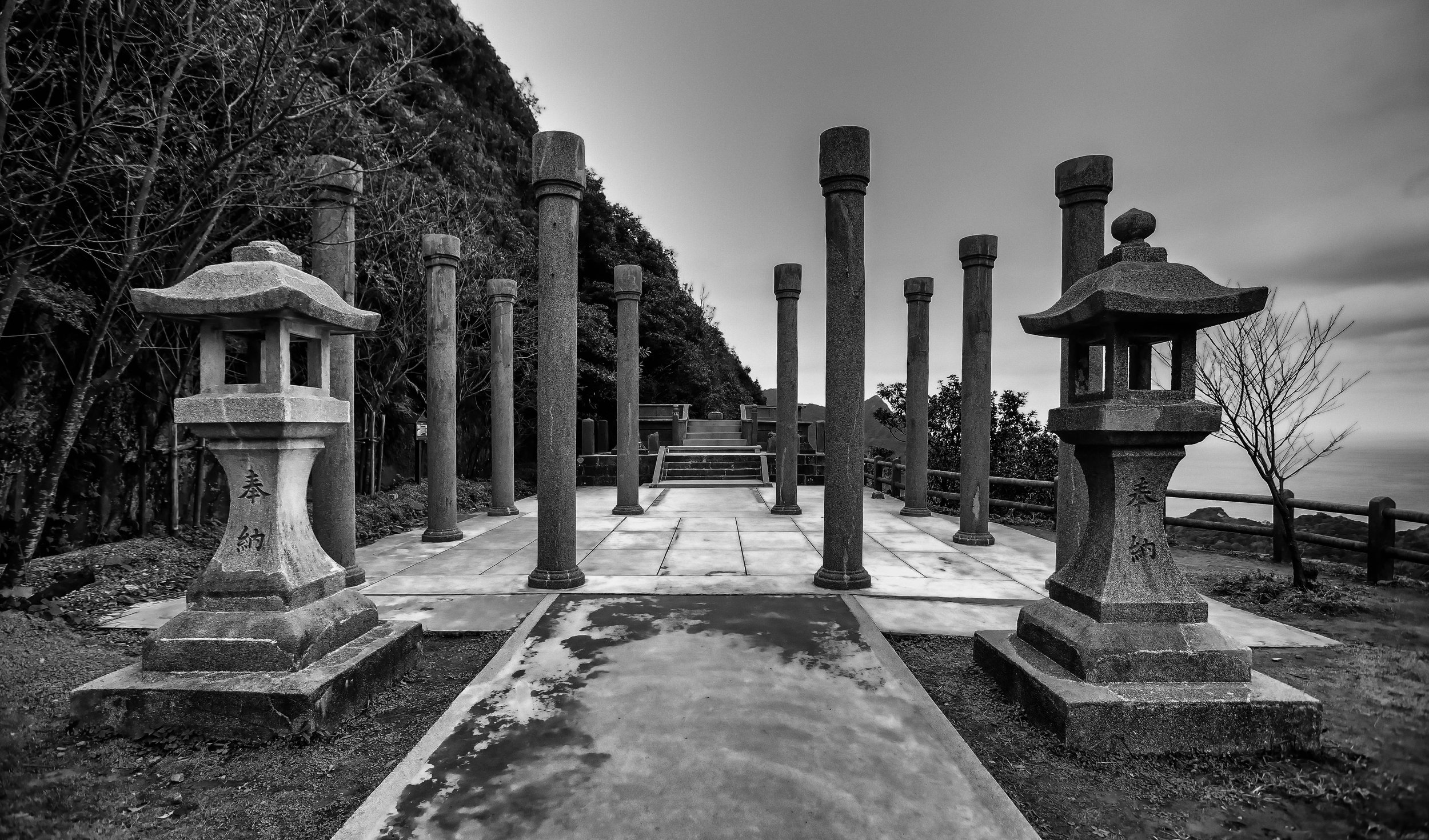
Battleship Rock (秀巒軍艦岩)

Over the years I’ve published quite a few articles about the mountains and hiking trails that encircle Taipei City - Starting with popular hikes like Elephant Mountain (象山) and the rest of the so-called Four Beasts (四獸山), I’ve also covered trails such as Fuzhou Mountain (福州山), Qixing Mountain (七星山), Jiantan Mountain (劍潭山), Jinmian Mountain (金面山) and Guanyin Mountain (觀音山). I’ve even published a guide that provides a comprehensive list of the best mountains and vistas in the city where you can take awesome photos of the city in my Taipei Cityscapes Guide.

With so many articles dedicated to the mountains that surround the capital of this great nation, some readers have asked why I’ve yet to publish anything about the popular ‘Battleship Rock’ (軍艦岩) hike in the city’s Beitou District (北投區) - Well, I’m here today to finally answer that question.

However, you may find yourself a little disappointed.

The ‘Battleship Rock’ I’m going to introduce today isn’t the popular hike in Taipei, but another tourist destination that shares the same name deep in the mountains of Hsinchu. Suffice to say, you won’t be getting instructions on how to hike the popular Taipei mountain this time round, but hey, you get to learn about and (possibly) enjoy photos of an entirely different ‘Battleship’ that rarely gets much attention.

The Battleship Rock I’m introducing this time is a lesser known, yet beautiful tourist stop high up the mountains of Hsinchu County’s Jianshih Village (尖石鄉). Instead of a beautiful cityscape, this location features a couple of beautiful suspension bridges, the confluence of two large rivers, wild hot springs, maple trees and a much larger ‘battleship' than the one in Taipei. However, while all of that might sound great, the biggest difference between this ‘Battleship’ and the one in Taipei is accessibility.

The hike in Taipei is one that is easily reachable via the city’s excellent public transportation network while this one is likely out of reach for most tourists. Nevertheless, even though Hsinchu’s Battleship Rock is more difficult to reach, if you are lucky enough to visit, likely on your way to Qalang Smangus (司馬庫斯部落), Cinsbu (鎮西堡) or the Syaroko Historic Trail (霞喀羅古道), you’re in for a treat.

As a travel-related article, I won’t be overloading you with information this time - I’m just going to spend some time introducing some of the cool things that you’ll see if you ever have a chance to visit the area. And hopefully the photos I share today might entice you to want to take some time to visit the area for a weekend, especially if Smangus is your final destination!

For those of you who landed here hoping to read about Taipei’s Battleship Rock, I hope I didn’t mislead you. I’ll eventually publish something about that hike - It’s on my list of places to write about, I just haven’t gotten to it yet, and these days I prefer to write about destinations that are off of the typical tourist’s radar.

Btunux Tukang (秀巒軍艦岩)

To introduce Hsinchu’s Battleship Rock, most writers would probably start with some scientific information about the geologic process that took place to form this beautiful rock. However, I feel like it’s a better idea to start out with an explanation of its name and the people who have lived in its midst for hundreds (if not thousands) of years.

Translated literally from Chinese as ‘Battleship Rock’ (軍艦岩 / jūn jiàn yán), it is known as ‘Btunux Tukang’ in the Tayal Indigenous language (泰雅語). Located a short distance from the rock, you’ll find the ‘Hbun-Tunan’ (控溪部落) tribe of Taiwan’s Tayal Indigenous People (泰雅族), whose ancestors settled along the river around four hundred years ago.

In the Chinese language, the tribe’s name is literally translated into English as the ‘River Control Tribe’ (控溪部落), a name which was given to them by the Japanese, and is something that might lead one to believe that they somehow nefariously controlled access to the mountains and river. However, in the Tayal language, ‘Hbun-Tunan’ instead refers to the geographic location where the two rivers intersected, and the traditional marketplace of goods that the tribe became known for.

Making their home in the river valley close to where Battleship Rock is located was geographically significant as the tribe played an important role within greater Tayal society for quite some time as the tribe was strategically located along the historic hunting trails used by the Indigenous people to traverse the mountains.

Crossing the river in front of Battleship Rock.

Acting as somewhat of a middle-man between the various tribes on either side of the river, the Hbun-Tunan, who are more commonly known these days as the Xiuluan Tribe (秀巒部落), created a marketplace that allowed the various tribes in the mountains to transport fruit, vegetables, meat and other commodities for trade.

That being said, the river valley was not only a strategic place to live, it was also filled with abundance as the river and the mountains provided the tribe with more than enough sustenance to get by on, and today that marketplace continues to thrive as Xiuluan Village (秀巒村) is the largest producer of peaches and pears in Taiwan.

Living in the midst of the giant rock, at some point, the Hbun-Tunan started referring to it as ‘Btunux Tukang’, which is likely pretty difficult for most native English speakers to even try pronouncing. Nevertheless, as the story goes, it was likely a name that was influenced by missionaries living in the area, because to the indigenous people, it was simply just a big rock. Thus, in Tayal, ‘Btunux’ is the equivalent of ‘rock’ (石頭) and ‘Tukang’ would have been a relatively new word to them that translated as ‘warship’ (軍艦).

Sadly, I spent quite a while trying to figure out the meaning of the name, consulting several Tayal scholars, who also thought it was funny.

The point where the confluence of rivers takes place.

Situated at the confluence where the Baishi / Sakyaking River (白石溪 / 薩克亞金溪) and Taigang / Takejin River (泰崗溪 / 塔克金溪) meet to form the Yufeng / Maliguang River (玉峰溪 / 馬里光溪), Battleship rock is said to resemble the bow of a giant warship. However, when it comes to (almost all of) Taiwan’s popular rock formation tourist destinations, my imagination tends not to be as wild as others. In this case though, I suppose you could argue that the sharp triangular shape of the rock cutting into the river actually does create the effect of a boat speeding its way through the water.

Admittedly, I’m not as knowledgeable about Taiwan’s river systems as others, but I was surprised to learn that two rivers that can see joining together here, eventually join with the greater Dahan / Takoham River (大漢溪 / 大嵙崁溪), which flows into Taoyuan, and is part of the river system controlled by the Shimen Reservoir (石門水庫).

Writing previously about the Youling Waterfalls (幽靈瀑布), Xiao Wulai Waterfall / Rahu-Ulay (小烏來瀑布) and other points of interest along the river, I was actually unaware that they were all part of the same tributary.

Note: For each of the location names above, I’ve included the name more commonly used on maps today as well as their original Tayal names for a bit of clarity.

Layers on the battleship.

Looking at Battleship Rock from a distance, you’re likely to notice the various layers in the rock, telling the story of its long history. Dating back to the collision of tectonic plates that allowed the land mass we known as Taiwan to emerge from the Pacific Ocean, the stripes in the rock are primarily comprised of silt, shale and white sandstone, each of which consists of a different shade.

Unfortunately, there is very little written about the area, and very few resources about provide any concrete estimation of how tall the rock is, but I’d estimate its anywhere between twenty to thirty meters tall.

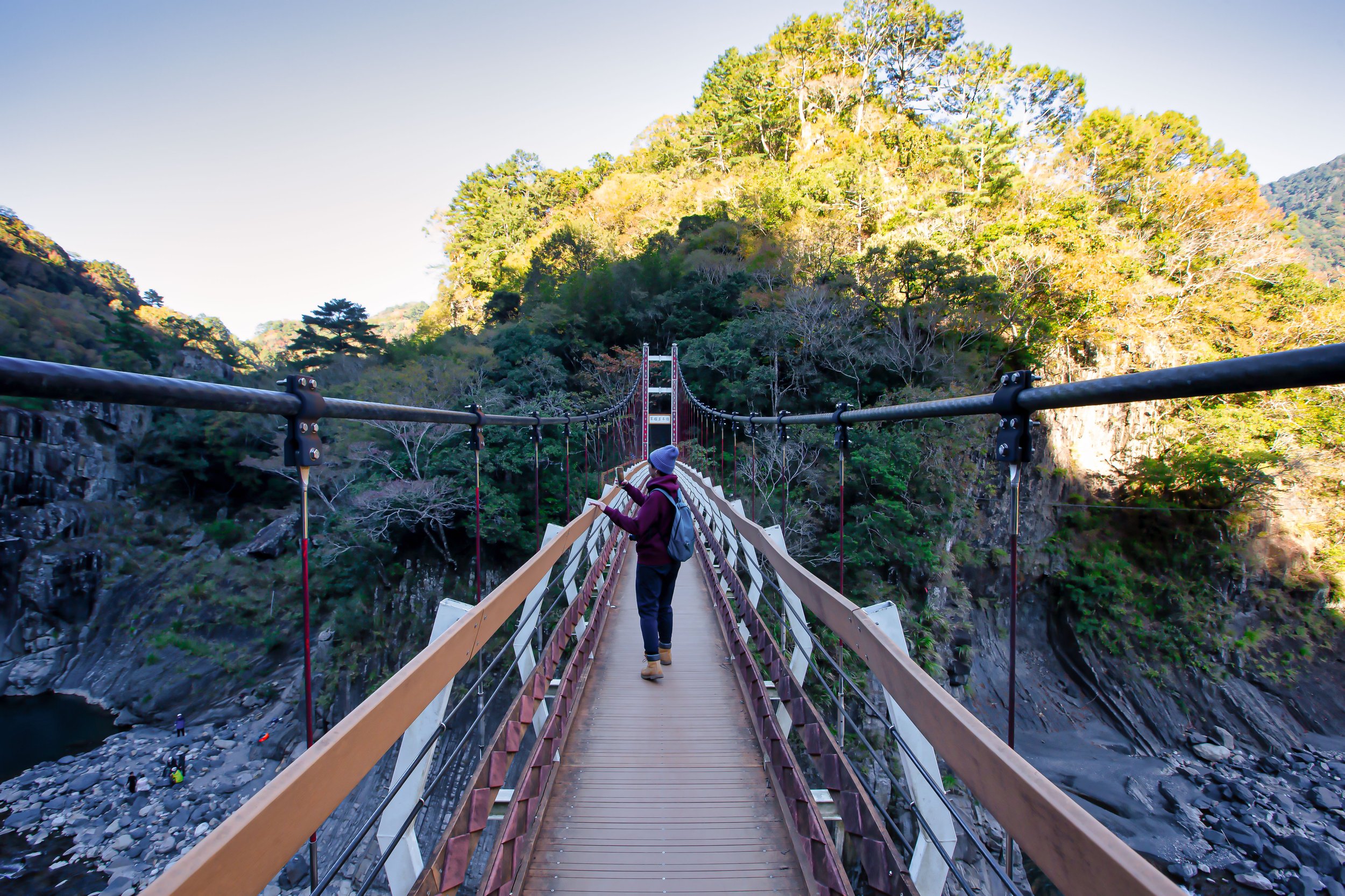
Fortunately, for anyone visiting today, the local government constructed a sixty meter long Battleship Rock Suspension Bridge (軍艦岩吊橋) in 2015 (民國104年), just over where the two rivers meet up.

The suspension bridge not only allows visitors to get a view of the rock from vantage points above the river, but also provides with the opportunity to cross to the other side to make your way down to the river bank where there are even closer views.

Likewise, just above the Baishi River, you’ll find the Kongxi Suspension Bridge (控溪吊橋), which was originally constructed during the Japanese-era, and then later rebuilt in 1985 (民國74年). In this case, the bridge allow visitors to enjoy the maple trees that grow on this side of the mountain during the late fall and winter months in addition to allowing visitors to make their way to the Taigang Wild Hotsprings (泰崗野溪溫泉) where you can dip your feet in the water.

Maples on the mountain across the river.

That being said, it’s important to remind readers that (as I mentioned earlier) the Hbun-Tunan tribe sat at the crossroads of the so-called ‘ancient’ network of Tayal trails that allowed the various tribes to connect with each other - so when the Japanese arrived in Taiwan in 1895, these routes were thought to pose a risk to their control. The early years of the colonial era saw a heavy handed approach to suppressing any opposition to Japanese rule, and given the tribe’s strategic geographic location, the military converted the ancient trails into police patrol roads which were equipped with artillery batteries and police stations in remote mountain areas.

While attempting to control the movements of the Indigenous people, a number of violent massacres took place leaving a legacy of violence that pushed the indigenous people further into the mountains and completely changed their traditional way of life.

Today, if you cross the Kongxi Suspension Bridge and continue hiking several kilometers up the mountain, you can find the ruins of some of those historic outposts, which were spread throughout the mountains, especially along the Syakoro Historic Trail (霞喀羅古道), where some of them have recently been restored.

Note: During the same visit to the area, I hiked part of the Syakaro Historic Trail, but it was more of a volunteer experience that didn’t allow me to hike the entire trail, so I missed out on the parts of the hike that I was most interested in. Eventually I’ll hike the entire length of the trail and write a blog about it, but until then I recommend you check out Anusha Lee’s article about the trail

Syakaro Historic Trail: A Hike with History, Suspension Bridges and Fall Foliage (Taiwan Hikes)

Crossing over onto maple mountain.

Somewhat ironically, despite the area being referred to as Battleship Rock, the maple trees growing on the mountain on the other side of the Kongxi Suspension Bridge have become the star attraction in recent years. During the months when the trees are changing colors, you’ll find the parking lot full of shuttle vans bringing tourists up and down the mountains.

While the Battleship Rock area isn’t the best spot for maple viewing in Jianshih Village, it’s probably the easiest for most people to get to, making it a popular spot for weekend day-trippers. Coming from Canada, it’s difficult to impress me when it comes to maple trees, but after years of not seeing the leaves change colors back at home in the autumn, it was nice to see Taiwan’s mountains changing colors, especially in this area with the combination of the rivers and the mountains.

With that in mind, the best time to visit the area is in the autumn between October and January, but you’ll want to remember that the maples change colors at different times than they do in North America, so you should consider going a bit later in the year to see them, or simply check the recent photos from the area on Instagram to see if its a good time to visit or not.

Visiting the Battleship Rock area probably won’t require a whole lot of time, but if you plan on hiking the trail to see some of the ruins, or soaking your feet in the wild hot spring, you might want to schedule a bit more time to enjoy yourself. Either way, the parking lot next to the bridge is 100NT per visit for a car, and 30NT for scooters. Everything else is free, unless of course you decide to buy some delicious indigenous snacks from the vendors across the street.

Getting There


Address: Xiuluan Village, Jianshih Village, Hsinchu (新竹縣尖石鄉秀巒村)

GPS: 24.633680, 121.279510

As mentioned earlier, the biggest difference between Taipei’s Battleship Rock and Hsinchu’s Battleship Rock is accessibility. The hike in Taipei is pretty easy to get to, but this one is considerably more difficult.

Part of the problem, at least for most international tourists, is that there is no method of public transportation that will take you anywhere near the area. So, if you’re interested in visiting, your only option is to go by car or scooter, or arrange for a shuttle bus to get you there.

That being said, if you’re driving a car or a scooter, I recommend inputting the address or coordinates provided above into a GPS system to map out your route. Depending on where you’re coming from, you’ll want to get off of Highway #3 at the Zhulin Interchange (竹林交流道) and make your way towards Neiwan (內灣) on the #120 County Highway. Passing Neiwan, you’ll continue on towards Jianshih on the #60 rural road pretty much until you arrive.

As one of the stops along the road towards Smangus or the Syaroko Historic Trail, if you’ve planned a trip to either location, Battleship Rock is one of the must-stops along the road. Not only will you get a break from sitting in the shuttle bus, but you’ll also enjoy the opportunity to get a sneak peek of some of the amazing natural beauty that you’re going to experience on your trip. On the other hand, if you’re just enjoying a day-trip through the area, it makes an excellent place to stop, hike a bit and then turn back on your way home. Whatever your itinerary, a visit to Hsinchu’s Battleship Rock is a rewarding experience

References

  1. 秀巒軍艦岩步道 (健行筆記)

  2. 漫步新竹尖石「秀巒軍艦岩」、「軍艦岩吊橋」壯闊美景 (Jamie慢森活)

  3. 新竹景點 尖石鄉/秀巒軍艦岩/軍艦岩吊橋/大自然之旅一日遊/陡峭岩壁超壯觀! | 綠歐樂生活 (綠歐樂生活)

  4. 新竹尖石二日遊 玉峰村部落住一晚,沿途遼闊山巒陵線,凝聽老鷹溪步道溪流 (微笑台灣)

  5. 秀巒 Hbun-Tunan (霞喀羅國家步道)

  6. 控溪部落 Hbun-tunan (Taiwan Indigenous People’s Portal)


Taiwan’s Remaining Japanese-era Train Stations (台鐵現存日治時期車站)

Over the past year or so, I’ve found myself spending a considerable amount of time researching the history of the railroad in Taiwan. Obviously, much of the rail network that we know and love today is primarily a result of the fifty-year Japanese Colonial Era, so as part of my evolving research and personal interest in that period of Taiwan’s history, I've been traveling around the country taking photos of a collection of century old stations.

That being said, over much of that time, I’ve been focused primarily on a specific group of stations known locally as the ‘Five Treasures of the Coastal Railway’ (海岸線五寶), with the lingering thought in the back of my mind that there are still dozens of others around the country that I’ll eventually have to visit. 

When it comes to these things, I tend to be a pretty organized person, so while writing about the Five Treasures, I came to the conclusion (mostly for my own research purposes) that I should compile a list of all of those stations. In this way, I could better allocate my time and ensure that whenever I travel, I’m able to use my time more wisely.

Taichung Train Station (台中車站)

While compiling the list however, I ended up discovering that there are very few authoritative resources that focus on these historic stations, or any that offer a complete list of what actually remains standing today. 

To solve this problem, I dove deep into that rabbit hole and compiled a comprehensive list of over sixty historic Japanese-era stations that continue to exist in some form today. The final result is a list that is divided into various sections based on the branch of the railway where you’ll find them, including stations that belong to the historic sugar and forestry lines. Moreover it offers information as to their current operational status as well as their original Japanese-era names. I’ve also added a list of other railway-related sites, including the three former Railway Bureau Offices (鐵道部) in addition to any railway hospital, dormitory, tunnel or railway-related place of interest that has been restored in recent years.

Historic Taichung Station with the current Taichung Station in the background

That being said, I still consider these lists to be a work in progress, and I’m sure that despite my best efforts, I’ve missed something, which will have to be added in the future.

So, if you are aware of a station or important Japanese-era railway site that I’ve yet to add to the list, I’d be more than happy for your feedback as I hope to see the list continue to evolve over time.

Similarly, as I continue to write new articles about these historic stations, I’ll continue to update links.

You might ask why I feel that these stations are important - they’re just train stations, right? 

Well, given Taiwan’s complicated history of colonial powers exerting control over the island, there has been an unfortunate erasure of history with each successive regime. Coupled with modern development having little-to-no regard for the nation’s history, a large percentage of what we could consider heritage sites across the country have been lost. Sure, we can easily find places of worship that are several hundred years old, but almost everything else has been torn down at some point in time.

Xinbeitou Station (新北投車站)

As I’ve already mentioned, the list I’m providing below features some century-old stations that continue to remain in service today in addition to others that have become historic tourist attractions.

With a total of around two-hundred train stations across the country, many of the originals have already been replaced, making those that remain part of a special group of ‘living’ historic sites, worthy of cultural preservation. 

Westerners might not consider a century-old building all that significant, but given Taiwan’s chaotic experience over the past two hundred years, any building that has been able to survive for so long deserves some respect. Likewise, it’s important to note that the introduction of an island-wide public transportation network was essentially a game changing moment in the development and industrialization of the island.

Shanjia Railway Station (山佳車站)

The railway not only brought modernity and economic opportunity, but also contributed to cultural and social change with railway stations acting as the beating heart of the modern Taiwanese town or city. Suffice to say, the ‘local railway station’ is often romanticized by many in Taiwan who have fond memories growing up with the trains becoming an essential part of their lives.  

As I move on below, I’ll provide a brief introduction to the history of the Japanese-era railway, then I’ll present the lists as well as a map where you’ll find each of the stations.

I hope this list will be of some use to you, but given that I’ve spent a considerable amount of my free time putting it together, and translating all of the names, I hope it won’t just be copied and stolen without contacting me to ask for permission.

Taiwan’s Japanese-era Railway (臺灣日治時期鐵路) 

Hsinchu Railway Station (新竹車站)

The history of Taiwan’s railway network dates as far back as the late stages of the Qing Dynasty when a rudimentary railway was constructed between Keelung and Taipei in the 1890s, with plans to further expand the line all the way to the south. For many, one of the biggest misconceptions of ‘Chinese’ rule here in Taiwan is that they controlled the entire island. They didn’t, and had little aspiration to expand beyond the pockets of the western coast of the island that they did control.

So when the short-lived First Sino-Japanese War (日清戰爭) broke out in 1894, plans for further expansion of the railway were ultimately abandoned due to a lack of funds, and a lack of interest in the island’s development.  

When the Japanese ultimately won that war, one of their demands was that the Qing cede the island of Taiwan (and the Pescadores) to the Japanese empire, which was quickly approved given that many back then considered the island a useless piece of untamed land, full of hostile indigenous peoples.

Tai’an Railway Station (泰安車站)

The Japanese on the other hand saw potential as the island was a massive cache of natural resources. So, in 1895 the Japanese showed up, and quickly got to work on plans to construct a railway network that would allow them to efficiently develop the island for the extraction of its precious natural resources.

Nearing the end of 1895 (明治28年), the colonial regime stationed a group of military engineers known as the ‘Temporary Taiwan Railway Team’ (臨時臺灣鐵道隊) in the northern port city of Keelung to carry out repairs on the existing railway, conduct surveys, and to come up with plans for improvements. Within a year proposals were drawn up to completely re-route the existing rail line from Keelung to Taipei in another direction for better efficiency, and a more ambitious plan known as the Jūkan Tetsudo Project (ゅうかんてつどう / 縱貫鐵道) was born.

Xiangshan Railway Station (香山車站)

Known in English as the ‘Taiwan Trunk Railway Project,’ the planning team sought to have the railroad pass through all of Taiwan’s already established settlements, including Kirin (基隆), Taihoku (臺北), Shinchiku (新竹), Taichu (臺中), Tainan (臺南) and Takao (高雄), a more than four-hundred kilometer railway.

Completed in 1908 (明治41), the railway connected the north to the south for the first time ever, and was all part of the colonial government’s master plan to ensure that natural resources would be able to flow smoothy out of the ports in Northern, Central, and Southern Taiwan. 

Then, the Railway Department of the Governor General of Taiwan (台灣總督府交通局鐵道部) set its sights on constructing branch lines across the island in addition to expanding the railway along the eastern coast. 

Looking at a map of the railway network today, one thing you’ll notice is that the lines appear to completely encircle the island. From the 1910s until 1945 (and in some cases longer), the network appeared more like an intricate spiderweb of lines with industrial branch lines scattered across the island.

Xinbeitou Station (新北投車站)

As the railway continued to expand across the island, cities and economic opportunity followed, but with limited space, there is only so much that they could construct. Thus, the fifty year period of Japanese colonial rule is often split into two different periods by historians - The period between 1895 (明治31年) and 1926 (昭和元年) is referred to as the period of major railway construction while 1927 (昭和2年) to 1945 (昭和20年) is regarded as the period of railway improvement.

Link: Railway Station Name Change Chart (臺灣日治時期火車站新舊地名對照表)

The vast majority of the railway network’s stations were constructed during the Meiji Era (明治) from the time that Japan took control of Taiwan until 1911. The Taisho (大正) and Showa (昭和) eras then saw continued expansion of the railway, but for the most part many of the rudimentary stations constructed in the early years of the colonial era were replaced or reconstructed, with many of the stations that we can still see today (on the list below). 

Tanwen Railway Station (談文車站)

There are several factors as to why authorities at the time sought to improve the infrastructure network, but I suppose the most obvious was due to the wear and tear caused by natural disasters such as earthquakes and typhoons, which so commonly take place here in Taiwan. The modern construction techniques and materials introduced during the Taisho era meant that instead of constructing buildings purely of timber, reinforced concrete could then be utilized to ensure a longer life for many of the island’s important buildings.

It was also during this time that the railway network was improved with new bridges, tunnels and train engines all working together to improve the efficiency of the network. 

Qidu Railway Station (七堵車站)

Ultimately, the colonial era came to a conclusion at the end of the Second World War and in the seven decades since, Taiwan’s railway (and public transportation network) has continued to grow with the railway finally encircling the entire island. In recent decades we have also seen the widening of tracks and the electrification of the system. Today, the railway in Taiwan is a well-oiled and efficient machine that is of benefit to every one of the twenty-three million people living in the country and works seamlessly with the High Speed Rail as well as the underground subway networks in Taipei, Taichung and Kaohsiung.  

Some pretty horrific things took place during the Japanese era, but it goes without saying that this country wouldn’t be the amazing place it is today if it weren’t for the introduction of the railway.

Now that I’ve said my piece, let's move on to the list of remaining Japanese-era stations. 

Taiwan’s Main Lines (營運路線)

Taiwan’s Main Branch Lines, namely those constructed for both passenger and freight services currently consist of three main sections: the Western Trunk Line (西部幹線), the Eastern Trunk Line (東部幹線) and the South-link Line (南迴線). All three of which were planned for construction during the colonial era, yet only the western and eastern lines were completed before the end of the Second World War.

It would take until 1991 for the South-Link Line to finally connect the eastern and western lines, allowing the railway to finally encircle the entire country.

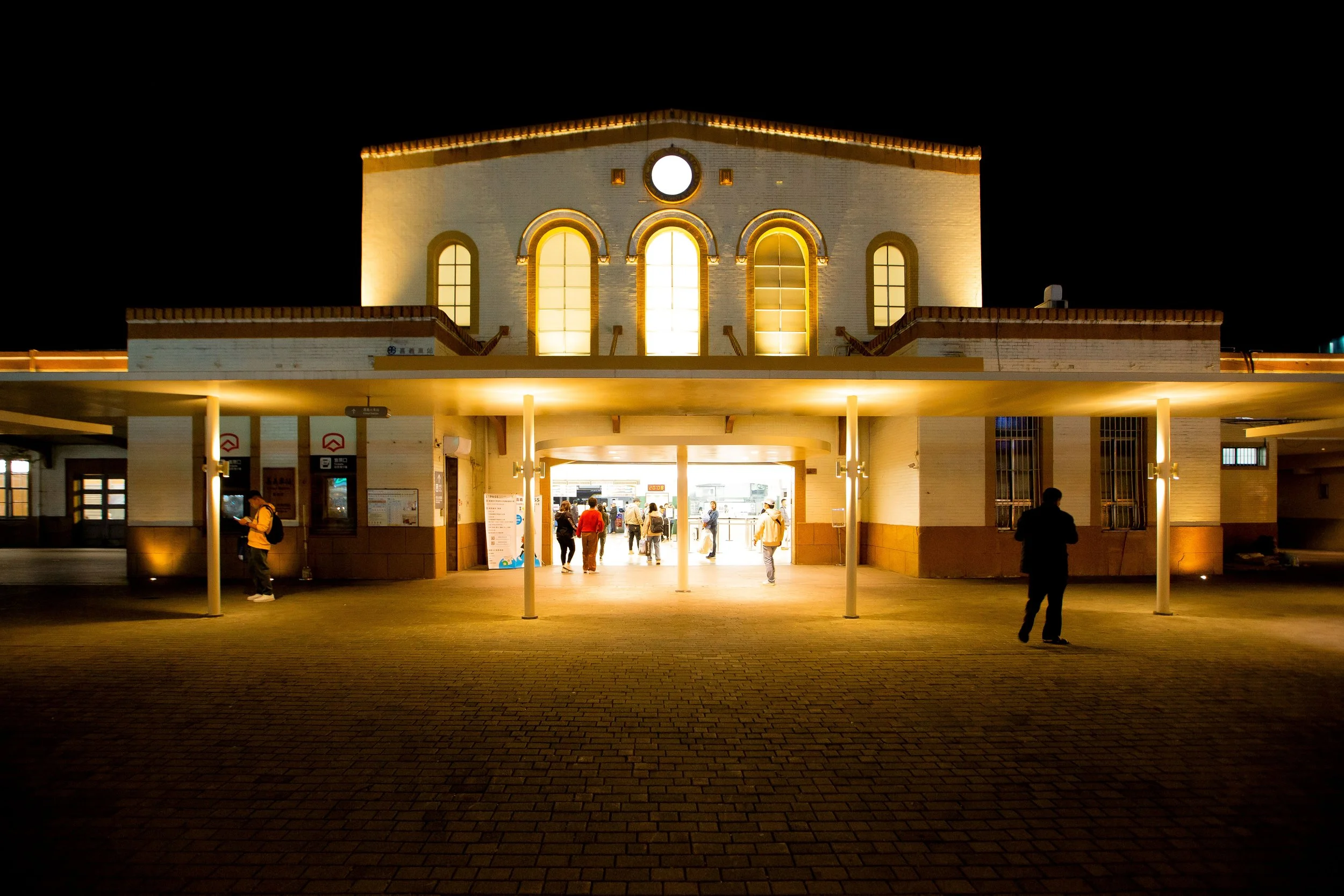
Chiayi Station (嘉義車站)

There are of course a number of factors involved, but it’s important to note that the majority of stations on the list below are located primarily along Taiwan’s western coast. The Western Trunk Line running between Keelung and Kaohsiung was completed within a decade of the Japanese taking control of Taiwan, while the construction of the eastern coast railway took a little longer.

The eastern coast of the country is prone to earthquakes, and is affected much more by typhoons than the rest of Taiwan, so it’s understandable that many of those historic stations have been lost over time. It’s also important to keep in mind that the western side of the island has experienced considerably more development than the east, so the number of historic railway stations vastly outnumbers what you’ll find along the eastern coast. 

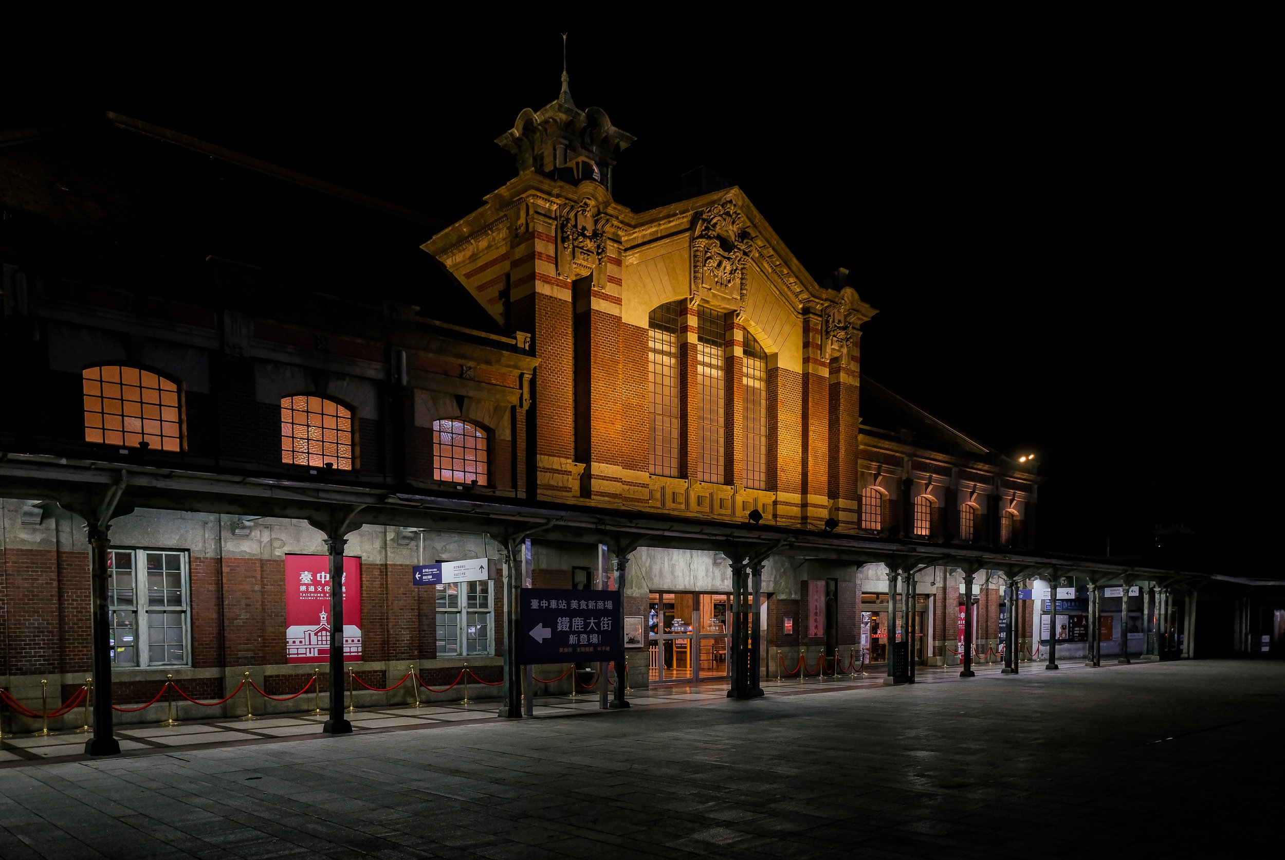
Historic Taichung Station (台中車站)

The list of stations below is organized from north to south and ends on the east coast:

    1. Qidu Station (七堵車站 / Shichito / しちとえき) - Still in operation (moved)

    2. Huashan Station (華山貨運站 / Kabayama / かばやまえき) Not in operation

    3. Shanjia Station (山佳車站 / Yamakogashi / さんかえき) - Still in operation (moved)

    4. Hsinchu Station (新竹車站 / Shinchiku / しんちくえき) - Still in operation

    5. Xiangshan Station (香山車站 / Kozan / こうざんえき) - Still in operation

    6. Tanwen Station (談文車站 / Tanbunmizumi / だんぶんみずうみえき) - Still in operation

    7. Dashan Station (大山車站/ Oyamagashi / おうやまあしえき) - Still in operation

    8. Hsinpu Station (新埔車站 / Shin-ho / しんほえき) - Still in operation

    9. Shenhsing Station (勝興車站 / Jurokufun / じゅうろくふんえき ) - Not in operation

    10. Rinan Station (日南車站 / Oyamagashi / おうやま あしえき) - Still in operation

    11. Qingshui Station (清水車站 / Kiyomizu / きよみずえき) - Still in operation

    12. Chuifen Station (追分車站 / Oikawe / おいわけえき) - Still in operation

    13. Zaoqiao Station (造橋車站 / Zokyo / ぞうきょうえき) - Still in operation

    14. Tongluo Station (銅鑼車站 / Dora / どうらえき) - Still in operation

    15. Tai-an Station (舊泰安車站 / Taian / たいあんえき) - Still in operation (moved)

    16. Taichung Station (台中車站 / Taichu / たいちゆうえき) - Still in operation (moved)

    17. Ershui Station (二水車站 / Nisui / にすいえき) - Still in operation

    18. Dounan Station (斗南車站 / Tonan / となんえき) - Still in operation

    19. Chiayi Station (嘉義車站 / Kagi / かぎえき) - Still in operation

    20. Shiliu Station (石榴車站 / Sekiryu / せきりゅうえき) - Still in operation

    21. Nanjing Station (南靖車站 / 水上駅 / Mizukami / みずかみえき) - Still in operation

    22. Houbi Station (後壁車站 / Koheki / こうへきえき) - Still in operation

    23. Linfengying Station (林鳳營車站 / Rinhoei / りんほうえいえき) - Still in operation

    24. Tainan Station (台南車站 / Tainan / たいなんえき) - Still in operation

    25. South Tainan Station (南台南車站 Shikenshozen / しげんしやうまへ) - Not in operation

    26. Bao-an Station (保安車站 / 車路墘駅 / Sharoken / しゃろけんえき) - Still in operation

    27. Luzhu Station (路竹車站 / Rochiku / ろちくえき) - Still in operation

    28. Qiaotou Station (橋頭車站 / 橋子頭駅 / Hashikotou / はしことうえき) - Still in operation

    29. Kaohsiung Station (舊高雄車站 / Takao / たかおえき) - Not in operation

    30. Sankuaicuo Station (三塊厝車站 / Sankaiseki / さんかいせき) - Still in operation (moved)

    31. Chutian Station (竹田車站 / Takeda / ちくでんえき) - Still in operation

    32. Guanshan Station (關山車站 / Kanzan / かんざんえき) - Still in operation (moved)

    33. Bin-lang Station (檳榔車站 / Hinashiki Teijajō / ひなしきていしゃじょう) - Not in operation 

Branch Lines (產業鐵路)

Most are surprised to learn that the railway that we know today is actually exponentially smaller than the railway of the Japanese era, which was home to dozens of branches off of the main lines.

Connecting important industries to the main transportation network, today, only a few of these branches remain in service. Most notably, the Pingxi Line (平溪線), Neiwan Line (內灣線), Jiji Line (集集線), and the Alishan Line (阿里山線). For the most part, these branch lines weren’t originally constructed with passenger service in mind, they were primarily used for transporting freight and commodities from their point of origin to the main lines so that they could be brought to port. 

The most prominent of these branch lines were the ‘Forestry Lines’ (林業鐵路) and the ‘Sugar Lines’ (糖業鐵路), which were constructed to haul sugarcane and timber, while also providing limited passenger services.

Today, a few of the original stations along those historic lines continue to exist, but for the most part service on these lines have been relegated as tourist attractions as the majority of those rail networks have been removed.

Zhulin Forest Railway Station (竹林車站)

Of those branch lines that continue to provide (limited) service today you’ll find the following:  

Sugar: the Magongcuo Line (馬公厝線), the Xihu Line (溪湖線), the Zhecheng Line (蔗埕線), the Baweng Line (八翁嫌), the Xingang East Line (新港東線) and the Qiaotou Line (橋頭線).

Forestry: the Alishan Forest Railway (阿里山森林鐵路), Taiping Mountain Forest Railway (太平山森林鐵道), the Luodong Forest Railway (羅東森林鐵路) and the Wulai Scenic Train (烏來台車).

To offer an idea of the scale of the Japanese-era railway, the network in Taiwan today is measured at 2,025 kilometers in length while the Japanese-era the branch railways would have tripled that total length with the Sugar Railways alone spanning 2,900km in central and southern Taiwan. 

Below you’ll find some of those stations that continue to exist in some form:   

    1. Jing-tong Station (青銅車站 / 菁桐坑驛 / Seito / せいとうえき) - Still in operation

    2. Xinbeitou Station (新北投車站 / Shinhokuto / しんほくとうえき) - Not in operation

    3. Hexing Station (合興車站) - Still in operation (Completed in 1950)

    4. Kanglang Station (槺榔驛 / Kanran / かんらんえき) - Not in operation

    5. Xihu Station (溪湖車站 / Keiko / けいこえき) - Not in operation

    6. Lukang Station (鹿港車站 / Rokko / ろっこうえき) - Not in operation

    7. Jiji Station (集集車站 / Shushu / しゅうしゅうえき) - Still in operation

    8. Checheng Station (車程車站 / 外車埕驛 / Gaishatei / がいしゃていえき) - Still in operation

    9. Huwei Station (虎尾車站 / Kobi / こびえき) - Not in operation

    10. Suantou Station (蒜頭車站 / Santo / さんとうえき) - Not in operation

    11. Wushulin Station (烏樹林車站 / Ujiyurin / うじゅりんえき) - Not in operation

    12. Yanshui Station (鹽水車站 / Ensui / えんすいえき) - Not in operation

    13. Qishan Station (旗山車站 / Kisan / きさんえき) - Not in operation

    14. Zhulin Station (竹林車站 / Chikurin / ちくりんえき) - Not in operation

    15. Dazhou Station (大洲車站 / Daishu / だいしゅうえき) - Not in operation

    16. Tiansongpi Station (天送埤車站 / Tensohi / てんそうひえき) - Not in operation

    17. Historic Morisaka Station (萬榮工作站 / Morisaka / もりさかえき) - Not in operation

Alishan Forest Railway Branch Line (阿里山林業鐵路)

Beimen Station (北門車站)

One of the Colonial Government’s most ambitious railway construction projects was the Alishan Forestry Branch line, which was constructed to more efficiently transport one of the era’s hottest commodities, Taiwanese cypress (hinoki / ひのき / 檜木).

The branch line has remained in operation for almost a century now, and despite a few setbacks, it remains a popular tourist excursion out of Chiayi. Below, I’m listing some of the Japanese-era stations that remain in operation along the line today.

I should note that there are several ‘stops’ along the way, such as the Sacred Tree Station (神木站), which some may consider to be a Japanese-era station when in fact it is really only just a platform, which is why I haven’t included it in the list.

    1. Beimen Station (北門車站 / Hokumon / ほくもんえき) - Still in operation

    2. Lumachan Station (鹿麻產車站 / Rokuma-san / ろくまさんえき) - Still in operation

    3. Zhuqi station (竹崎車站 / Takezaki / ちくきえき) - Still in operation.

    4. Mululiao Station (木履寮車站 / Mokuriryo / もくりりょうえき) - Still in operation

    5. Jhangnaoliao Station (樟腦寮車站 / Shounoryo / しょうのうりょうえき) - Still in operation

    6. Dulishan Station (獨立山車站 / Dokuritsu-san / どくりつさんえき) - Still in operation

    7. Jiaoliping Station (交力坪車站 / Koriyokuhei / こうりょくへいえき) - Still in operation

    8. Shueisheliao Station (水社寮車站 / Suisharyo / すいしゃりょうえき) - Still in operation

    9. Fenchihu Station (奮起湖車站 / Funkiko / ふんきこ-えき) - Still in operation

    10. Duolin Station (多林車站 / Tarin / たりんえき) - Still in operation

    11. Shitzulu Station (十字路車站 / Jiyuujiro / じゅうじろえき) - Still in operation

    12. Chaoping Station (沼平車站 / Shohei / しょうへいえき) - Reconstructed

Japanese-era railway-related places of interest

Taihoku Railway Department

In addition to the Japanese-era railway stations that remain in Taiwan, there are also a large number of historically important buildings and places of interest with regard to the railway.

The most prominent of these being the three Railway Bureau Offices, which were the geographically strategic offices for the operation and maintenance of the railway.

There are also quite a few other places of interest, and this is where my list will ultimately continue to grow over time as there are a number of railway-related buildings currently in the process of being restored as well as a number of branch line-related sugar factories, which have been converted into culture parks.


Map of Japanese-era Railway Stations

Combining the three lists above, the map I’ve created below features all of the stations and Japanese-era railway-related places of interest in one convenient location. This should help you easily identify where you’ll be able to find these historic locations.

Each of spots on the map features basic information about the stations as well as links to articles about them, if available. 

As you can see from the modest number of links I’ve provided, I still have quite a bit of work to do with regard to documenting the history of these stations - So, as I mentioned earlier, this article is very much a work in progress, and as I continue to work on a number of other ongoing projects, I’ll try to visit as many of these these historic stations as I can while traveling around the country.

That being said, I hope that this list and the map I’ve created for you are both interesting and helpful.

If you have any questions or comments, feel free to get in touch!


Tamsui Police Commissioners Residence (淡水日本警官宿舍)

I’ve you’ve lived in Taiwan long enough, you may have noticed that the Taipei MRT has changed the romanized name it uses for Tamsui Station (淡水捷運站) on a couple of occasions. Whenever these things happen, it usually follows with heated public debate and questions as to why they’re once again wasting money on these unnecessary changes. Suffice to say, whatever ‘official’ reason is given for the change, most people know that they’re actually politically motivated.

Correct me if I’m wrong, but I remember during the most recent incident, one of the reasons given for the change to ‘Danshui’ was that International tourists couldn’t pronounce ‘Tamsui’, so they had to change it to something more recognizable. ‘Danshui’ which is the Mandarin pronunciation romanized into Hanyu Pinyin (漢語拼音) was thought to be more foreign-friendly than the original name of the area, ‘Tamsui’, which is the Taiwanese-Hokkien pronunciation. Nevertheless, the change didn’t last very long as it was quickly changed back.   

Given that the area has been referred to as ‘Tamsui’ for hundreds of years, it comes across as a bit odd that there are all of these contemporary naming issues, but Taiwan can be a pretty complicated place at times, and it’s well-known that the Chinese Nationalists were never really big fans of the local language. The irony however, is that during the Japanese-era, the original name remained exactly the same. During that half-century period, ‘Tamsui’ (淡水) simply became known as Tansui (淡水郡 / たんすゐぐん), the Japanese pronunciation of the original name.

Geographically, the Tamsui District (淡水區) of today is considerably smaller than the Tamsui District (淡水郡) of the Japanese era, in that the latter consisted of districts that currently make up New Taipei City’s Shimen District (石門區), Sanzhi District (三芝區) and Bali District (八里區) - known during the Japanese era as Sekimon-sho (石門庄 / せきもんょう), Sanshiba-sho (三芝庄 / さんしょう) and Hachiri-sho (八里庄 / はちりしょう) respectively. The district also included the main town of Tansui (淡水街 / たんすいまち), where a considerable amount of commerce and international trade was taking place.

The area ended up being so vital to the Japanese colonial government that they quickly got to work on the construction of the twenty kilometer-long Tamsui Branch Line (淡水線 / たんすい) that followed the east bank of the Danshui River from the capital. The railway was a game changer for the district, which originally acted as a port of trade with China, in turn sending products down the river into Dadaocheng (大稻埕) or Bangkha (艋舺). The completion of the railway in 1901 allowed for a more efficient process of getting things to the capital, making the port town an important one for the colonial government with regard to transporting things from the Japanese mainland to Taiwan, easing some of the congestion from the other northern port in Keelung (基隆). More importantly however, the branch railway kept the people of the area connected with the capital in a way that ensure that it would always remain an important part of Taipei.

Note: The Tamsui Line consisted of the following stations: Daitotei (大稻埕), Hokumon (北門), Taihoku (台北), Taishogai (大正街), Soren (雙連), Maruyama (圓山), Miyanoshita (宮ノ下), Shirin (士林), Kirigan (石牌), Hokuto (北投), Kanto (關渡), Chikui (竹圍) and Tansui (淡水). For those unaware, these historic stations, which were in service from 1901 (or added in 1915) and make up much of what is today the Red Line (紅線) of the Taipei MRT, which replaced the original railway.

The ability to maintain it’s economic prosperity meant a lot for the people of the area, which is something that continues to be celebrated today with both domestic and international tourists making their way from the city to enjoy the Tamsui Old Street, it’s beautiful riverside, and a large number of historic buildings and tourist destinations. The prosperity enjoyed by the people of Tamsui during the colonial era is clearly visible along the old street today, where the architectural design of the buildings is indicative of what we’ve come to expect from any of the historic “Old Streets” (老街) that have been converted into tourist destinations.

Covering an area of 227km², and with a population of nearly 60,000, Tamsui was one of the many districts under the governance of Taihoku Prefecture (台北州 / たいほくしゅう). In 1920 (大正9年) however, the colonial government refined and redistricted Taiwan’s geographic and administrative system. This was when  ‘Tansui District’ (淡水郡), or county depending on your translation, was brought to life. The changes in administrative control required the construction of a new town hall, namely the Tamsui Town Office (淡水郡役所 / たんすゐぐんやくしょ) in addition to a number of new civic buildings in the port town including the post office, telecommunications office, etc. Likewise, even though there was already a police presence in the area, the redistricting now meant that police service in the area would be carried out by the local Tamsui Police Branch (淡水郡警察課) of the Taihoku Prefectural Police Service (台北州警務部).

All of this new local governance brought with it a number of important positions that had to be filled, similarly requiring a number of new official residences. While there were already a number of official residences in the area made available for teachers, police and other civil servants, the redistricting required the construction of housing for the mayor and the police chief, among others. Unfortunately, unlike a lot of other areas around the country, many of these official residences in Tamsui have already been torn down to make way for modern construction projects, making the few that remain quite important. Today, I’ll be introducing one of them, namely the former residence of the Tamsui Police Chief.

Recently restored and re-opened to the public as a tourist destination, the house is one of the few remaining wooden residences in Tamsui today, and given its proximity to the old street, it makes for an interesting stop if you find yourself in the area for the day.

As always, I’ll start by explaining the history of the residence, followed by its architectural design, and then end by offering directions on how to get there.

Tamsui Police Chief’s Residence (淡水日本警官宿舍)

Coinciding with the establishment of Tamsui District in the 1921 redistribution of Taiwan’s administrative regions, a number of buildings were constructed within the port town to facilitate the administrative upgrade the town was receiving. One of those buildings was the official residence provided to the district’s Police Chief.

Constructed a short distance from the Town Office mentioned above, the modest residence was built on the side of a hill that overlooked the bustling commercial area of Tamsui and the river, with a nice view of Guanyin Mountain in the distance. In terms of it’s size, the Japanese-Western fusion style residence was modest to say the least, especially in comparison to some of its contemporaries.

Unfortunately for all of the Police Chiefs who served in Tamsui over the next two and a half decades of the colonial era, and then into the post-war era, the building was constructed a year prior to the Governor General’s Office enacting a law (台灣總督府官舍建築標準) regarding official building standards in Taiwan - Those new standards specified a clear set of regulations regarding the size of buildings provided for civil servants of various ranks, divided between Senior Officials (高等官 / こうとうかん) and Junior Officials (判任官 / はんにんかん). Meant to improve the living standards in the housing provided for civil servants as well as to encourage staff to work hard and earn a promotion in order to receive more comfortable housing for their families.

Granted, the Police Chief of Tamsui District wouldn’t have been on the same level of the bureaucratic hierarchy as the Police Commissioner of Hsinchu, but if you compare the two residences, you’ll notice a considerable difference in their size.

Link: Shinchiku Police Commissioner's Residence (新竹州警務部部長官舍)

According to my research for the article linked above, under the new housing system, the Police Commissioner’s Official Residence was classified as a Level Two Senior Official (高等官官舍第二種) house, meaning that the building should be at least 165㎡ (50坪) in size accompanied, by a plot of land that was at least 1003㎡ (303.5坪). The Tamsui District Police Chief (淡水郡警察課長), however would have been considered a Level Four Senior Official (高等官官舍第四種) and thus would have been afforded a residence up to 109㎡ (33坪) in size, with a plot of land up to 440㎡ (132坪). Constructed a year prior to the new regulations, the residence is 73㎡ (22坪) in size and the total size of the land is 241㎡ (73坪), considerably smaller than it would have been if it were constructed a year later.

If you’re wondering why I’ve gone off on this size tangent, the answer comes in a few different forms - The first being that it would have been one of the reasons that the position as the Police Chief of Tamsui district would have been considered a stepping-stone to something bigger and better. This will become more obvious in the list of residents I’m providing below. The second reason is that in the post-war era, the residence continued to be occupied by the local police chief, but when the housing crisis in Taiwan (brought on by the influx of several million Chinese refugees) stabilized, officials elected to find their own housing.

Below you’ll find a list of the residents of the building during the Japanese era, or at least from 1921-1945. You’ll notice there was quite a turn around for these Police Chiefs, but it’s not that the job was terrible, as mentioned above, it was essentially a position that would have propelled people to bigger and better things. In each case though, whether it was for a few years, or a few months, the residence was made available to the chief and his family.

Japanese-era Residents (淡水郡警察課長)

  1. 1921 (大正10年) 竹內健藏

  2. 1924 (大正13年) 高橋秀二

  3. 1924 (大正13年) 手貝千代志

  4. 1925 (大正14年) 倉持泰

  5. 1926 (昭和元年) 高橋政吉

  6. 1927 (昭和2年) 小泉清

  7. 1928 (昭和3年) 蘆田俊

  8. 1931 (昭和6年) 酒井林藏

  9. 1936 (昭和11年) 金丸繁治

  10. 1938 (昭和13年) 清水增吉

  11. 1939 (昭和14年) 久保田豐太郎

  12. 1941 (昭和16年) 神代文治

When Japan surrendered at the end of the Second World War, the shame of defeat was too much for some of it citizens, especially for some of the police who had also served as members of the military. In what is possibly the first case I’ve come across where something like this happened, the humiliation of defeat was so unbearable that two of the residents of the house hung themselves inside, which would cause some complications during the post-war era.

From what I found during my research, the residence continued to serve as the official residence for the Police Chief of Tamsui in the post-war era - The thing is though, that no one lived in the building until a few years after the arrival of the Chinese Nationalists. Given the housing crisis that took place in the early years of the Nationalists retreat to Taiwan, it’s a bit strange. The reason for this, I’m assuming was based on a couple of different reasons - The first is that the house was constructed on the site of a Qing-era graveyard. The second is that the two Japanese who hung themselves in the building would have made it a ‘haunted house’ (凶宅) according to Chinese cultural standards.

It wasn’t until 1951 (民國40年) that the house started being occupied again. Similar to what happened during the Japanese era, the men who served as Police Chief in Tamsui only ever lasted for a few years, with the house being occupied by a number of police chiefs, including Sun Zhao (孫肇), He Qi (何琦), Chang Yifei (張一飛), Chang Jianxun (張建勳) and Jin Fuhai (金福海). Going back to a point I made earlier though, as the housing situation stabilized in Taiwan, few actually wanted to continue living in the residence provided to them.

Thus, the last official residents of the building were the Deputy Police Chief (淡水警分局副分局長), Jin Fuhai and his wife Lin Meimei (林美美) who moved into the residence in 1968 (民國57年). Living in the house long after the death of her husband, Lin Meimei enjoyed the comfort of the historic building for well over four decades until she moved out in 2007 (民國96年). Ms. Lin could have lived out the rest of her life in the house, but even though she absolutely loved all the time she spent there, she also recognized that if she continued living there, the nearly one-hundred year old historic property would eventually be lost completely, like so many of Taiwan’s other historic buildings. Vacating the residence in 2007, the building was quickly registered as a protected New Taipei City Historic Property (新北市歷史建築) that same year, with plans to have it restored.

Sitting abandoned for over half a decade, Ms. Lin was unimpressed with the long bureaucratic process that slowed down the restoration of the building and it’s reported that she pressed authorities on several occasions throughout the years to start the restoration work before it was too late. Still, it took until 2013 for the government to send researchers to the building to start the process of documenting the building and coming up with a plan for its restoration. The restoration proposal was completed in 2015 and the government opened up a tender for companies to bid on the project. Finally, twelve years after Ms. Lin moved out, the historic residence was reopened to the public in December of 2019 under the operational control of the Tamsui Historical Museum (淡水古蹟博物館), which curates a number of exhibits within the many historic buildings in the area.

Although it may seem like I was criticising the size of the building earlier, it is actually one of the buildings strongest aspects at the moment as they haven’t been able to fill it with a bunch of pointless exhibition pieces; It’s possible that this could change in the future, but during my visit, I highly enjoyed that the few things put on display within the building focused solely on its history and architectural design. They didn’t add a bunch of needless display pieces to take up space, they just left the building open, which allows visitors to enjoy the space a lot more than a lot of the other buildings that have been restored in recent years.

Now that I’ve gone over a bit of the history of the building, I’m going to spend some time explaining its architectural design.

Architectural Design

I had a bit of a good time with some of the ‘official’ descriptions of the residence’s architectural design, especially those coming from the government - Described as a fusion-style of architectural design, some of the information available about the building from the tourism bureau will claim that it is a fusion of Japanese, Western and Taiwanese design. While that is partly true, the building was originally designed as a Japanese-Western fusion (和洋並置), with what I suppose you could refer to as ‘Taiwanese’ elements added to the building in the post-war era.

The problem with describing these additions as ‘Taiwanese’ elements however doesn’t give much credit to Taiwanese architectural design. The residence was expanded during the stay of Police Chief Sun Zhao (孫肇), who lived there for seven years from 1951-1958. The expansion which merely added a reinforced concrete section to the back of the house provided a bit more space, but wasn’t inherently ‘Taiwanese’ in design, so I’d go as far as to say that anyone who makes these claims is doing a disservice to traditional Taiwanese design.

For you naysayers, I assure you, there is far more to Taiwanese architectural design than the pouring of concrete.

Not sure what happened here. It’s probably where the restoration team removed some of the additions.

As mentioned above, the residence is a total of 73㎡ (22坪), making it quite small in terms of Japanese-era houses. Nevertheless, the layout of the building adheres to traditional Japanese architectural design with the interior space divided into three separate spaces, a living space (起居空間), a service space (服務空間) and a passage space (通行空間). To explain, the “living space” is essentially a multi-functional space where the residents spend time together having meals, drinking tea and sleeping. The “service space” on the other hand includes a number of functional spaces including the kitchen, bathroom, washroom, etc. Finally, the “passage space” generally refers to the various entrances, and the corridors within. One of the important things to keep in mind with regard to traditional Japanese-style residences like this is that the fusion of all three of these spaces skillfully separates the ‘public’ parts of the home from the ‘private’ through the usage of walls, sliding doors and corridors that reach around the building.

As I’ve done in the past, I’ll make use of the floor plan to briefly introduce each of the various spaces within the residence to better explain their function. To make things easier to understand, I’ve numbered each of the space on the plan above so that you know which part of the house I’m referring to:

Passage Space (通行空間)

(1) The front entrance, or the ‘foyer’ to the residence is known in Japan as a ‘genkan’ (玄關 / げんかん), and features compartments for shoes, umbrellas, etc. The foyer is located on ground-level as opposed to the rest of the building, which is elevated. Once you enter the building you’ll find a set of stairs that brings you up to the core parts of the building. As part of the separation of the public and private parts of the home, the foyer has two doors, one directly ahead that leads to the private space and another on the left that leads to the reception room.

(2) Regarded as a ‘transitionary’ space, the ‘toritsugi’ (取次 / とりつぎ), or the second foyer was directly in front of the main entrance to the residence. Once you walked up the stairs to the main area, you’d find a small space with another set of sliding doors that opened up to the tea room. This space is somewhat ceremonial, but also functional in that it offers another storage space for coats, while the space below was reserved for shoes and umbrellas.

(3) What I’d consider the best part of living in this house, and the part of every traditional Japanese home that I appreciate the most is what is know as the ‘engawa’ (緣側/えんがわ). This is essentially a wide corridor on the side of the building that overlooks the river and features sliding glass doors that open up to the yard in addition to sliding panels that open up to the living space, with another door connecting to the guest space. The sliding glass doors would have allowed for a significant amount of natural air to breeze through the residence, offering a natural air conditioner of sorts, but the best part of this space is that the residents could spend hours sitting on the covered veranda watching the hustle and bustle of the street below as well as the boats passing by in the river.

Finally, within the building you’ll find a number of corridors that connect each of the spaces with each other. I haven’t listed each of them on the photo above, but the ‘rou’ (廊 / ろう) are essential in these buildings as they play an integral part in separating each of the spaces. Most of them are located on the northern and southern sections of the building, with the middle section reserved as the living space.

Living Space (起居空間)

(5-6) Within the private area, you’ll find the most spacious area of the home, which is typically separated into two sections known as the ‘zashiki’ (座敷 / ざしき) and the ‘ima’ (居間 / いま), which together act as what we’d consider a ‘living room’ and a ‘bedroom’ however, they’re a bit more complex than that. Within the ‘ima’ section, which acts as the sleeping space, you’ll find alcoves known as ‘oshiire’ (押入 / おしいれ), which are used for storing bedding during the day.

Likewise, within the ‘zashiki’ you’d find similar alcoves known as tokonoma (床の間/とこのま) and chigaidana (違棚 / ちがいだな), which are both spaces reserved for decorative elements of the living space. In these traditional homes, sleeping spaces were communal, and the living space was used by the family as a space to hang out, or entertain close friends.

The important thing to remember is that during the day all of the clutter would have been stored away, making these two spaces quite open and enjoyable. One of the things to take note of when you’re in the living space are the sliding wooden panels that can be closed to separate the two spaces. These panels are said to be originals and feature some beautiful calligraphy-style paintings on either side.

(7) Separated from the foyer and the waiting room by a sliding door, you’d find what was known as the tea room (茶之間 / ちゃのま), which essentially served as the dining room as it was connected directly to the kitchen. In smaller residences like these, the tea room also acted as a reading room (書齋 / しょさい) when the larger reception space wasn’t being used.

(8) One of the spaces that was extended over the years, the ‘ousetsushitsu’ (應接室 / おうせつしつ) could go by a number of names in English; Essentially it was a meeting room, or a space where residents could receive guests. Over the years, the various Police Chiefs likely received guests during their off-hours to discuss work-related issues. Separated from the private area of the living space, it was connected to the rest of the house by the ‘foyer’ and the ‘veranda’ making it easily accessible whenever anyone visited. This is one of the ‘fusion’ areas of the house though as it was also considered a ‘western style’ living room with sofas and later a television, etc. Located in the southern corner of the house, the room would have had a nice view of the river and the afternoon sun.

Service Space (服務空間)

Finally, the ‘service space’ is admittedly the most difficult space of the building to explain, as most of it is not open to the public. These space were restored along with the rest of the building, but are currently occupied as spaces by the administration of the building as storage space. Nevertheless, for clarity sake, the service space included the (9) lavatory (便所 / べんじょ), the (10) kitchen (台所 / だいどころ) and the (11) bathroom (風呂 / ふろ). Truth be told though, tourists aren’t probably all that interested in checking out a one-hundred year old bathroom, right?

Now that I’ve explained the interior, let’s take a few minutes to talk about the exterior of the building. Constructed in the irimoya-zukuri (入母屋造) style of design, which basically means that the base of the building is smaller than the roof, the weight of which is supported by a network of trusses (屋架) in the ceiling that helps to support the weight of the four-sided sloped hip roof (四坡頂). However, when you look at the roof from above today, it is clear that the shape of the original roof has been altered considerably. Likewise, the the original roof tiles were replaced with plastic-looking tiles and the onigawara (鬼瓦) end tiles have all been replaced. Also, the wooden shitamiita (下見版 / したみいた) siding on the buildings has been replaced. They are currently quite dark in color, but as they age the colors will fade.

Although the additions to the building over the past century have increased its size, they have also altered the original shape. The space in front of the veranda is quite narrow as it overlooks the hill, while the space on the ends of the building on the kitchen side as well as the meeting room side have reduced the size of the space in the yard. These additions however haven’t really been reflected well in the restoration of the building, which offers a pretty good view of what the building would have originally looked like, with the additions making up the administrative sections of the building.

Getting There


Address: #5, Alley #12, Zhongzheng Road, Danshui (新北市淡水區中正路12巷5號)

GPS: 25.170740, 121.439940

Located within the heart of Tamsui’s Historic Old Street (淡水老街), the former Police Chief’s dorm sits on prime real estate just to the rear of what would have been one of the most important places of worship in town. A short walk up a set of stairs to the rear of Fuyou Temple (淡水福佑宮), otherwise known as the Tamsui Mazu Temple (淡水媽祖廟), the former residence is within walking distance of both the Tamsui MRT Station (淡水捷運站) as well as the Tamsui Ferryboat Wharf (淡水渡船碼頭), making getting there rather easy.

Taking into consideration that the Tamsui Old Street is quite narrow, your best option for getting to any of the tourist destinations in the area is to simply walk. The stretch of Zhongzheng Road (中正路) where the temple is located is quite narrow, making it difficult for buses to get in and out, but makes it great for pedestrian traffic with wide sidewalks.

From the Tamsui MRT Station, the walk to Fuyou Temple is about 550 meters, an estimated six minute trip according to Google Maps. To get there simply walk out of the MRT station and walk straight until you find yourself on Zhongzheng Road. Once you find yourself on the Old Street, simply walk straight until you reach Fuyou Temple. On either side of the temple you’ll notice a set of stone stairs that leads you up behind the historic temple to the residence, in addition to a neighborhood that overlooks the harbor and is close to a number of other historic tourist destinations.

While you’re in the area, in addition to the historic old street and the riverfront, you may want to also consider visiting the Tamsui Longshan Temple (淡水龍山寺), Tamsui Qingshui Temple (淡水清水巖), the Tamsui Customs Officers’ Residence (小白宮), the Tamsui Presbyterian Church (長老教會淡水教會) and the Huwei MacKay Hospital (滬尾偕醫館), all of which are within walking distance of the old street. Similarly, you may also want to visit Fort San Domingo (淡水紅毛城), the Tamsui Martyrs Shrine (新北市忠烈祠) or the Tamsui Fisherman’s Wharf (淡水漁人碼頭), which are both a little further away.

Recently restored and reopened to the public, the Japanese-era Police Chief’s residence is probably one of the lesser known of Tamsui’s tourist attractions, but that also makes it one of the most relaxing places to visit. There isn’t a whole lot to see when you visit the house, but the building has a great view of the harbor and you may want to sit on the veranda to take a break from your travels prior to moving on to your next destination. If you find yourself visiting on a hot day, the respite from the sun should be a welcome-enough experience for a weary traveler, especially with the peace and quiet offered by the house.

References

  1. 淡水日本警官宿舍 (Wiki)

  2. 淡水郡 | 淡水街 | 台北州 | 淡水線 (Wiki)

  3. 淡水日本警官宿舍 (淡水維基館)

  4. 淡水日本警官宿舍 (國家文化資產網)

  5. 新北市歷史建築淡水日本警官宿舍修復或再利用計畫 (新北市政府文化局)

  6. 終於修復完工!淡水「日本警官宿舍」開放參觀,重現日治時期「和洋折衷式」建築風貌 (Shopping Design)

  7. 淡水重建街添一好拍景點 超美日本高階警官宿舍今開放 (新北市政府警察局板橋分局)

  8. 日本警官宿舍 見證日本警察統治的漢人社會 (國家文化記憶庫)

  9. 淡水老街又ㄧ重要歷史建築將獲保存 前縣議員林美美老宿舍可望指定為歷史建築 (許慧明 / 淡水文化基金會)