Travel

Jialishan (加里山)

Miaoli’s Jiali Mountain has been a hike that has been at the top of my list of trails to check out for quite some time, but has sadly stayed that way due to it being somewhat inaccessible, that is, if you don’t have your own means of transportation - So, when a good friend of mine sent a late night text asking: “Jialishan, this Sunday, you in?”, I didn’t need to take any time to consider, it was an automatic yes.

And, let me tell you, I was so happy that I was able to add this one to my list of mountains in Taiwan that I’ve hiked.

The weather that day was absolutely perfect, the light on the trail was beautiful, the scenery on the peak was spectacular, and I also met some cool new hiking friends in the process!

Nicknamed Taiwan’s Mount Fuji (台灣富士山), with a peak reaching 2220 meters, Jialishan is one of the highest of Taiwan’s ‘100 Minor Peaks’ (小百岳), a group of mountains that range between elevations of 2600m at the highest and 20m at the lowest. Unlike Taiwan’s highest peaks, however, each of which reach over 3000m in height, the ‘Minor Peaks’ are a constantly evolving selection of popular day-hikes that range from entry-level hikes, with easy access to public transportation, to hikes like this one that require a little more skill and effort to complete.

Whereas the major peaks often require permits and a commitment of several days to complete, many are surprised to learn that they may have already completed some of the ‘Minor Peaks,’ some of which include Taipei’s Qixing Mountain (七星山), Jiantan Mountain (劍潭山) and the so-called ‘Four Beasts Mountains’ (四獸山). So, if you’ve found yourself on the peak of Taipei’s Elephant Mountain (象山) enjoying the spectacular views of the Taipei cityscape, you’ve already been on at least one of the ‘minor peaks’.

In each case, the hikes mentioned above are easy to get to, and don’t particularly require too much effort or skill to complete. That being said, there are a number of hikes on the list, mostly located in central Taiwan, that are considerably more difficult, and require a lot more effort. At 2663m, the highest mountain on the list, Mount Daito (大塔山), might not be the most difficult to complete, but still, it takes the better part of a day. The fifth highest mountain on the list, Jialishan, similarly takes the better part of a day to complete, but isn’t exactly the easiest to reach, nor is it the easiest for most people to complete.

Nevertheless, the challenges you face while hiking the trail aren’t likely to outweigh the rewards as you’ll enjoy dense forests of Japanese cedar, a historic timber railway, and stunning views of the several mountain ranges.

Hiking the mountain on a clear day, we were able to enjoy a view of Taiwan’s second-highest peak, Snow Mountain (雪山), which was covered in snow at the time. At the same time, thanks to the peak being the highest in the area, we were also rewarded with 360 degree views of the Central Mountain Range, which includes the Alishan Mountain Range (阿里山山脈) to the south, where Mount Daito, mentioned above is the highest peak.

Given that I love hiking Taiwan’s mountains, and the hike also included a walk along a historic Japanese-era railway, this is exactly the kind of experience that the doctor ordered after a long, rainy and cold Lunar New Year holiday. The popularity of this hike shouldn’t surprise anyone as all of your sweat won’t compare to the rewards you’ll receive at the peak.

Today, I’m going to introduce the trails on the hike, talk a bit about the railway you’ll see along the way, and offer information about how to get there so that anyone wanting to enjoy the hike has the information they need to get there. Unfortunately, I have to preface this by letting you know that for most foreign visitors, getting to the trail isn’t that easy, and its likely that you’ll need help in that department, so I’ll be providing links to groups that will be able to help arrange transportation and guides.

Jialishan (加里山)

Before I start introducing the trails on the hike, let me first take some time to provide some practical information about the mountain and the range that it is a part of. If you’re already familiar with Taiwan’s geography, you’re likely aware that the country is geologically ‘split’ between the eastern and western sides by several mountain ranges. The term “Central Mountain Range” is probably the most well-known in this regard, but there are actually several ranges that make up what is essentially the spine of Taiwan, including the Alishan Range (阿里山山脈), Xueshan Range (雪山山脈), the Coastal Mountain Range (海岸山脈) and the Yushan Range (玉山山脈).

The Jialishan Mountain Range (加里山山脈), is located on the north-western edge of the spine spreading from Nantou County (南投縣) in central Taiwan to Keelung (基隆) on the north coast. About 180 kilometers in length, the range includes a number of mountains, several of which are well over 2000 meters in height, most notably Jialishan at 2,220 meters, Dongxishui Shan (東洗水山) at 2,248 meters, and the highest mountain on the range, Le Mountain (樂山) at 2,618 meters. While they not be the largest on the range, there are a number of peaks that are part of the Jialishan Range that are incredibly popular with tourists, some of which I already mentioned above, such as Elephant Mountain (香山), Jinmian Mountain (金面山), Jiantan Mountain (劍潭山), Bitou Cape (鼻頭角), etc.

A snow-capped Snow Mountain in the distance.

Suffice to say, you may not have heard the term before, but if you’ve spent any time hiking in Taipei, you’re likely to have found yourself enjoying one of the mountains that is part of the mountain range.

Despite Jialishan itself not being the highest peak on the range, geographer Tomita Yoshirou (富田芳郎 / とみたよしろう) and geologist Lin Chaoqi (林朝棨) coined the term during the Japanese-era, and it stuck. That being said, there is debate as to whether the ‘Jialishan Range’ is actually a mountain range or not. Similarly known as the “Western Thrust Fault Mountains” (西部衝上斷層山地), one of the main reasons why it’s not incorporated into the Xueshan Range is due to differences in the range’s geology, which is more similar to that of the Alishan Range to the south. Another reason why there is debate as to whether or not it is a mountain range on its own is because its topography is cut by several different rivers, which act as tributaries for some of Taiwan’s major sources of fresh water.

The debate as to whether it’s a mountain range or not really isn’t the point for this article, but as the namesake for the range, Jialishan is not only a popular hike, but a prominent mountain as well. Located between Miaoli County’s Nanzhuang (南庄鄉) and Tai’an (泰安鄉) townships, the mountain has been known throughout history as “Jiali'xian Mountain” (加里仙山), Santai Mountain (三台山), or Jialishan (嘉璃山), which has a similar pronunciation to the current name, but uses different Chinese characters. Today, the mountain is officially know as “Jiali Mountain” (加里山), but is also nicknamed ‘Miaoli Mountain’ (苗栗縣山), and since the Japanese-era, it has been referred to as ‘Taiwan’s Fuji Mountain’ (台灣富士山).

The Jialishan trailhead is located deep within the mountains, and as mentioned earlier, isn’t the easiest to get to, but as you pass through the historic Hakka village of Nanzhuang and make your way further up into the mountains, you’ll discover that you’re passing through several indigenous communities, and the further you make your way up the road to the trailhead, the more remote you’ll find these communities become, consisting mostly of mountain-side farms.

Note: Located within Nanzhuang Township, you’ll find the following indigenous tribes: Rareme’an (向天湖部落), Kahkahoe’an (八卦力部落), Hororok (鵝公髻部落), Walo’ (瓦祿部落), Ray’in (蓬萊部落), Sasasezeman (東江新邨部落), Raisinay (石壁部落), P’anoh (鹿場部落), Sinpitu (鹿湖部落), Haboeh (大窩山部落), Batbato’an (二坪部落), Tamayo’an (大湳部落), all of which are members of the Saisiyat People (賽夏族), one of the smallest of Taiwan’s officially recognized indigenous groups, mostly located within Hsinchu County and Miaoli County.

Link: Council of Indigenous Peoples (原住民族委員會)

The important thing to remember about the road to Jialishan is that the further you drive into the mountains, the narrower, and more steep the road becomes. It’s not an easy road for most vehicles, and you need to drive carefully and constantly be aware of and considerate of on-coming traffic. On our drive to the trailhead, we encountered a relatively new Lexus that was overheating and had to stop on the side of the road to let the car cool down. With that in mind, you’ll want to keep not only your own physical condition in mind, but also the condition of your vehicle before attempting to reach the trailhead.

Once you’ve arrived at the parking lot, you’ll pay a small parking fee, and the trailhead is a short walk away.

Jialishan Trail (加里山登山步道)

A short distance from where you park your car, you’ll find the trailhead marker for the trail, where you’re likely to encounter fellow hikers taking photos prior to setting off, or just after they’ve finished their hike. The marker includes both the name of the trail and a map of the routes you can take through the forest. While looking at the map, you’re likely to notice that you have a few options on the hike, but most people choose to hike to the peak, and then either leaving the way they came, or completing a circuit from the trailhead to the peak, to another peak, and then down through the historic timber railway trail.

The first option, which is probably the most popular, is just over seven kilometers in length, and will likely take anywhere between six and seven hours to complete. That, however, depends on the amount of time you take to enjoy the peak, and how often you take breaks.

The circuit hike on the other hand takes considerably longer, and is almost double the length. While the vast majority of people hiking the trail are likely only hiking in and out, if you’re like myself and want to enjoy the complete experience, the most important thing you’re going to have to keep in mind is the time you’re setting off from the trailhead - if you aren’t at the trailhead shortly after the sunrise, its probably not a great idea to hike the circuit as you’re likely to find yourself hiking out in the dark. Today, I’ll be sharing photos from the circuit hike, which my group started shortly after 7:30am, and didn’t actually finish until close to 4:00 in the afternoon. So, for your own personal safely, you’re going to want to keep this in mind prior to starting the hike.

As I move on below, I’ll introduce both the in-and-out ‘Jialishan Return’ hike as well as the ‘Circuit Hike’ with an introduction to each of the hikes, a break down of the routes you’ll take, and offer downloadable GPX files that you can put on your phone prior to the hike. Then I’ll offer information about how to get to the trail and the things you’ll need to bring with you.

Jialishan Return Trip

As I’ve mentioned a few times already, the in-and-out route is probably the preferred hike for most people hiking this mountain - It’s a straight forward 3.9 kilometer hike to the peak, and then heading back the way you came. I’ve seen some articles claim that the hike is seven kilometers in length, but the good people at the Hiking Journal (健行筆記), one of Taiwan’s best resources for information about mountains and trails, have a detailed break down of the hike with GPX that show that its actually closer to eight.

The estimated break down for the hike is as follows:

Jialishan Trailhead (加里山鹿場登山口) → Fengmei River (風美溪) - 0.6K, 15min

Fengmei River → Refuge Hut (避難山屋) - 1.3K, 70min

Refuge Hut - #9 Boulder Ascent ( 九號救援椿陡升坡) - 1.3K, 45min

#9 Boulder Ascent → Jialishan Peak (加里山三角點) - 0.5K, 45min

Jialishan Peak - Jialishan Trailhead - 3.9K, 175min

Once you’ve parked your car, you’ll find it’s a very short walk to the trailhead and given that you’ve already travelled so far up into the mountains already, it shouldn’t be much of a surprise that the transition from paved parking lot to nature is almost instantaneous. For much of the first hour or two of the hike, you’ll be passing through a forest of Japanese cedar trees that date back to Taiwan’s Japanese era (1895 - 1945), part of a reforestation effort after the timber industry culled the original forest. It’s not until you reach higher elevations that you’ll encounter the mountain’s native alpine-like forest.

Even though the trail is well-maintained, one of the things you’ll have to be mindful of while hiking are all of the tree roots that you’ll encounter along the trail. In some areas, the roots are absolutely beautiful, especially when the morning light is shining on them, so even though you need to tread carefully, they’re also an enjoyable aspect of the hike. Similarly, the first portion of the hike travels along an abandoned railway, so you’ll have to be careful while walking along the rails as some of them have become dislodged over the decades.

Along the way, you’ll encounter several rest stops where you and your party can sit, catch your breath, or have a snack. The stops usually feature a bench, but the higher you get, you’ll also find that the trail is home to some really large boulders that are pretty good for sitting on as well.

You’ll also come across periodic trail markers that provide information about the direction hikers need to take, and the remaining length of the trail that are meant to help you from getting lost.

Shortly after starting the hike, you’ll have to cross the Fengmei River (風美溪), but don’t worry, you won’t get wet. There are large rocks you can walk on and ropes that assist you in crossing the river. Prior to crossing the river, the hike is a quaint walk through a flat forest, leading you to think that its going to be a pretty easy day.

After crossing the river, though, the flat sections of trail are few and far between as the trail becomes quite steep. This is where the rest stops come in handy as you’ll undoubtedly need to take breaks. Later on, there are several slopes that you’ll have to climb, so if you have brought gloves with you, you’ll probably want to put them on to keep your hands soft and pretty.

That being said, the slopes are rarely very difficult to walk up, so even though it’s advised that you bring a pair of gloves with you on the hike, it’s not like other popular hikes like Wuliaojian (五寮尖), Stegosaurus Ridge (劍龍稜) or Huang Di Dian (皇帝殿) where gloves are an absolute necessity.

After a few hours of hiking, you’ll reach the aptly named ‘#9 Boulder Ascent’ rock, which comes with a warning sign for danger, but don’t let it scare you, it’s pretty easy to walk up the rock, and once you get to the top, you’re treated to your first glimpse of the amazing views that the peak is renowned for, looking directly toward the Snow Mountain Range.

From there, the peak is only a few hundred meters away, and once you arrive you’ll be treated to 360 degree views of several different mountain ranges. While at the top, you’ll likely want to take a photo with the stone triangulation point (三角點), identifying the peak of Jialishan, with the name of the mountain and its elevation, for your collection.

The peak tends to be quite windy as it’s completely open to the elements, so even though you’ll want to stay there to enjoy the view for a while, it’s probably a good idea to wear a hat to prevent yourself from getting sunstroke. You might also need a windbreaker, even on a hot day.

While we were on the peak, there was a group of seasoned Taiwanese hikers who had nestled themselves into a flat spot and were having a massive full course spread before leaving. So, if you can find a spot, you’ll probably want to have something to eat before heading back.

Once you’re done on the peak, simply head back down the way you came.

This time, though, you’ll want to take extra care on the slopes as you’ll be walking down them instead of up, and you might run into traffic along the way. Take it slow.

Trailhead (登山口): Jialishan Hiking Trail (加里山登山步道)

Trail Length (步道里程): 7.8km

Altitude (海拔高度): 1280-2220m

Time: 6-7 hours

Difficulty: (難易度): Medium

Permit: (申請入山): No

The downloadable GPX for the Jialishan Return hike is linked below:

Link: Jialishan Return Hike (健行筆記)

Jialishan - Dujuanling Circuit (加里山 - 杜鵑嶺)

Your other option, which if you have enough time - I highly recommend, is to complete the Jialishan - Dujuanling Circuit hike. However, with the in-and-out route reaching nearly eight kilometers, it’s already quite long for what most people are comfortable with for a day hike. The circuit route is considerably longer, more difficult, and requires a lot more time, but along the way you’ll make your way to Dujuanling (杜鵑嶺), another peak, and get to experience a completely different forest, one that was left somewhat untouched by the timber industry, before making your way to the historic timber railway part of the route.

The break down for the circuit hike is as follows:

Jialishan Trailhead (加里山鹿場登山口) → Fengmei River (風美溪) - 0.6K, 15min

Fengmei River → Refuge Hut (避難山屋) - 1.3K, 70min

Refuge Hut - #9 Boulder Ascent ( 九號救援椿陡升坡) - 1.3K, 45min

#9 Boulder Ascent → Jialishan Peak (加里山三角點) - 0.5K, 45min

Jialishan Peak → Dujuanling (杜鵑嶺) - 1.7K, 40min

Dujuanling → Marker #4 (杜鵑嶺四號救援椿) - 1.0K, 50min

Marker #4 → Marker #14 (14號救援椿) - 1.3K, 60min

Marker #14 → Jialishan Trail (加里山登山口叉) - 2.7k, 70min

Jilishan Trail → Refuge Hut - 2.7K, 70min

Refuge Hut - Jialishan Trailhead - 1.9K, 50min

The circuit hike follows the same route to the peak of Jialishan, but once you’ve reached the peak, you’ll continue walking along the ridge on a path that takes you to another peak named Dujuanling (杜鵑嶺). Completely different than the peak of Jialishan, this one is tree-covered and measures at an altitude of 2113m, just seven meters lower than the Jialishan. For a lot of hikers, the hike to Dujuanling means that they get to cross another one off of their list, so it’s well worth the extra effort.

That being said, there’s not much to see at the peak of Dujuanling, so you’ll probably just take a photo with the triangulation point and then continue making your way back down to the trailhead.

As mentioned earlier, one of the main reasons why the circuit hike is more attractive is that you get to travel through a more untouched portion of the forest, and then meet up with the area where a historic trolly system met with the timber railway.

Unlike the first portion of the trail, which pretty much just goes up, this part of the circuit trail has several areas where you’re going up, down, up, and then down again - it’s a lot harder on the legs - so if you’re hiking this one, you’re going to get a pretty good workout on the extra four kilometers of trail. Once again, given that you’ll need a few extra hours to complete this hike, the time you arrive at the trailhead is really important, as is your level of fitness. Requiring around eight hours, if you haven’t arrived early enough, it’s probably not a good idea to hike the circuit.

Trailhead (登山口): Jialishan Hiking Trail (加里山登山步道)

Trail Length (步道里程): 12.5km

Altitude (海拔高度): 1280-2220m

Time: 7-9 hours

Difficulty: (難易度): Medium-Difficult

Permit: (申請入山): No

The downloadable GPX for the Jialishan Circuit Trail is linked below:

Link: Jialishan Circuit Trail GPX (健行筆記)

Jialishan Timber Railway (加里山林業鐵道)

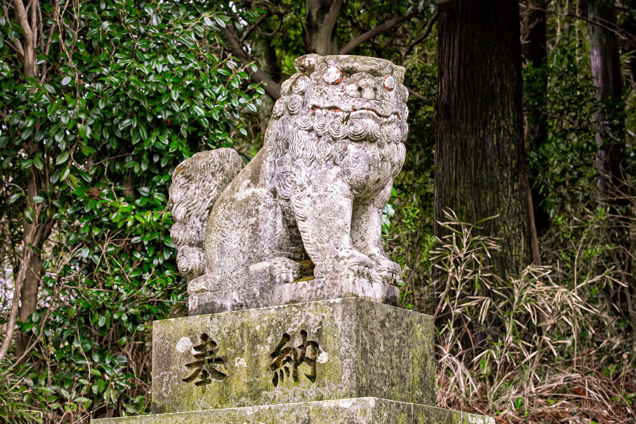
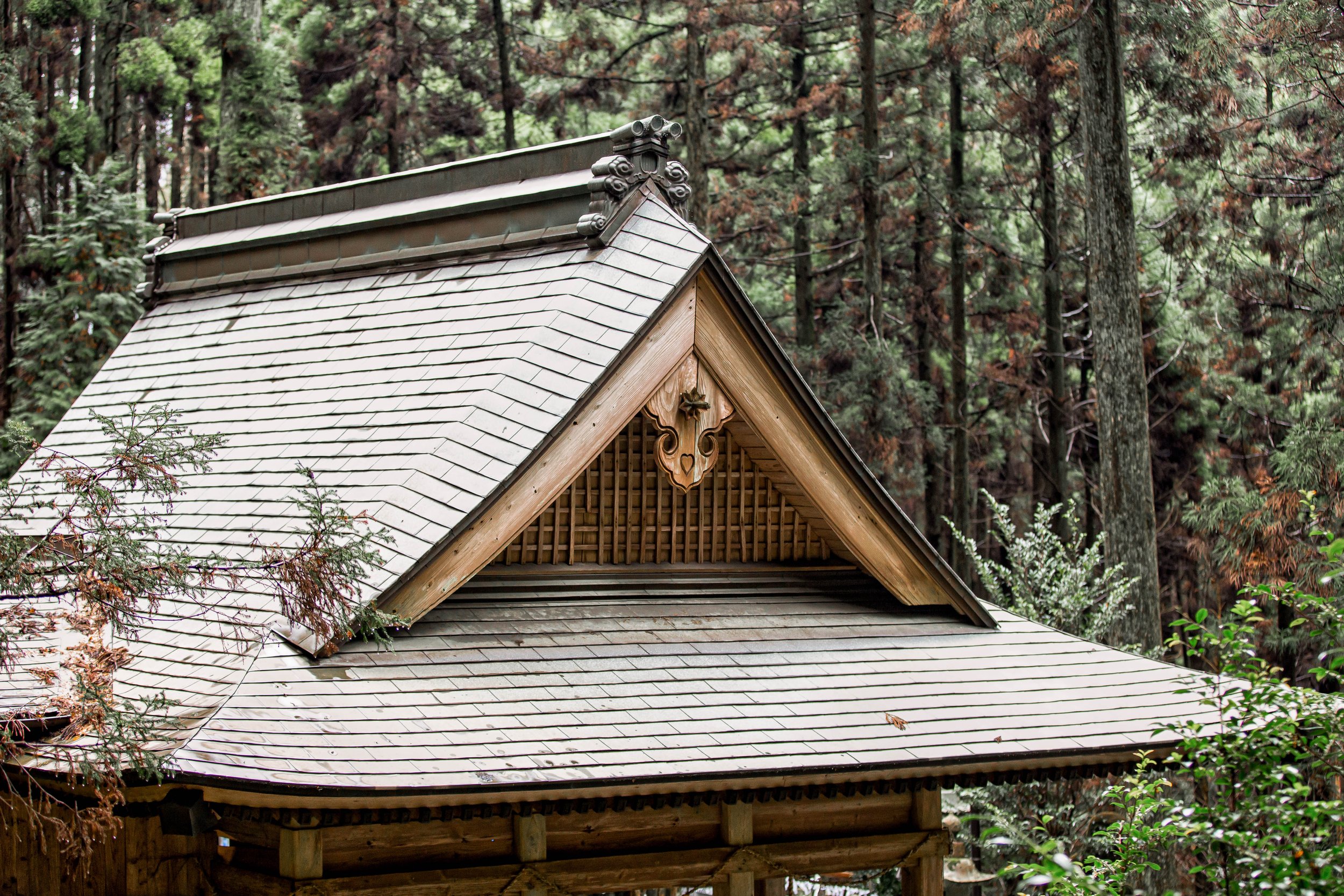
The historic ‘Old Street’ in Nanzhuang (南庄老街) has been a popular destination for weekend tourist crowds for quite a while, but unlike most of Taiwan’s other so-called ‘Old Streets’, such as Daxi Old Street (大溪老街), the history of Nanzhuang isn’t very well advertised. When you visit, you’ll find an incredible amount of Hakka and Indigenous culture and cuisine lining the streets, but explanations as to why the village was once so prosperous are hard to come by.

Like most of Taiwan’s other tourist old streets, you’ll find buildings constructed with baroque facades, a massive temple, and vendors lining the streets selling local snacks, but one of the problems caused by Miaoli being Taiwan’s most debt-ridden county is that it is unable to restore buildings of historic significance. In Nanzhuang’s case, the village would do well to follow the example of Daxi, and restore some of the buildings that were instrumental in bringing so much wealth to the village.

Link: The Daxi that Japan left behind (日本留下的大溪)

In 1918 (大正7年), the Taiwan Governor General’s Office established the Nanzhuang Camphor Forest Operations Headquarters (南庄樟林作業所), and over the next few decades, the village experienced massive growth thanks to the Forestry Industry, extracting not only camphor from the mountains, but citronella oil and coal, as well.

Jialishan, the highest mountain in the area was home to a large amount of camphor (樟腦), an incredibly important natural resource during the Japanese era, so the mountain became home to a highly developed logging industry that boasted over 5,200 meters of railway, and a cable trolly that transported timber down the mountain.

When the Japanese era came to an end, the timber industry continued for a short time, but the operation was eventually abandoned as camphor reserves were depleted, and its importance wained in favor of a synthetic alternative. Left abandoned for decades, the railway and (amazingly) some of the trolly equipment can still be found on the mountain today. As you hike the mountain, you’ll have the opportunity to walk along the historic railway in areas where the rails are still intact, but changes in the landscape over the years have made it so that the original route isn’t accessible or safe to hike.

While I do write hiking guides somewhat regularly, one of my areas of expertise with regard to my research and writing about Taiwan focuses on the island’s fifty year of Japanese colonial rule. Most of you are here for information on the hike, but I think it’s important to note how that period transformed a lot of what you’ll experience when you hike the Jialishan Trail today. The key thing to keep in mind was that in addition to Taiwan’s fruit, sugar and coal, camphor was one of the most important natural resources extracted by the Japanese, making the island an untapped treasure trove that assisted in amassing massive amounts of foreign exchange and fueling Taiwan’s development.

One area that is quite admirable, especially when you look back with a modern view of these things, is that there was enough foresight to realize that the extraction of camphor was an unsustainable industry, and that the reforestation of these mountainous areas was essential for not only the long-term health of the timber industry, but for the natural environment as well.

Scientists were sent to Taiwan to set up research stations in many of the main timber industry locations around the island, such as those in nearby Kappazan (角板山) and Chikuto (竹東). It was in these stations where they made scientific breakthroughs, such as in the cultivation of cinchona (金雞納樹), a flowering plant known for its medicinal value, especially with regard to treating malaria. In other cases, many of the mountainous forests around Taiwan were reforested with Japanese cedar (杉 / すぎ), which was also incredibly important for the future development and construction projects across Taiwan.

Today, you’ll find several ‘Forest Recreation Parks’ (森林遊樂區) around Taiwan that were once occupied by the timber industry, but have been converted into mountainous hiking trails where people are able to escape the city and enjoy nature. Dongyanshan (東眼山) in the mountains of Taoyuan is another well-known example, and is an area that was also reforested with beautiful Japanese cedars that have been growing for nearly a century.

Link: Dongyanshan Forest Recreation Park (東眼山國家森林遊樂區)

For a lot of hikers, the abandoned railway on this hike is reminiscent of what you’ll experience on other popular tourist mountains, like Alishan (阿里山) and Taipingshan (太平山), but in this case, the railway isn’t as accessible, so the photos you’ll get won’t be the same as those that have become popular on Instagram in recent years!

preparing for the Hike

As mentioned earlier, while preparing to hike Jialishan, there are a few things you’ll first need to take into consideration as well as some other things you’ll want to take along with you for the hike, so I’ll offer a few helpful suggestions for those of you wanting to enjoy this trail.

The first, and probably most important thing you’ll want to consider is your level of fitness, and the amount of time you have to complete the hike.

In both cases, you’ll want to arrive early in the morning to start the hike, but when it comes to the ‘circuit’ hike, both the amount of time you have, and your level of fitness are going to be major factors in your level of success. The circuit hike is a lot longer, and a lot more difficult to complete, and you’re going to have to carry a lot more water and food with you if you choose that option. As a frequent hiker, when I’m not climbing mountains, I spend a lot of time on cardio at the gym, and still, at the end of this one, my legs were feeling a bit like rubber. If you have doubts, I highly recommend sticking to the shorter hike.

Things you’ll need to bring:

  • Water - It’s advisable that you carry at least 2-3 litres of water with you on this hike. Depending on how much water you drink, you might even want to carry more with you just in case. I completed the circuit hike, and I can attest that 2L was not sufficient.

  • Food - You should prepare some high-protein snacks, and bring a lunch that you can enjoy while hiking. As you pass through Nanzhuang, there are a number of convenience stores and supermarkets where you can stop and purchase snacks, but that will be your last chance to purchase anything, so make sure you have what you need beforehand, and also don’t forget to carry your garbage out with you.

  • Gloves - There are a number of areas where you’re going to have to pull yourself up a rock face with the help of ropes. The ropes are a great help, but they can be hard on your skin. You’ll probably want to prepare a pair of gloves that you can put on when necessary. Most hardware stores in Taiwan sell cheap $10NT work gloves that you can purchase for hikes like this. You don’t need to buy an expensive pair of gloves at a hiking store.

  • Sun Protection - One of my worst habits is that I rarely remember to prepare sunscreen (or a hat) for the hikes I go on, and I often end up getting heat stroke, which was the case with this hike. During the hike, especially when nearing the peak, you are going to be completely open to the sun, so you’ll want to make sure to prepare both sunscreen and a hat to protect yourself.

  • Towel / Quick Dry Clothing - You’re going to sweat on this one, so I highly recommend you bring a towel with you to wipe yourself down from time to time. I don’t sweat as much as most of my hiking friends, but I was absolutely dripping during this hike. Similarly, you’re going to want to wear quick-dry clothing to ensure that all of your sweat doesn’t result in you catching a cold when you’re done.

  • Windbreaker - While on the peak of the mountain, it’s going to be quite windy. You should probably consider preparing a windbreaker jacket to protect yourself.

  • Phone / Camera - This is something that I probably don’t really have to mention, but if the photos in this article aren’t already evidence enough, the trail and the peak are absolutely beautiful. You’ll definitely want to have something to help record your experience. On that note, though, if you have a drone, you should leave it at home. The peak of Jialishan is in a restricted zone, so you’ll have carried your heavy drone for nothing as it won’t take off unless you have a special permit.

  • Friends to enjoy the experience with - Hiking is always better with friends. For safety, don’t hike this one alone. Friends are also useful for helping to take photos.

Getting There

Jialishan Hiking Trail

Address: Luchang Communication Rd, Nanzhuang Township, Miaoli County (苗栗縣南庄鄉東河村鹿場24鄰19-20號)

GPS: 24.586000, 120.997240

Alright, so here’s the bad news. Getting to Jialishan isn’t so easy.

You more or less need to have your own means of transportation, and the road to the mountain is very remote and narrow. It’s more or less impossible for a bus to get up there, and if someone even attempted it, it would cause massive traffic jams or accidents on what are cliff-side roads.

The address and GPS coordinates I’ve provided above aren’t for the trailhead, they’re for the parking lot that is made available to hikers a short walk from where the trail starts.

If you have your own means of transportation, the parking lot has a fee of $100NT for the day, no matter how long you’re on the trail, and there will be people there to direct you where to park.

Included in your parking fees are access to a public restroom where you can use the washroom before and after your hike, or simply just to wash up.

The Parking Lot on Google Maps is listed as the “Jialishan Trailhead Forest Camping Area” (加里山登山口森林露營區), and there are camp grounds near by, which might actually be quite useful if you can get to the trail the night before and wake up early in the morning for the hike.

In terms of public transportation, there’s nothing that will get you even remotely close to the trail, so your only option would be to hop on a bus to Nanzhuang and then grabbing a taxi to the trailhead. That being said, getting back down from there would be a bit of a nightmare as its unlikely that many taxi drivers would be willing to go that far and take their car on the steep road just to pick you and your group up.

If you’re intent on hiking the trail, you’re in luck, as the best option would be to take a chartered ride with the good people at Parkbus, who often schedule trips to this mountain (as well as others) for a minimal charge.

I can’t guarantee the frequency for which they plan trips to this specific mountain, but as I’m looking at the site now, their next trip to Jialishan is taking place a month from now, so they likely have a regular schedule of trips to the mountain that you’ll want to keep track of.

Their services include both pick up and drop off at Taipei Station, so you’ll have your travel completely covered, as well as the assistance of an experienced English-speaking guide.

Link: Jiali Mountain -加里山 (Parkbus)

Long on my list of trails to hike, I have to say, I was quite content with this one. The day we hiked the mountain was absolutely beautiful with great weather and clear skies. The trail was fun, and even though I was feeling the pain when I got home, it was well worth it. The views from the peak of Jialishan are spectacular, and if you’re well-versed in Taiwan’s geography, you’ll easily be able to point out some of the other major mountains off in the distance. Suffice to say, this is a hike that is highly recommended, but you need to keep your level of fitness in mind, and make sure that you bring enough water and snacks to keep your body well-fueled for the experience.

If you end up hiking the mountain, have fun and be safe!


References

  1. 加里山 (Wiki)

  2. 加里山山脈 | Jialishan Range (Wiki)

  3. 台灣小百岳 (Wiki)

  4. 台灣小百岳列表 (Wiki)

  5. 加里山登山步道 (健行筆記)

  6. 加里山登山步道 | Mt. Jiali Summit Trail (台灣山林悠遊網)

  7. 苗栗加里山步道 (WalkerLand)

  8. 台灣小百岳苗栗加里山 (GoSunBody)

  9. Jiali Mountain (Taiwan Trails and Tales)

  10. Jiali Mountain (Parkbus)

  11. Hiking Jialishan (Taiwan Outdoors)


Jiantian Historic Temple (劍潭古寺)

No matter where you go in Taiwan, it’s highly likely that you’ll encounter a 7-11 or a temple along the way - finding either is about as simple as finding a cup of coffee, and when you’re a tourist, you’re blessed with a multitude of choices to compete for your precious, but limited travel time.

For most people, visiting one or two of what are considered Taipei’s ‘Top Three’ temples is more than enough ‘temple-time’ during a short visit to Taiwan, but there are a number of impressive places of worship in the capital, as well as around the country, where tourists can spend time learning more about the history and culture of this country than they ever will in most of its museums.

I’ve been writing about Taiwan for almost a decade now, and even though I’ve spent a considerable amount of time recommending that people travel outside of the capital in order to better understand, and enjoy all that this beautiful country has to offer, it’s also important to face the fact that not every tourist has the opportunity, or the time to make their way down south. So even though I’d personally highly recommend anyone who visits Taiwan to pay a visit to Tainan’s Confucius Temple, its Grand Mazu Temple or Lukang’s Longshan Temple over most of the places of worship on the ‘Top Three’ list above, like I said, not everyone has the ability to leave Taipei.

Fortunately, there are a number of historic places of worship within the Greater-Taipei area that wonderfully compliment the city’s so-called ‘Top Three’ temples, so if you’ve discovered, like I have, an interest in visiting this sort of destination, here are some of the others I recommend checking out while you’re in town:

Today, I’m going to introduce another one of the city’s more prominent places of worship, and one that should be on your list of places to visit if you have some extra time while you’re in town. Boasting a history that is arguably longer than any other place of worship in Taipei, there’s certainly something special about this temple, but to tell the truth, it’s also somewhat of a confusing place as even locals have a difficult time understanding its significance.

Most commonly referred to either as Jiantan Temple (劍潭寺), or Jiantan Historic Temple (劍潭古寺), what I personally find interesting about this temple is the addition of the word “ancient” or “historic” (古) to its title in both Chinese and in English. There are surprisingly very few places of worship in Taiwan that make the concerted effort to put the word ‘historic’ directly in their name - although in some cases I think they’d prefer you just assume that’s the case - nevertheless, as one of Taipei’s ‘first’ places of worship, this one holds a special place within the history of the city.

The other thing that I think is important to point out about the name of this temple is the name ‘Jiantan’ (劍潭), which is probably confusing for tourists who might not be so familiar with Taipei’s geography. These days, the name ‘Jiantan’ is more or less synonymous with the Jiantan MRT Station (劍潭捷運站), which is home to Shilin Night Market (士林夜市), another one of Taipei’s most popular tourist destinations. Unfortunately, if you’re thinking that a visit to this temple could be combined with a visit to the night market, you might be disappointed. It’s actually not that close.

Never fear, though, as I move on below, I’ll provide a detailed explanation of the temple’s confusing history, how you can get there, all of which should help anyone who reads this better understand the temple, its special architectural design, and ultimately the history of the area we refer to as ‘Jiantan’ today. Before I start though, I have to say that even though this temple is one of the city’s oldest places of worship, it unfortunately doesn’t receive as much attention as it deserves, and very little has been written about it in the English-language, so I hope this article answers any questions you might have about it.

Jiantan Temple (劍潭古寺)

Legend has it that during the 17th Century, while Koxinga (鄭成功) and his army were sailing up the Keelung River, on their way to remove the Dutch from the island, they came upon a sudden and massive storm caused by river serpents. Attempting to prevent them from going any further, the storm was so violent that many in the army wanted to turn around. Koxinga, being the ever-so-clever pirate and experienced captain, was undeterred by the serpent’s interference in his plans, drew his sword and subdued the serpent. However, while in the midst of the fierce battle, his ‘sword’ was lost in the deep pool of water where the serpent lived.

For those of you who are unaware, the words “jian” (劍) and “tan" (潭) when put together basically translate as “Sword Pool” or “Sword Pond,” so even though the Koxinga legend is just local folklore, he was such a prolific figure in Taiwan’s history that a story about him mistakenly dropping his sword into a pool of water was reason enough to give a place a name.

Obviously, when it comes to the origin of the name, historians point to factual events that took place between Dutch traders, and the local indigenous people, but with regard to this temple, the legend of Koxinga is of particular note as you’ll discover later.

Its important to note that there was once a pond along the banks of the Keelung River that had been referred to as “Jiantan” for several hundred years. Located at a point of the river where the it curves between the areas we know today as Dazhi (大直) and Shilin (士林), that pond has since disappeared due to river diversion projects that sought to control water levels and prevent parts of the city from flooding during typhoons.

Today, the area we refer to as Jiantan covers several hundred hectares of land within the city, and even has a mountain that shares the same name.

Link: Jiantan Mountain (劍潭山)

Jiantan Temple during the Japanese-era

If one legend weren’t enough, another explains that in 1634 (崇禎7年), a monk named Huarong (僧侶華榮和尚) was dispatched from his monastery on Putuo Mountain (普陀山) to deliver a stone statue of Guanyin to Taiwan. Arriving in Taiwan at the port in Tamsui (淡水), he continued south on the road to Keelung (基隆), but along the path he encountered a massive red snake that was blocking the way. Personally, I’m not particularly a huge fan of snakes, and if I encountered one while hiking in Taiwan, I’d likely turn around, but for Huarong, this was deemed as an auspicious event.

Note: The number ‘eight’ is an auspicious number for Buddhists, referring to either the Dharma Wheel (法陀) or the Eight Great Bodhisattvas.

Instead of taking off like I would have done, he set up camp for the night where the Buddha appeared before him in his dreams and instructed him to go to the local port (probably in Bangka), and solicit donations from eight merchant captains. When he woke up, he made his way to the port where he came across the eight ships in his dream and when the merchants on the ships heard his story, they donated graciously to his cause. With the money donated by the local merchants, Huarong had a thatched hut built on the location where he came across the red snake, and that became the home of the Guanyin Statue, instead of its original destination in Keelung.

Later, in the early eighteenth century, the thatched hut, which had become known as the Guanyin Pavilion (觀音亭) was replaced by a more formal temple, known as the “Western Temple” (西方寶剎). That name, however, wasn’t one that would remain for very long as the temple was renamed Jiantan Temple (劍潭寺) in 1746 (乾隆11年).

Over the next century, Jiantan Temple became one of the more prominent Buddhist temples in northern Taiwan, resulting in a number of restoration and expansion projects to accommodate the number of monks who came to serve at the temple. Then, when the abbot of the Bangka Longshan Temple (艋舺龍山寺) took administrative control of the temple, he once again oversaw another expansion project that would not only benefit Jiantan Temple, but Longshan Temple as well with monks being able to travel back and forth between two of northern Taiwan’s most important temples.

For the next half century, things more or less stayed the same at the temple, but when the Japanese took control of Taiwan in 1895 (明治28年), the situation changed almost overnight. When the Governor General of Taiwan, Kodama Gentaro (兒玉源太郎) requested monks from the Rinzai school (臨濟宗) of Zen Buddhism to come to Taiwan to promote Japanese Buddhism, the influence of Japanese-style Buddhism started taking over on the island, and Jiantan Temple was promptly converted into a Myoshin Temple (妙心寺).

Link: Huguo Rinzai Temple (臨濟護國禪寺)

The interesting thing to keep in mind was that during the Meiji Restoration (明治維新), which started decades before the Japanese took control of Taiwan, Buddhism was classified by the government as a source of foreign interference. It was during this time that the more than a thousand year old tradition of fusion between Buddhism and Shinto were forcibly separated with the Buddhist temples that were constructed next to Shinto Shrines torn down. Here in Taiwan, though, Buddhism, had a long established a foothold on the island thanks to places of worship like Jiantan Temple, thus they became one of the tools that the Japanese authorities used to help bring the two peoples together.

Ironic given that Buddhism was suppressed back in Japan.

From the outset, the Japanese brought Buddhist monks with them to serve roles within the military as ‘chaplain-missionaries’, offering spiritual guidance during the initial years of the occupation. In addition to serving the military, the monks began to construct language schools and charity hospitals where they would focus on improving the lives of average Taiwanese citizens as well as promoting Japanese-style Buddhism. Over the next few decades, the temple continued to grow, and between 1918 and 1924, the temple was completely reconstructed, making use of modern construction techniques to ensure its longevity. The irony however was that just over a decade after the rebuild was completed, the temple was then forced to relocate due to an expansion project at the Taiwan Grand Shrine (臺灣神宮), which was also located on Jiantan Mountain (劍潭山) to the rear of the temple.

With insufficient funds available for the construction of a new temple, the administration came up with a plan to have the buildings completely deconstructed, and then reconstructed with the materials that could be salvaged in a new location. Migrating several kilometers away to the Dazhi (大直) area, the temple was carefully put back together again. However, the new plot of land that was allocated for the temple wasn’t nearly as larger as the original space, so alterations had to be made, and as you may have noticed from the historic photo above, it is considerably smaller today.

In its current location for nearly a century, Jiantan has been restored several times, repairing elements of the temple that have allowed it to remain intact while also bringing it back to life by refining the building’s decorative elements which were once its defining features.

As one of Taipei’s first major places of worship, predating many of the capital’s other major temples, Jiantan Temple has a long and storied history and while it’s not uncommon for places of worship to be moved to a new location, the experience of deconstructing the temple and sending putting it back together in another location is reminiscent of the nearby Lin An Tai Mansion (林安泰古厝), which had a similar experience.

In 2004 (民國93年), Jiantan Temple was officially recognized by the Taipei City Government under the Cultural Heritage Preservation Act (文化資產保存法) as a protected heritage building (歷史建築).

Link: 臺北市歷史建築列表 (List of Taipei City Protected Heritage Buildings)

Whether you refer to this temple as Jiantan Temple (劍潭寺) or Jiantan Ancient Temple (劍潭古寺), it’s up to you, but one of the things that sets this one apart from many of the other historic temples around Taipei is that it features a little park where it proudly displays its history. Some of the objects within the park, mostly stone tablets and pillars are things that you probably won’t see anywhere else in the capital, but are much more common in Tainan where historic temples are found on almost every street corner. If you visit the temple, I highly recommend you take some time to check out some of the objects on display, even though they are admittedly pretty old and in some cases the words that have been etched on the stone have started to fade.

Deities Enshrined at Jiantan Temple

As you saw from the history detailed above, from the outset, Jiantian Temple was dedicated to Guanyin (觀音), the Chinese version of Avalokiteśvara, the Buddha of Compassion. With a statue brought directly from Putuo Mountain (普陀山), one of China’s four sacred Buddhist mountains, it shouldn’t be much of a surprise to anyone that the figures enshrined within the temple are for the most part, Buddhist. That being said, similar to what you’ll experience if you visit Bangka’s Longshan Temple, which is also primarily a Buddhist place of worship, over the years, figures from Chinese folk religion have been added over the years to the shrine. In Taiwan, this is something that has become quite common, so within the temple you’ll also find shrines dedicated to ‘deities’ who you won’t traditionally find in Buddhist temples elsewhere, especially in other countries where Buddhism is the predominant religion.

  • Guanyin (觀世音菩薩) - As noted earlier, Jiantan Temple was (historically) dedicated primarily to the Buddha of Compassion, Guanyin (觀音), one of the most prolific Buddhist figures in Taiwan. Within the shrine room, you’ll find several different statues dedicated to different incarnations of Guanyin, with two large statues of a sitting Guanyin on either side of the main shrine. The original statue has since been moved to a new location within the main shrine and is somewhat difficult to see amongst the crowd of Buddhist figures in the main shrine. The most important difference between the various statues of Guanyin is that the original is regarded as a ‘Child-Bearing Guanyin’ (送子觀音). In front of the historic statue, you’ll find a version of a sitting Guanyin and as is usually the case, she is accompanied by her two acolytes, a pair of children who went to her side while she was meditating at Mount Putuo, Longnu (龍女) and Shancai (善財童子).

  • Shakyamuni Buddha (釋迦牟尼) - In one of the most recent changes to the ‘ancient’ temple, a statue of Shakyamuni Buddha was added to the main shrine in the post-war period. The jade statue was added shortly after the Foguangshan Organization took over administrative control of the temple, which is something I’ll talk briefly about below. The statue holds a ‘seal’ (降魔印) for subjugating demons. The interesting thing about the statue is that its appearance isn’t typical for a Chinese-style Buddha statue. It appears more as if it came from South East Asia, more specifically the Myanmar area. It possibly came to Taiwan with Chinese refugees from the Yunnan region, but I’m not particularly sure about its origin. During my visit to the temple, I inquired about the design of the statue, and the person who I was talking to was surprised that I could tell the difference between an image of the Buddha from Myanmar compared to one that you’d typically find in Taiwan, but the explanation I received as to its origin wasn’t particularly convincing, and its likely that there were some politics involved that they didn’t really want to mention.

  • The Prince of Yanping (延平郡王) - Looking back to the legends of the naming of Jiantan, you might remember that one of the local folklore stories claims that Koxinga (鄭成功) threw his sword into the pond to dispatch a violent serpent that was preventing them from advancing. What I didn’t mention was that Koxinga would later go on to defeat the Dutch and proclaim a kingdom of his own in the south of Taiwan, known as the Kingdom of Tungning. Given that Koxinga’s legend shares a relationship with the local area, and his being deified in Taiwan after his death, it shouldn’t be a big surprise that there is a shrine dedicated in his honor at the temple. When you find a shrine dedicated to Koxinga in Taiwan, he’ll either be referred to as the Prince of Yanping (延平郡王), a title bestowed upon him by a Ming Emperor, or Kaishan Shengwang (開山聖王). Interestingly, if you climb Jiantan Mountain to the rear of the temple, you’ll find an entire temple dedicated to Koxinga, known as the Taipei Koxinga Temple (成功廟開臺聖王).

  • The Eighteen Arhats (十八羅漢) - On either side of the Main Hall, you’ll find wood-carved representations of the ‘Eighteen Arhats’, who are basically like the twelve disciples of Jesus. The original followers of the Buddha, the ‘Arthats’ are figures each of whom has attained enlightenment, but have dedicated their lives to being reincarnated on earth until everyone attains enlightenment. A common image in Taiwan, you’ll find nine of the arhats on each side of the shrine, and each of them appears quite differently, so you might want to take a moment to look at them as they are all interesting characters.

With regard to the statues in the shrine room, there has been somewhat of an unresolved controversy in recent years as the administration of the temple is now overseen by the large and powerful Foguangshan (佛光山) organization. The controversy revolves around a differing outlook between the followers of the original temple and the new organization that took over. Long story short, the main shrine was originally dedicated to Guanyin, but it was adjusted to provide a seat to the Shakyamuni Buddha, instead.

The historic statue of Guanyin was thus moved to a level below the Buddha, which, angered the followers of the temple. Likewise, some of the other statues of Guanyin that were originally in the temple were moved outside of the temple where they would get rained on and polluted from dirty air.

In the time since the controversy, which made headlines across the country, changes have been made to bring the statues of Guanyin back inside the temple, but the main shrine continues to place the Buddha in the main seat, which doesn’t particularly reflect the history of the temple.

Link: 主神換位 劍潭古寺主位觀音變佛陀 (TVBS)

Jiantan Ancient Temple Timeline

Obviously, Jiantan Temple couldn’t be considered an “ancient” temple if it didn’t have a long history. As one of the first Buddhist places of worship in Taipei, there is clearly a long and interconnected history that coincides with the development of Taiwan’s capital into the high-tech economic powerhouse that it is today. That being said, the history of the temple tends to be a little confusing, and not very well detailed in either Chinese or English. I’ve done my best to put together a list of events with regard to the temple’s history that should give readers an idea of the timeline of events over the past three centuries of its history.

Click the dropdown below to read more:

  • •1634 (崇禎7年) - Buddhist Monk Huarong (僧侶華榮和尚), travels to Taiwan from his monastery on the famed Putuo Mountain (普陀山) to welcome a stone statue of Guanyin to the island.

    •1718 (康熙57年) - A Buddhist temple named the ‘Western Temple’ (西方寶剎) was established along the banks of the Keelung River with Jiantan Mountain to its rear.

    1746 (乾隆11年) - Jiantan Temple (劍潭寺) is officially established.

    1773 (乾隆38年) - The temple goes through its first period of restoration.

    1800 (家慶5年) - The temple goes through another period of restoration.

    1836 (道光17年) - The temple goes through a period of expansion, making space for an official residence for the monks who stayed on-site.

    1843 (道光24年) - The abbot of Longshan Temple in Bangka assumes administrative control over the temple, and materials are donated to once again expand and restore the grounds.

    1895 (明治28年) - The Japanese Empire takes control of Taiwan.

    1899 (明治32年) - During the Japanese era, the temple became a Myoshin Temple (妙心寺), part of the Rinzai Sect (臨濟宗) of Japanese Buddhism.

    1914 (大正3年) - The monks living at the temple initiate a fundraising campaign to have the temple reconstructed.

    1918 (大正7年) - With the fund raising campaign completed, famed craftsman Chen Yingbin (陳應彬) is contracted to oversee a complete overhaul and redesign of the temple.

    1924 (大正13年) - The reconstruction project on the temple is completed, with a brand new traditionally Chinese-style design fused with Japanese elements and construction techniques.

    1937 (昭和12年) - Shortly after the expensive reconstruction of the temple is completed, an expansion project at the nearby Taiwan Grand Shrine (台灣神宮) forces the temple to relocate to another location a short distance away. Due to a lack of funds, the temple is more or less deconstructed, and then reconstructed in its original location.

    1945 (民國34年) The Second World War comes to an end and the Republic of China takes control of Taiwan

    1978 (民國67年) - A restoration project takes place, repairing and restoring some of the aging elements of the temple, and replacing the roof tiles with Taiwanese-style yellow tiles (黃色琉璃瓦).

    2004 (民國93年) - The temple is officially recognized as a protected heritage building (歷史建築).

    2007 (民國96年) - A restoration project takes place that restores the shape and design of the roof to its original 1924 design and all of the original decorative elements are carefully reproduced to reflect the original appearance of the temple.

    2017 (民國106年) - A newly constructed Guanyin Shrine is consecrated within the temple.

Architectural Design

The story of Jiantan Temple’s architectural design is a bit of a complicated one, and is something that you may have noticed in the timeline above has been altered several times, throughout its three-century long history. Over the years, the temple has been renovated, expanded, restored, reduced in size, and ultimately moved to an entirely new location.

Fortunately, thanks to the dedication of Japanese-era photographers, we have a pretty good idea of how it originally appeared prior to its migration, as you’ll have seen in some of those photos above. I’m not going to spend too much of your time talking about the temple’s past glory, or what is missing. Instead, I’m only going to focus on what you’ll experience when you visit today, which itself is a beautiful place of worship, full of complex design and decorative elements, some of which are uncommon in Taipei today.

If we take into consideration that the temple migrated to its current location during the Japanese-era, you’ll also discover that even though it maintains many traditional Taiwanese temple features, it is also a case-study in the fusion of Taiwanese-Japanese design of the era, which makes it quite special.

As I mentioned earlier, when the temple was forced to migrate, they lacked the necessary funds to construct an entirely new building. Thus, it was decided that instead of demolishing the original temple that they would have it deconstructed as carefully as possible in order to recycle the original materials to bring it back to life. Unfortunately, due to a lack of space on the plot of land that was allocated to the temple, and the difficulty of deconstructing the original, the end-result was a temple that was considerably smaller than the original.

The current design retains much of the original wood and stone that was used to construct the temple, which have been recycled. The size of the building is officially measured in ‘bays’ (開間), an ancient style of measurement that you won’t see mentioned very often in Taiwan these days, except for at historic places of worship like this. Essentially a ‘bay’ was the space between columns that held up the roof. Generally-speaking that was about 3.6 meters in length. Using this method, Jiantan Temple is officially eleven bays in length (面寬十一開間), which makes it just about 40 meters (131 feet) wide.

Keeping with the traditional design of a Hokkien-style temple, the facade of Jiantan Temple resembles that of the Front Hall (前殿) at Lukang’s famed Longshan Temple (鹿港龍山寺) in that it features a ‘Five Door Hall” (五門殿) style of design. In this style of design, there is a central wing that features the temple’s three main doors, with separate ‘dragon’ and ‘tiger’ wings (龍虎翼廊) on either side. Both of the wings feature a Swallow-Tail Roof (燕尾屋脊), which are equal in height, while the central portion is much higher. This style of roof, which is indicative of Hokkien-style architectural design differs from the typical style of ‘hip-and-gable’ roof that you’ll find at many Chinese, Japanese or Korean-style Buddhist temples. Yet it is one of the most common styles of architectural design with regard to the historic temples, mansions and ancestral halls around Taiwan.

Essentially, a ‘Swallow-Tail Roof’ is a roof that features an upward-curving ridge, resembling the tail of a swallow, and is typically adorned with a number of decorative elements, which are most often porcelain carvings (剪瓷雕). Depending on the amount of cash you have available, and how much you want to show off your wealth, this style of roof could be either single or dual-layered to add even more complexity. In this particular case, you might think with the varying heights between the wings and the central portion of the building that it is dual-layered, but it’s actually only a single-layer roof as the roofs over the wings are independent of the other. Nevertheless, despite the curvature of each of the roofs being one of their key features, you’ll notice that the mid-section is the most prominent as the two wings only feature half-curves, and neither of them reach as high as the mid-section.

One area where the Hokkien-style Swallow-Tail roof resembles that of a hip-and-gable roof is that the roof eclipses the base of the building in size, extending well beyond the front of the building. Thus, to help support the weight of the roof, you’ll find a number of pillars used for support both within the interior and on the exterior as well. The most prominent of these support pillars are located on either side of the middle door, and are beautifully-carved stone dragons that encircle the columns.

Link: Hokkien Architecture (Wiki)

While the temple may seem somewhat subdued in its design from afar, the devil is really in its finer details as the closer you look, the more exquisite you’ll discover its decorative elements are thanks to the 2007 restoration work that went into the temple (mentioned on the timeline above). It was at this time that the yellow cylindrical bamboo-like tiles (燒筒板瓦) that covered the roof were completely replaced as were almost all of the cut-and-stick decorations (剪黏), which are integral to Hokkien-style design.

The newly-designed decorative elements were part of a long research project that ultimately restored the original elements that you would have found at the original temple, when it was still in its original location. In this case, the temple contracted Pan Kundi (潘坤地), a master craftsman who is most well-known for his contributions to the restoration of Dalongdong’s Bao-An Temple (大龍峒保安宮), a Taiwanese national treasure, and recognized by UNESCO for its contribution to the preservation of cultural heritage.

One of the problems that might arise when you visit the temple today is that the ‘finer details’ mentioned above are abundant, and you may find yourself spending quite a bit of time looking at the decorative elements on top of the ridges, between the ridges, and along the ends of each of the them and contemplating their meaning. Never fear, I’ll do my best to answer some of those questions with the help of my telephoto lens!

Starting with the more obvious design elements, you’ll notice the ‘Double Dragon Pagoda’ (雙龍寶塔) directly in the middle of the apex of the roof. This is a decorative element that is common at Buddhist temples, and represents a number of important things - First, it is used to ward off evil spirits and fire, but it also represents ‘filial piety’ and ‘virtue’. Another way of interpreting it is by explaining that ‘pagodas’ were traditionally buildings where Buddhist texts were kept, so having the dragons encircling the pagoda in this way is a way of ‘protecting the Buddha’ or ‘precious things’.

The next thing you’ll probably notice is that on each of the ridges, there is a dragon-like creature facing toward the pagoda. In fact, this creature is referred to as an “Aoyu” (鰲魚), and is basically a carp that is in the process of transforming into a dragon featuring the head of a dragon and the body of a fish. Similar to the Dragon-Pagoda’s nature of helping to ward off fire or other disasters, the Aoyu are known for their ability to ‘swallow fire and spit water’ meaning that they’re also there to offer protection to the temple.

Conveniently located just under the two Aoyu in the mid-section, you’ll find one of the ‘Four Heavenly Kings’ (四大天王) accompanying them. Known as important Buddhist figures with regard to ‘protection’, in Mandarin, the names of the kings go together to form the idiom “fēngtiáoyǔshùn” (風調雨順), or “seasonable weather with gentle breeze and timely rain,” and by this point you’re probably wondering just how often temples burn to the ground. With the amount of candles and incense that are burnt in these temples, it probably shouldn’t be too surprising that it does, unfortunately, happen from time to time.

Two of the four Heavenly Kings on the far left and right.

The design of each of the kings is slightly different, but its important to offer a bit of detail:

  1. Virulhaka (增長天王) - holding a jeweled double-edged sword

  2. Vessavana (多聞天王) - holding a jeweled umbrella

  3. Dhatarattha (持國天王) - holding a pipa (a traditional musical instrument)

  4. Virupakkha (廣目天王) - holding a dragon in his hand

Link: Four Heavenly Kings (Wiki)

Once again, looking carefully along the Xishi Ridge (西施脊), the flat part of the top ridge, you’ll find some pretty intricate decorative elements in the space between the Four Heavenly Kings. Directly under the Dragon Pagoda, there is a mural that depicts the folklore story of ‘Guanyin conquering the phoenix’ (老古板的古建築之旅). The story, which originated in the Song Dynasty (宋朝), is a popular one in Taiwan that has been converted into a Taiwanese opera, which is often performed outside of temples. In the story, “Dapeng” (大鵬金翅明王), the Chinese manifestation of the Hindu deity Garuda turned into a human and came to earth to wreak havoc, forcing Guanyin to appear to make an appearance and back him under control. Legends regarding the mythical ‘Dapeng Phoenix’ appear throughout Chinese history, but in most of the stories, one of the commonalities is that it is often subservient to the Buddha or Guanyin.

One thing that confused me, and sent me down a bit of a rabbit hole looking for information, were the five animals located below the Guanyin mural. It is common to find ‘four’ animals depicted in this particular space within Taiwan’s temples, known as the ‘Auspicious Four Beasts’ (四祥獸), most often represented as a Tiger, Leopard, Lion and Elephant (虎豹獅象) - just like the so-called ‘Four Beasts Mountains’ in Taipei. Once again, as with the other decorative elements discussed so far, the presence of the beasts is meant to help suppress evil spirits and protect the temple. In this case, however, there are ‘Five Auspicious Beasts’ thanks to the inclusion of a Qilin (麒麟), a mythical Chinese chimera.

Link: Four Beasts Hiking Trail (四獸山步道)

Swallow-Tail roofs not only feature an upward-curving ridge at the apex of the roof but also often have eaves that descend from the ridge to the lower section of the roof where you’ll find a platform for additional decorative elements. Known in Taiwanese as the ‘paitoh’ (牌頭), you’ll find another set of elaborate murals at the end of each of the roof’s eaves.

There are two murals in the mid-section, and another one on each of the ends of the eastern and western wings. Two of the murals depict events from the life of the Buddha, while the other two are related to Guanyin.

Speaking of the wings, they feature similar decorative elements along their ridges, but in both cases are a bit more subdued, with simple depictions of peonies (牡丹), phoenixes (鳳), qilin (麒麟) and peacocks (孔雀).

Link: Animals & Mythical Creatures (Buddhist Symbols)

Moving on from the roof, located directly in front of the middle door in the centre of the building, you’ll find a beautifully designed Tiangong Incense Cauldron (天公爐) that features the words ‘Taipei Jiantan Historic Temple’ (台北劍潭古寺) carved on the bowl. The design here is slightly different than what you’d see at other places of worship in Taiwan as it is quite narrow compared to the cauldrons you’ll find at other temples. What remains the same is that you’ll find 'dragons grabbing pearls’ (雙龍戲珠) on either side and an octagonal-covered roof with three legs that represent a ‘tiger’ (寅), ‘horse’ (午) and ‘dog’ (戌), which are considered the ‘triad of heaven, earth and man’ (天地人).

Note: The ‘double dragons grabbing pearls’ (雙龍戲珠) are part of an ancient Chinese-language idiom that symbolizes humanity’s constant pursuit of happiness. It has also become an important image with regard to weddings as the harmony between husband and wife and mutual respect, humility and tolerance.

On either side of the cauldron you’ll find the beautifully-carved traditional stone dragon pillars (龍柱) that I mentioned earlier. The pillars, which aren’t from the original temple, are thought to be a product of the early 1900s, although you won’t find a date carved on them to prove that. Still, they’re well over a century old and have recently been given a bit of restoration. Featuring dragons that encircle each of the pillars. You’ll also find depictions of people and animals walking along each of the dragon's backs.

Directly in front of the cauldron, you’ll find a stone-carved Dragon Ramp (龍陞) between the ground and the platform in front of the doors. Also referred to as a ‘Royal Ramp’ (御路), the sloping ramp is reserved for the passage of royalty, or for whenever one of the statues has to be moved outside of the temple. Even though Taiwan doesn’t have any royalty, and the only royals to have ever visited the country were from the Japanese imperial family, these sloping ramps are a common feature among the temples you’ll find across the country.

Another common feature that the temple shares with most other places of worship in Taiwan is that there is a name plaque located above the middle door. The beautifully inscribed plaque (牌匾) features the temple’s name scripted in calligraphy and obviously if you take a look at it, it’s in pretty good shape, but in this case you can see the date it was placed, which was in August of 1981 (民國70年8月).

Speaking of recent additions, the shrine is currently home to lacquered wooden sliding panels with golden latticed windows. The wood-carved latticed windows (木柵窗格) don’t actually look like typical ‘windows’, but they feature intricately carved floral designs with birds and peacocks.

Finally, if you find yourself standing on the platform by the central door, you’ll discover that there are some really intricate and beautifully hand-carved wooden figures (木雕) that are used to decorate the trusses and eaves that connect to the pillars, which are instrumental in working together to help to support the weight of the roof. The carvings, which feature lions and murals, like the lattice windows below are all painted gold and make the exterior of the temple much more beautiful.

Before I move on to briefly describing the interior of the temple, I think it’s important to note that if you search for images of the temple online, you’re going to notice a stark difference between some of the photos you’ll find.

Prior to 2007, the temple looked considerably different, and very much more ‘plain’ that what you’ll see today. As I mentioned earlier, the design of the roof was completely changed to reflect the temple’s original design and it was during that restoration project that most of the decorative elements that I’ve described above were added. Given that the master craftsman mentioned above is known for not only his skills with traditional Hokkien cut-porcelain carvings (剪瓷雕), but also his wood-carving skills, it’s safe to say that all of the decorative elements that we enjoy today are thanks to his genius and hard work.

I won’t spend too much describing the interior of the temple, simply due to the fact that Hokkien-style Buddhist temples place an incredible amount of detail on the decorative elements of the exterior of the building while the interior is much more subtle. That being said, it has to be mentioned that, like the Lukang Longshan Temple, the temple features a beautifully designed ‘caisson’ (八卦藻井) in the main shrine room. Also known as a “Ba-Gua ceiling,” it would be an understatement to say that it is a masterpiece of architectural design. Octagonal in shape, each side of the caisson symbolizes eight symbols in Taoism that represent the fundamental principles of reality.

Somewhat difficult to describe properly, a caisson is basically a sunken layered panel in a ceiling that raises above the rest of the ceiling almost as if there were a dome above it. The layers of the caisson are often beautifully decorated and with a design at the center which in this case is just a painted flower that has a lamp hanging from the middle.

The most amazing thing to keep in mind about these caissons is that they are designed using expertly measured interlocking pieces that connect together in a way that means that neither beams nor nails are used to keep them in place. They simply lock together to form a six-layer deep spider-web of beauty. It takes a considerable amount of skill and patience to make one of these, so if you visit, one of the first things the people at the temple will do is make sure you take note of it.

As mentioned above, the interior of the temple is split into three sections with the main shrine in the middle. The wing to the left of the main shrine room is used for administrative purposes while the wing on the right is home to the Koxinga Shrine. The passage ways from both of the wings feature a couple of objects that should be noted. First, on the left wing, you’ll find a drum hanging within the passageway while on the right wing you’ll find a large stone bell, both of which are common within Buddhist temples as a way of indicating the time, attracting crowds, and announcing the beginning of preaching.

Finally, one last thing I’d like to point out is the ‘Dragon Altar’ (案桌) in the middle of the shrine - the altar features a painted dragon with the words ‘Jiantan Buddha’ (劍潭佛祖) on it. Likely one of the oldest parts of the current temple (save for the Guanyin statue), the altar dates back to the reign of Emperor Daoguang (道光) of the Qing Dynasty, placing it somewhere between 1821 and 1850. On either side of the altar, you’ll find some stone pillars with calligraphy engraved on each of them. Speaking to the history of the temple, they tell a story of how the migration of the temple to its current location wasn’t an optimal decision, but was forced upon them by the Japanese. I’d attempt to translate the text, but I have to admit that its beyond my level. Nevertheless, the sentiment is a bit salty.

The text is provided below for anyone interested:

Note:「寶劍劫灰塵爐火重新光大直,澄潭涵法雨川流終古擁觀音」and「庚辰劍潭古寺移築大直」

Getting There


Address: #6, Alley 805, Bei-An Road, Zhongshan District, Taipei

(臺北市中山區北安路805巷6號)

GPS: 25.085910, 121.554330

Conveniently located a short walk from an MRT station, visiting the Jiantan Historic Temple is actually quite straightforward, and is easily accessible for any tourist who’d like to visit. That being said, there are faster options than the MRT if you’re taking public transportation, so I’ll provide directions for both the MRT and the bus routes that will get you there below.

MRT

Located across the Keelung River from Taipei in Neihu’s Dazhi (大直) neighborhood, taking the MRT is obviously one of the most convenient methods of getting to the temple. That being said, even though the MRT drops you off pretty much at the temple’s doorsteps, its convenience doesn’t necessarily mean that it’s the quickest way to get there as the Brown Line trains are considerably slower than the normal underground MRT, and you’ll likely have to pass by Songshan Airport on your way there.

Nevertheless, if your preferred method of transportation is to take the MRT, simply get yourself on the Brown Line either at Zhongxiao Fuxing (忠孝復興) or Nanjing Fuxing (南京復興), heading in the direction of Nangang Station (南港捷運站). Getting off the train at Jiannan Road Station (劍南路捷運站), you’ll take Exit #1 and walk straight along Beian Road (北安路) where you’ll notice Jingye Park (敬業公園) on your right and the temple about a minute away on the left.

Bus

Similarly, given that the Jiannan Road MRT Station is located next to the Miramar Shopping Mall (美麗華百樂園), famed for its giant roof-top ferris wheel, there are a number of bus routes that will help you get there just as easily as the MRT. The closest bus stop to the temple is the Jiannan Road Stop (捷運劍南路站), directly in front of the MRT Station, so if you end up taking a bus, the walking route to the temple follows the same route.

Given the popularity of the Miramar Shopping Center, there are far too many bus routes that service this bus stop, and since Internet links for these things in Taiwan are notoriously unstable, I’m not going going to link to each of the routes individually here. I highly recommend travelers make use of the Taipei eBus website, or download the Bus Tracker Taipei app on your phone (Android | iOS) or use the Real-Time Bus Tracking service offered on the eBus website.

Here are the following routes that service the Jiannan Road Stop: Neihu Express Line (內湖幹線), Red #3 (紅3), Blue #26 (藍26), #28, #33, #42, #72, #208, #222, #247, #256, #267, #268, #287, #556, #620, #646, #681, #683, #902, #957, #1801

Youbike

If you’re feeling adventurous, you can easily hop on one of Taipei’s convenient shared Youbikes and make your way along the Keelung River all the way to Dazhi where you’ll be able to park the bike in front of the Jiannan Road MRT Station and make your way to the temple. If you’d like to make use of a Youbike, one of the best routes would be to grab a bike at the Yuanshan MRT Station (圓山捷運站), and make your way along the Dajia Riverside Park (大家河濱公園) where you’ll cross the pedestrian section of the Dazhi Bridge (大直橋), and from there making your way toward the Jiannan Road Station. There are of course a number of routes that you could take to get there, though, so I recommend opening up Google Maps on your phone and mapping out a bike route from wherever you’re starting from!

If you haven’t already, I highly recommend downloading the Youbike App to your phone so that you’ll have a better idea of the location where you’ll be able to find the closest docking station.

Link: Youbike App - Apple / Android

To be frank, I don’t really spend very much time in the Neihu area of Taipei. I’ve visited most of Taipei’s most important places of worship over the years, but this temple was one that I’ve always had on my list, but took quite a while to actually get around to. It’s not that I didn’t think it was important, or that it should be high on the list of places that people should visit when they’re in town, I just personally only find myself in that area when I’m hiking along the Jiantan Mountain ridge. Nevertheless, if you find yourself in the city and the temples are of particular interest to you, I highly recommend checking out some of those listed above, and if you’ve still got time left, head over to this one to check it out as well!

I suppose that doesn’t particularly sound like a rousing endorsement of the temple, but I’m not sure how much appeals to most short-term tourists. I have to say, though, that the temple was a lot more beautiful than I expected, and if the photos in this article are any indication, you’re in for a treat if you visit, especially since its a much more quiet place of reflection than some of the other major temples that tourists visit.

References

  1. 劍潭古寺 (Wiki)

  2. 劍潭 (Wiki)

  3. 劍潭寺 | Jiantan Temple (台灣宗教文化地圖)

  4. 劍潭寺 (國家文化資產網)

  5. 劍潭古寺 (台灣好廟網)

  6. 劍潭古寺 (Tony的自然人文旅記)

  7. 巴字第974號:劍潭古寺 (地球上的火星人)

  8. 中山區 劍潭古寺 — 隱身於熱鬧商場旁之臺北盆地最早古剎,有段被迫搬遷的過往 (Mobile01)

  9. 剪黏藝術欣賞(五) 劍潭古寺 (老古板的古建築之旅)

  10. 劍潭古寺 (淡水維基館)

  11. Jiantan Temple (Travel Taipei)

  12. Hokkien architecture | 闽南传统建筑 (Wiki)


Kamishikimi Kumanoimasu Shrine (上色見熊野座神社)

I tend to be rather easy-going, so while we were planning our trip to Kyushu, one of our ideas was to stop in Kumamoto City (熊本市) for a night so that we could check out the city’s famous castle, and some of its other sights. After doing a bit of research, however, we found out that the castle was undergoing a massive restoration project as a result of the damage caused by the 2016 Kumamoto Earthquakes. With that souring our plans a bit, my partner suggested we spend a little more time in the Mount Aso (阿蘇山) region, which would include a trip to the top of the volcano, a beautiful gorge, and a couple historic Shinto Shrines.

I thought hey, why not, I mean, I’ve been to Europe and seen my fair share of castles, and I’m not all that impressed by them anymore. Being a bit of a nerd, I had known about Mount Aso for quite a while as it is the home of Godzilla’s frienemy, Rodan (ラドン), the winged fire-demon!

Once in the countryside in the midst of the famed volcano, my partner decided enough was enough and that it was my turn to drive the car. I’ve never actually driven on the ‘right’ side before, so we stopped off in an empty parking lot, and I circled around a few times before I felt confident enough to get on the road. Fortunately, drivers in Japan drive really slowly and really politely, so I was able to get the hang of it in no time.

Unfortunately, as we approached the caldera of the volcano, which is apparently quite beautiful, an incredibly thick fog surrounded us, and although we kept making our way to the parking lot in the hope that it would clear up, once we arrived and made our way to the viewing area, visibility was pretty non-existent.

Feeling somewhat defeated, my partner said to me - “Don’t worry! We have a backup destination. Something I think you’ll enjoy.”

We got back in the car and she input the address of our next destination into the GPS and we were on our way - About an hour later we pulled into an empty parking lot with a food truck that was selling gourmet hotdogs. I scratched my head and wondered if she knew something about these hot dogs that I didn’t, but she laughed and we started walking down the road. About two minutes later we arrived at a set of stairs that featured a shrine gate, and a set of stone lion-dog guardians, so I felt a bit of relief.

I’m not a big fan of hot dogs.

Walking up the stairs to the shrine, it took us about two minutes before we realized that this ‘backup’ destination was likely to become the highlight of our entire trip to Japan. I would later discover that the shrine was the inspiration for a recent Japanese movie, but that was something we were both completely unaware of before arriving.

The thing about Shinto Shrines in Japan is that they’re pretty much everywhere you go, but when you’re able to find one deep in the forest on a mountain like this, they’re a lot more special as they blend so effortlessly in the nature that surrounds them, and this was exactly the experience that I was looking forward to the most.

Link: Into the Forest of Fireflies' Light 蛍火の杜へ (Wiki)

Poster for the Film.

If you’ve seen the film, "Into the Forest of Fireflies' Light” (蛍火の杜へ / ほたるびのもりへ), you may have an idea of what I’m talking about when I try to describe how beautiful this shine is, but if you haven’t, let me take a minute to try to set the scene: At an elevation of about 670 meters on the slopes of Mount Aso, you’ll find a narrow stone path with around three hundred stone steps that climbs a hill in a thick forest of Japanese cedar.

The stone path features nearly one-hundred stone lanterns on either side, each of which has progressively been reclaimed by nature, with thick green moss growing on them. Walking up the stairs, the path is dark, with a mixture of fog and sunlight battling to make their way through the thick forest.

The shrine is eerily quiet, with only the sound of woodpeckers and other animals going about their business. At times you might hear bells ringing, or the chattering of visitors, but if you’re lucky enough to visit when no one else is there, it’s an almost zen-like experience where you’ll feel incredibly relaxed as you make your way up the hill to the shrine.

I wish I could say that the photos I took of the shrine did it justice, but having visited the shrine, the experience of enjoying its peace and quiet is something that probably doesn’t translate as well as I’d like.

The ‘Kamishikimi Kumanoimasu Shrine’ has become a popular destination for travelers in recent years, likely thanks to being featured in the anime, but it is a place of worship that has been around for a very long time. Although although most of what you see at the shrine today is a product of the last century, the shrine has a history of human activity that dates back to the 4th and 5th centuries with the shrine itself possibly dating back to the Kamakura (1185–1333) or Muromachi Periods (1336 to 1573).

Unfortunately there is very little information as to when the shrine was actually established, it’s safe to say that whether its more than a thousand years old or not, it’s probably never been as popular as it is today with visitors from all over the world coming to experience it’s beauty.

As I move on below, I’m going to introduce the origin of the shrine and the kami worshiped there. I’ll then move on to explaining each of the important aspects of the shrine that visitors should pay attention to.

Sadly, there isn’t much written about the shrine apart from simple introductions, so I hope this article helps more people understand what they’ll see when the visit.

Kamishikimi Kumanoimasu Shrine (上色見熊野座神社)

To start introducing the shrine, I think it’s probably a good idea to first break down it’s official name, which actually tells us a lot about its history, and its affiliations.

English: Kamishikimi Kumanoimasu Shrine

Kanji: 上色見熊野座神社

Hiragana: かみしきみくまのざじんじゃ

So let’s start out by breaking down the first part, ‘Kamishikimi’ (上色見)

In the Japanese language, certain Kanji can have a number of pronunciations, so it’s important to note that the ‘Kami’ in the name here isn’t actually referring to Shinto deities - Instead, ‘kami’ (上 / かみ) refers to the ‘upper' reaches of a mountain or a stream. Or, at least, the upper area of ‘Shikimi Village’ (上色村 / しきみむら). In fact, this shrine isn’t the only ‘Shikimi-Kumanoimasu’ Shrine in town, so the ‘kami’ in this case helps to differentiate the two. The second part of the first word, ‘Shikimi’ was once a village within Kumomoto’s Aso County (阿蘇郡) until 1955, when the village was amalgamated into Takamori District (高森町). Situated on the South-Eastern slopes of Mount Aso, the village has traditionally been an agricultural area, with only a small number of residents.

The second part of the name is quite important as it points to the shrine’s affiliation, as it is part of a network of 3,000 shrines that have a relationship with the Kumano Sanzan (熊野三山) shrines in Wakayama Prefecture (和歌山県) on the Main Island’s Southern Kansai Region (関西地方).

The ‘Kumano Sanzan’ are three shrines, which act as the spiritual headquarters for a sect of that is known for its syncretism of Shintoism and Buddhism, known as ‘shinbutsu-shūgō’ (神仏習合 / しんぶつしゅうごう). The Kumano region has been known since ancient times as a place of physical healing, and has become the site of one of the world’s largest religious pilgrimages as people from all walks of life from all over Japan come together to traverse the mountains on a pilgrimage to visit the three shrines.

For a shrine to become affiliated with the Kumano sect, it needs to take part in a ‘divinity-sharing’ pilgrimage in which the power of the Kumano deities are divided up and shared with new members.

Now that we know what the name of the shrine is referring to, let’s talk a bit about it’s history, which unfortunately isn’t very well documented.

It’s unclear as to when the shrine was officially established, but it’s important to keep in mind that even though much of what you’ll see there today is relatively new, people have been coming to this location for a long, long time. As I mentioned earlier, quite a few burial mounds dating back to the 4th and 5th century have been discovered on-site, so it’s safe to say that human activity in the area has been taking place for more than 1500 years.

Ugeto-iwa Cave (穿戸岩)

One of the main reasons why the area became an important religious space was thanks to the rare Ugeto-iwa Cave (穿戸岩) that sits high above where the shrine is located today - Given that one of the core aspects of Shintoism is that ‘kami’ are believed to inhabit all things, including forces of nature and prominent landscape locations, it’s understandable that the rock would become a place of interest, especially for people living in the area more than a thousand years ago. As an important aspect of the shrine’s precinct, the cave also lends to regional legends, which have helped to determine the ‘kami’ who are worshiped at the shrine.

That being said, as I mentioned earlier, it is thought that the shrine may have been established sometime between 1185–1573. Officially, what we do know is that at some point during the 16th century, much of the original shrine was burnt to the ground during the Sengoku Period (戦国時代), otherwise known as Japan’s Warring States Period.

Estimated to have been burnt down sometime between 1573 and 1593, the shrine would have been reconstructed shortly thereafter, nevertheless, it was rebuilt again in 1722, and then again in 1979.

Obviously, as a Kumano Shrine, one of the key things to remember is that the shrine shares a special relationship with the natural environment that surrounds it. With that in mind, it’s important to point out that there are legends told in both the Kojiki (故事書) and Nihon Shoki (日本書紀), which play an important role with regard to the origin of the shrine, and to that extent, the formation of human settlements in the Mount Aso region.

To explain that though, let me first introduce the three ‘kami’ who call the shrine home:

There are three kami enshrined at the shrine, the first two of which are important figures within the Shinto creation myth. The third deity is a much more regional figure, but also hails from the same ‘lineage’ as the other two deities, and the creation of Japan as a landmass and a nation.

The first two kami pretty much go hand-in-hand with each other as they are the central figures in the Japanese creation myth - Brother Izanagi (伊邪那岐命 / いさなき の みこと) and sister Izanami (伊邪那美命 / いざなみのみこと), whose names can be translated as “He Who Invites” and “She Who Invites,” respectively. As important figures in Japan’s creation myth, they are responsible for not only the formation of the islands that make up the Japanese nation, but also a number of other important Shinto deities.

Tales of their exploits are told as myths in the Kojiki and Nihon Shoki, and as the Japanese Imperial Family claims ancestry from their daughter, Amaterasu (天照大神), who it is said sent her own son to earth to rule over Japan as its first emperor.

The important thing to keep in mind about the Izanami and Izanagi enshrined here is that they are connected to a network of over 3,000 shrines in Japan where their divinity has been shared by a process of propagation called bunrei (分霊) or kanjō (勧請). Basically, it’s a process of ‘dividing’ the power of a deity. Shared directly from the Kumano Sanzan (熊野三山) shrines mentioned earlier.

Now, let’s get into some specifics about the third kami, which is a figure that is closely related to the Mount Aso region in addition to being someone who could is considered a distant relative of Izanagi and Izanami.

General Ishikun (石君大将軍 / たけいわたつのみこと)

One of the more confusing aspects with regard to my research about the shrine was when it came to identifying who ‘General Ishikun’ actually was. With the title ‘Seii Taishōgun’ (征夷大将軍 / せいいたいしょうぐん), or what we would refer to as a ‘Shogun’ in the west, one might come to the conclusion that the ‘Ishikun’ enshrined here might have been a historic army commander, who shared a relationship with the Shikimi region.

After an hour or so of searching for information about the shogun, I discovered that he wasn’t actually a ‘shogun' at all, it is just another name for ‘Takeiwatatsu no Mikoto’ (健磐龍命 / たけいわたつのみこと), a legendary figure known in the region as the god of agriculture.

Japanese cedar forest

Considered to be the grandson of Emperor Jimmu (神武天皇 / じんむてんのう), the first emperor of Japan, myths of his life are told in the Kojiki and Nihon Shoki, but given how incredible the stories are, it’s debated whether or not he ever existed. Suffice to say, legends explain that Takeiwatatsu was sent to the region of Kyushu we know as ‘Aso’ (阿蘇) today to assist in the creation of an agricultural community there.

With divine abilities thanks to his great grandmother, the Goddess Amaterasu, it is said that he traversed Aso Mountain (阿蘇山) and forcibly kicked down part of the caldera’s rim, which drained its volcanic lake, allowing the local people to become incredibly successful farmers.

Takeiwatatsu no Mikoto is today the primary deity enshrined within the Aso Shrine (阿蘇神社), the highest-ranking shrine in Kumamoto Prefecture (熊本縣), and many of the other Shinto Shrines in the region worship him as well, including this shrine.

How Takeiwatatsu no Mikoto relates to this shrine in particular, however, is an interesting part of the region’s folklore, thanks to the legends told in the Kojiki. Essentially the story goes a little like this - While Takeiwatatsu was doing his ‘work’ on Mount Aso, helping to shape the land, allowing for the volcanic water to help with irrigation, he often took breaks to practice shooting his bow as he was also a gifted archer.

With his assistant Kihachi (鬼八) by his side, he shot ninety-nine arrows from the peak of Mount Aso, with his assistant running off into the distance to retrieve them. By the time he shot the one-hundredth arrow however, Kihachi was exhausted. So, instead of carrying the arrow back, he kicked it toward Takeiwatatsu, who got angry and pursued him around the mountain. Kihachi fled for his life, but he found himself blocked by a rock and couldn’t escape, so he used his last bit of strength to kick it in.

Unfortunately, he was eventually caught and Takeiwatatsu cut his head off.

The giant hole in the mountain thus is part of legends that date back as far as the Kojiki, which was written between 711-712.

The mountains behind the cave, presumably from which the legends came from.

Interestingly, there is a shrine nearby that is dedicated to Kihachi, who was thought to have turned into an ‘evil spirit’ after being murdered by Takeiwatatsu. Seeking revenge for his murder, he destroyed all of the crops that were planted in the area. So, to appease Kihachi’s tormented soul, Takeiwatatsu had his head enshrined at the Shimomiya Shrine.

Read more about the shrine, and its unique annual event in the link below:

Link: Shimomiya Shrine - A small shrine that holds an interesting yearly event (Japan Travel)

As to the reason why the name ‘General Ishikun’ was used instead of the title that more people are familiar with, I still haven’t figured that out - If anyone has any idea, feel free to let me know in the comments below!

Architectural Design

As mentioned earlier, there isn’t particularly a lot for tourists to see and do in the Takamori area, but in recent years thanks to it’s likeness appearing in a popular Japanese anime, the shrine attracts a fair number of tourists, who stop by to enjoy its beauty - and its architectural design is one of the main reasons why it has become so popular. It goes without saying that the main attraction for most tourists is the mixture of the mountain’s natural beauty, and the stone path that leads up to the shrine - while the shrine itself might just be an added bonus.

The walk up the hill makes for a perfectly ‘instagrammable' experience, but its still important to understand the purpose of each part of the shrine. Unfortunately, due to there being so little information available, most tourists might have difficulty understanding what’s actually going on, and why things are the way they are, which is something that I’ll hopefully be able to clear up as I break down the shrine below.

The Visiting Path (參道 / さんどう)

The Visiting Path, otherwise known as the “sando” (さんどう), is an important aspect of the design of any Shinto Shrine, and in most cases is essentially just a long pathway that leads visitors to the shrine. While these paths serve a functional purpose, they are also quite symbolic in that the “road” is the path that one takes on the road to spiritual purification. Shintoism itself is literally translated as the “Pathway to the Gods” (神道), so having a physical pathway that leads the worshiper from the realm of the profane to that of the sacred is quite important. 

In this case, the Visiting Path is the most iconic part of the shrine, consisting of a stone set of stairs that leads visitors up the mountain to where the sacred space of the shrine is located. Covered entirely by a thick green forest, the path tends to be dark, damp and quiet, often covered in mist or decorated with beams of sunlight that pierce their way through the thick forest.

Starting at the entrance to the Visiting path, you’ll find the first of the two Shrine Gates (鳥居 / とりい), which mark the entrance to where you start your journey into the ‘sacred space’ of the shrine. The first Shrine Gate dates back to 1955 (昭和30年), and was constructed in the classic shinmei-style (神明鳥居 / しんめいとりい). Hanging from the gate, you’ll find a ‘shimenawa’ (標縄 / しめなわ) sacred rope and a plaque in the center that reads “Kumano Shrine” (熊野宮) in Kanji.

Note: In most cases these name plaques on the gates demarcates the name of the shrine, but in this case, it only displays “Kumano Shrine,” which gives people an indication of what to expect within.

Halfway up the Visiting Path, you’ll find the second Shrine Gate, which dates back to 1973 (昭和48年), and is almost identical to the first, but most notably, it has started being taken over by nature.

After passing through the first Shrine Gate, you’ll find two sets of stone guardians. The so-called ‘Lion-Dogs’ are prominent features of any Shinto Shrine, and are similar to the stone lions that act as temple guardians at other temples across Asia. Known in Japan as ‘komainu’ (狛犬 / こまいぬ), the word translates as “Korean Dog” (高麗犬), referring to the ancient Korean Kingdom of “Koguryo” (高麗國), where it is thought that the tradition was passed on to Japan. The interesting thing about the lion-dogs at the shrine is that the newer set appears to be quite traditional, only dating back to 1966 (昭和41年) while the other set doesn’t appear like any of the stone guardians that you’ll find at other shrines. The date of their donation is unknown, but they do appear to be quite old.

Although there can be exceptions to the rule, the lion-dogs generally appear as a pair and are placed on either side of a visiting path or at the entrance to a shrine. Often appearing as a male and female, they are only distinguishable only by their facial expressions, with the male “a-gyo” (阿型) having an open mouth and the female “un-gyo” (吽形) having a closed mouth. The male komainu in the traditional set has its mouth open with a stone ball between its teeth while the other set looks as if he’s smiling awkwardly with its mouth open.

Link: Komainu Lion Dogs (Japan Visitor)

Further up the Visiting Path, as you approach the level where the Worship Hall is located, you’ll find another set of stone guardians. Interestingly, these guardians are somewhat of a fusion of the two sets below in that they’re shaped like traditional lion-dogs, but their mouths appear more similar to the the other set with one clenching its teeth and the other barely opening its mouth. This set dates back to 1967 (昭和42年) and have been there long enough for nature to start taking over with moss growing all over them, making the inscriptions on the base a bit difficult to see.

The Visiting Path is about 200 meters in length, with about 260 stone steps from ground level up the side of the mountain to the base where the Worship Hall is located. As mentioned earlier, for almost every visitor, the highlight of any visit to this shrine are the Stone Lanterns (石燈籠 / しゃむしょ) that are lined symmetrically on both sides of the path.

While I didn’t count the number of lanterns, there are about a hundred of them. For those of you who don’t know, on the front side of each of the lanterns you’ll find the Kanji for ‘donated’ (奉納 / ほうのう). Donations like this are common at Shinto Shrines, and you’ll often find that sections of the shrine were paid for through the generosity of private individuals or companies. On the rear side of the lanterns, you’ll find more details about the donation, so it’s always important to check out some of the finer details.

In this case, the lanterns were part of a very generous donation by a local entrepreneurs who gave thanks to the shrine for their financial successes. With so many lanterns, I didn’t check every single one of them, but it seems like most of them were donated between 1969 and 1980.

Note: The rear of the lanterns don’t list dates from the western calendar, instead making use of the Japanese calendar, which is based off of the year of the reign of the emperor. In this case, most of the lanterns at the shrine list the years “昭和44” and “昭和55”, which are the 44th and 55th year of the reign of Emperor Showa (昭和皇帝), known to most in the west as Hirohito, or 1969 and 1980, respectively.

When you start walking up the Visiting Path, the distance between the lanterns seems a little more spread out, but as it becomes narrower, the distance between them becomes much shorter. Keeping that in mind, most of the photos that you’ll see of the shrine are from the areas where the Visiting Path becomes narrow and the lanterns are squeezed together, but the other areas of the path are just as beautiful.

The Purification Fountain (手水舍 / ちょうずしゃ)

Located along the Visiting Path, between the first Shrine Gate and the second, you’ll find what is known as the Purification Fountain, an essential addition to any Shinto Shrine. One of the key aspects of a Shinto Shrine’s Visiting Path is that it symbolizes the journey that visitors take from the realm of the profane to that of the sacred, known as “hare and ke” (ハレとケ), or the "sacred-profane dichotomy."

As part of that symbolic journey, it is important for visitors who are crossing the barrier into the sacred realm to do so in the cleanliest possible manner by performing a symbolic purification at the Purification Fountain, known either as a chozuya (ちょうずしゃ) or temizuya (てみずしゃ).

Purification Fountains at Shinto Shrines come in all shapes and sizes, but as a small shrine on the side of a mountain, this one is pretty basic. You’ll get to purify yourself with mountain spring water in the fountain provided.

Amazingly, you can also relieve yourself in the restrooms provided directly opposite the fountain. While the fountain itself is quite basic, the restroom is fully equipped and is comparable to the facilities you’d find in a department store in Fukuoka!

Hall of Worship (拜殿 / はいでん)

Once you’ve reached the end of the Visiting Path, you’ll find the ‘Hall of Worship’ directly in front of you. Known as the “haiden” (拜殿 /はいでん), for the vast majority of locals who visit, this building is regarded as the spiritual heart of the shrine - It’s also the largest building on site, providing an ample amount of space in the interior for any of the annual ceremonies that take place there.

It’s unclear as to when the shrine’s first Hall of Worship was constructed, but it was apparently destroyed by fire sometime between 1573 and 1593. It was rebuilt again at some point shortly thereafter, and then reconstructed again in 1722 (享保7年).

The current Hall of Worship was reconstructed in 1979 (昭和54年).

The Hall of Worship was constructed using the ubiquitous irimoya-zukuri (入母造 / いりもやづくり) architectural style, one of the most common of Japan’s traditional architectural designs. Constructed almost entirely of wood, the building is elevated off of the ground using thick wooden pillars that also help to support the weight of the roof.

With twelve pillars used to prop up the core of the building, known as the ‘moya’ (母屋 / もや), and a network of trusses within the interior, the roof is able to extend well-beyond the base, eclipsing the lower section in size.

Given that the building falls under the irimoya style of architectural design, it goes without saying that the roof is going to be constructed with what is known as a hip-and-gable (歇山頂) design. Within Japanese architectural design, there are a number of styles of roof that fall under this category, but the two that are most often associated with irimoya are a combination of the two-sided kirizuma-zukuri (切妻造 / きりづまづくり), and the four-sided yosemune-zukuri (寄棟造 / よせむねづくり) styles, which work together to create a curvy 3D-like design.

To explain what this means in simple terms, the lower ‘yosumune’ section is the four-sided ‘hip’ part of the roof that both covers and extends beyond the base. The upper ‘kirizuma’ portion is a two-sided sloping ‘gable’, which is likened to the shape of an open book. The combination of both styles of the roof is probably better explained in the diagram below:

Most people might miss this while visiting the shrine, but if we take into consideration that the Hall of Worship ‘connects’ to the Main Hall of the shrine at the rear of the building, an extension has been constructed at the rear where the people in charge of the shrine are able to make their way up the set of stairs to the building where the kami make their home.

If you continue walking up the hill towards the cave, you may notice this extension at the rear from the side of the building as you make your way up the path. The reason I mention the extension is because it is covered by a two-sided roof of its own that connects to the main roof of the building.

As is the case with most Shinto Shrines, the Hall of Worship isn’t actually ‘open’ to the general public, so most people just approach the front of the building to announce their arrival. To help out with that announcement, the front of the building features three large ropes that are attached to bells, so when you’re getting close to the shrine, it’s likely that you’ll hear the bells ringing as visitors are showing their respect at the front of the shrine.

Similar to the two Shrine Gates on the Visiting Path below, there is a plaque just above the front door that reads ‘Kumano Shrine’ (熊野宮). Also, for those familiar with these things, there is a donation box at the entrance where people throw coins as offerings. On the front of the box, you’ll be able to see the ‘Leaf Emblem’ (梛紋 / 違い梛の葉 / ちがいなぎのは), a kamon (家紋 / かもん) that is emblematic of the sacred tree of the Kumano Shrines in Wakayama Prefecture (和歌山縣), and is another way to help identify the relationship this shrine shares with the Kumano sect.

Link: Kamon Symbols of Japan (Encyclopedia of Japan)

Main Hall (本殿 / ほんでん)

Located to the rear of the Hall of Worship, you’ll find the Main Hall, otherwise known as the “honden” (本殿/ほんでん), the most sacred part of any Shinto Shrine as it is the home of the kami. As mentioned earlier, from the rear extension of the larger building, there is a set of stairs that’ll brings you up another flattened section of the mountain where the Main Hall is located. In most cases, these Main Halls are off limits to the general public, especially at larger shrines where you might only be able to catch a quick glimpse of the building. In this case however, you can walk up to the building to check it out while on your way up the path to the cave above.

At the top of the stairs, in front of the building, you’ll find the fourth set of Stone Guardian Lion-Dogs. The smallest set at the shrine, the lion dogs are facing each other and are meant to add a bit of extra ‘protection’ to the unmanned shrine. This particular set was donated to the shrine in 1968 (昭和43年), which is interesting because the Main Hall was reconstructed alongside the Hall of Worship in 1979, which means that they’re older than the building they protect, but presumably they were placed there before the original building was torn down.

Like the Hall of Worship, the Main Hall is elevated off of the ground on a cement base, and is a much smaller building than the one in front of it. The architectural style of the building remains quite traditional given that it only serves as a repository, or a home for the kami. Appearing quite similar to many of it contemporaries across the country, it was constructed using the nagare-zukuri (流造 / ながれづくり) style.

More specifically, the building is a ‘ichiken’ (一間社流造) style of building, which means that the roof is modest in size and features a sloping two-sided kirizuma-zukuri (切妻造 / きりづまづくり) roof similar to the Hall of Worship. The biggest difference with this building however, is that the front side slopes a bit further and extends well-beyond the front steps of the building.

One might think that the roof of the building appears a lot more basic than the Hall of Worship, but there are actually quite a few elements that have been added that make it stand out as it is decorated with katsuogi (鰹木/かつおぎ) and chigi (千木 / ちぎ) ornaments on it’s ridge. To the naked eye, they may just seem like unimportant decorations, but they have traditionally been used to assist in differentiating Shinto Shrines from Buddhist Temples as well as giving an indication as to the ‘kami’ that are enshrined within.

Katsuogi are long timber-like pieces of wood that rest atop the flat base of a roof. While they serve a decorative purpose, they are also functional in that an even number of them indicates that a female divinity resides within the building, while an odd number signifies a male. In this case, there are three of them, which indicates that the kami enshrined within are male. On the other hand, the chigi, which are located on the two ends of the roof are also used as a method for identifying the kami enshrined within the building depending on the direction they’re facing. In this case, I found it interesting that they identify that the kami within are female.

One might hypothesize that the katsuogi and chigi were constructed in this conflicting way because there are both male and female kami within, but I have seen others suggested that it indicates that the kami are androgynous.

Moving on, located on the gables of both sides of the roof, you’ll find decorative ‘hanging fish’, known as gegyo (懸魚 / げぎょ). Unlike the two elements mentioned above, they don’t serve any relation to the kami housed within the building, but they are placed there as ‘protective’ elements to help prevent the building from burning down.

It is highly unlikely that the doors to the Main Hall will ever be open during your visit, unless you happen to go on a day when there is an event taking place. Nevertheless, located within the building there are what’s called ‘shintai’ (神体 / しんたい) for each of the three kami that are worshiped at the shrine. For those who are unaware, ‘shintai’ basically translates as the ‘sacred body of a kami’, but unlike in other places of worship around Asia, doesn’t feature a statue, instead, the ‘shintai’ is essentially a ‘repository’ that most often appears in the form of a mirror.

Ugeto-iwa Cave (穿戸岩 / うげといわ)

If you continue to follow the path up the mountain, you’ll eventually reach the Ugetoiwa Cave, which is quite important with regard to the origin of the shrine. I’m going to throw this out here and say that ‘cave’ is probably not the best word usage for this spot. Basically, it’s a massive rock at at the top of the ridge on the mountain where the shrine is located.

The rock has a giant hole in the middle, which is about ten meters in depth and looks almost as if its providing a window to the other side of the valley.

As part of the legends mentioned earlier as to the origin of the shrine, if you find yourself visiting the area, you should probably make sure to take a few minutes to walk to the top of the hill to check it out.

There is a small shrine nestled within the rock, and it is said that if you pay respect at the shrine, you’re likely to receive some help with regard to success in life and business ventures.

Getting There


Address: 2619 Kamishikimi, Takamori, Aso, Kumamoto (阿蘇郡高森町上色見2619)

GPS: 32.853848,131.158438

Telephone: 0967-62-1111

Unfortunately, this is where I have to let you in on a bit of bad news about the shrine. As I mentioned earlier, it’s located on the southern slopes of Mount Aso, in the countryside of Kumamoto Prefecture. Travel websites will say that it is a ten minute drive from Takamori Station (高森駅), but what they don’t tell you is that most of the stations along the Minami-Aso Railway (南阿蘇鉄道高森線) were damaged and shut down as a result of the 2016 Kumamoto Earthquakes, and are yet to re-open.

The important thing to keep in mind here is that the five stations that are (currently) operating on the line are yet to be re-connected to the Hohi Main Line (豊肥本線), which is accessible from Kumamoto and the other major cities in Kyushu.

Note: It is likely that the Minami-Aso Railway will re-open in its entirety in July 2023, so the railway from Kumamoto may once again become an option for getting to the shrine. Not a great one, though.

Yours truly.

The next problem you’ll face with the train is that even if you find yourself at Takamori Station, it’s not a highly trafficked station, so it might not be very easy to find a taxi to take you to the shrine. The more important issue in this regard isn’t getting the taxi to the shrine, it’s getting back that’ll cause the most difficulty. There is a taxi station located across from the train station, so you may be able to find a driver and negotiate a reasonable price, but it likely won’t be very cheap if you want them to wait for you while you check out the shrine.

The next issue travelers will face if that even though it’s not impossible to take a bus to the shrine, the buses only come a few times a day, so unless you plan on spending three or four hours at the shrine, public transport isn’t really a very good option.

Local travel sites often provide some public transport options to the shrine, but most of these are pre-pandemic, and in some cases, pre-earthquake, which means that they don’t take into consideration that many of these routes have been shut down due to a lack of tourists in the area.

My best suggestion would be to ignore anything you see on travel sites and simply open up Google Maps on your phone, map out your route to the shrine, and it’ll list the best options and the times that the buses will arrive.

Reminder: You’ll want to make sure that you’ve checked ‘Kamishikimi Kumanoimasu Shrine’ and not the nearby ‘Shikimi-Kumanoimasu Shrine’, which is another Kumano Shrine a short distance away.

For most travelers, the easiest way to get to the shrine is to take part in a Mount Aso day-trip tour, which is likely to include a stop at the shrine as part of the itinerary, or renting a car and getting there on your own.

Renting a vehicle in Japan is (surprisingly) inexpensive, and driving in this area in specific is quite leisurely as people drive quite slowly and politely.

If you have your own means of transportation, simply input the telephone number listed above into your vehicle’s navigation system and it’ll map out your route for you. One thing that is important to remember is that there is a large parking lot that is available for visitors free of charge, a short distance from the entrance. If you plan on visiting, don’t park on the side of the road, the parking lot is spacious enough that you won’t have any issue finding a spot.